Brooks is a town in Fayette County, Georgia, United States. As of the 2010 census, it had a population of 524.
| Name: | Brooks town |
|---|---|
| LSAD Code: | 43 |
| LSAD Description: | town (suffix) |
| State: | Georgia |
| County: | Fayette County |
| Elevation: | 837 ft (255 m) |
| Total Area: | 4.35 sq mi (11.26 km²) |
| Land Area: | 4.29 sq mi (11.11 km²) |
| Water Area: | 0.06 sq mi (0.15 km²) |
| Total Population: | 568 |
| Population Density: | 132.40/sq mi (51.12/km²) |
| ZIP code: | 30205 |
| Area code: | 770 |
| FIPS code: | 1311056 |
| GNISfeature ID: | 0354866 |
| Website: | www.brooksga.com |
Online Interactive Map
Click on ![]() to view map in "full screen" mode.
to view map in "full screen" mode.
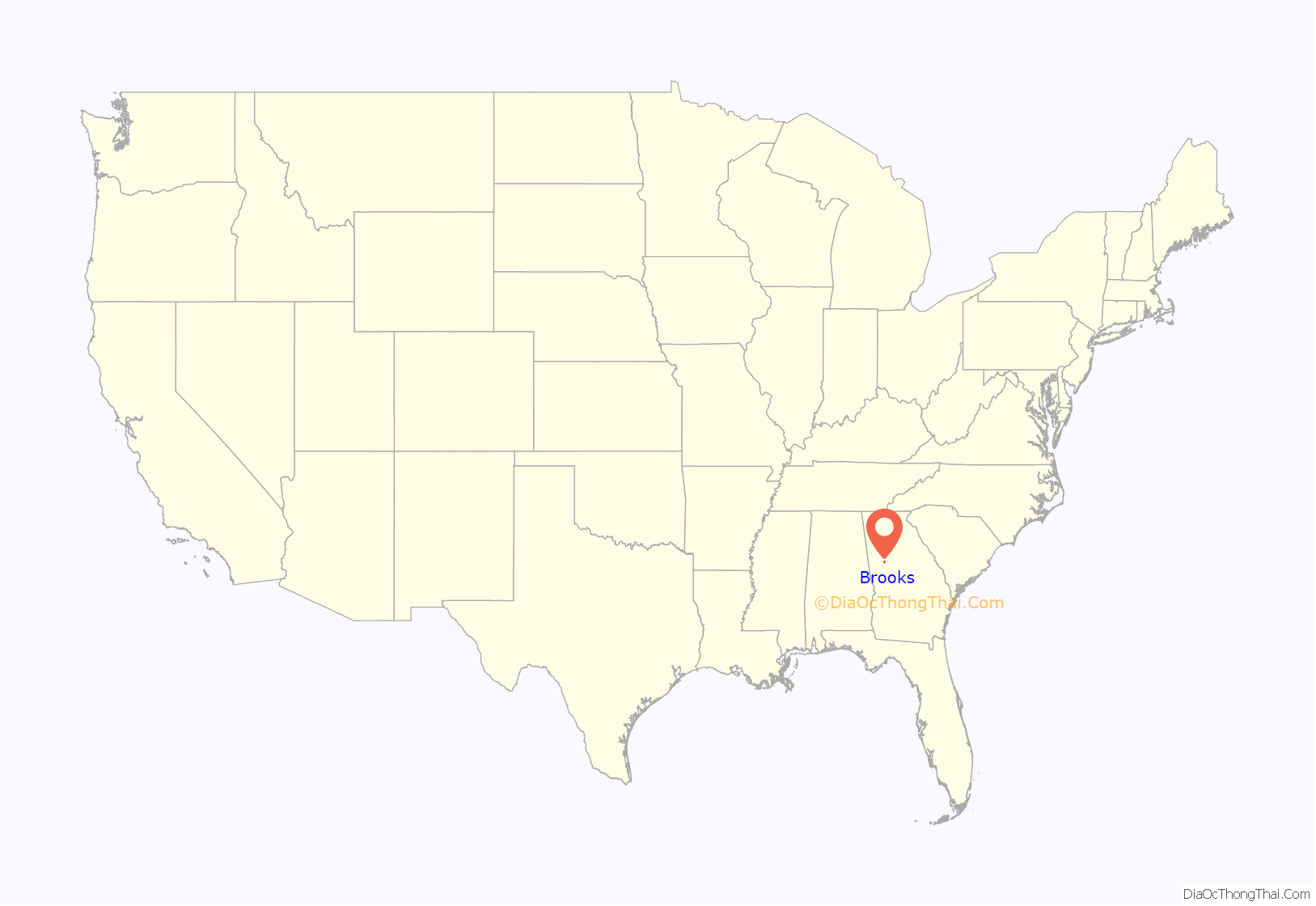
Brooks location map. Where is Brooks town?
History
Before white settlers came to the area, Creek Indians lived in the Brooks area. The first white settlers to reside in the area were the Haisten family. At first the town was called “Haistentown”, but after several other names, Brooks became the name of the town in 1905, after a local planter, Hillery Brooks, who contributed greatly to the construction of the railroad and a much needed depot. During the Civil War, the town sent many young men to fight in the Confederate Army. Several of these men were killed during the war.
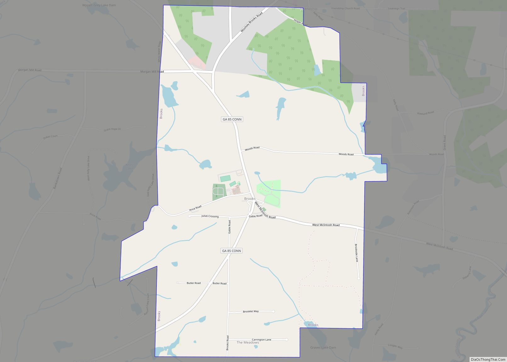
Brooks Road Map
Brooks city Satellite Map
Geography
Brooks is located in southern Fayette County, 13 miles (21 km) south of Fayetteville, the county seat, 12 miles (19 km) southeast of Peachtree City, and 13 miles (21 km) west of Griffin. Brooks is 35 miles (56 km) south of downtown Atlanta. According to the United States Census Bureau, Brooks has a total area of 4.4 square miles (11.3 km), of which 4.3 square miles (11.1 km) is land and 0.1 square miles (0.2 km), or 1.38%, is water.
See also
Map of Georgia State and its subdivision:- Appling
- Atkinson
- Bacon
- Baker
- Baldwin
- Banks
- Barrow
- Bartow
- Ben Hill
- Berrien
- Bibb
- Bleckley
- Brantley
- Brooks
- Bryan
- Bulloch
- Burke
- Butts
- Calhoun
- Camden
- Candler
- Carroll
- Catoosa
- Charlton
- Chatham
- Chattahoochee
- Chattooga
- Cherokee
- Clarke
- Clay
- Clayton
- Clinch
- Cobb
- Coffee
- Colquitt
- Columbia
- Cook
- Coweta
- Crawford
- Crisp
- Dade
- Dawson
- Decatur
- DeKalb
- Dodge
- Dooly
- Dougherty
- Douglas
- Early
- Echols
- Effingham
- Elbert
- Emanuel
- Evans
- Fannin
- Fayette
- Floyd
- Forsyth
- Franklin
- Fulton
- Gilmer
- Glascock
- Glynn
- Gordon
- Grady
- Greene
- Gwinnett
- Habersham
- Hall
- Hancock
- Haralson
- Harris
- Hart
- Heard
- Henry
- Houston
- Irwin
- Jackson
- Jasper
- Jeff Davis
- Jefferson
- Jenkins
- Johnson
- Jones
- Lamar
- Lanier
- Laurens
- Lee
- Liberty
- Lincoln
- Long
- Lowndes
- Lumpkin
- Macon
- Madison
- Marion
- McDuffie
- McIntosh
- Meriwether
- Miller
- Mitchell
- Monroe
- Montgomery
- Morgan
- Murray
- Muscogee
- Newton
- Oconee
- Oglethorpe
- Paulding
- Peach
- Pickens
- Pierce
- Pike
- Polk
- Pulaski
- Putnam
- Quitman
- Rabun
- Randolph
- Richmond
- Rockdale
- Schley
- Screven
- Seminole
- Spalding
- Stephens
- Stewart
- Sumter
- Talbot
- Taliaferro
- Tattnall
- Taylor
- Telfair
- Terrell
- Thomas
- Tift
- Toombs
- Towns
- Treutlen
- Troup
- Turner
- Twiggs
- Union
- Upson
- Walker
- Walton
- Ware
- Warren
- Washington
- Wayne
- Webster
- Wheeler
- White
- Whitfield
- Wilcox
- Wilkes
- Wilkinson
- Worth
- Alabama
- Alaska
- Arizona
- Arkansas
- California
- Colorado
- Connecticut
- Delaware
- District of Columbia
- Florida
- Georgia
- Hawaii
- Idaho
- Illinois
- Indiana
- Iowa
- Kansas
- Kentucky
- Louisiana
- Maine
- Maryland
- Massachusetts
- Michigan
- Minnesota
- Mississippi
- Missouri
- Montana
- Nebraska
- Nevada
- New Hampshire
- New Jersey
- New Mexico
- New York
- North Carolina
- North Dakota
- Ohio
- Oklahoma
- Oregon
- Pennsylvania
- Rhode Island
- South Carolina
- South Dakota
- Tennessee
- Texas
- Utah
- Vermont
- Virginia
- Washington
- West Virginia
- Wisconsin
- Wyoming
