Canon is a city in Franklin and Hart counties in the U.S. state of Georgia. The population was 804 at the 2010 census.
| Name: | Canon city |
|---|---|
| LSAD Code: | 25 |
| LSAD Description: | city (suffix) |
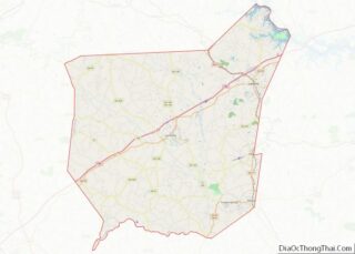
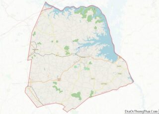
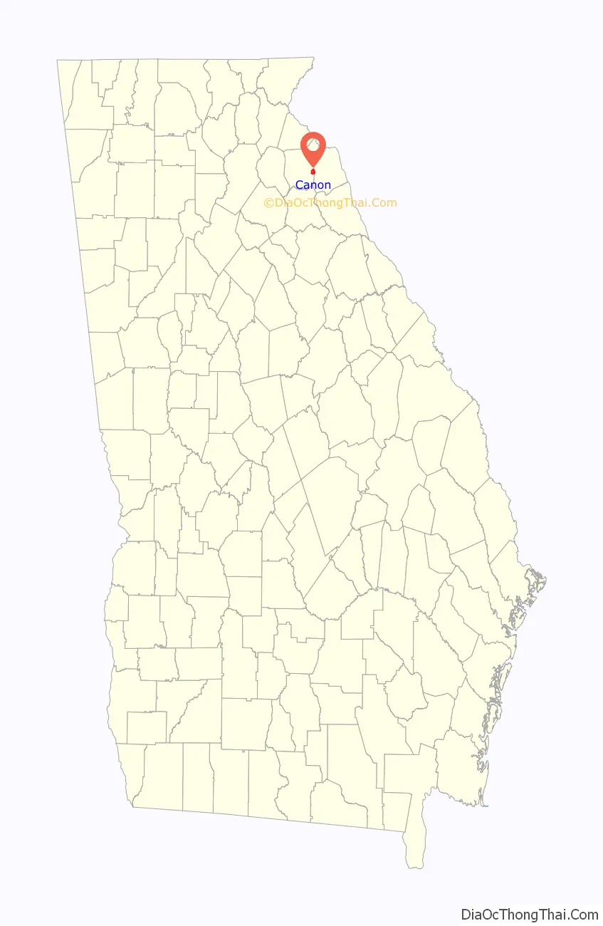
| State: | Georgia |
| County: | Franklin County, Hart County |
| Elevation: | 919 ft (280 m) |
| Total Area: | 3.13 sq mi (8.10 km²) |
| Land Area: | 3.12 sq mi (8.08 km²) |
| Water Area: | 0.01 sq mi (0.02 km²) |
| Total Population: | 643 |
| Population Density: | 206.02/sq mi (79.54/km²) |
| ZIP code: | 30520 |
| Area code: | 706 |
| FIPS code: | 1312932 |
| GNISfeature ID: | 0354984 |
| Website: | www.canongeorgia.com |
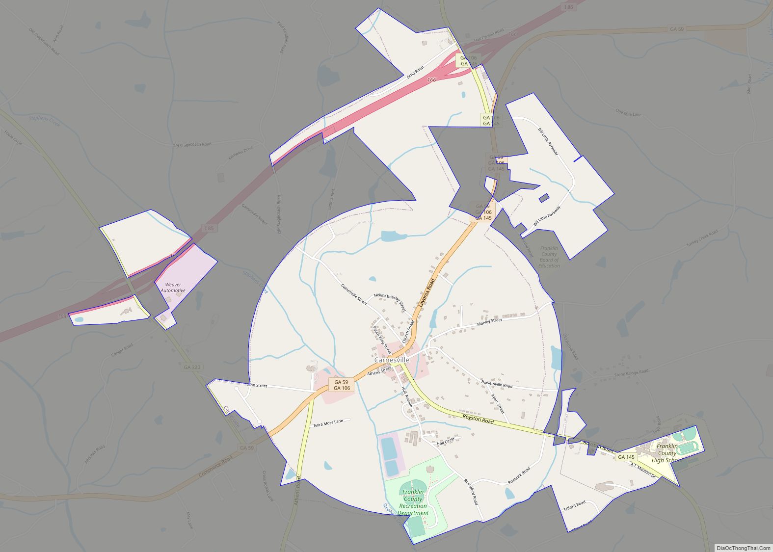
Online Interactive Map
Click on ![]() to view map in "full screen" mode.
to view map in "full screen" mode.
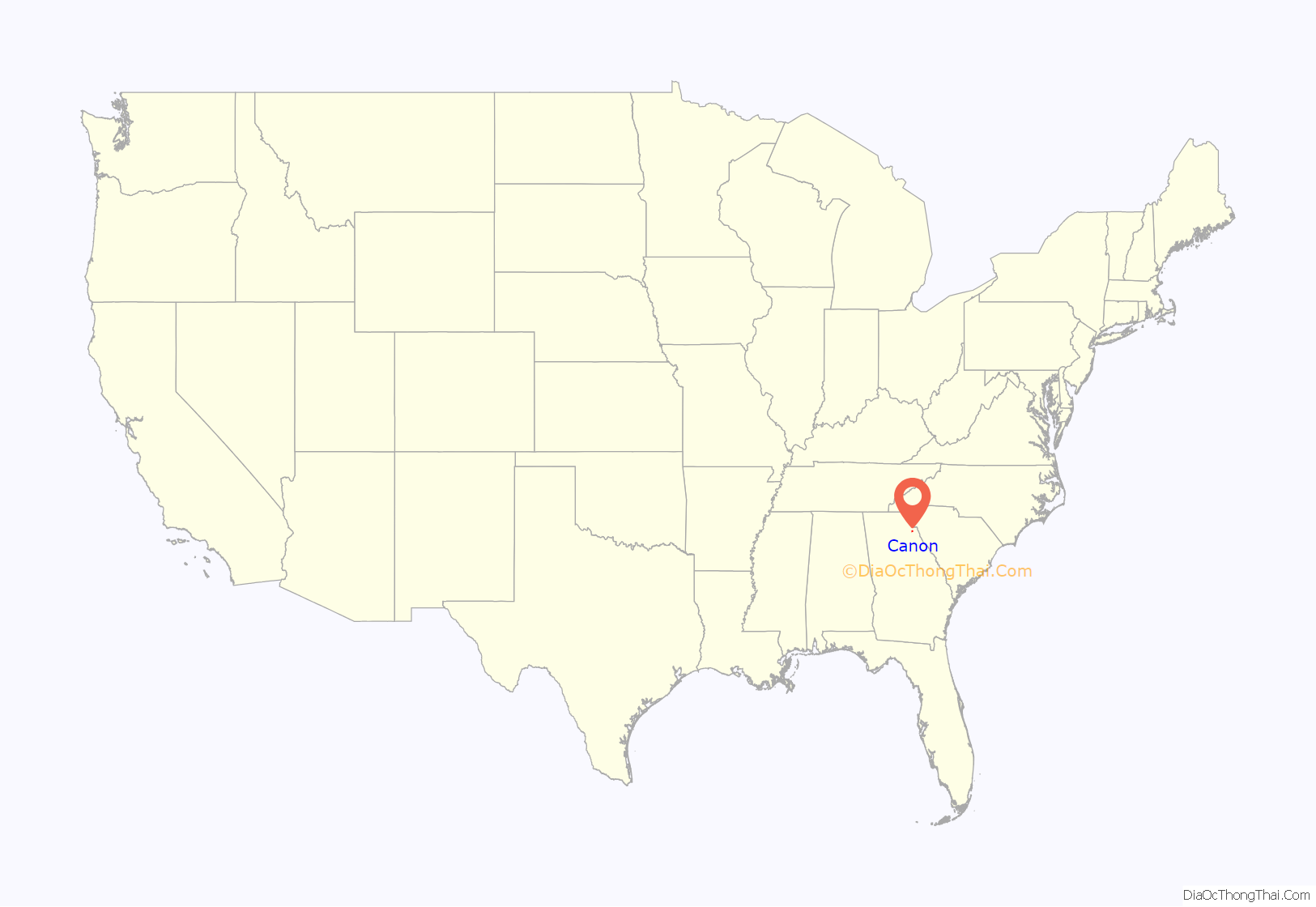
Canon location map. Where is Canon city?
History
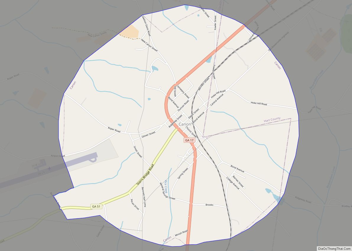
Canon was originally called “West Bowersville“, and under the latter name was laid out in 1875. The Georgia General Assembly incorporated the place as the “Town of Canon” in 1902, with the town corporate limits extending in a one-mile radius from the intersection of Broad and Depot streets.
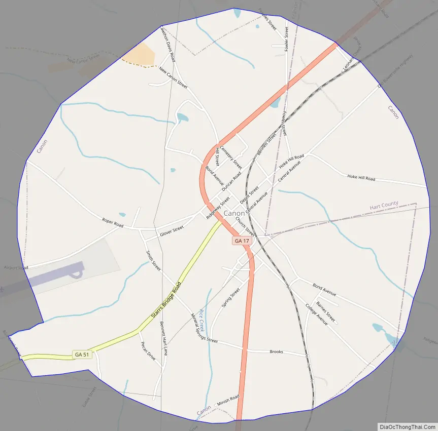
Canon Road Map
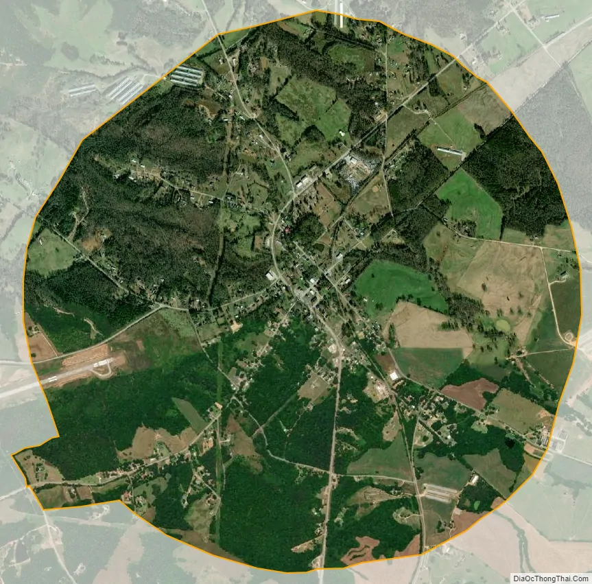
Canon city Satellite Map
Geography
Canon is located in eastern Franklin County and western Hart County at 34°20′44″N 83°06′31″W / 34.345576°N 83.108741°W / 34.345576; -83.108741. Georgia State Routes 17 and 51 pass through the center of town. SR 17 leads south 4 miles (6 km) to Royston, while SR 51 leads southwest by an indirect route 10 miles (16 km) to Sandy Cross. The two highways together lead northeast 2.5 miles (4.0 km) to Bowersville.
According to the United States Census Bureau, Canon has a total area of 3.1 square miles (8.1 km), of which 0.01 square miles (0.02 km), or 0.19%, is water.
See also
Map of Georgia State and its subdivision:- Appling
- Atkinson
- Bacon
- Baker
- Baldwin
- Banks
- Barrow
- Bartow
- Ben Hill
- Berrien
- Bibb
- Bleckley
- Brantley
- Brooks
- Bryan
- Bulloch
- Burke
- Butts
- Calhoun
- Camden
- Candler
- Carroll
- Catoosa
- Charlton
- Chatham
- Chattahoochee
- Chattooga
- Cherokee
- Clarke
- Clay
- Clayton
- Clinch
- Cobb
- Coffee
- Colquitt
- Columbia
- Cook
- Coweta
- Crawford
- Crisp
- Dade
- Dawson
- Decatur
- DeKalb
- Dodge
- Dooly
- Dougherty
- Douglas
- Early
- Echols
- Effingham
- Elbert
- Emanuel
- Evans
- Fannin
- Fayette
- Floyd
- Forsyth
- Franklin
- Fulton
- Gilmer
- Glascock
- Glynn
- Gordon
- Grady
- Greene
- Gwinnett
- Habersham
- Hall
- Hancock
- Haralson
- Harris
- Hart
- Heard
- Henry
- Houston
- Irwin
- Jackson
- Jasper
- Jeff Davis
- Jefferson
- Jenkins
- Johnson
- Jones
- Lamar
- Lanier
- Laurens
- Lee
- Liberty
- Lincoln
- Long
- Lowndes
- Lumpkin
- Macon
- Madison
- Marion
- McDuffie
- McIntosh
- Meriwether
- Miller
- Mitchell
- Monroe
- Montgomery
- Morgan
- Murray
- Muscogee
- Newton
- Oconee
- Oglethorpe
- Paulding
- Peach
- Pickens
- Pierce
- Pike
- Polk
- Pulaski
- Putnam
- Quitman
- Rabun
- Randolph
- Richmond
- Rockdale
- Schley
- Screven
- Seminole
- Spalding
- Stephens
- Stewart
- Sumter
- Talbot
- Taliaferro
- Tattnall
- Taylor
- Telfair
- Terrell
- Thomas
- Tift
- Toombs
- Towns
- Treutlen
- Troup
- Turner
- Twiggs
- Union
- Upson
- Walker
- Walton
- Ware
- Warren
- Washington
- Wayne
- Webster
- Wheeler
- White
- Whitfield
- Wilcox
- Wilkes
- Wilkinson
- Worth
- Alabama
- Alaska
- Arizona
- Arkansas
- California
- Colorado
- Connecticut
- Delaware
- District of Columbia
- Florida
- Georgia
- Hawaii
- Idaho
- Illinois
- Indiana
- Iowa
- Kansas
- Kentucky
- Louisiana
- Maine
- Maryland
- Massachusetts
- Michigan
- Minnesota
- Mississippi
- Missouri
- Montana
- Nebraska
- Nevada
- New Hampshire
- New Jersey
- New Mexico
- New York
- North Carolina
- North Dakota
- Ohio
- Oklahoma
- Oregon
- Pennsylvania
- Rhode Island
- South Carolina
- South Dakota
- Tennessee
- Texas
- Utah
- Vermont
- Virginia
- Washington
- West Virginia
- Wisconsin
- Wyoming