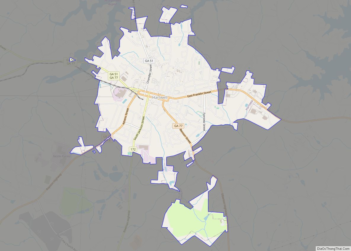
Hartwell is a city in Hart County, Georgia, United States. The population was 4,469 at the 2010 census. The city is the county seat of Hart County.
| Name: | Hartwell city |
|---|---|
| LSAD Code: | 25 |
| LSAD Description: | city (suffix) |
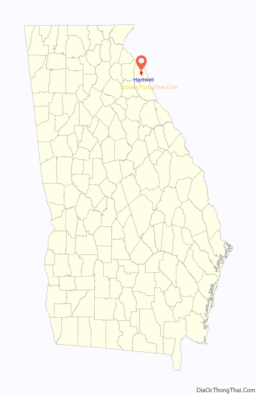
| State: | Georgia |
| County: | Hart County |
| Elevation: | 801 ft (244 m) |
| Total Area: | 5.05 sq mi (13.08 km²) |
| Land Area: | 5.04 sq mi (13.05 km²) |
| Water Area: | 0.01 sq mi (0.03 km²) |
| Total Population: | 4,470 |
| Population Density: | 887.26/sq mi (342.56/km²) |
| ZIP code: | 30643 |
| Area code: | 706 |
| FIPS code: | 1337144 |
| GNISfeature ID: | 0331924 |
| Website: | www.hartwell-ga.info |
Online Interactive Map
Click on ![]() to view map in "full screen" mode.
to view map in "full screen" mode.
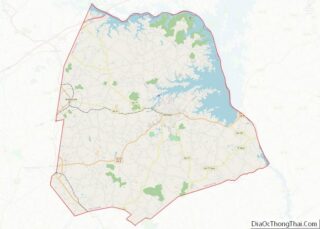
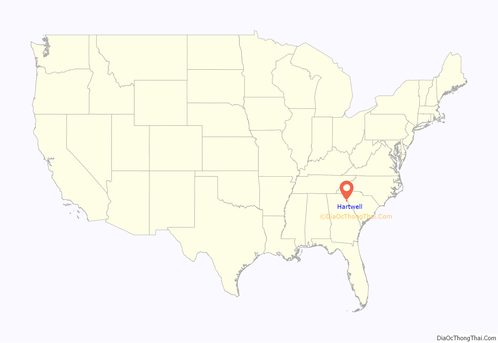
Hartwell location map. Where is Hartwell city?
History
Hartwell was founded in 1854 as seat of the newly formed Hart County. It was incorporated as a town in 1856 and as a city in 1904. The town was named for Revolutionary War figure Nancy Morgan Hart.
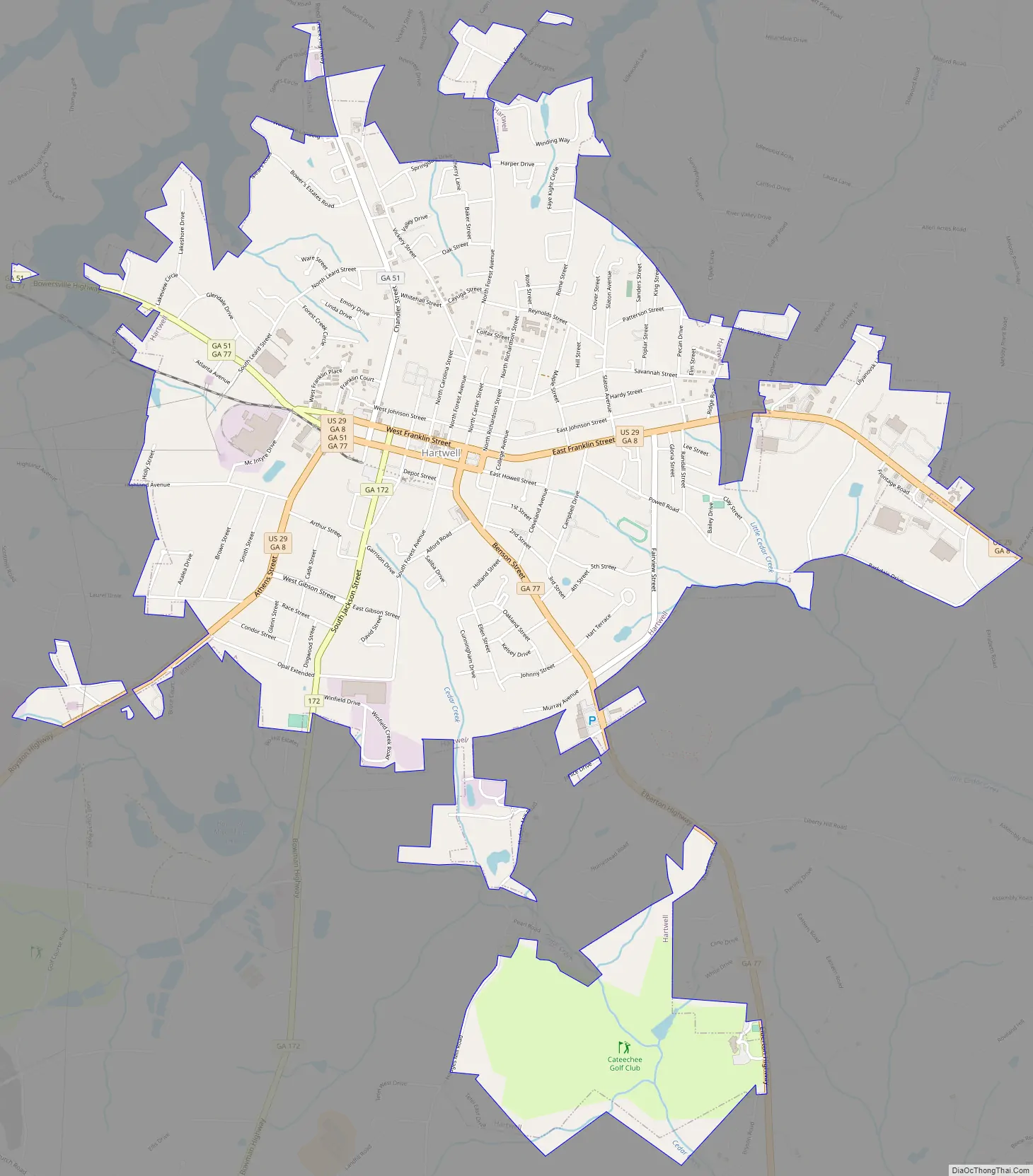
Hartwell Road Map
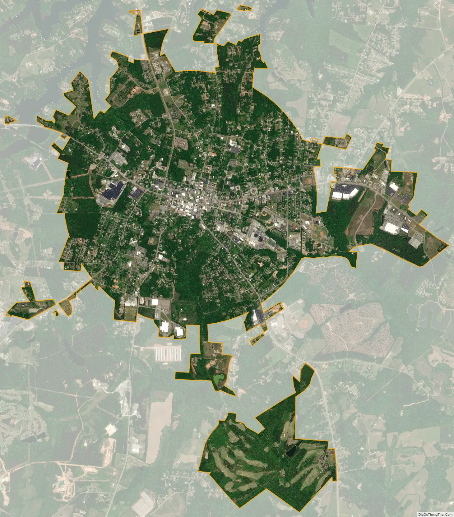
Hartwell city Satellite Map
Geography
Hartwell is located in central Hart County at 34°21′10″N 82°55′52″W / 34.35278°N 82.93111°W / 34.35278; -82.93111 (34.352738, -82.931161). It sits 4 miles (6 km) southwest of Lake Hartwell, which acquired its name from the city. Hartwell is in the Piedmont region of Georgia, or the Upland South, and lies 30 miles (48 km) southeast of the foothills of the Appalachian Mountains at Toccoa.
U.S. Route 29 passes through the center of Hartwell, leading east 7 miles (11 km) to the South Carolina border at Hartwell Dam on the Savannah River, and southwest 12 miles (19 km) to Royston. Anderson, South Carolina, is 23 miles (37 km) to the northeast via US 29, and Athens, Georgia, is 43 miles (69 km) to the southwest. Georgia State Route 51 also passes through Hartwell, leading north 7 miles (11 km) to Reed Creek and west 9 miles (14 km) to Bowersville.
According to the United States Census Bureau, Hartwell has a total area of 5.1 square miles (13.2 km), of which 0.02 square miles (0.04 km), or 0.32%, are water.
Climate
See also
Map of Georgia State and its subdivision:- Appling
- Atkinson
- Bacon
- Baker
- Baldwin
- Banks
- Barrow
- Bartow
- Ben Hill
- Berrien
- Bibb
- Bleckley
- Brantley
- Brooks
- Bryan
- Bulloch
- Burke
- Butts
- Calhoun
- Camden
- Candler
- Carroll
- Catoosa
- Charlton
- Chatham
- Chattahoochee
- Chattooga
- Cherokee
- Clarke
- Clay
- Clayton
- Clinch
- Cobb
- Coffee
- Colquitt
- Columbia
- Cook
- Coweta
- Crawford
- Crisp
- Dade
- Dawson
- Decatur
- DeKalb
- Dodge
- Dooly
- Dougherty
- Douglas
- Early
- Echols
- Effingham
- Elbert
- Emanuel
- Evans
- Fannin
- Fayette
- Floyd
- Forsyth
- Franklin
- Fulton
- Gilmer
- Glascock
- Glynn
- Gordon
- Grady
- Greene
- Gwinnett
- Habersham
- Hall
- Hancock
- Haralson
- Harris
- Hart
- Heard
- Henry
- Houston
- Irwin
- Jackson
- Jasper
- Jeff Davis
- Jefferson
- Jenkins
- Johnson
- Jones
- Lamar
- Lanier
- Laurens
- Lee
- Liberty
- Lincoln
- Long
- Lowndes
- Lumpkin
- Macon
- Madison
- Marion
- McDuffie
- McIntosh
- Meriwether
- Miller
- Mitchell
- Monroe
- Montgomery
- Morgan
- Murray
- Muscogee
- Newton
- Oconee
- Oglethorpe
- Paulding
- Peach
- Pickens
- Pierce
- Pike
- Polk
- Pulaski
- Putnam
- Quitman
- Rabun
- Randolph
- Richmond
- Rockdale
- Schley
- Screven
- Seminole
- Spalding
- Stephens
- Stewart
- Sumter
- Talbot
- Taliaferro
- Tattnall
- Taylor
- Telfair
- Terrell
- Thomas
- Tift
- Toombs
- Towns
- Treutlen
- Troup
- Turner
- Twiggs
- Union
- Upson
- Walker
- Walton
- Ware
- Warren
- Washington
- Wayne
- Webster
- Wheeler
- White
- Whitfield
- Wilcox
- Wilkes
- Wilkinson
- Worth
- Alabama
- Alaska
- Arizona
- Arkansas
- California
- Colorado
- Connecticut
- Delaware
- District of Columbia
- Florida
- Georgia
- Hawaii
- Idaho
- Illinois
- Indiana
- Iowa
- Kansas
- Kentucky
- Louisiana
- Maine
- Maryland
- Massachusetts
- Michigan
- Minnesota
- Mississippi
- Missouri
- Montana
- Nebraska
- Nevada
- New Hampshire
- New Jersey
- New Mexico
- New York
- North Carolina
- North Dakota
- Ohio
- Oklahoma
- Oregon
- Pennsylvania
- Rhode Island
- South Carolina
- South Dakota
- Tennessee
- Texas
- Utah
- Vermont
- Virginia
- Washington
- West Virginia
- Wisconsin
- Wyoming