Chickamauga is a city in Walker County, Georgia, United States. The population was 2,917 at the 2020 census. It is part of the Chattanooga, TN–GA Metropolitan Statistical Area.
| Name: | Chickamauga city |
|---|---|
| LSAD Code: | 25 |
| LSAD Description: | city (suffix) |
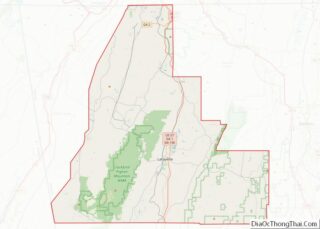
| State: | Georgia |
| County: | Walker County |
| Elevation: | 732 ft (223 m) |
| Total Area: | 2.86 sq mi (7.41 km²) |
| Land Area: | 2.85 sq mi (7.38 km²) |
| Water Area: | 0.01 sq mi (0.03 km²) |
| Total Population: | 2,917 |
| Population Density: | 1,024.23/sq mi (395.42/km²) |
| ZIP code: | 30707 |
| Area code: | 706/762 |
| FIPS code: | 1315984 |
| GNISfeature ID: | 0355145 |
| Website: | www.cityofchickamaugageorgia.org |
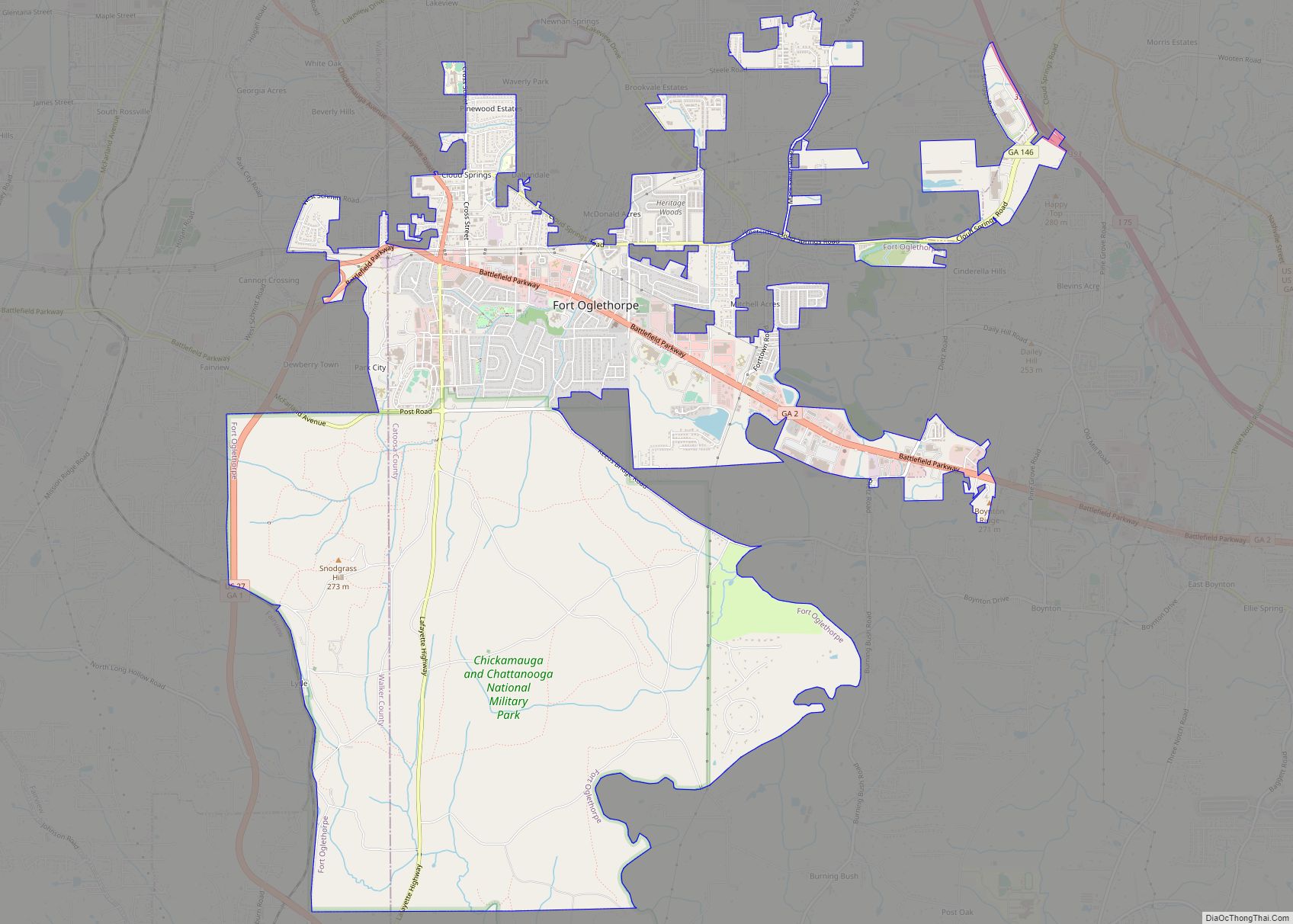
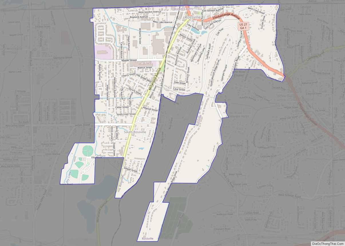
Online Interactive Map
Click on ![]() to view map in "full screen" mode.
to view map in "full screen" mode.
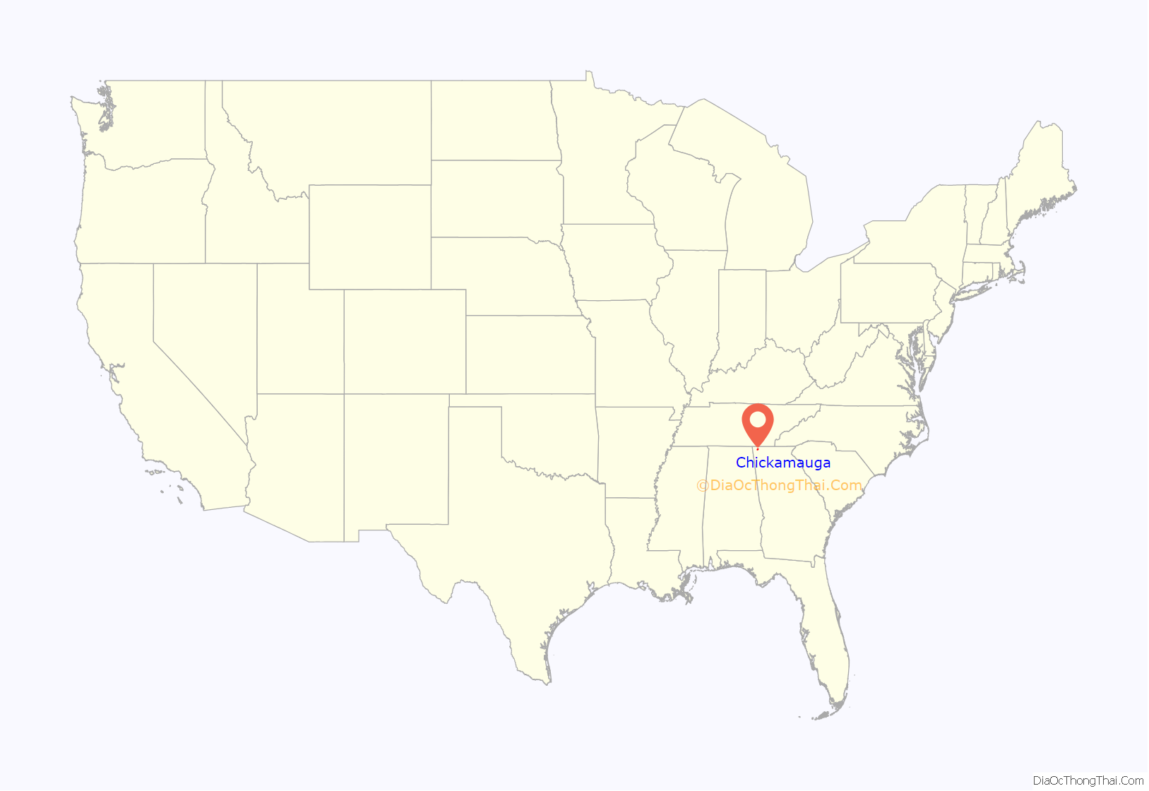
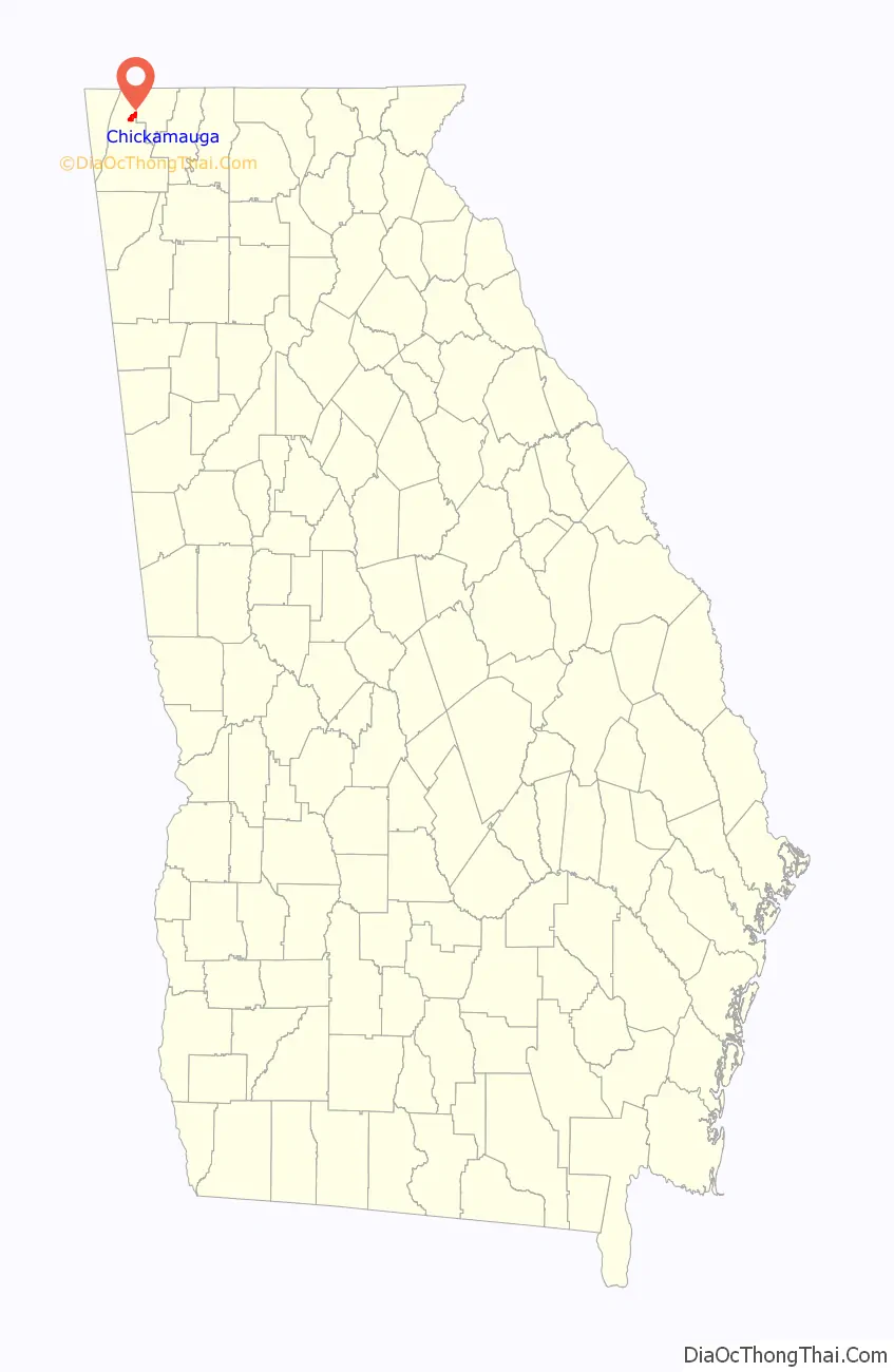
Chickamauga location map. Where is Chickamauga city?
History
Before the 1800s, the Chickamauga Cherokee settled around Chickamauga Creek, where they farmed and hunted the lands. They stayed there until their forced exodus during the Trail of Tears (1838). In the early to mid-19th century, the present town of Chickamauga was a large plantation in the rolling hills of northern Georgia. When the Cherokee Nation was divided into districts and courts in 1820, Crawfish Springs was made the capital of the new Chickamauga District. After the Cherokee removal, the first court in Walker County was held there in the former Cherokee courthouse. The local post office was Crawfish Springs.
During the War of 1812, 500 Cherokee warriors from the area fought alongside General Andrew Jackson at the Battle of Horseshoe Bend, against the Creek Indians, who were aligned with the United Kingdom of Great Britain and Ireland. The battle ended in a victory for the Americans.
The Lee and Gordon families greatly influenced Chickamauga’s post-Cherokee history. In 1836 Gwinnett County native James Gordon established a plantation at Crawfish Springs and built a grist mill two miles east of town, on Chickamauga Creek. Lee and Gordon’s Mill, which contained the area’s first general store, was situated near a blacksmith shop and stagecoach stop. From 1840 to 1847, Gordon built his Doric-columned brick house (known today as the Gordon-Lee Mansion), which overlooks Crawfish Springs.
The area was settled by many other farm families and life was busy and fruitful in the fertile valleys, until even this remote part of the South was visited by the sounds of cannon and guns during the American Civil War. The Battle of Chickamauga, named for nearby Chickamauga Creek, was fought on September 19–20, 1863. It involved more than 150,000 soldiers of the Northern and Southern armies. Before the battle, Union Gen. William Rosecrans put his headquarters at the Gordon Lee Mansion. During the battle, wounded and injured soldiers were cared for in the home and nearby buildings. Many Union doctors remained behind to care for their patients after the Southern victory. Parched soldiers of both sides drank from the town’s namesake springs.
Crawfish Springs was the site of an 1889 reunion of veteran soldiers, Northern and Southern, who had fought in the Battle of Chickamauga. Called the “Blue and Gray Barbecue”, hundreds of soldiers and their families visited the sites of the bloody battle from over 25 years before, smoking the pipe of peace, healing the wounds, and helping start the Chickamauga National Park. The Chickamauga Battlefield, established in 1890, is just north of the City of Chickamauga, and is a part of the Chickamauga and Chattanooga National Military Park, the first and largest in the country.
In 1888, a railroad line was built through Crawfish Springs. A syndicate bought the land and used some of it to develop a summer resort, complete with the Park Hotel, which opened in 1891. Around this same time, the Central of Georgia Railway built a stone depot for visitors to the hotel (both the tracks and depot remain today). After passenger service ceased in the 1950s, the city schools, library system, and recreation department used the depot. It now houses the Walker County Regional Heritage and Model Train Museum. Occasional tourist train excursions stop at the Chickamauga depot. The Durham Iron and Coal Company built coke ovens on Chickamauga’s north side, used to transform coal into coke for iron and steel foundries in Chattanooga. Beginning in 1891, coal was transported by train twice daily from Lookout Mountain to Chickamauga. Production peaked in 1904, at about 700 to 1,000 tons of coal per day, and ended entirely during the Great Depression. These coke ovens were restored in the 1990s for exhibition.
In the early 20th century, Chickamauga became a textile-mill town. New England native Daniel Ashley Jewell, who had moved to middle Georgia prior to the Civil War, built a cotton mill. The small community in central Georgia that grew up around his mill is still called Jewell. His sister subsequently married a Colonel W.L.L. Bowen. Jewell and his brother-in-law reorganized the bag company and it became the Bowen-Jewell Bag Company. Soon after, Colonel Bowen’s nephew, A. S. Bowen, joined the company as a salesman.
The company’s best customers were the large grain mills in east Tennessee. For this reason, it was determined to move the company to Chattanooga in 1905. D.A. Jewell and business partner Colonel Bowen bought land in Chickamauga in 1907 from US Senator Gordon Lee. The men had heard that Lee, the owner of the springs, was proud of his sharp business dealings and had sold Crystal Spring several times, only to repossess it as soon as the first payment was missed. Jewell and Bowen dressed themselves in their worst clothes and tried to look like a less than affluent rural men. They approached Lee and discussed buying the land. When a price had been quoted, they told Lee to have his attorney draw up the papers and they would return to work out the terms of purchase. When they came back, they were wearing their normal clothes and had their attorney with him. Rather than seeking terms, they paid in cash, and Lee had no choice but to relinquish the property.
Jewell and Bowen also built the Crystal Springs Bleachery Company (in 1909). The Crystal Springs Bleachery Company was a major local employer and a significant player in the development of the town. The mill remained in operation until 2013. Other notable manufacturers have interests in Chickamauga such as Shaw Industries.
Over the last century, the city has changed and grown, from a population of 95 (in 1900) to 3,101 (in the 2010 official Census). The city is surrounded by the north Georgia mountains and valleys, and the history of the area has been rediscovered and restored wherever possible. Today Chickamauga is host to a wide variety of antique, boutique and specialty shops, cafes and restaurants. Within a few blocks of the main shopping district are public parks and historic sites, including Crawfish Springs Park, Coke Oven Park, and Holland-Watson Veterans Memorial Park. From April to September the Tennessee Valley Railroad Museum offers weekend train excursions from Chattanooga to Chickamauga.
When the city was incorporated in 1891, the city’s north–south avenues were named for Confederate generals. Today avenues named for Longstreet, Hood, Crittenden, Stewart, and more are clearly marked by large, wood framed signs displaying a description of the General’s accomplishments, his picture, and flags of the day.
Several major Civil War battle sites and museums are near the city: Chickamauga & Chattanooga National Military Park, Lookout Mountain, Lee & Gordon’s Mill, McLemore’s Cove, and the Martin-Davis House, on the site of the Battle of Davis’s Cross Roads.
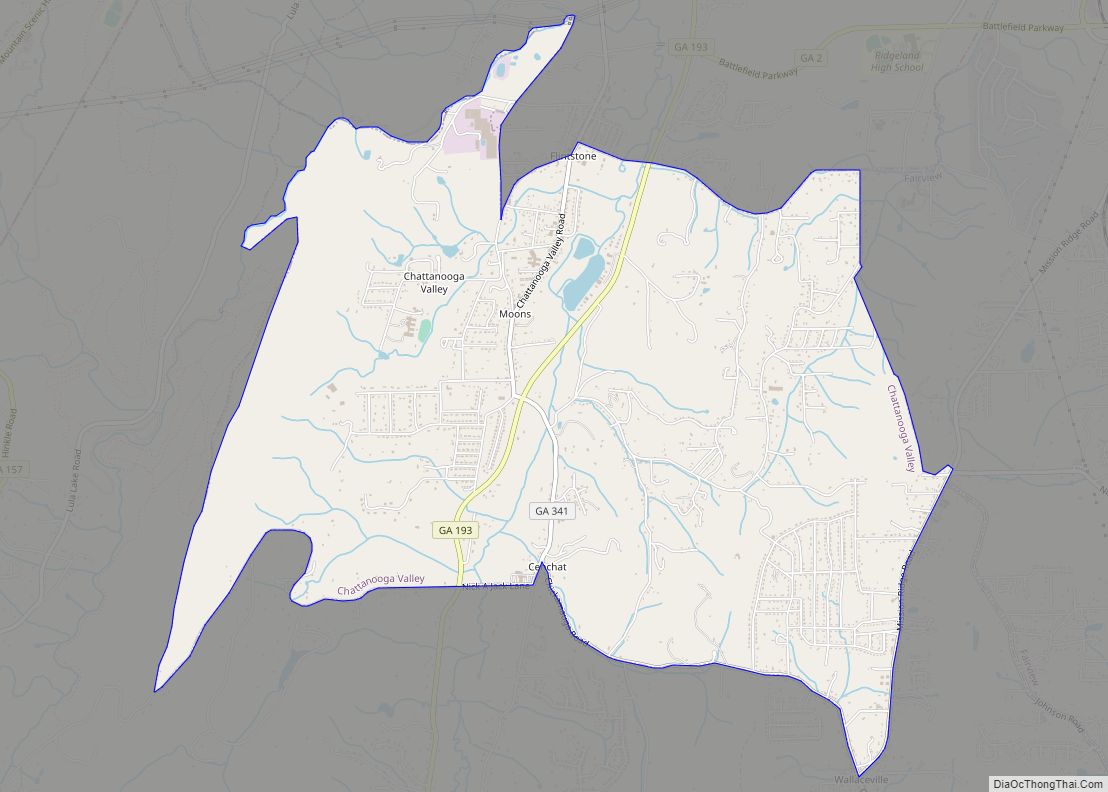
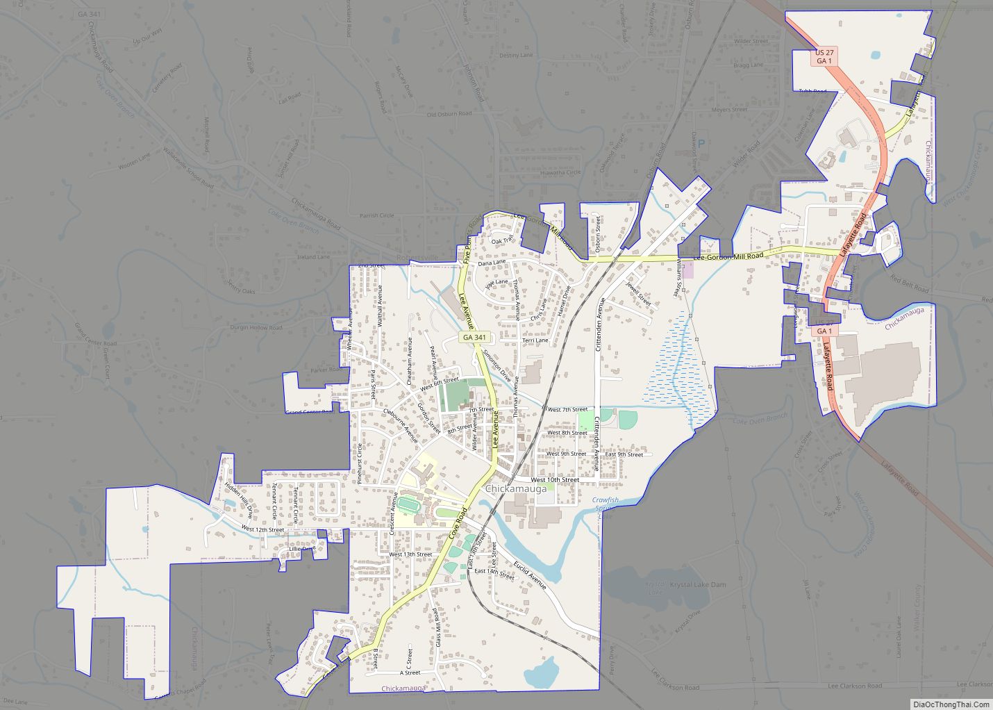
Chickamauga Road Map
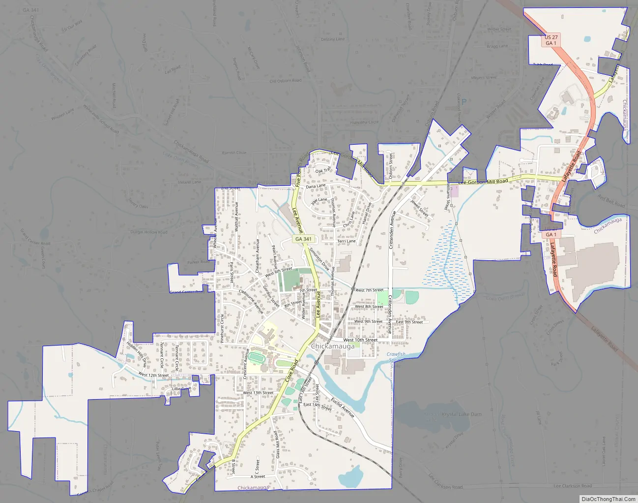
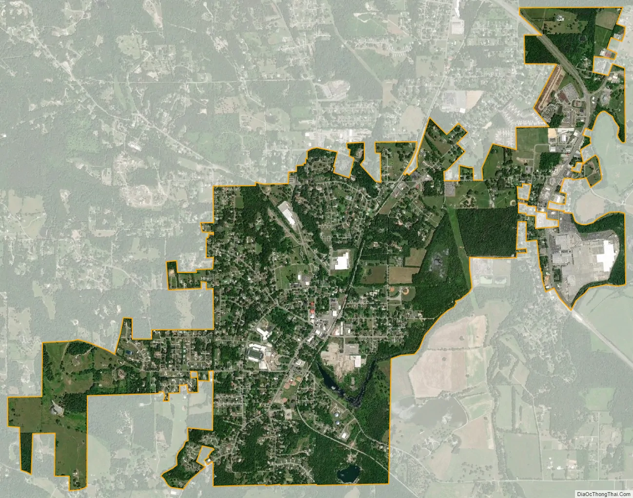
Chickamauga city Satellite Map
Geography
Chickamauga is located at 34°52′29″N 85°17′34″W / 34.87472°N 85.29278°W / 34.87472; -85.29278 (34.874696, −85.292751). According to the United States Census Bureau, the city has a total area of 1.8 square miles (4.7 km), of which 1.8 square miles (4.7 km) is land and 0.55% is water.
Climate
Chickamuga has a humid subtropical climate (Köppen climate classification Cfa), with cool to mild winters and hot, humid summers. Rainfall is abundant and highest in the winter and spring months, with an average of 57 inches (1,449 mm).
See also
Map of Georgia State and its subdivision:- Appling
- Atkinson
- Bacon
- Baker
- Baldwin
- Banks
- Barrow
- Bartow
- Ben Hill
- Berrien
- Bibb
- Bleckley
- Brantley
- Brooks
- Bryan
- Bulloch
- Burke
- Butts
- Calhoun
- Camden
- Candler
- Carroll
- Catoosa
- Charlton
- Chatham
- Chattahoochee
- Chattooga
- Cherokee
- Clarke
- Clay
- Clayton
- Clinch
- Cobb
- Coffee
- Colquitt
- Columbia
- Cook
- Coweta
- Crawford
- Crisp
- Dade
- Dawson
- Decatur
- DeKalb
- Dodge
- Dooly
- Dougherty
- Douglas
- Early
- Echols
- Effingham
- Elbert
- Emanuel
- Evans
- Fannin
- Fayette
- Floyd
- Forsyth
- Franklin
- Fulton
- Gilmer
- Glascock
- Glynn
- Gordon
- Grady
- Greene
- Gwinnett
- Habersham
- Hall
- Hancock
- Haralson
- Harris
- Hart
- Heard
- Henry
- Houston
- Irwin
- Jackson
- Jasper
- Jeff Davis
- Jefferson
- Jenkins
- Johnson
- Jones
- Lamar
- Lanier
- Laurens
- Lee
- Liberty
- Lincoln
- Long
- Lowndes
- Lumpkin
- Macon
- Madison
- Marion
- McDuffie
- McIntosh
- Meriwether
- Miller
- Mitchell
- Monroe
- Montgomery
- Morgan
- Murray
- Muscogee
- Newton
- Oconee
- Oglethorpe
- Paulding
- Peach
- Pickens
- Pierce
- Pike
- Polk
- Pulaski
- Putnam
- Quitman
- Rabun
- Randolph
- Richmond
- Rockdale
- Schley
- Screven
- Seminole
- Spalding
- Stephens
- Stewart
- Sumter
- Talbot
- Taliaferro
- Tattnall
- Taylor
- Telfair
- Terrell
- Thomas
- Tift
- Toombs
- Towns
- Treutlen
- Troup
- Turner
- Twiggs
- Union
- Upson
- Walker
- Walton
- Ware
- Warren
- Washington
- Wayne
- Webster
- Wheeler
- White
- Whitfield
- Wilcox
- Wilkes
- Wilkinson
- Worth
- Alabama
- Alaska
- Arizona
- Arkansas
- California
- Colorado
- Connecticut
- Delaware
- District of Columbia
- Florida
- Georgia
- Hawaii
- Idaho
- Illinois
- Indiana
- Iowa
- Kansas
- Kentucky
- Louisiana
- Maine
- Maryland
- Massachusetts
- Michigan
- Minnesota
- Mississippi
- Missouri
- Montana
- Nebraska
- Nevada
- New Hampshire
- New Jersey
- New Mexico
- New York
- North Carolina
- North Dakota
- Ohio
- Oklahoma
- Oregon
- Pennsylvania
- Rhode Island
- South Carolina
- South Dakota
- Tennessee
- Texas
- Utah
- Vermont
- Virginia
- Washington
- West Virginia
- Wisconsin
- Wyoming