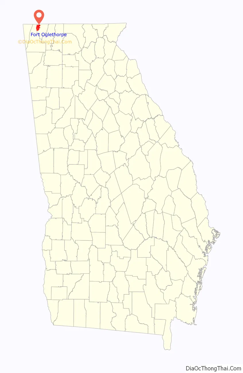
Fort Oglethorpe is a city predominantly in Catoosa County with some portions in Walker County in the U.S. state of Georgia. As of the 2020 census, the city had a population of 10,423. It is part of the Chattanooga, TN–GA Metropolitan Statistical Area. It is home to Lakeview – Fort Oglethorpe High School.
| Name: | Fort Oglethorpe city |
|---|---|
| LSAD Code: | 25 |
| LSAD Description: | city (suffix) |
| State: | Georgia |
| County: | Catoosa County, Walker County |
| Elevation: | 732 ft (223 m) |
| Total Area: | 13.90 sq mi (36.00 km²) |
| Land Area: | 13.90 sq mi (36.00 km²) |
| Water Area: | 0.00 sq mi (0.00 km²) |
| Total Population: | 10,423 |
| Population Density: | 749.91/sq mi (289.55/km²) |
| ZIP code: | 30742 |
| Area code: | 706/762 |
| FIPS code: | 1330956 |
| GNISfeature ID: | 0331756 |
| Website: | www.fortogov.com |
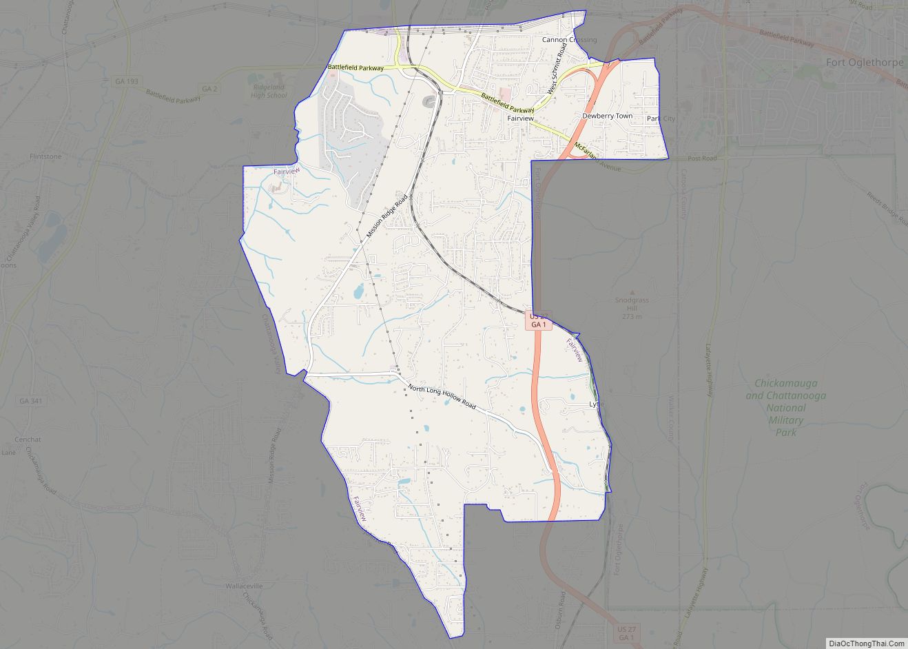
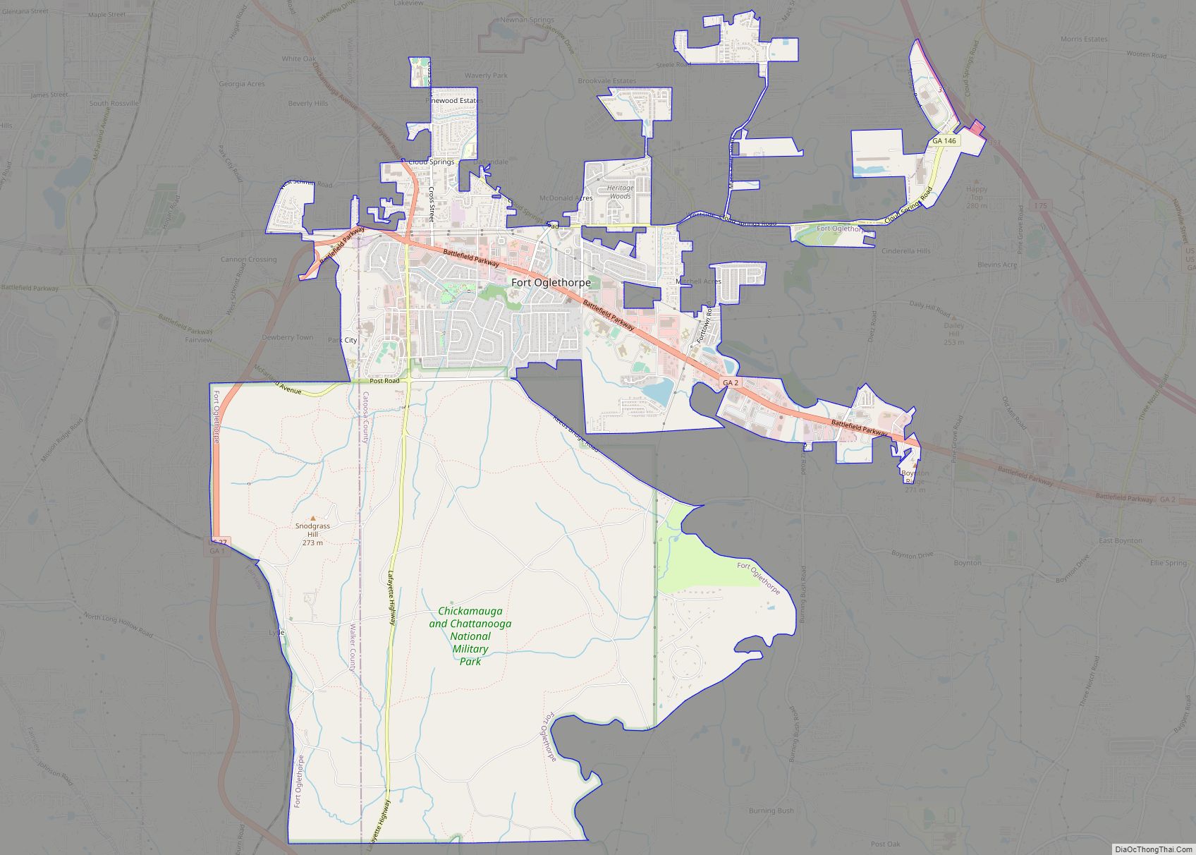
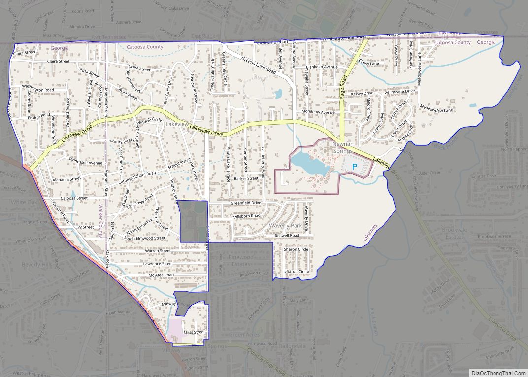
Online Interactive Map
Click on ![]() to view map in "full screen" mode.
to view map in "full screen" mode.
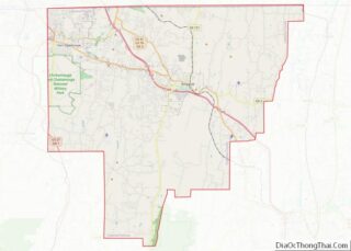
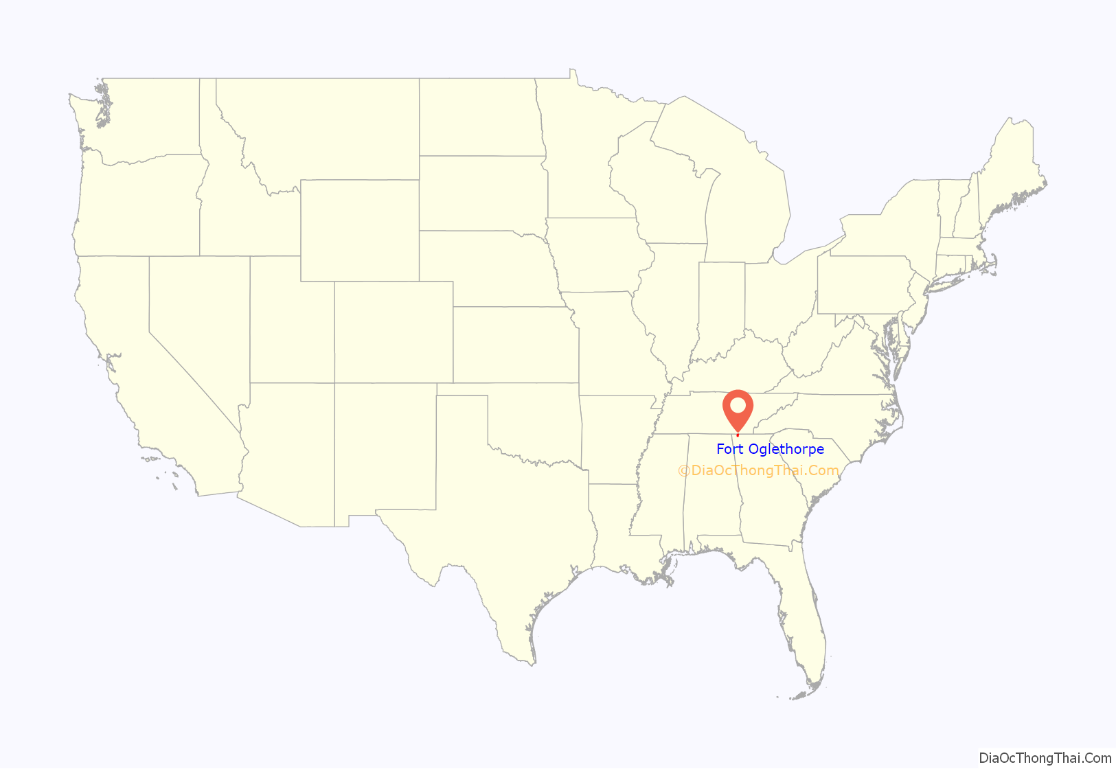
Fort Oglethorpe location map. Where is Fort Oglethorpe city?
History
The United States Army established a cavalry post at the site of Hargrave, Georgia, an unincorporated town situated next to the Chickamauga National Battlefield. The existing settlement was named for a Confederate soldier, William Hamilton Hargrave, who along with his wife Amelia Cecilia Strange-Hargrave owned most of the land in the area. The couple was well known in the 19th century to travellers heading to Ross’s Landing on the Tennessee River from LaFayette, Georgia. William Hargrave and other landowners in the area were forced to sell their property to the Army to be used as a base for the 6th Cavalry. The Chickamauga Post established in 1902 by the U.S. Army was later named Fort Oglethorpe after James Oglethorpe, the founder of the Colony of Georgia. During and after World War I, the fort served between 1917 and 1920 as an detention camp for civilian internees and prisoners of war. During World War II, the area served as a war-time induction and processing center, and again housed prisoners of war. Fort Oglethorpe was a major training center for the Women’s Army Corps during World War II. The post land was declared surplus in 1947 and returned to civilian hands, forming the nucleus for a town that was incorporated in 1949.
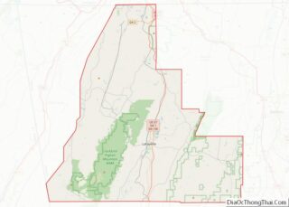
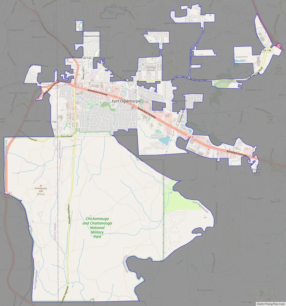
Fort Oglethorpe Road Map
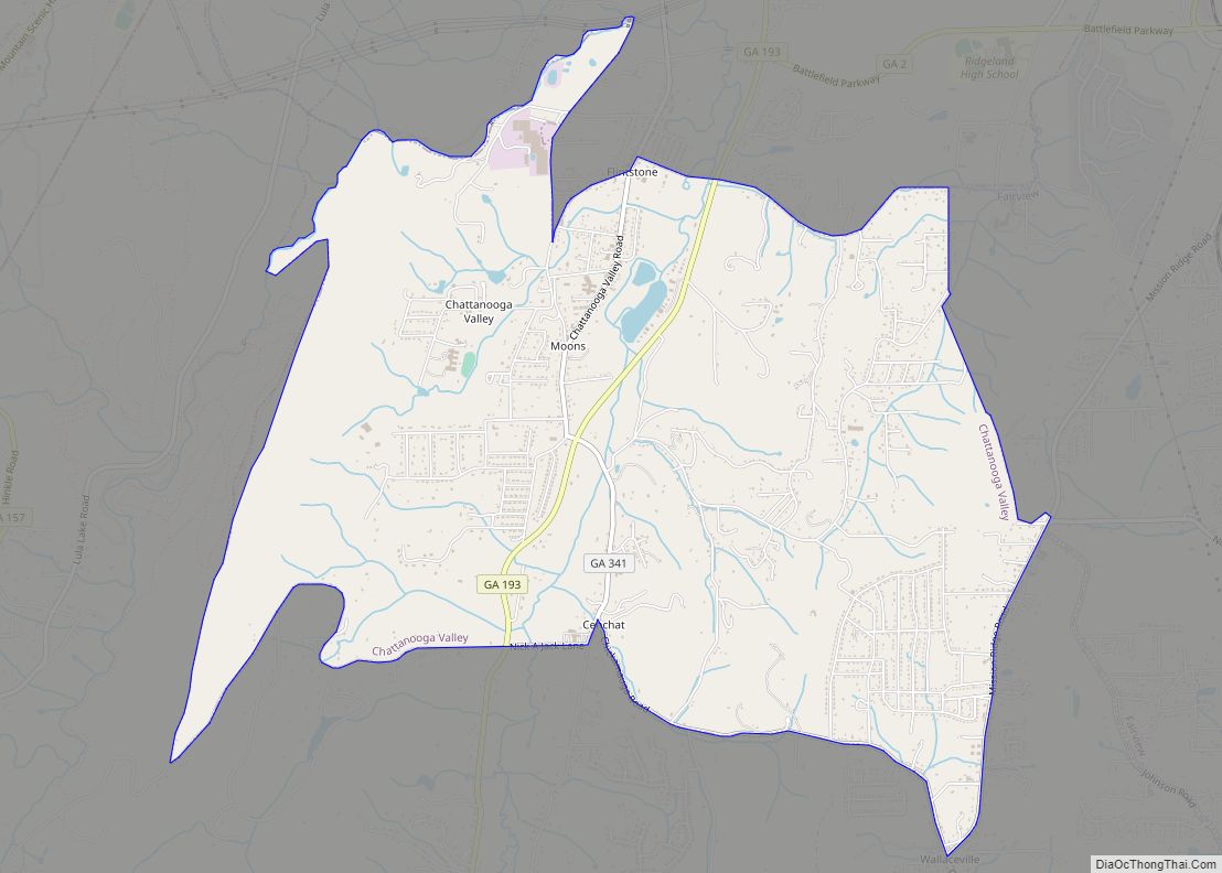
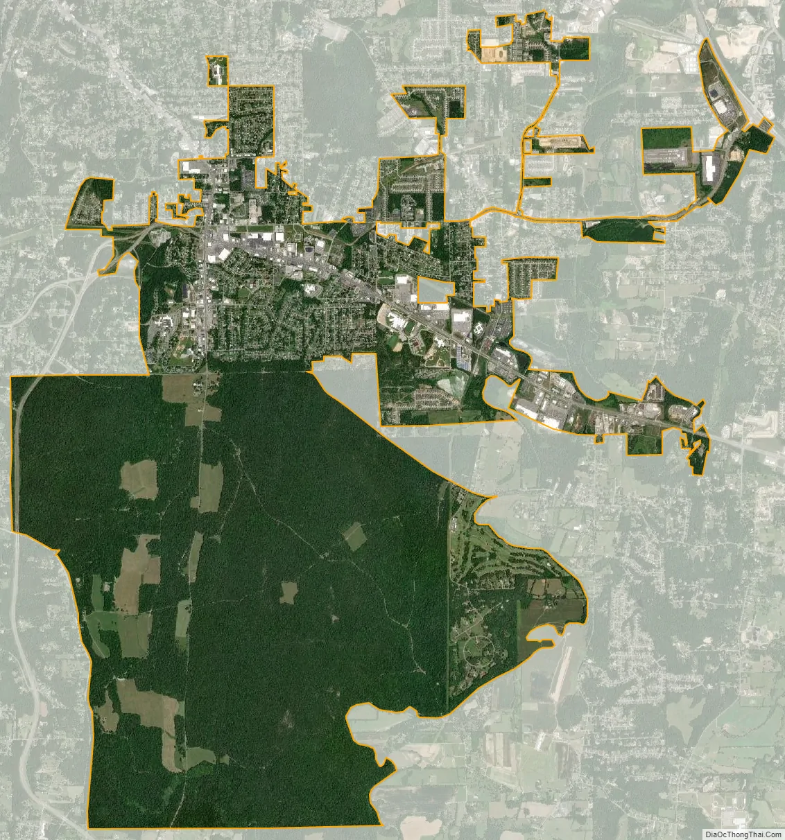
Fort Oglethorpe city Satellite Map
Geography
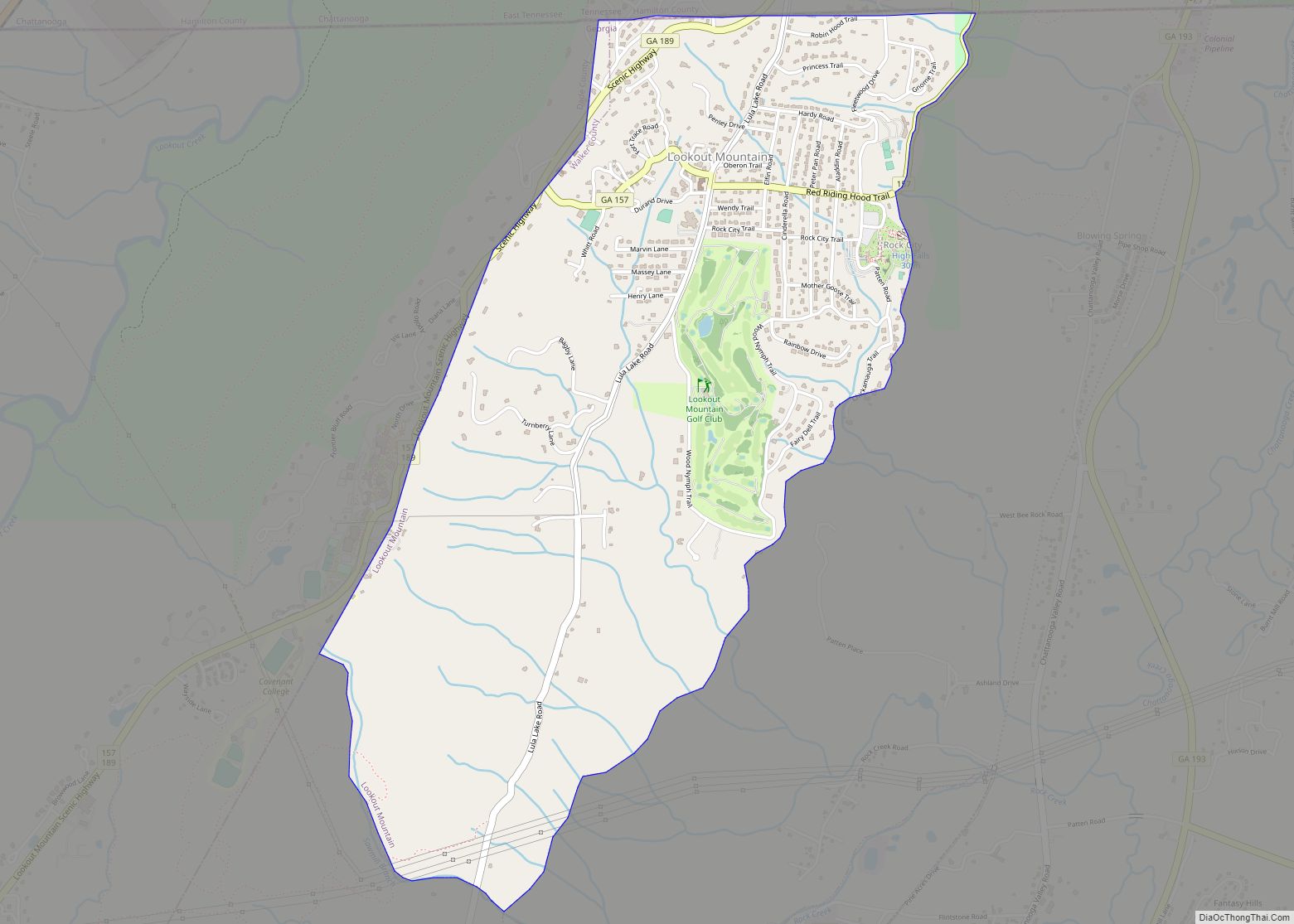
Fort Oglethorpe is located in western Catoosa County and northeastern Walker County at 34°56′44″N 85°14′44″W / 34.94556°N 85.24556°W / 34.94556; -85.24556 (34.945683, -85.245653). It is 9 miles (14 km) south of Chattanooga, Tennessee, by U.S. Route 27, which also leads south 18 miles (29 km) to LaFayette, Georgia. The Chickamauga and Chattanooga National Military Park takes up the southern two-thirds of the city’s area.
According to the United States Census Bureau, the city has a total area of 13.9 square miles (36.0 km), all land.
See also
Map of Georgia State and its subdivision:- Appling
- Atkinson
- Bacon
- Baker
- Baldwin
- Banks
- Barrow
- Bartow
- Ben Hill
- Berrien
- Bibb
- Bleckley
- Brantley
- Brooks
- Bryan
- Bulloch
- Burke
- Butts
- Calhoun
- Camden
- Candler
- Carroll
- Catoosa
- Charlton
- Chatham
- Chattahoochee
- Chattooga
- Cherokee
- Clarke
- Clay
- Clayton
- Clinch
- Cobb
- Coffee
- Colquitt
- Columbia
- Cook
- Coweta
- Crawford
- Crisp
- Dade
- Dawson
- Decatur
- DeKalb
- Dodge
- Dooly
- Dougherty
- Douglas
- Early
- Echols
- Effingham
- Elbert
- Emanuel
- Evans
- Fannin
- Fayette
- Floyd
- Forsyth
- Franklin
- Fulton
- Gilmer
- Glascock
- Glynn
- Gordon
- Grady
- Greene
- Gwinnett
- Habersham
- Hall
- Hancock
- Haralson
- Harris
- Hart
- Heard
- Henry
- Houston
- Irwin
- Jackson
- Jasper
- Jeff Davis
- Jefferson
- Jenkins
- Johnson
- Jones
- Lamar
- Lanier
- Laurens
- Lee
- Liberty
- Lincoln
- Long
- Lowndes
- Lumpkin
- Macon
- Madison
- Marion
- McDuffie
- McIntosh
- Meriwether
- Miller
- Mitchell
- Monroe
- Montgomery
- Morgan
- Murray
- Muscogee
- Newton
- Oconee
- Oglethorpe
- Paulding
- Peach
- Pickens
- Pierce
- Pike
- Polk
- Pulaski
- Putnam
- Quitman
- Rabun
- Randolph
- Richmond
- Rockdale
- Schley
- Screven
- Seminole
- Spalding
- Stephens
- Stewart
- Sumter
- Talbot
- Taliaferro
- Tattnall
- Taylor
- Telfair
- Terrell
- Thomas
- Tift
- Toombs
- Towns
- Treutlen
- Troup
- Turner
- Twiggs
- Union
- Upson
- Walker
- Walton
- Ware
- Warren
- Washington
- Wayne
- Webster
- Wheeler
- White
- Whitfield
- Wilcox
- Wilkes
- Wilkinson
- Worth
- Alabama
- Alaska
- Arizona
- Arkansas
- California
- Colorado
- Connecticut
- Delaware
- District of Columbia
- Florida
- Georgia
- Hawaii
- Idaho
- Illinois
- Indiana
- Iowa
- Kansas
- Kentucky
- Louisiana
- Maine
- Maryland
- Massachusetts
- Michigan
- Minnesota
- Mississippi
- Missouri
- Montana
- Nebraska
- Nevada
- New Hampshire
- New Jersey
- New Mexico
- New York
- North Carolina
- North Dakota
- Ohio
- Oklahoma
- Oregon
- Pennsylvania
- Rhode Island
- South Carolina
- South Dakota
- Tennessee
- Texas
- Utah
- Vermont
- Virginia
- Washington
- West Virginia
- Wisconsin
- Wyoming