Climax is a small town in Decatur County, Georgia, United States. The town was named “Climax” because it is located at the highest point of the railroad between Savannah, Georgia, and the Chattahoochee River. The population was 280 at the 2010 census.
| Name: | Climax city |
|---|---|
| LSAD Code: | 25 |
| LSAD Description: | city (suffix) |
| State: | Georgia |
| County: | Decatur County |
| Elevation: | 285 ft (87 m) |
| Total Area: | 0.80 sq mi (2.08 km²) |
| Land Area: | 0.80 sq mi (2.08 km²) |
| Water Area: | 0.00 sq mi (0.00 km²) |
| Total Population: | 276 |
| Population Density: | 343.71/sq mi (132.69/km²) |
| ZIP code: | 31734, 39834 |
| Area code: | 229 |
| FIPS code: | 1316908 |
| GNISfeature ID: | 0355192 |
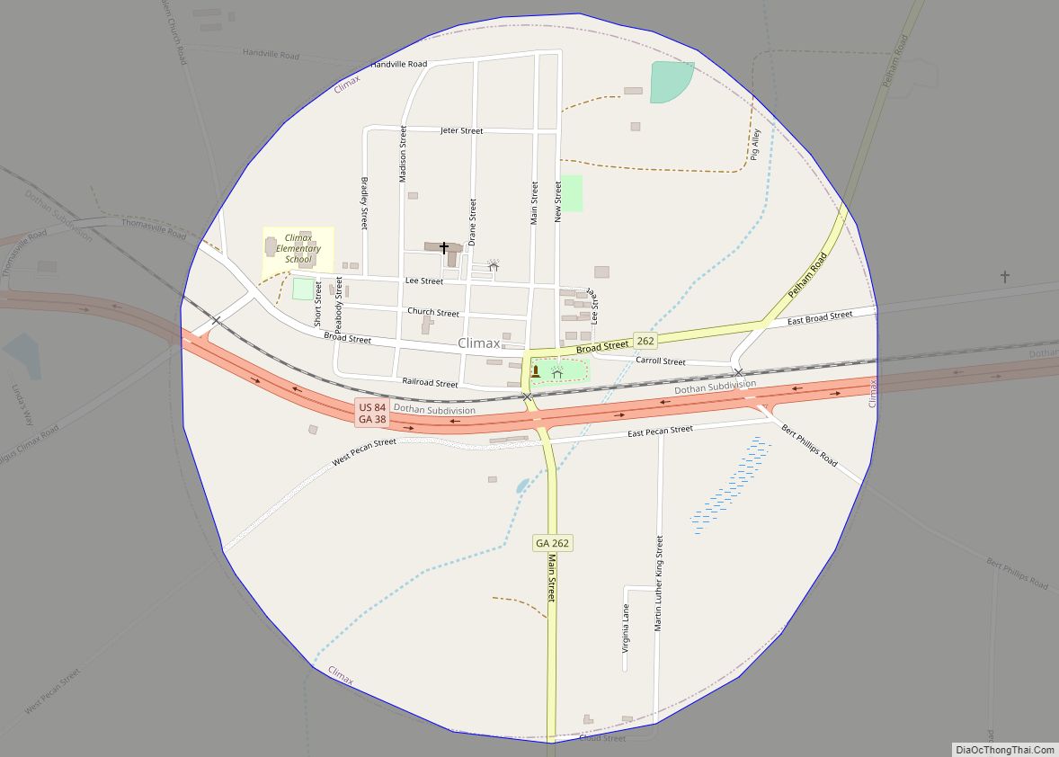
Online Interactive Map
Click on ![]() to view map in "full screen" mode.
to view map in "full screen" mode.
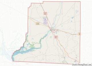
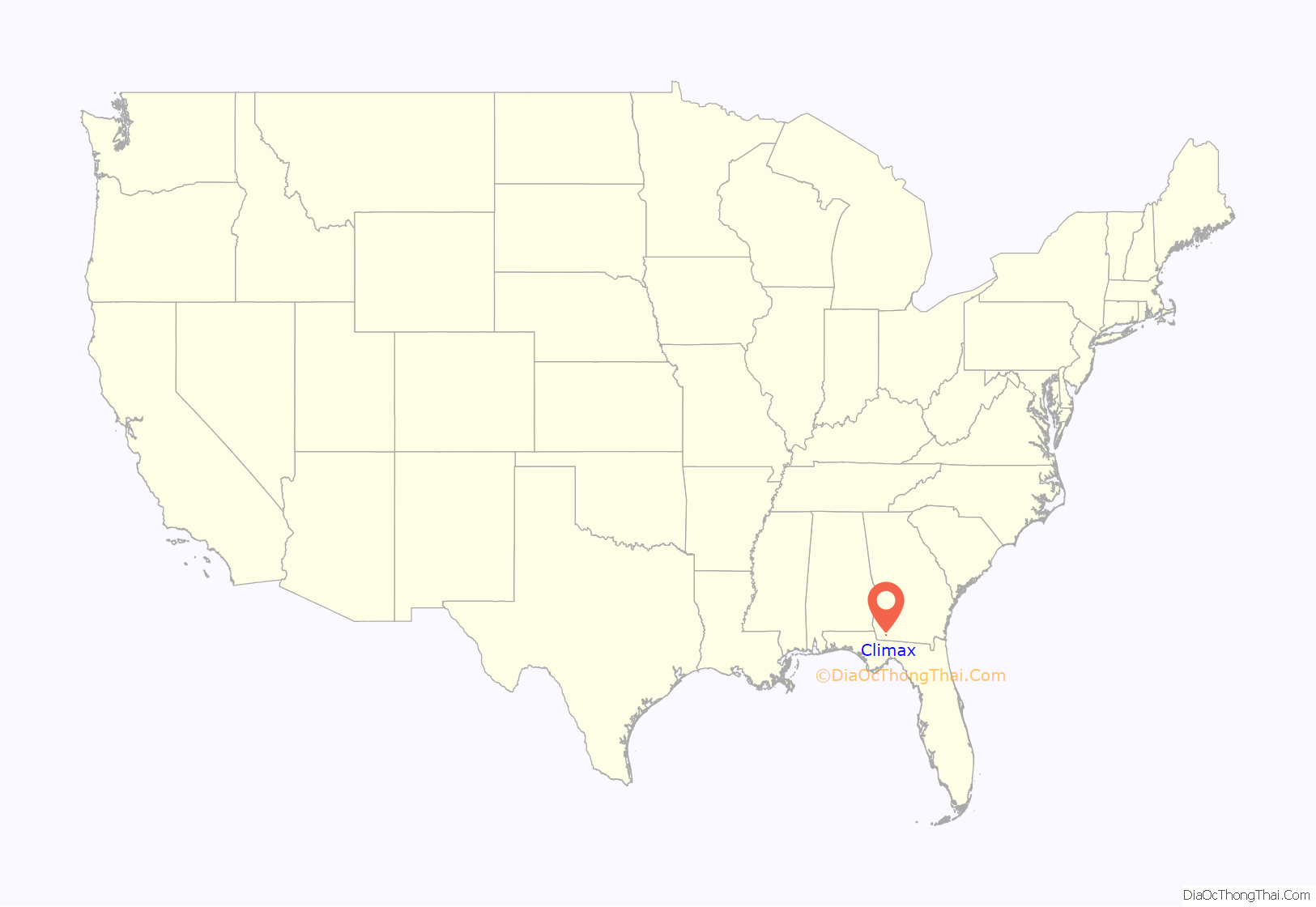
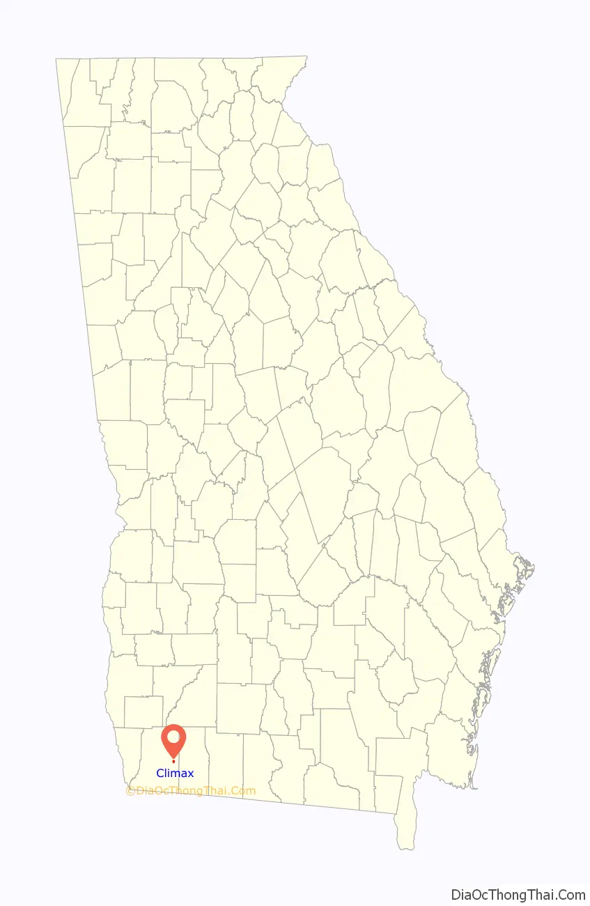
Climax location map. Where is Climax city?
History
Climax was platted in 1833, and named for its lofty elevation. The Georgia General Assembly incorporated the place in 1905 as the “Town of Climax”, with the municipal corporate limits extending in a one-half mile radius from the town’s central water well.
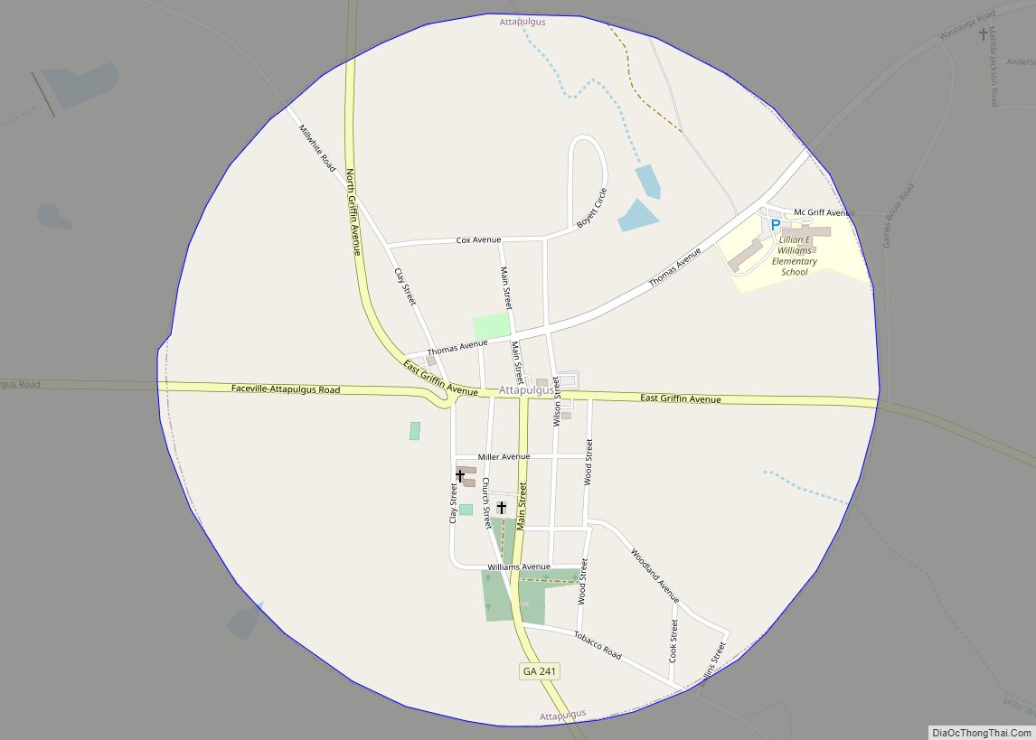
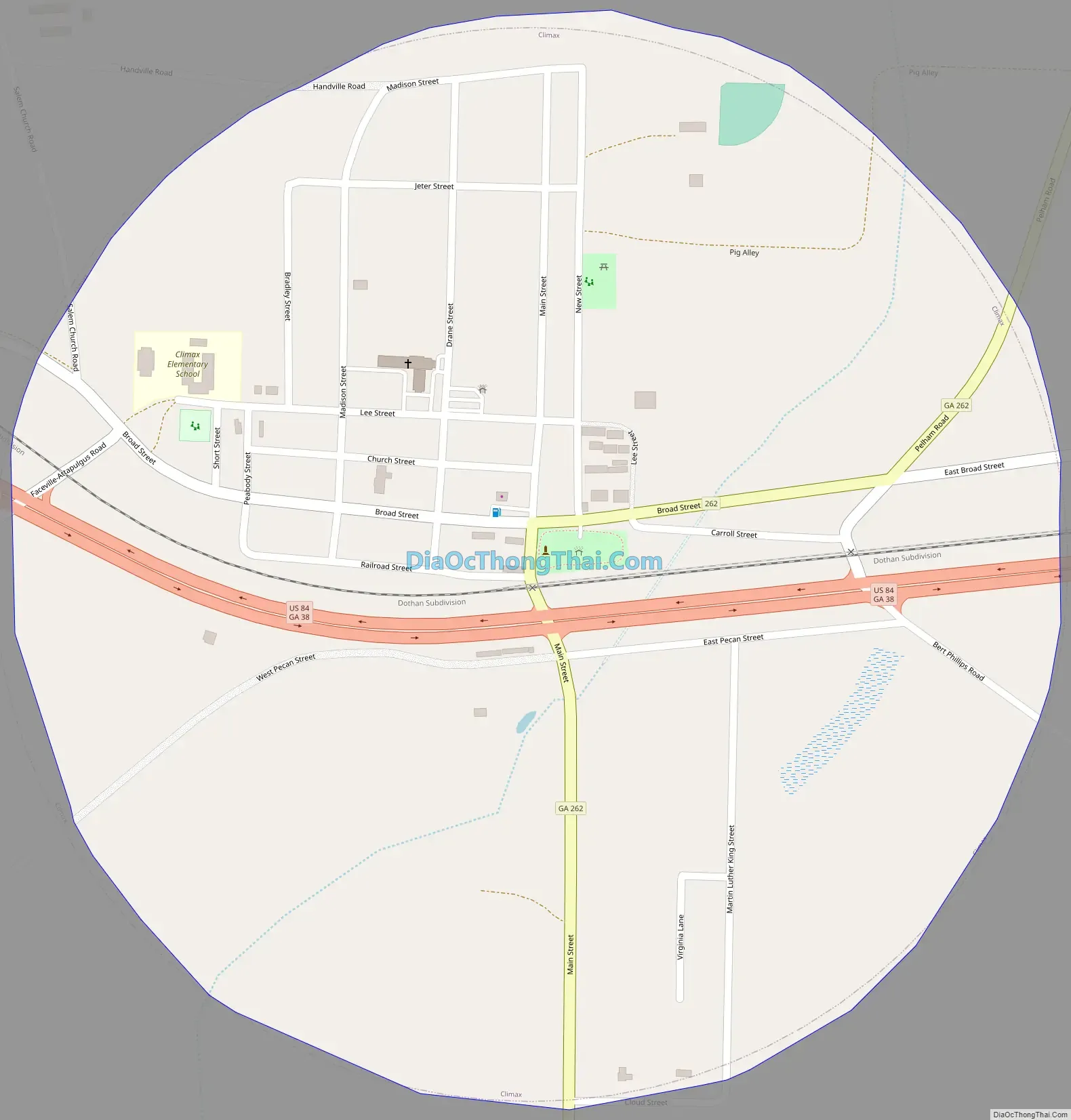
Climax Road Map
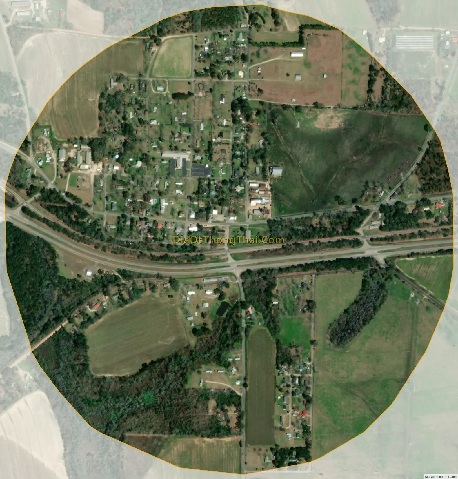
Climax city Satellite Map
Geography
Climax is located in eastern Decatur County at 30°52′38″N 84°25′55″W / 30.87722°N 84.43194°W / 30.87722; -84.43194 (30.877194, -84.431975). It sits on the crest of Curry Hill, a 300-foot-high (91 m) escarpment that forms the southwestern side of the Flint River valley.
U.S. Route 84 passes through Climax, leading west 10 miles (16 km) to Bainbridge, the Decatur County seat, and east 15 miles (24 km) to Cairo.
According to the United States Census Bureau, the town of Climax has a total area of 0.81 square miles (2.1 km), all land.
See also
Map of Georgia State and its subdivision:- Appling
- Atkinson
- Bacon
- Baker
- Baldwin
- Banks
- Barrow
- Bartow
- Ben Hill
- Berrien
- Bibb
- Bleckley
- Brantley
- Brooks
- Bryan
- Bulloch
- Burke
- Butts
- Calhoun
- Camden
- Candler
- Carroll
- Catoosa
- Charlton
- Chatham
- Chattahoochee
- Chattooga
- Cherokee
- Clarke
- Clay
- Clayton
- Clinch
- Cobb
- Coffee
- Colquitt
- Columbia
- Cook
- Coweta
- Crawford
- Crisp
- Dade
- Dawson
- Decatur
- DeKalb
- Dodge
- Dooly
- Dougherty
- Douglas
- Early
- Echols
- Effingham
- Elbert
- Emanuel
- Evans
- Fannin
- Fayette
- Floyd
- Forsyth
- Franklin
- Fulton
- Gilmer
- Glascock
- Glynn
- Gordon
- Grady
- Greene
- Gwinnett
- Habersham
- Hall
- Hancock
- Haralson
- Harris
- Hart
- Heard
- Henry
- Houston
- Irwin
- Jackson
- Jasper
- Jeff Davis
- Jefferson
- Jenkins
- Johnson
- Jones
- Lamar
- Lanier
- Laurens
- Lee
- Liberty
- Lincoln
- Long
- Lowndes
- Lumpkin
- Macon
- Madison
- Marion
- McDuffie
- McIntosh
- Meriwether
- Miller
- Mitchell
- Monroe
- Montgomery
- Morgan
- Murray
- Muscogee
- Newton
- Oconee
- Oglethorpe
- Paulding
- Peach
- Pickens
- Pierce
- Pike
- Polk
- Pulaski
- Putnam
- Quitman
- Rabun
- Randolph
- Richmond
- Rockdale
- Schley
- Screven
- Seminole
- Spalding
- Stephens
- Stewart
- Sumter
- Talbot
- Taliaferro
- Tattnall
- Taylor
- Telfair
- Terrell
- Thomas
- Tift
- Toombs
- Towns
- Treutlen
- Troup
- Turner
- Twiggs
- Union
- Upson
- Walker
- Walton
- Ware
- Warren
- Washington
- Wayne
- Webster
- Wheeler
- White
- Whitfield
- Wilcox
- Wilkes
- Wilkinson
- Worth
- Alabama
- Alaska
- Arizona
- Arkansas
- California
- Colorado
- Connecticut
- Delaware
- District of Columbia
- Florida
- Georgia
- Hawaii
- Idaho
- Illinois
- Indiana
- Iowa
- Kansas
- Kentucky
- Louisiana
- Maine
- Maryland
- Massachusetts
- Michigan
- Minnesota
- Mississippi
- Missouri
- Montana
- Nebraska
- Nevada
- New Hampshire
- New Jersey
- New Mexico
- New York
- North Carolina
- North Dakota
- Ohio
- Oklahoma
- Oregon
- Pennsylvania
- Rhode Island
- South Carolina
- South Dakota
- Tennessee
- Texas
- Utah
- Vermont
- Virginia
- Washington
- West Virginia
- Wisconsin
- Wyoming