Donalsonville is a city in and the county seat of Seminole County, Georgia, United States. The population was 2,650 at the 2010 census.
| Name: | Donalsonville city |
|---|---|
| LSAD Code: | 25 |
| LSAD Description: | city (suffix) |
| State: | Georgia |
| County: | Seminole County |
| Elevation: | 148 ft (45 m) |
| Total Area: | 3.99 sq mi (10.34 km²) |
| Land Area: | 3.97 sq mi (10.29 km²) |
| Water Area: | 0.02 sq mi (0.05 km²) |
| Total Population: | 2,833 |
| Population Density: | 713.42/sq mi (275.43/km²) |
| ZIP code: | 39845 |
| Area code: | 229 |
| FIPS code: | 1323368 |
| GNISfeature ID: | 0331568 |
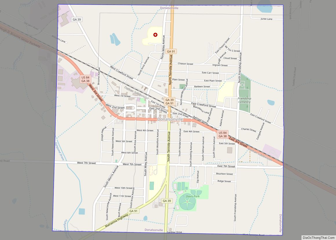
Online Interactive Map
Click on ![]() to view map in "full screen" mode.
to view map in "full screen" mode.
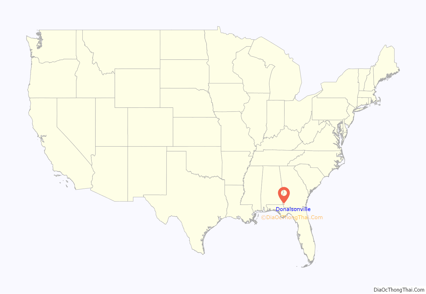
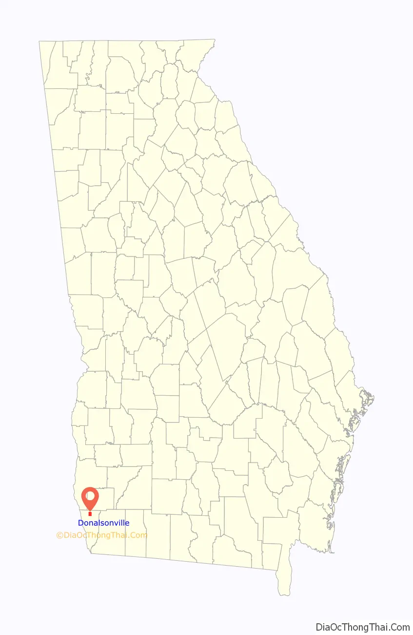
Donalsonville location map. Where is Donalsonville city?
History
Donalsonville was originally part of Decatur County. It is named after John Ernest Donalson (1846–1920), also known as Jonathan or John E. Donalson, a prominent businessman of the area. Donalson built the first lumber mill in Donalsonville, Donalson Lumber Company. He also built homes and a commissary for the workers of the mill. The lumber company paved the way for the town’s growth.
Donalsonville was first chartered as a town in Georgia on December 8, 1897. When Seminole County was formed in January 1920, Donalsonville was named as its county seat. By August 1922, the Town of Donalsonville became known as the City of Donalsonville, with the charter passing on August 19, 1922.
The Seminole County Courthouse was erected in 1922 and is still standing today. The Courthouse is listed on the National Register of Historic Places. (Wolfe)
Donalsonville is the location of the lynching of Ollie Hunter, an African American woman in her mid-sixties, who, in 1944, was assaulted and killed by a young white manupon leaving a local general store. The identity of her killer (who was briefly detained but released and never prosecuted) remains unknown.
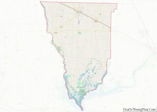
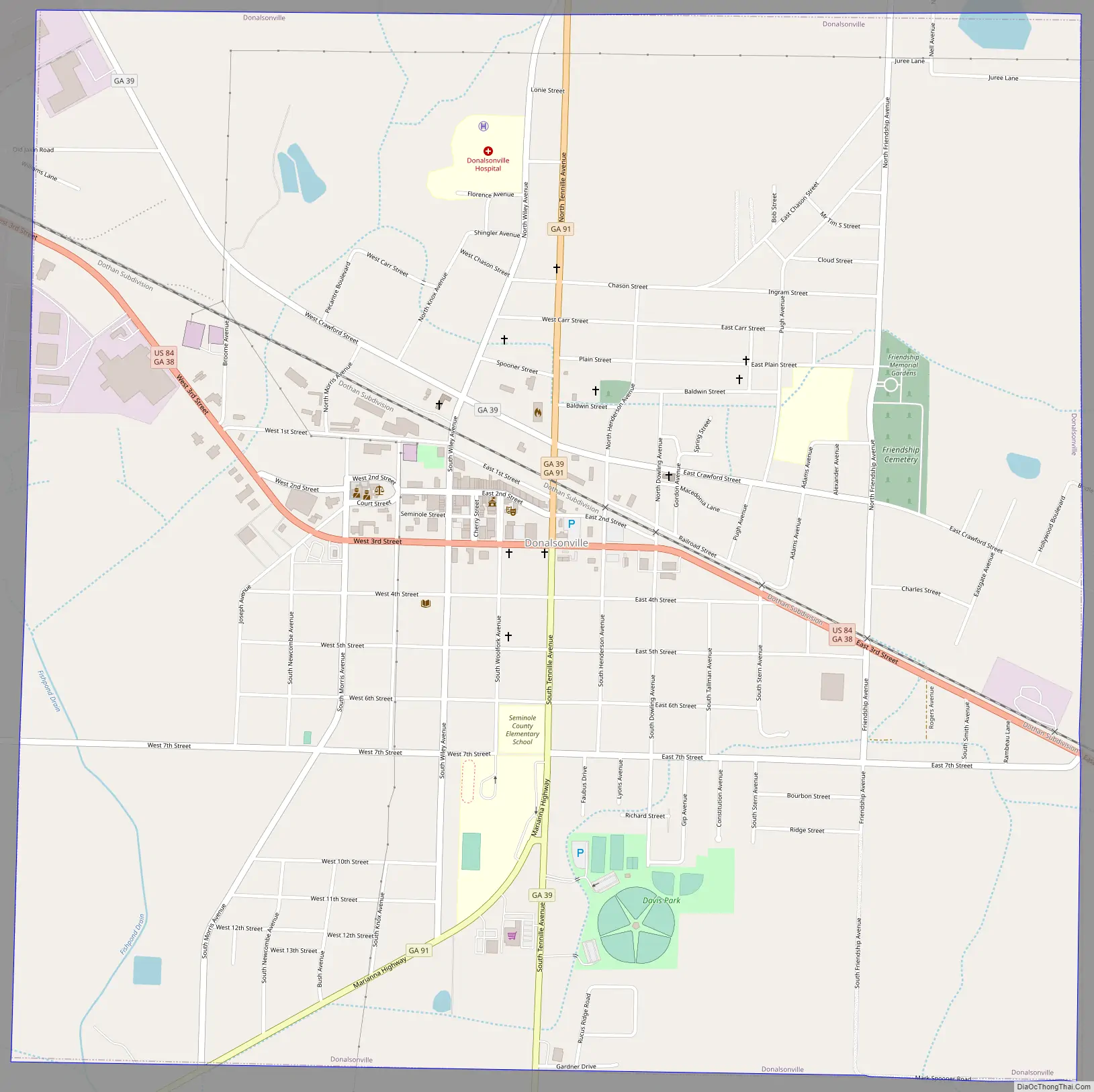
Donalsonville Road Map
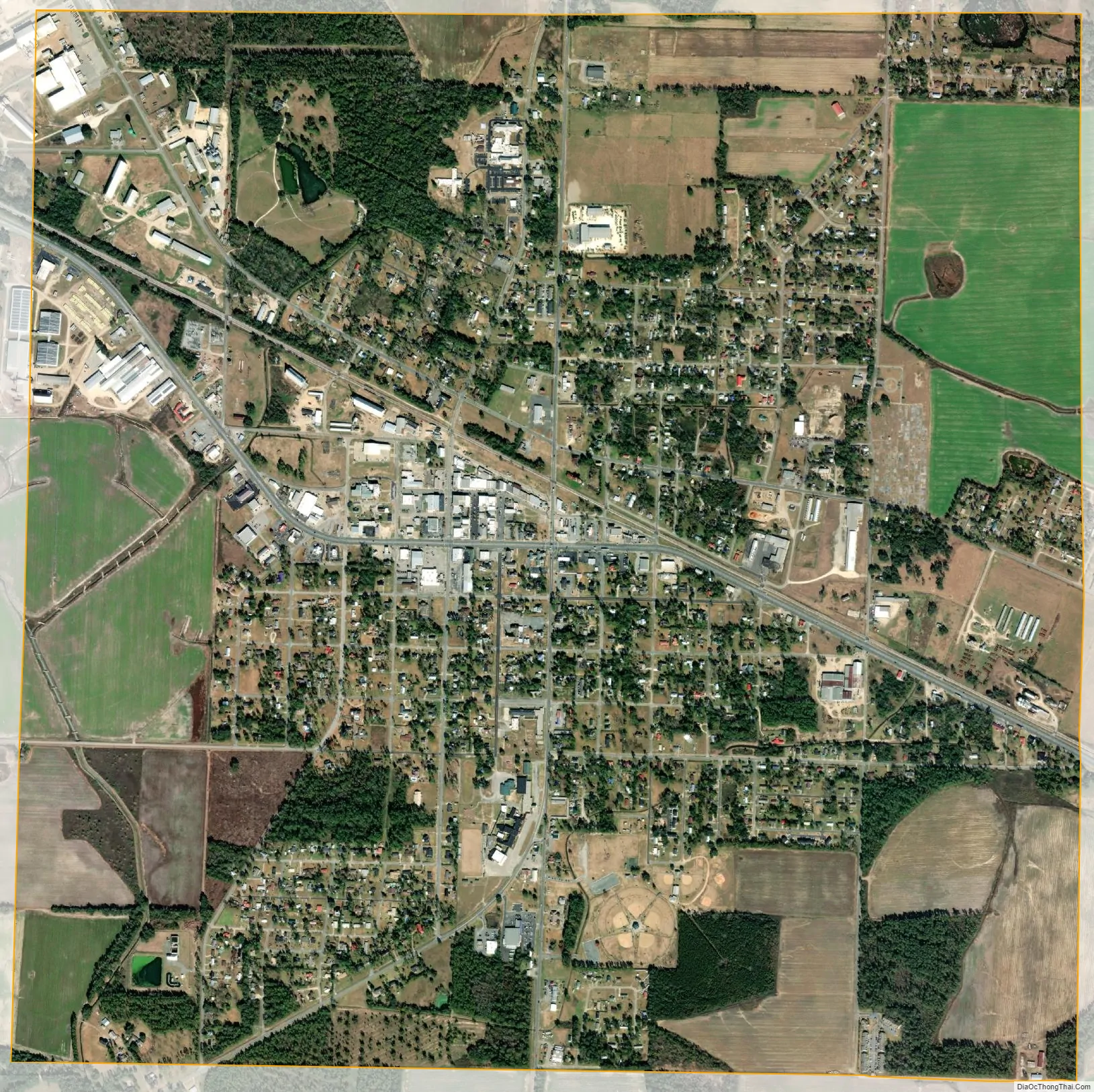
Donalsonville city Satellite Map
Geography
Donalsonville is located at 31°2′27″N 84°52′42″W / 31.04083°N 84.87833°W / 31.04083; -84.87833.
According to the United States Census Bureau, the city has a total area of 4.0 square miles (10 km), of which 4.0 square miles (10 km) is land and 0.25% is water. The city is located 20 minutes north of Lake Seminole, 62 miles (100 km) south of Albany, 36 miles (58 km) east of Dothan, Alabama and 107 miles (172 km) west of Valdosta.
Climate
See also
Map of Georgia State and its subdivision:- Appling
- Atkinson
- Bacon
- Baker
- Baldwin
- Banks
- Barrow
- Bartow
- Ben Hill
- Berrien
- Bibb
- Bleckley
- Brantley
- Brooks
- Bryan
- Bulloch
- Burke
- Butts
- Calhoun
- Camden
- Candler
- Carroll
- Catoosa
- Charlton
- Chatham
- Chattahoochee
- Chattooga
- Cherokee
- Clarke
- Clay
- Clayton
- Clinch
- Cobb
- Coffee
- Colquitt
- Columbia
- Cook
- Coweta
- Crawford
- Crisp
- Dade
- Dawson
- Decatur
- DeKalb
- Dodge
- Dooly
- Dougherty
- Douglas
- Early
- Echols
- Effingham
- Elbert
- Emanuel
- Evans
- Fannin
- Fayette
- Floyd
- Forsyth
- Franklin
- Fulton
- Gilmer
- Glascock
- Glynn
- Gordon
- Grady
- Greene
- Gwinnett
- Habersham
- Hall
- Hancock
- Haralson
- Harris
- Hart
- Heard
- Henry
- Houston
- Irwin
- Jackson
- Jasper
- Jeff Davis
- Jefferson
- Jenkins
- Johnson
- Jones
- Lamar
- Lanier
- Laurens
- Lee
- Liberty
- Lincoln
- Long
- Lowndes
- Lumpkin
- Macon
- Madison
- Marion
- McDuffie
- McIntosh
- Meriwether
- Miller
- Mitchell
- Monroe
- Montgomery
- Morgan
- Murray
- Muscogee
- Newton
- Oconee
- Oglethorpe
- Paulding
- Peach
- Pickens
- Pierce
- Pike
- Polk
- Pulaski
- Putnam
- Quitman
- Rabun
- Randolph
- Richmond
- Rockdale
- Schley
- Screven
- Seminole
- Spalding
- Stephens
- Stewart
- Sumter
- Talbot
- Taliaferro
- Tattnall
- Taylor
- Telfair
- Terrell
- Thomas
- Tift
- Toombs
- Towns
- Treutlen
- Troup
- Turner
- Twiggs
- Union
- Upson
- Walker
- Walton
- Ware
- Warren
- Washington
- Wayne
- Webster
- Wheeler
- White
- Whitfield
- Wilcox
- Wilkes
- Wilkinson
- Worth
- Alabama
- Alaska
- Arizona
- Arkansas
- California
- Colorado
- Connecticut
- Delaware
- District of Columbia
- Florida
- Georgia
- Hawaii
- Idaho
- Illinois
- Indiana
- Iowa
- Kansas
- Kentucky
- Louisiana
- Maine
- Maryland
- Massachusetts
- Michigan
- Minnesota
- Mississippi
- Missouri
- Montana
- Nebraska
- Nevada
- New Hampshire
- New Jersey
- New Mexico
- New York
- North Carolina
- North Dakota
- Ohio
- Oklahoma
- Oregon
- Pennsylvania
- Rhode Island
- South Carolina
- South Dakota
- Tennessee
- Texas
- Utah
- Vermont
- Virginia
- Washington
- West Virginia
- Wisconsin
- Wyoming