Hapeville (Abbr: HVL), established 1891, is a city in Fulton County, Georgia, United States. Hapeville is 2.5 square miles wide and located inside I-285 between the city of Atlanta to its North and the Atlanta International Airport to its south. The population was 6,553 at the 2020 census, an increase of 180 residents from the 2010 census. Hapeville is named for Dr. Samuel Hape, one of the area’s original landowners and its first mayor. Dr. Hape and other members of his family are buried in Atlanta’s Oakland Cemetery.
| Name: | Hapeville city |
|---|---|
| LSAD Code: | 25 |
| LSAD Description: | city (suffix) |
| State: | Georgia |
| County: | Fulton County |
| Elevation: | 984 ft (300 m) |
| Total Area: | 2.41 sq mi (6.23 km²) |
| Land Area: | 2.41 sq mi (6.23 km²) |
| Water Area: | 0.00 sq mi (0.00 km²) |
| Total Population: | 6,553 |
| Population Density: | 2,723.61/sq mi (1,051.59/km²) |
| ZIP code: | 30354 |
| Area code: | 404 |
| FIPS code: | 1336472 |
| GNISfeature ID: | 2403795 |
| Website: | http://www.hapeville.org/ |
Online Interactive Map
Click on ![]() to view map in "full screen" mode.
to view map in "full screen" mode.
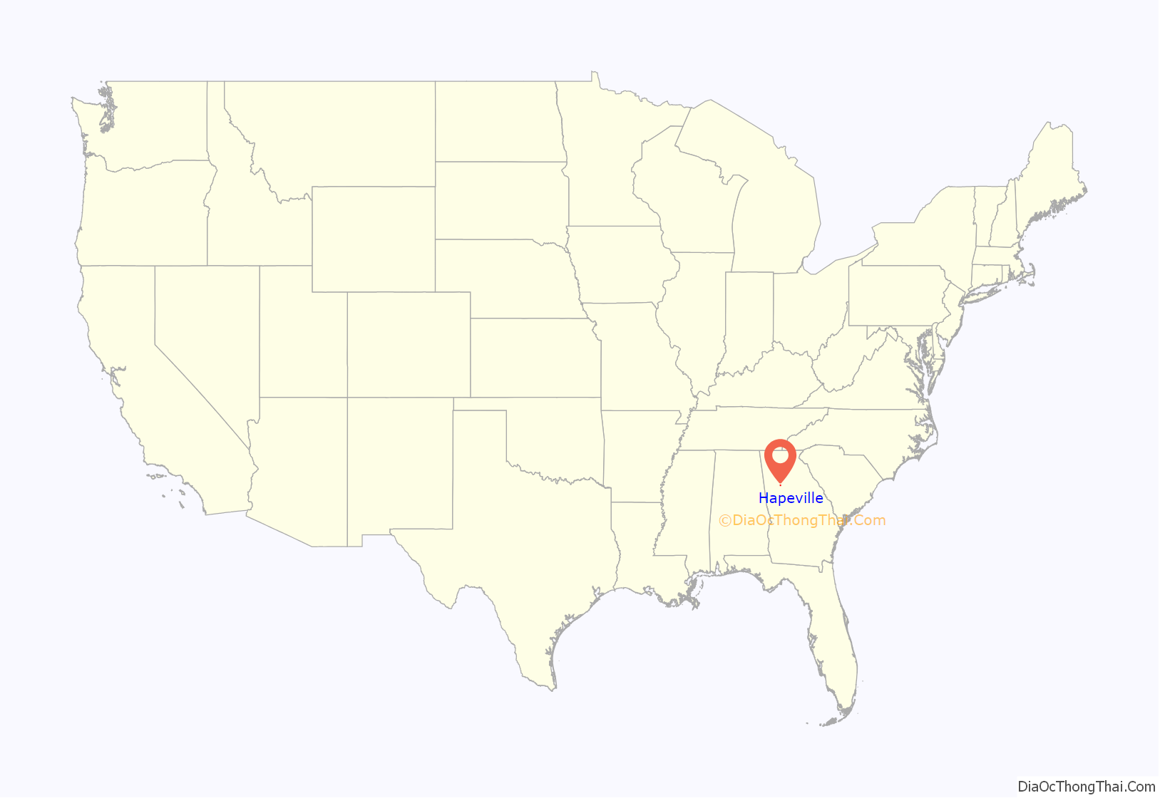
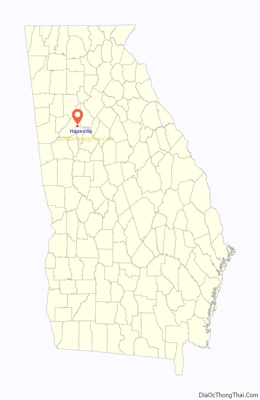
Hapeville location map. Where is Hapeville city?
History
During the 1950s and 1960s, Hapeville was a thriving part of the Tri-City (Hapeville, East Point, College Park) area and its post-World War II population supported four elementary schools (Josephine Wells, North Avenue, College Street, and St. John’s Catholic school) and one high school. During the 40 years following, it became regarded as a somewhat depressed industrial area. Since 2005, Hapeville has seen significant gentrification, beginning with the Virginia Park neighborhood and then spreading throughout the city. Hapeville has been discovered by young professionals seeking historic neighborhoods close to downtown Atlanta, and there has been a great deal of new residential construction, including single-family homes, townhomes, and upscale apartments. This new residential development has led to a revived historic downtown. Hapeville has also been discovered by metro Atlanta’s arts community, and the beginnings of an artist colony have taken shape with the formation of the Hapeville Arts Alliance. The Hapeville Historic District is listed on the National Register of Historic Places.
From 1947 until 2006, Hapeville was home to the Ford Atlanta Assembly Plant, recently manufacturing the Taurus. There are development plans to open a multi-use development, Aerotropolis Atlanta, on the site, which is adjacent to Atlanta Airport. Currently, Porsche North America is building its North America Headquarters on the Ford site.
Hapeville is also home to the Dwarf House – the first Chick-fil-A restaurant which was totally rebuilt and greatly expanded in 2021, the original location’s 4th incarnation. Hapeville is also home to the first Johnny’s Pizza. Today, Hapeville is also home to portions of the Porsche North American Headquarters. While their HQ building is technically in Atlanta, their new Porsche Classic Cars Restoration Facility, Porsche Automotive Service Center, and the Porsche Experience track expansion are all in Hapeville.
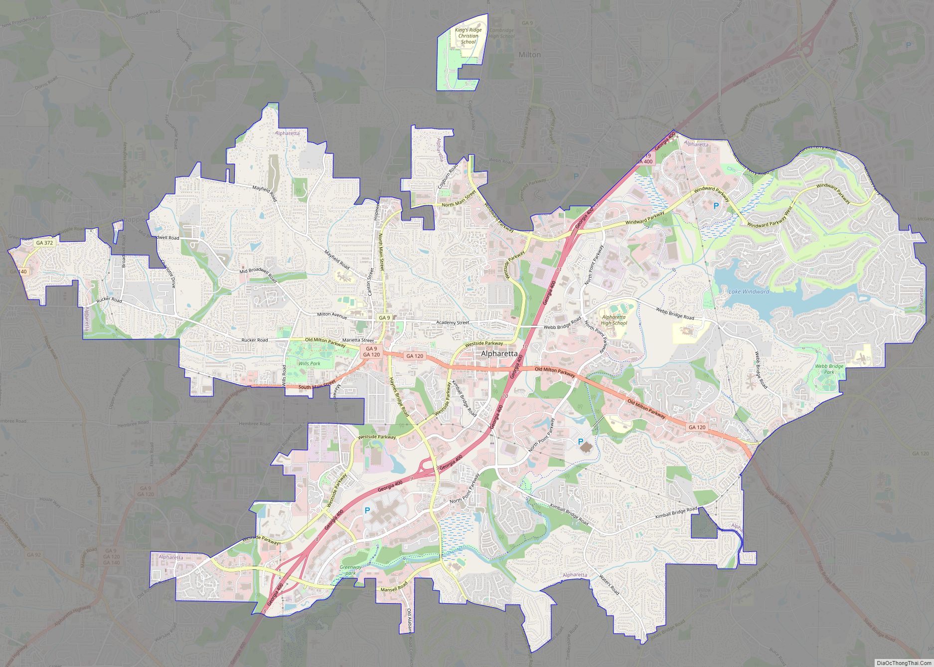
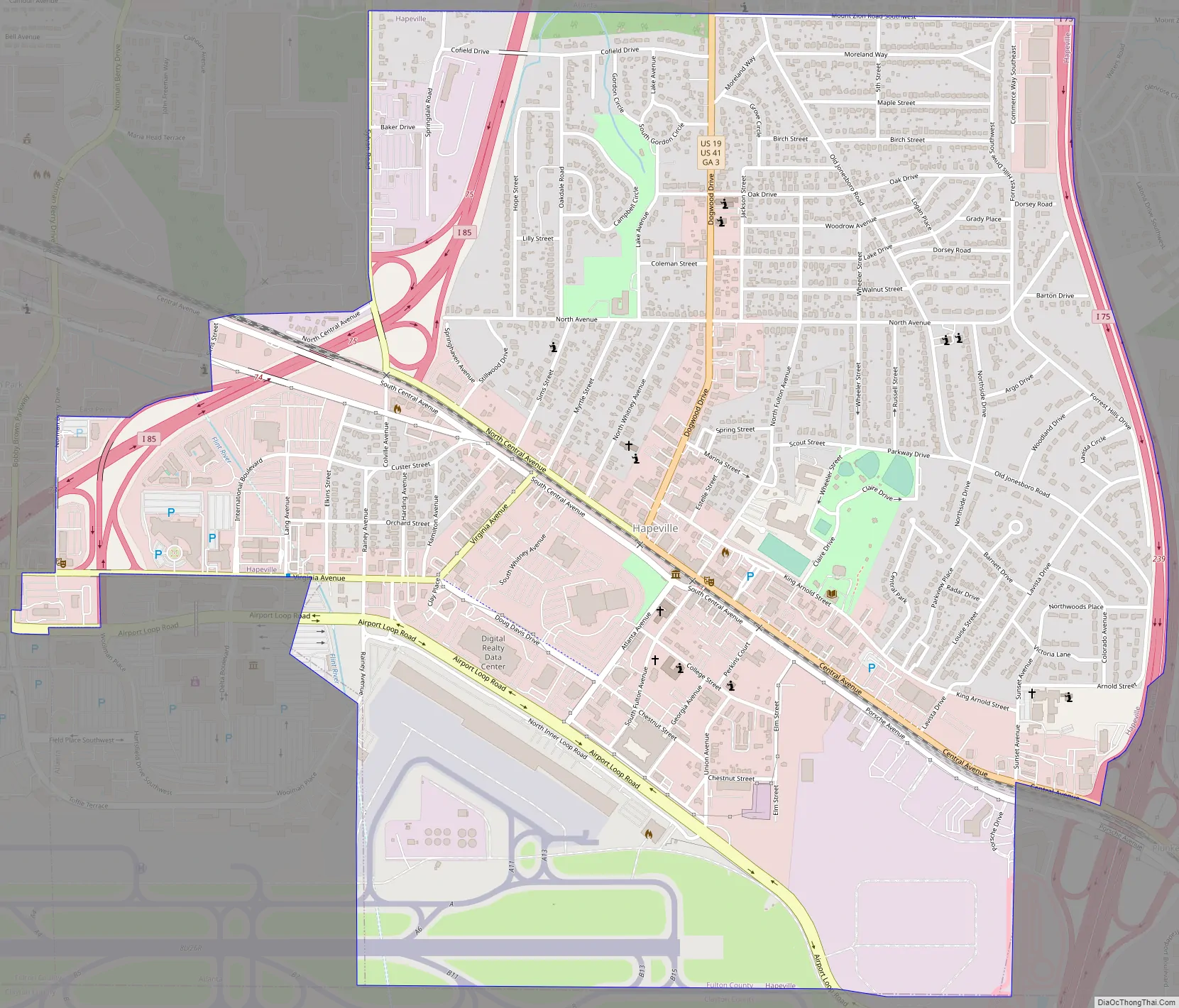
Hapeville Road Map
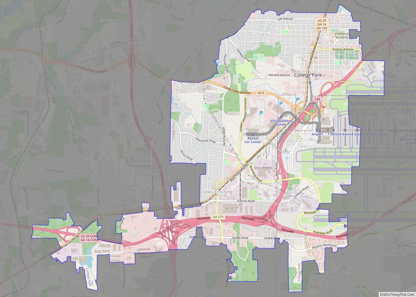
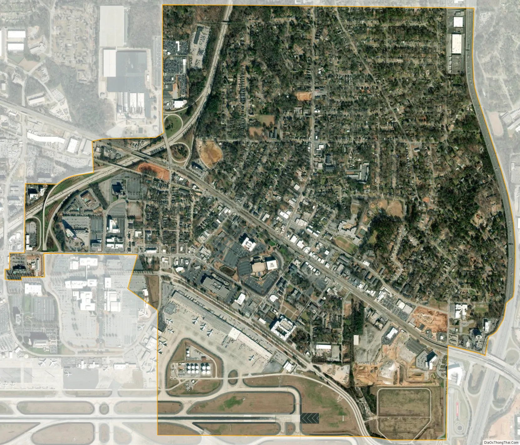
Hapeville city Satellite Map
Geography
According to the United States Census Bureau, the city has a total area of 2.4 square miles (6.2 km), all land.
See also
Map of Georgia State and its subdivision:- Appling
- Atkinson
- Bacon
- Baker
- Baldwin
- Banks
- Barrow
- Bartow
- Ben Hill
- Berrien
- Bibb
- Bleckley
- Brantley
- Brooks
- Bryan
- Bulloch
- Burke
- Butts
- Calhoun
- Camden
- Candler
- Carroll
- Catoosa
- Charlton
- Chatham
- Chattahoochee
- Chattooga
- Cherokee
- Clarke
- Clay
- Clayton
- Clinch
- Cobb
- Coffee
- Colquitt
- Columbia
- Cook
- Coweta
- Crawford
- Crisp
- Dade
- Dawson
- Decatur
- DeKalb
- Dodge
- Dooly
- Dougherty
- Douglas
- Early
- Echols
- Effingham
- Elbert
- Emanuel
- Evans
- Fannin
- Fayette
- Floyd
- Forsyth
- Franklin
- Fulton
- Gilmer
- Glascock
- Glynn
- Gordon
- Grady
- Greene
- Gwinnett
- Habersham
- Hall
- Hancock
- Haralson
- Harris
- Hart
- Heard
- Henry
- Houston
- Irwin
- Jackson
- Jasper
- Jeff Davis
- Jefferson
- Jenkins
- Johnson
- Jones
- Lamar
- Lanier
- Laurens
- Lee
- Liberty
- Lincoln
- Long
- Lowndes
- Lumpkin
- Macon
- Madison
- Marion
- McDuffie
- McIntosh
- Meriwether
- Miller
- Mitchell
- Monroe
- Montgomery
- Morgan
- Murray
- Muscogee
- Newton
- Oconee
- Oglethorpe
- Paulding
- Peach
- Pickens
- Pierce
- Pike
- Polk
- Pulaski
- Putnam
- Quitman
- Rabun
- Randolph
- Richmond
- Rockdale
- Schley
- Screven
- Seminole
- Spalding
- Stephens
- Stewart
- Sumter
- Talbot
- Taliaferro
- Tattnall
- Taylor
- Telfair
- Terrell
- Thomas
- Tift
- Toombs
- Towns
- Treutlen
- Troup
- Turner
- Twiggs
- Union
- Upson
- Walker
- Walton
- Ware
- Warren
- Washington
- Wayne
- Webster
- Wheeler
- White
- Whitfield
- Wilcox
- Wilkes
- Wilkinson
- Worth
- Alabama
- Alaska
- Arizona
- Arkansas
- California
- Colorado
- Connecticut
- Delaware
- District of Columbia
- Florida
- Georgia
- Hawaii
- Idaho
- Illinois
- Indiana
- Iowa
- Kansas
- Kentucky
- Louisiana
- Maine
- Maryland
- Massachusetts
- Michigan
- Minnesota
- Mississippi
- Missouri
- Montana
- Nebraska
- Nevada
- New Hampshire
- New Jersey
- New Mexico
- New York
- North Carolina
- North Dakota
- Ohio
- Oklahoma
- Oregon
- Pennsylvania
- Rhode Island
- South Carolina
- South Dakota
- Tennessee
- Texas
- Utah
- Vermont
- Virginia
- Washington
- West Virginia
- Wisconsin
- Wyoming