Milton is a city in Fulton County, Georgia, United States. Located about 30 miles due north of Atlanta, Milton is known for its rural and equestrian heritage. The City was incorporated on December 1, 2006, out of the unincorporated northernmost part of northern Fulton County. As of the 2010 census, Milton’s population was 32,661, with an estimated population of 39,587 in 2019. Milton is named in honor of the former Milton County, which was named after Revolutionary War hero John Milton. The portion of north Fulton County generally north of the Chattahoochee River comprises most of the territory of the former Milton County.
| Name: | Milton city |
|---|---|
| LSAD Code: | 25 |
| LSAD Description: | city (suffix) |
| State: | Georgia |
| County: | Fulton County |
| Incorporated: | December 1, 2006 |
| Elevation: | 942 ft (287 m) |
| Total Area: | 39.11 sq mi (101.29 km²) |
| Land Area: | 38.50 sq mi (99.72 km²) |
| Water Area: | 0.60 sq mi (1.56 km²) 1.6% |
| Total Population: | 41,296 |
| Population Density: | 1,072.51/sq mi (414.10/km²) |
| ZIP code: | 30004, 30009 |
| Area code: | 770, 678 |
| FIPS code: | 1351670 |
| GNISfeature ID: | 2404269 |
| Website: | www.cityofmiltonga.us |
Online Interactive Map
Click on ![]() to view map in "full screen" mode.
to view map in "full screen" mode.
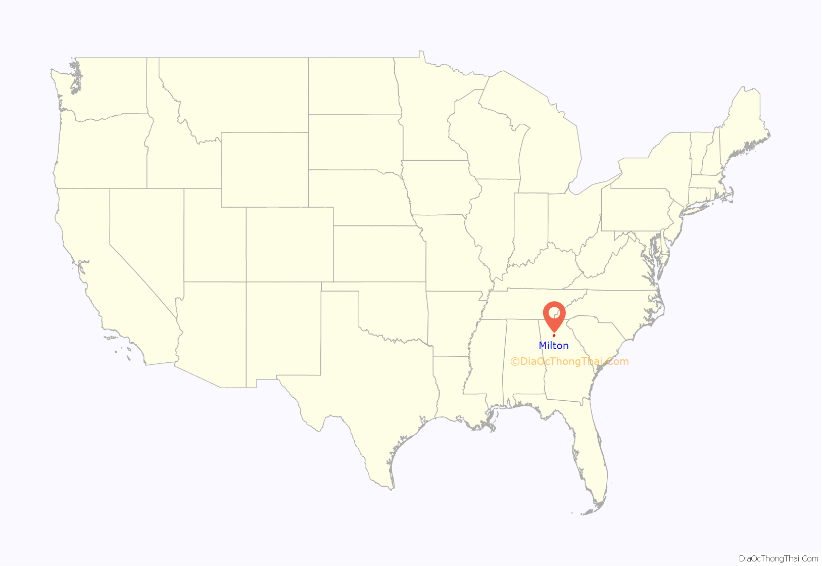
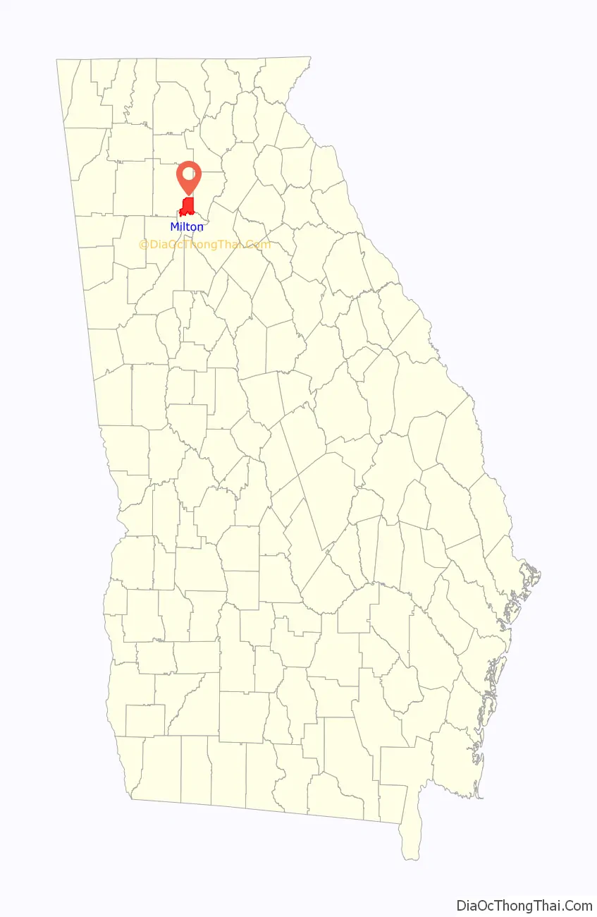
Milton location map. Where is Milton city?
History
Incorporation
A citizens’ committee was formed in 2005 to help determine the viability of incorporating unincorporated northern Fulton County. After debate, the Georgia State House and Senate approved a bill creating the city of Milton on March 9, 2006. On March 28, Governor Sonny Perdue signed the bill into law. In July 2006, voters approved a ballot referendum on July 18 by more than 86%. On August 4, 2006, Governor Perdue appointed a five-person commission to serve as the interim government of Milton (composed of Ron Wallace, Brandon Beach, Gregory Mishkin, Dan Phalan and Cecil Pruitt ) . Milton adopted the existing county ordinances on December 1, 2006.
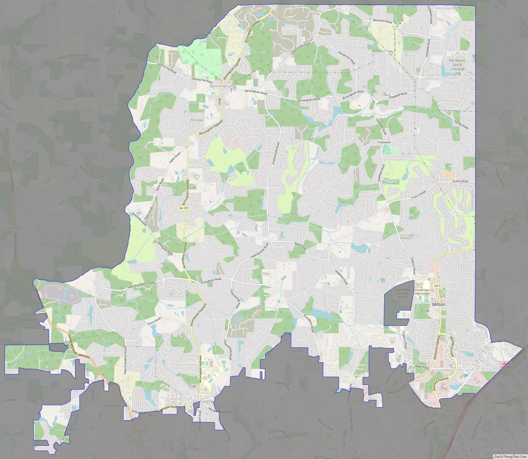
Milton Road Map
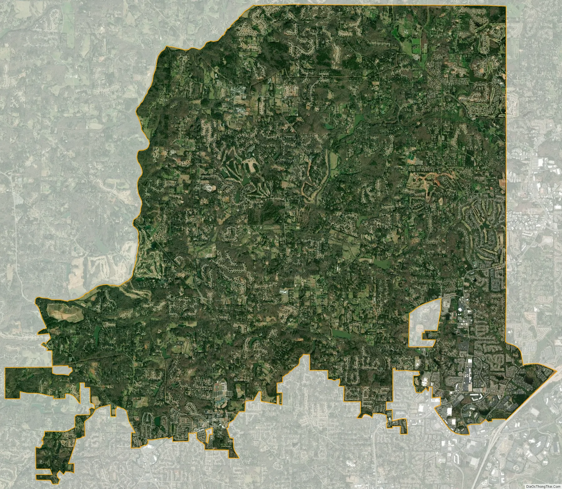
Milton city Satellite Map
Geography
Milton occupies the northern tip of Fulton County — bounded on the south by the cities of Roswell and Alpharetta, on the east by Forsyth County and Alpharetta, and on the north and west by Cherokee County. The City’s latest Comprehensive Plan divides Milton into eight “character areas” that each have, to some degree, their own unique attributes; they are Arnold Mill, Bethany, Birmingham, Central Milton, Crabapple, Deerfield, Milton Lakes and Sweetapple.
The two major north-south roads that run through Milton are State Route 9 (in the city’s southeast) and State Route 372 (more central), which is also known as Birmingham Highway. State Route 140 (Arnold Mill Road) is on the southwest part of Milton.
According to the U.S. Census Bureau, the city of Milton has a total area of 39.2 square miles (101.4 km), of which 38.5 square miles (99.8 km) is land and 0.62 square miles (1.6 km), or 1.59%, is water. The elevation ranges from 950 to 1,280 feet (290 to 390 m) above sea level.
As of April 2007, the US Postal Service recognizes Milton as a valid alias for ZIP code 30004, which is served from the Alpharetta post office.
See also
Map of Georgia State and its subdivision:- Appling
- Atkinson
- Bacon
- Baker
- Baldwin
- Banks
- Barrow
- Bartow
- Ben Hill
- Berrien
- Bibb
- Bleckley
- Brantley
- Brooks
- Bryan
- Bulloch
- Burke
- Butts
- Calhoun
- Camden
- Candler
- Carroll
- Catoosa
- Charlton
- Chatham
- Chattahoochee
- Chattooga
- Cherokee
- Clarke
- Clay
- Clayton
- Clinch
- Cobb
- Coffee
- Colquitt
- Columbia
- Cook
- Coweta
- Crawford
- Crisp
- Dade
- Dawson
- Decatur
- DeKalb
- Dodge
- Dooly
- Dougherty
- Douglas
- Early
- Echols
- Effingham
- Elbert
- Emanuel
- Evans
- Fannin
- Fayette
- Floyd
- Forsyth
- Franklin
- Fulton
- Gilmer
- Glascock
- Glynn
- Gordon
- Grady
- Greene
- Gwinnett
- Habersham
- Hall
- Hancock
- Haralson
- Harris
- Hart
- Heard
- Henry
- Houston
- Irwin
- Jackson
- Jasper
- Jeff Davis
- Jefferson
- Jenkins
- Johnson
- Jones
- Lamar
- Lanier
- Laurens
- Lee
- Liberty
- Lincoln
- Long
- Lowndes
- Lumpkin
- Macon
- Madison
- Marion
- McDuffie
- McIntosh
- Meriwether
- Miller
- Mitchell
- Monroe
- Montgomery
- Morgan
- Murray
- Muscogee
- Newton
- Oconee
- Oglethorpe
- Paulding
- Peach
- Pickens
- Pierce
- Pike
- Polk
- Pulaski
- Putnam
- Quitman
- Rabun
- Randolph
- Richmond
- Rockdale
- Schley
- Screven
- Seminole
- Spalding
- Stephens
- Stewart
- Sumter
- Talbot
- Taliaferro
- Tattnall
- Taylor
- Telfair
- Terrell
- Thomas
- Tift
- Toombs
- Towns
- Treutlen
- Troup
- Turner
- Twiggs
- Union
- Upson
- Walker
- Walton
- Ware
- Warren
- Washington
- Wayne
- Webster
- Wheeler
- White
- Whitfield
- Wilcox
- Wilkes
- Wilkinson
- Worth
- Alabama
- Alaska
- Arizona
- Arkansas
- California
- Colorado
- Connecticut
- Delaware
- District of Columbia
- Florida
- Georgia
- Hawaii
- Idaho
- Illinois
- Indiana
- Iowa
- Kansas
- Kentucky
- Louisiana
- Maine
- Maryland
- Massachusetts
- Michigan
- Minnesota
- Mississippi
- Missouri
- Montana
- Nebraska
- Nevada
- New Hampshire
- New Jersey
- New Mexico
- New York
- North Carolina
- North Dakota
- Ohio
- Oklahoma
- Oregon
- Pennsylvania
- Rhode Island
- South Carolina
- South Dakota
- Tennessee
- Texas
- Utah
- Vermont
- Virginia
- Washington
- West Virginia
- Wisconsin
- Wyoming