Martin is a town in Stephens and Franklin County counties in the U.S. state of Georgia. The population was 381 at the 2010 census, up from 311 in 2000.
| Name: | Martin town |
|---|---|
| LSAD Code: | 43 |
| LSAD Description: | town (suffix) |
| State: | Georgia |
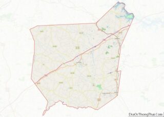
| County: | Franklin County, Stephens County |
| Elevation: | 919 ft (280 m) |
| Total Area: | 2.53 sq mi (6.56 km²) |
| Land Area: | 2.51 sq mi (6.50 km²) |
| Water Area: | 0.02 sq mi (0.06 km²) |
| Total Population: | 336 |
| Population Density: | 133.81/sq mi (51.67/km²) |
| ZIP code: | 30557 |
| Area code: | 706 |
| FIPS code: | 1350008 |
| GNISfeature ID: | 0317732 |
| Website: | http://www.townofmartin.com |
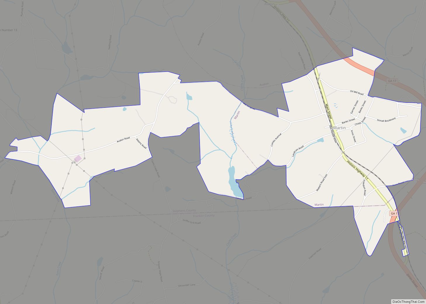
Online Interactive Map
Click on ![]() to view map in "full screen" mode.
to view map in "full screen" mode.
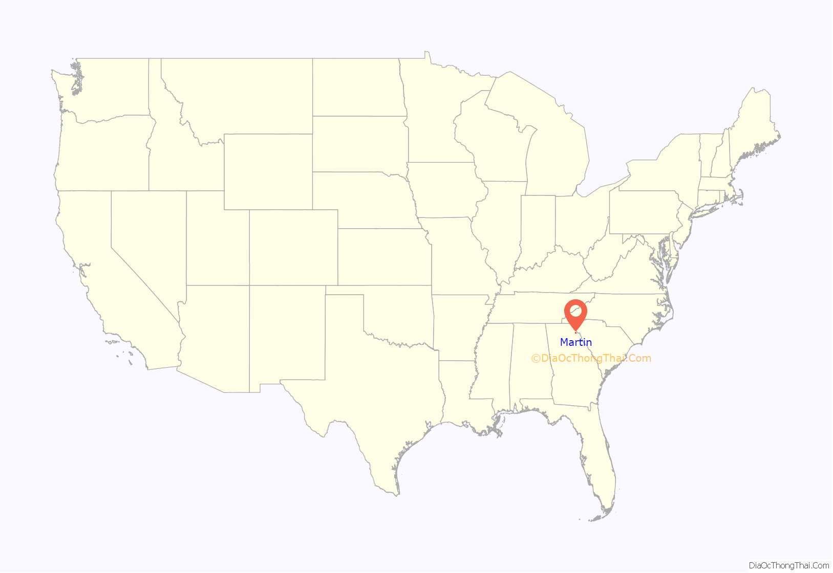
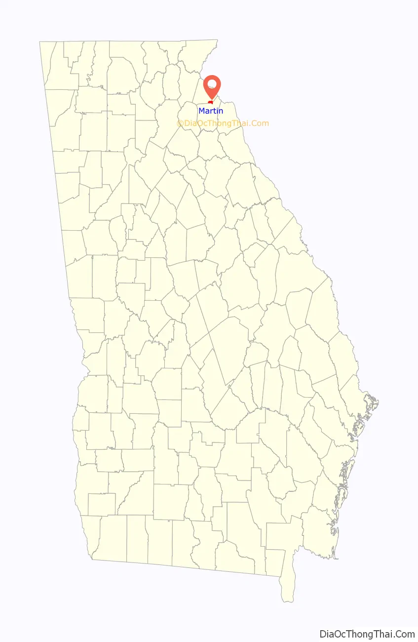
Martin location map. Where is Martin town?
History
Martin was incorporated in 1891. Its first settler, Henry C. Black, was the Air Line Railroad agent at its station (set up in 1877) at the junction of Red Hollow Road and the railroad. Henry Black built houses and established stores around the junction, which attracted other settlers. The Red Hollow Road was an important conduit for farm products from the mountain areas to Augusta and Savannah. The town was named for John Martin, a Rhode Island man who became governor of Georgia in 1782.
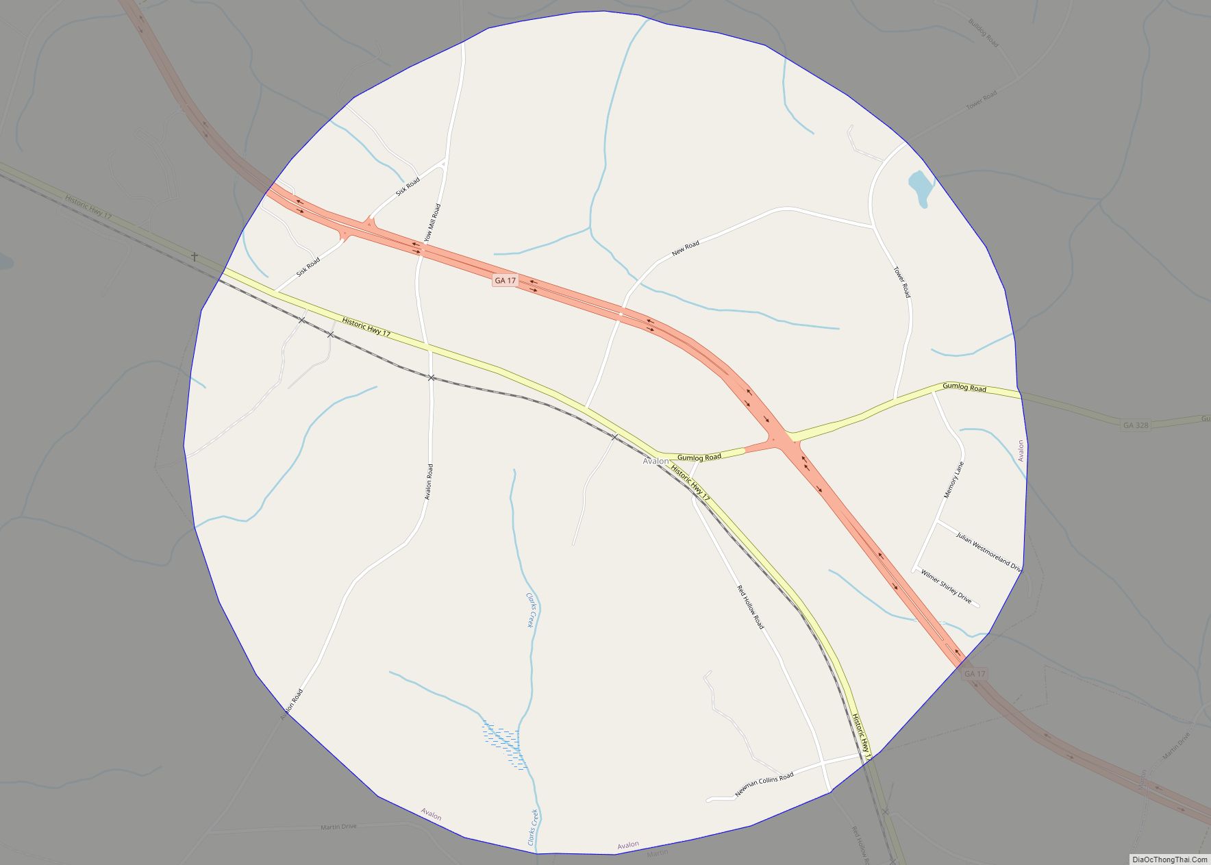
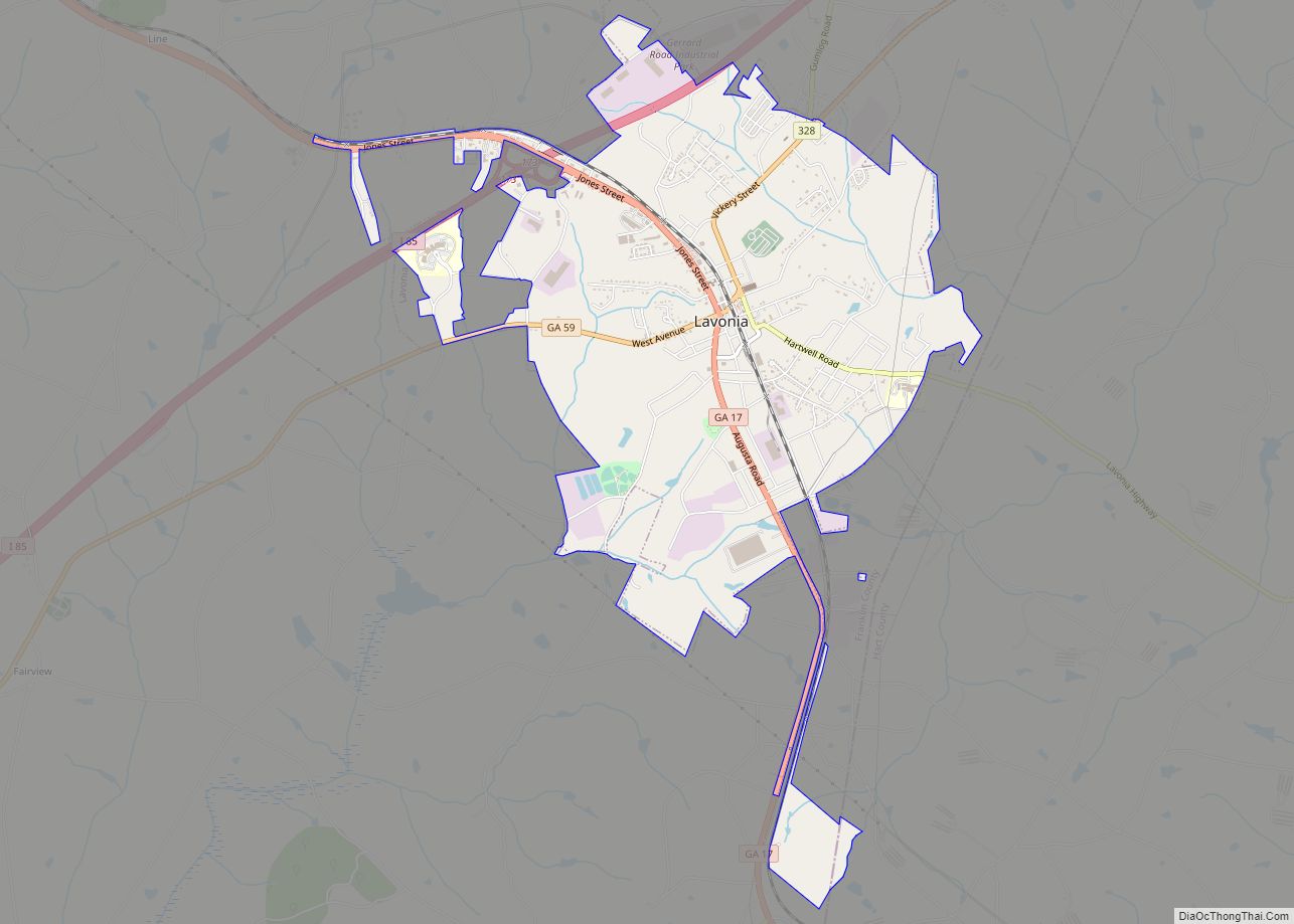
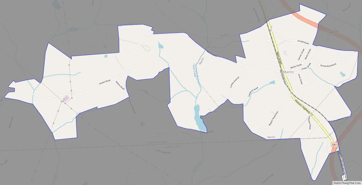
Martin Road Map
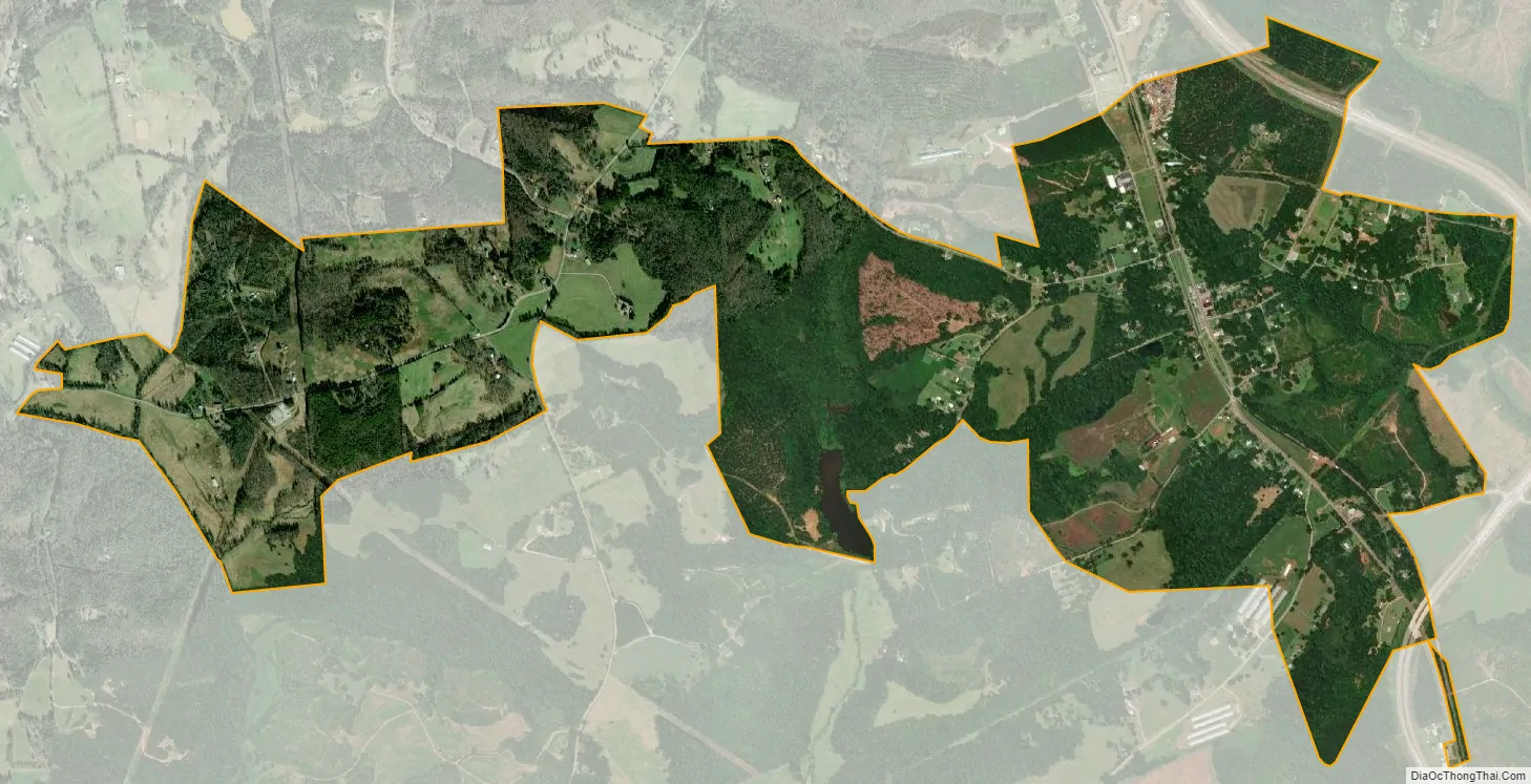
Martin city Satellite Map
Geography
Martin is located in southeastern Stephens County at 34°29′12″N 83°11′8″W / 34.48667°N 83.18556°W / 34.48667; -83.18556 (34.486662, -83.185656) A small portion extends south into Franklin County. It is bordered to the north by the town of Avalon. Georgia State Route 17 passes through Martin, leading northwest 11 miles (18 km) to Toccoa and southeast 6 miles (10 km) to Lavonia.
According to the United States Census Bureau, the town of Martin has a total area of 2.5 square miles (6.6 km), of which 0.02 square miles (0.06 km), or 0.85%, is water.
See also
Map of Georgia State and its subdivision:- Appling
- Atkinson
- Bacon
- Baker
- Baldwin
- Banks
- Barrow
- Bartow
- Ben Hill
- Berrien
- Bibb
- Bleckley
- Brantley
- Brooks
- Bryan
- Bulloch
- Burke
- Butts
- Calhoun
- Camden
- Candler
- Carroll
- Catoosa
- Charlton
- Chatham
- Chattahoochee
- Chattooga
- Cherokee
- Clarke
- Clay
- Clayton
- Clinch
- Cobb
- Coffee
- Colquitt
- Columbia
- Cook
- Coweta
- Crawford
- Crisp
- Dade
- Dawson
- Decatur
- DeKalb
- Dodge
- Dooly
- Dougherty
- Douglas
- Early
- Echols
- Effingham
- Elbert
- Emanuel
- Evans
- Fannin
- Fayette
- Floyd
- Forsyth
- Franklin
- Fulton
- Gilmer
- Glascock
- Glynn
- Gordon
- Grady
- Greene
- Gwinnett
- Habersham
- Hall
- Hancock
- Haralson
- Harris
- Hart
- Heard
- Henry
- Houston
- Irwin
- Jackson
- Jasper
- Jeff Davis
- Jefferson
- Jenkins
- Johnson
- Jones
- Lamar
- Lanier
- Laurens
- Lee
- Liberty
- Lincoln
- Long
- Lowndes
- Lumpkin
- Macon
- Madison
- Marion
- McDuffie
- McIntosh
- Meriwether
- Miller
- Mitchell
- Monroe
- Montgomery
- Morgan
- Murray
- Muscogee
- Newton
- Oconee
- Oglethorpe
- Paulding
- Peach
- Pickens
- Pierce
- Pike
- Polk
- Pulaski
- Putnam
- Quitman
- Rabun
- Randolph
- Richmond
- Rockdale
- Schley
- Screven
- Seminole
- Spalding
- Stephens
- Stewart
- Sumter
- Talbot
- Taliaferro
- Tattnall
- Taylor
- Telfair
- Terrell
- Thomas
- Tift
- Toombs
- Towns
- Treutlen
- Troup
- Turner
- Twiggs
- Union
- Upson
- Walker
- Walton
- Ware
- Warren
- Washington
- Wayne
- Webster
- Wheeler
- White
- Whitfield
- Wilcox
- Wilkes
- Wilkinson
- Worth
- Alabama
- Alaska
- Arizona
- Arkansas
- California
- Colorado
- Connecticut
- Delaware
- District of Columbia
- Florida
- Georgia
- Hawaii
- Idaho
- Illinois
- Indiana
- Iowa
- Kansas
- Kentucky
- Louisiana
- Maine
- Maryland
- Massachusetts
- Michigan
- Minnesota
- Mississippi
- Missouri
- Montana
- Nebraska
- Nevada
- New Hampshire
- New Jersey
- New Mexico
- New York
- North Carolina
- North Dakota
- Ohio
- Oklahoma
- Oregon
- Pennsylvania
- Rhode Island
- South Carolina
- South Dakota
- Tennessee
- Texas
- Utah
- Vermont
- Virginia
- Washington
- West Virginia
- Wisconsin
- Wyoming