Morganton is a city in Fannin County, Georgia, United States. The population was 303 at the 2010 census.
| Name: | Morganton city |
|---|---|
| LSAD Code: | 25 |
| LSAD Description: | city (suffix) |
| State: | Georgia |
| County: | Fannin County |
| Elevation: | 1,778 ft (542 m) |
| Total Area: | 0.79 sq mi (2.05 km²) |
| Land Area: | 0.78 sq mi (2.03 km²) |
| Water Area: | 0.01 sq mi (0.02 km²) |
| Total Population: | 285 |
| Population Density: | 363.52/sq mi (140.40/km²) |
| ZIP code: | 30560 |
| Area code: | 706/762 |
| FIPS code: | 1352724 |
| GNISfeature ID: | 0328842 |
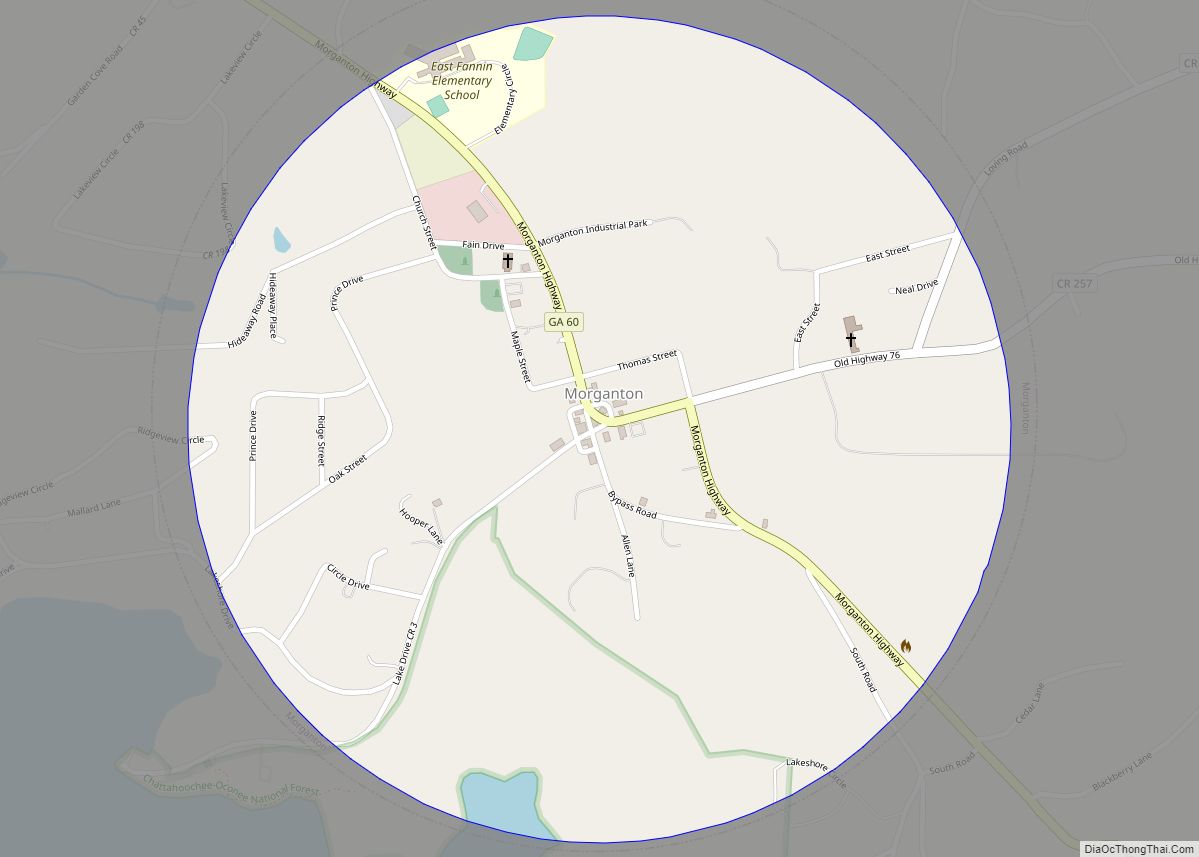
Online Interactive Map
Click on ![]() to view map in "full screen" mode.
to view map in "full screen" mode.
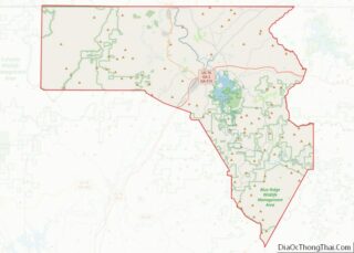
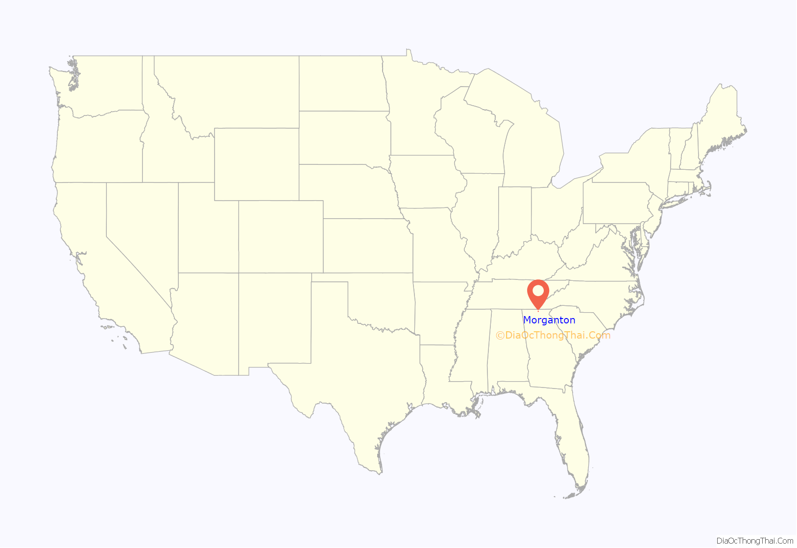
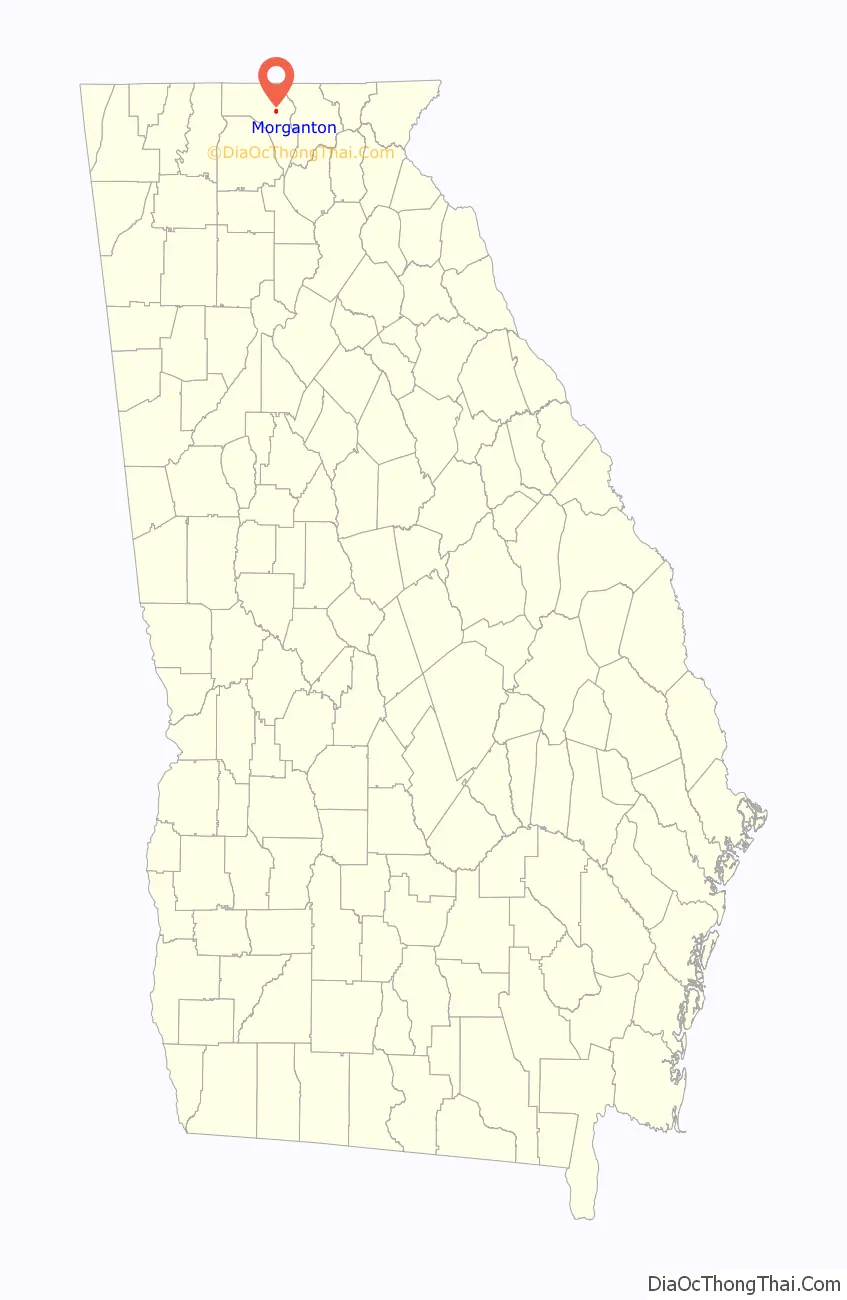
Morganton location map. Where is Morganton city?
History
Prior to European colonization, the area that is now Morganton was inhabited by the Cherokee people and other Indigenous peoples for thousands of years.
The Georgia General Assembly incorporated Morganton in 1856. The town’s name is a transfer from Morganton, North Carolina.
Morganton served as the seat of Fannin County from 1854 until 1895, when the seat was transferred to Blue Ridge.
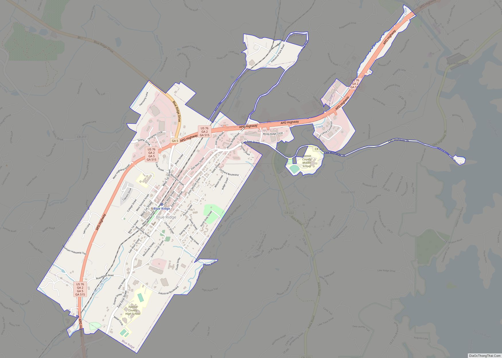
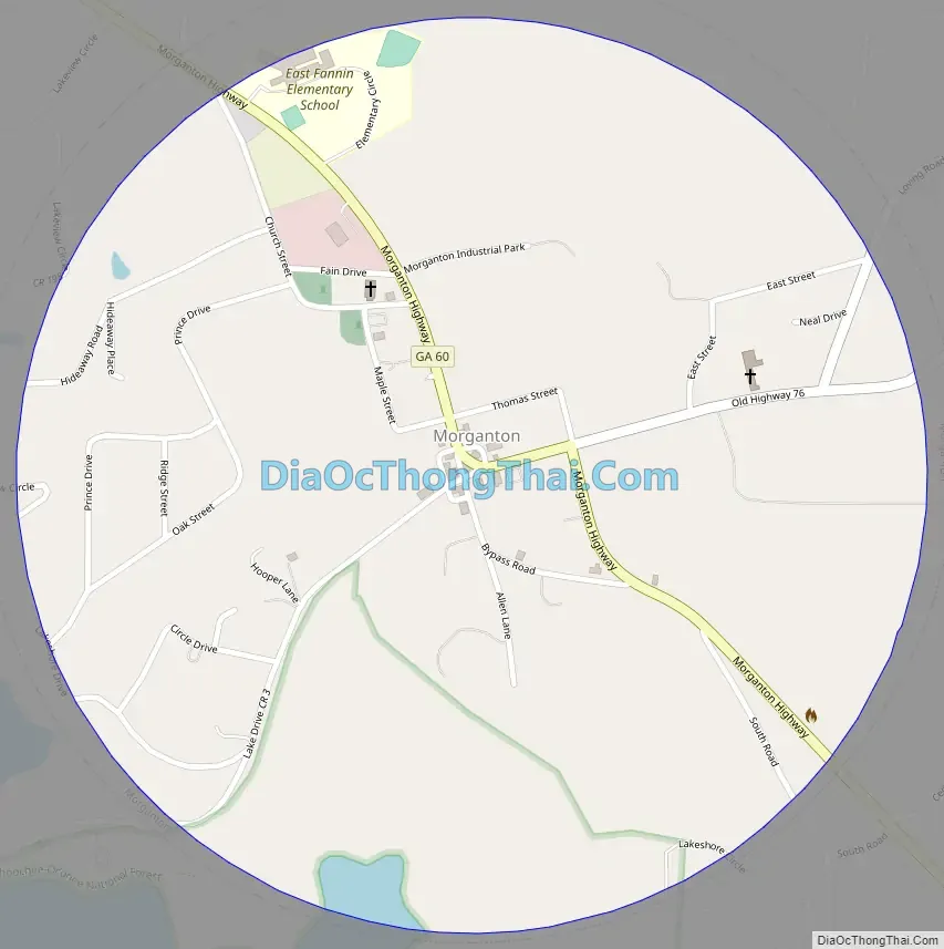
Morganton Road Map
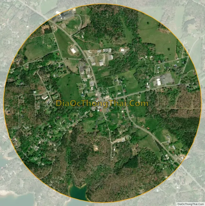
Morganton city Satellite Map
Geography
Morganton is located in eastern Fannin County at 34°52′36″N 84°14′44″W / 34.87667°N 84.24556°W / 34.87667; -84.24556 (34.876616, -84.245432), on the northeast side of Blue Ridge Reservoir. Georgia State Route 60 passes through the city, leading northwest 1.5 miles (2.4 km) to U.S. Route 76 and southeast 26 miles (42 km) to Suches. Via SR 60 and old US 76, it is 6 miles (10 km) west to Blue Ridge, the county seat.
According to the United States Census Bureau, Morganton has a total area of 0.83 square miles (2.16 km), of which 0.004 square miles (0.01 km), or 0.66%, is water.
See also
Map of Georgia State and its subdivision:- Appling
- Atkinson
- Bacon
- Baker
- Baldwin
- Banks
- Barrow
- Bartow
- Ben Hill
- Berrien
- Bibb
- Bleckley
- Brantley
- Brooks
- Bryan
- Bulloch
- Burke
- Butts
- Calhoun
- Camden
- Candler
- Carroll
- Catoosa
- Charlton
- Chatham
- Chattahoochee
- Chattooga
- Cherokee
- Clarke
- Clay
- Clayton
- Clinch
- Cobb
- Coffee
- Colquitt
- Columbia
- Cook
- Coweta
- Crawford
- Crisp
- Dade
- Dawson
- Decatur
- DeKalb
- Dodge
- Dooly
- Dougherty
- Douglas
- Early
- Echols
- Effingham
- Elbert
- Emanuel
- Evans
- Fannin
- Fayette
- Floyd
- Forsyth
- Franklin
- Fulton
- Gilmer
- Glascock
- Glynn
- Gordon
- Grady
- Greene
- Gwinnett
- Habersham
- Hall
- Hancock
- Haralson
- Harris
- Hart
- Heard
- Henry
- Houston
- Irwin
- Jackson
- Jasper
- Jeff Davis
- Jefferson
- Jenkins
- Johnson
- Jones
- Lamar
- Lanier
- Laurens
- Lee
- Liberty
- Lincoln
- Long
- Lowndes
- Lumpkin
- Macon
- Madison
- Marion
- McDuffie
- McIntosh
- Meriwether
- Miller
- Mitchell
- Monroe
- Montgomery
- Morgan
- Murray
- Muscogee
- Newton
- Oconee
- Oglethorpe
- Paulding
- Peach
- Pickens
- Pierce
- Pike
- Polk
- Pulaski
- Putnam
- Quitman
- Rabun
- Randolph
- Richmond
- Rockdale
- Schley
- Screven
- Seminole
- Spalding
- Stephens
- Stewart
- Sumter
- Talbot
- Taliaferro
- Tattnall
- Taylor
- Telfair
- Terrell
- Thomas
- Tift
- Toombs
- Towns
- Treutlen
- Troup
- Turner
- Twiggs
- Union
- Upson
- Walker
- Walton
- Ware
- Warren
- Washington
- Wayne
- Webster
- Wheeler
- White
- Whitfield
- Wilcox
- Wilkes
- Wilkinson
- Worth
- Alabama
- Alaska
- Arizona
- Arkansas
- California
- Colorado
- Connecticut
- Delaware
- District of Columbia
- Florida
- Georgia
- Hawaii
- Idaho
- Illinois
- Indiana
- Iowa
- Kansas
- Kentucky
- Louisiana
- Maine
- Maryland
- Massachusetts
- Michigan
- Minnesota
- Mississippi
- Missouri
- Montana
- Nebraska
- Nevada
- New Hampshire
- New Jersey
- New Mexico
- New York
- North Carolina
- North Dakota
- Ohio
- Oklahoma
- Oregon
- Pennsylvania
- Rhode Island
- South Carolina
- South Dakota
- Tennessee
- Texas
- Utah
- Vermont
- Virginia
- Washington
- West Virginia
- Wisconsin
- Wyoming