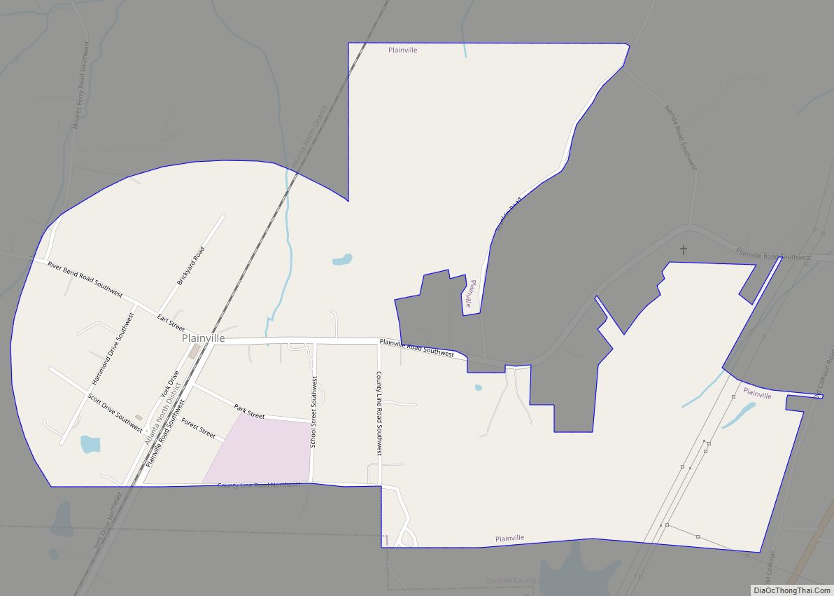
Plainville is a city located in Gordon County, Georgia. The population of Plainville was 313 at the 2010 census, up from 257 at the 2000 census.
| Name: | Plainville city |
|---|---|
| LSAD Code: | 25 |
| LSAD Description: | city (suffix) |
| State: | Georgia |
| County: | Gordon County |
| Elevation: | 679 ft (207 m) |
| Total Area: | 0.72 sq mi (1.87 km²) |
| Land Area: | 0.72 sq mi (1.87 km²) |
| Water Area: | 0.00 sq mi (0.00 km²) |
| Total Population: | 356 |
| Population Density: | 493.07/sq mi (190.32/km²) |
| ZIP code: | 30733 |
| Area code: | 706/762 |
| FIPS code: | 1361684 |
| GNISfeature ID: | 0332706 |
| Website: | plainvillega.com |
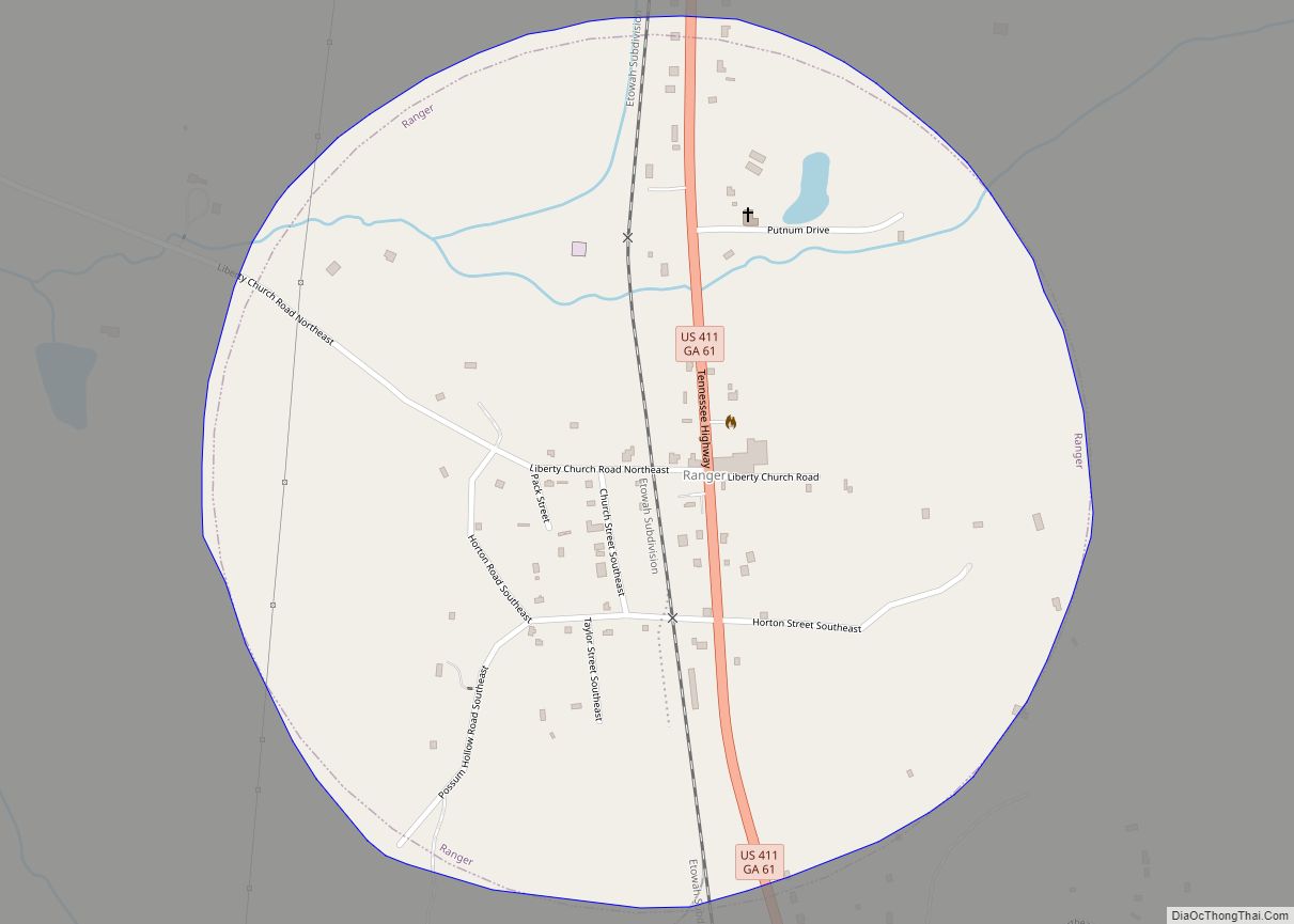
Online Interactive Map
Click on ![]() to view map in "full screen" mode.
to view map in "full screen" mode.
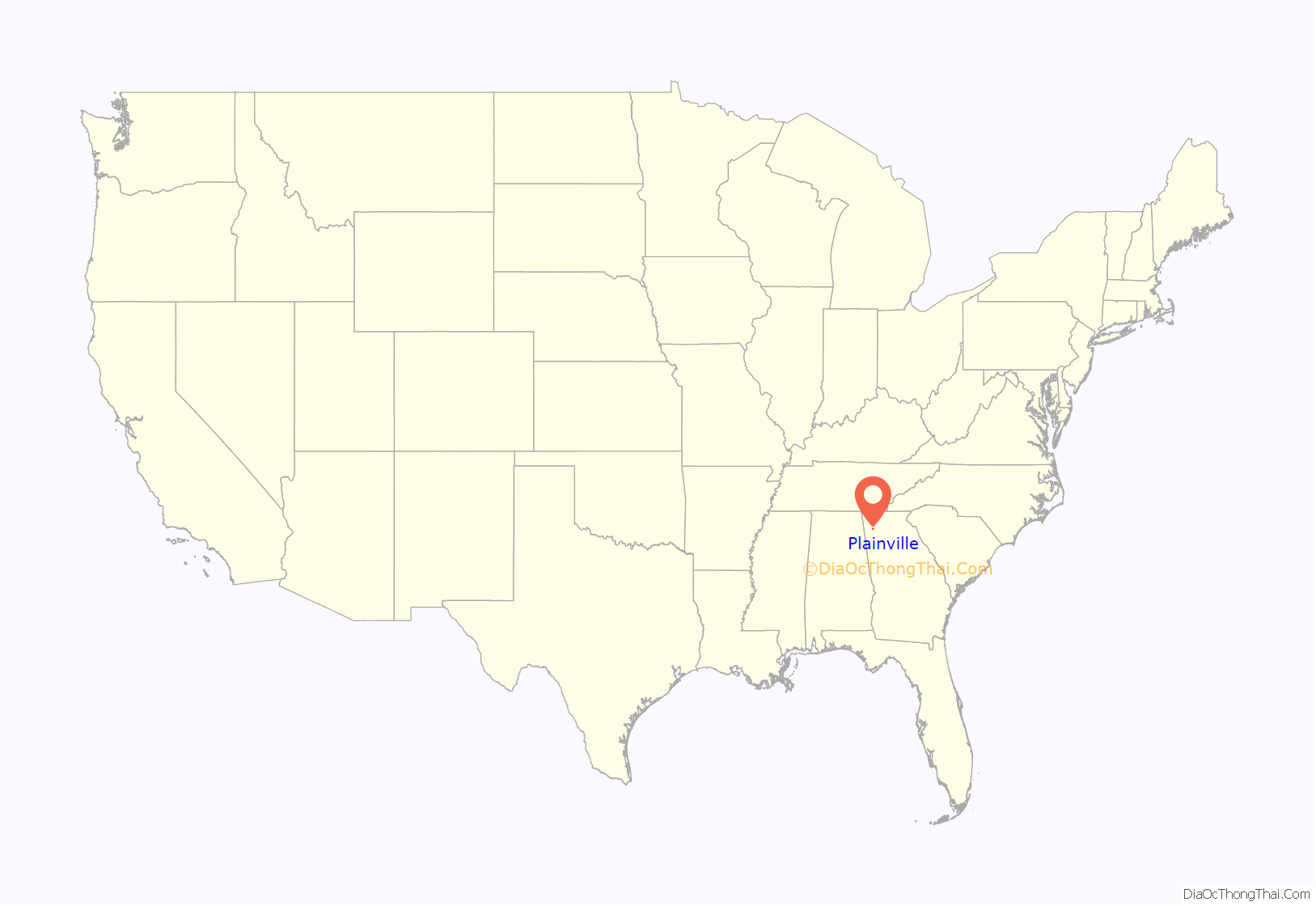
Plainville location map. Where is Plainville city?
History
Plainville was incorporated in 1903. The name is a transfer from Plainville, Connecticut.
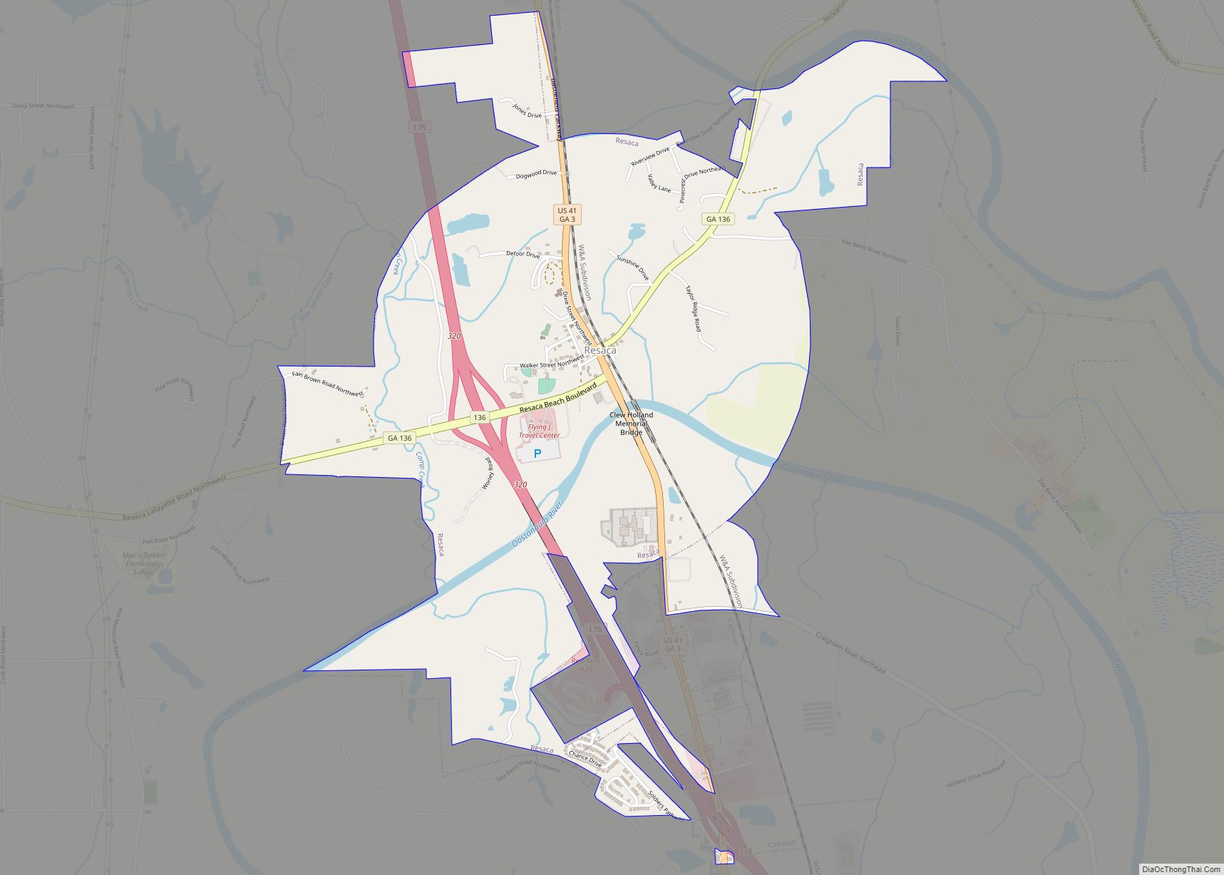
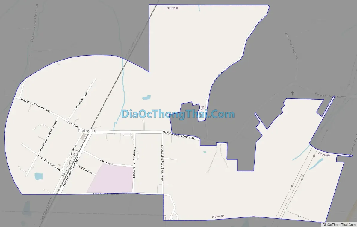
Plainville Road Map
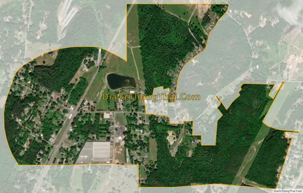
Plainville city Satellite Map
Geography
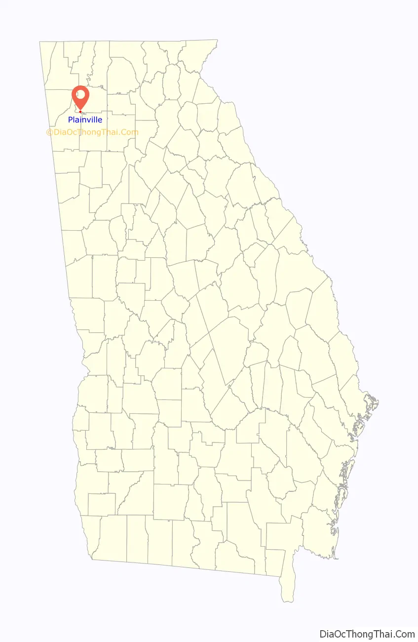
Plainville is located in southwestern Gordon County at 34°24′15″N 85°2′15″W / 34.40417°N 85.03750°W / 34.40417; -85.03750 (34.404212, -85.037404). The southern border of the town is the Floyd County line. Georgia State Highway 53 passes 1.5 miles (2.4 km) east of the city, leading northeast 8 miles (13 km) to Calhoun, the Gordon County seat, and southwest 14 miles (23 km) to Rome.
Plainville has an area of 0.72 square miles (1.87 km), all land.
Plainville is situated in the Ridge-and-Valley region of northwest Georgia, about 3 miles (5 km) east of a bend in the Oostanaula River, an area known as “the Bend”.
See also
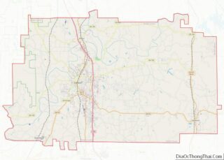
Map of Georgia State and its subdivision:- Appling
- Atkinson
- Bacon
- Baker
- Baldwin
- Banks
- Barrow
- Bartow
- Ben Hill
- Berrien
- Bibb
- Bleckley
- Brantley
- Brooks
- Bryan
- Bulloch
- Burke
- Butts
- Calhoun
- Camden
- Candler
- Carroll
- Catoosa
- Charlton
- Chatham
- Chattahoochee
- Chattooga
- Cherokee
- Clarke
- Clay
- Clayton
- Clinch
- Cobb
- Coffee
- Colquitt
- Columbia
- Cook
- Coweta
- Crawford
- Crisp
- Dade
- Dawson
- Decatur
- DeKalb
- Dodge
- Dooly
- Dougherty
- Douglas
- Early
- Echols
- Effingham
- Elbert
- Emanuel
- Evans
- Fannin
- Fayette
- Floyd
- Forsyth
- Franklin
- Fulton
- Gilmer
- Glascock
- Glynn
- Gordon
- Grady
- Greene
- Gwinnett
- Habersham
- Hall
- Hancock
- Haralson
- Harris
- Hart
- Heard
- Henry
- Houston
- Irwin
- Jackson
- Jasper
- Jeff Davis
- Jefferson
- Jenkins
- Johnson
- Jones
- Lamar
- Lanier
- Laurens
- Lee
- Liberty
- Lincoln
- Long
- Lowndes
- Lumpkin
- Macon
- Madison
- Marion
- McDuffie
- McIntosh
- Meriwether
- Miller
- Mitchell
- Monroe
- Montgomery
- Morgan
- Murray
- Muscogee
- Newton
- Oconee
- Oglethorpe
- Paulding
- Peach
- Pickens
- Pierce
- Pike
- Polk
- Pulaski
- Putnam
- Quitman
- Rabun
- Randolph
- Richmond
- Rockdale
- Schley
- Screven
- Seminole
- Spalding
- Stephens
- Stewart
- Sumter
- Talbot
- Taliaferro
- Tattnall
- Taylor
- Telfair
- Terrell
- Thomas
- Tift
- Toombs
- Towns
- Treutlen
- Troup
- Turner
- Twiggs
- Union
- Upson
- Walker
- Walton
- Ware
- Warren
- Washington
- Wayne
- Webster
- Wheeler
- White
- Whitfield
- Wilcox
- Wilkes
- Wilkinson
- Worth
- Alabama
- Alaska
- Arizona
- Arkansas
- California
- Colorado
- Connecticut
- Delaware
- District of Columbia
- Florida
- Georgia
- Hawaii
- Idaho
- Illinois
- Indiana
- Iowa
- Kansas
- Kentucky
- Louisiana
- Maine
- Maryland
- Massachusetts
- Michigan
- Minnesota
- Mississippi
- Missouri
- Montana
- Nebraska
- Nevada
- New Hampshire
- New Jersey
- New Mexico
- New York
- North Carolina
- North Dakota
- Ohio
- Oklahoma
- Oregon
- Pennsylvania
- Rhode Island
- South Carolina
- South Dakota
- Tennessee
- Texas
- Utah
- Vermont
- Virginia
- Washington
- West Virginia
- Wisconsin
- Wyoming