Resaca is a town in Gordon County, Georgia, United States, with unincorporated areas extending into Whitfield County. Resaca lies along the Oostanaula River. The population was 544 at the 2010 census. It is home to the Resaca Confederate Cemetery (Battle of Resaca) and a monastery.
| Name: | Resaca town |
|---|---|
| LSAD Code: | 43 |
| LSAD Description: | town (suffix) |
| State: | Georgia |
| County: | Gordon County |
| Elevation: | 643 ft (196 m) |
| Total Area: | 2.83 sq mi (7.33 km²) |
| Land Area: | 2.77 sq mi (7.18 km²) |
| Water Area: | 0.06 sq mi (0.15 km²) |
| Total Population: | 1,142 |
| Population Density: | 411.98/sq mi (159.05/km²) |
| ZIP code: | 30735, 30701 |
| Area code: | 706/762 |
| FIPS code: | 1364736 |
| GNISfeature ID: | 0356494 |
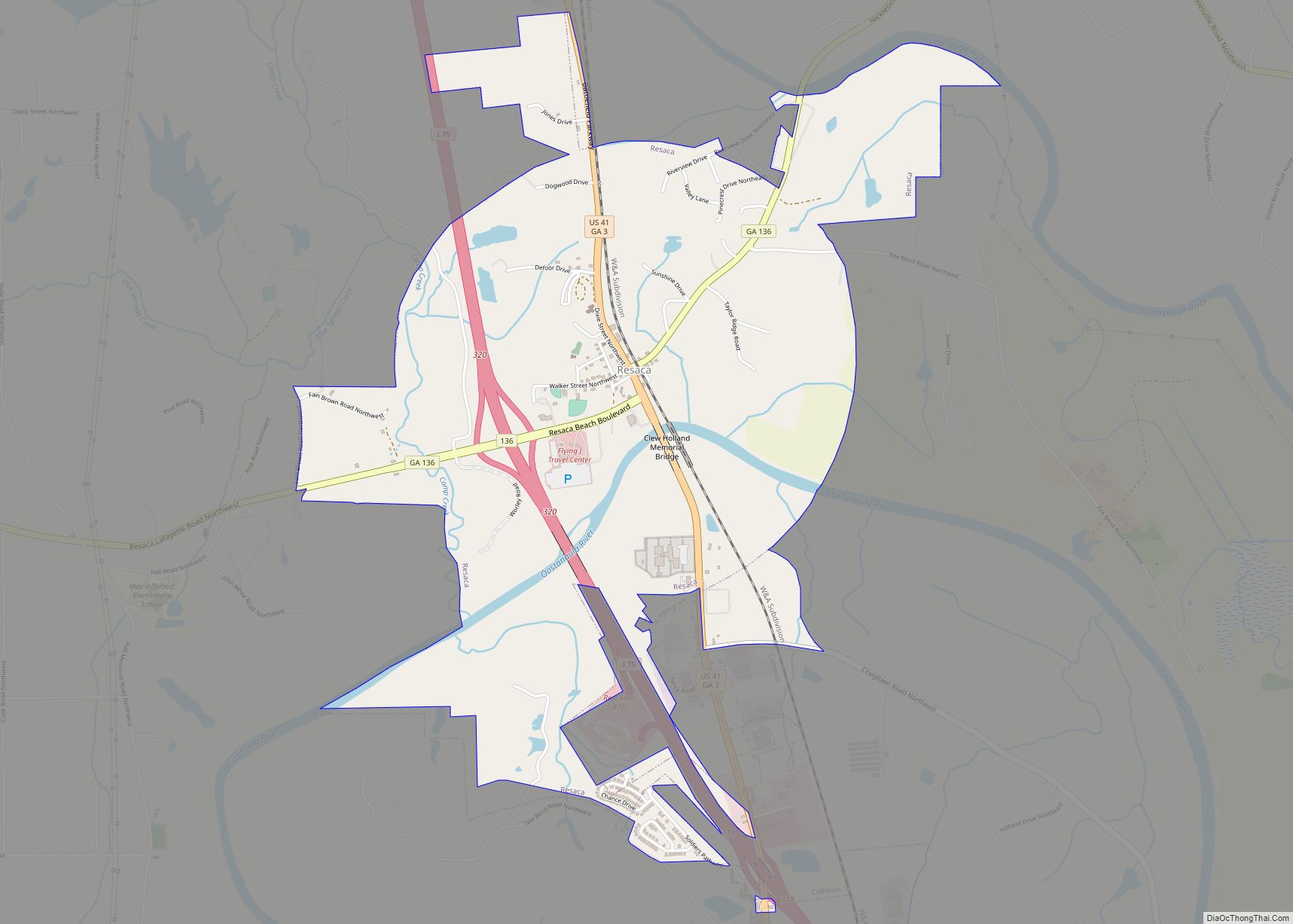
Online Interactive Map
Click on ![]() to view map in "full screen" mode.
to view map in "full screen" mode.
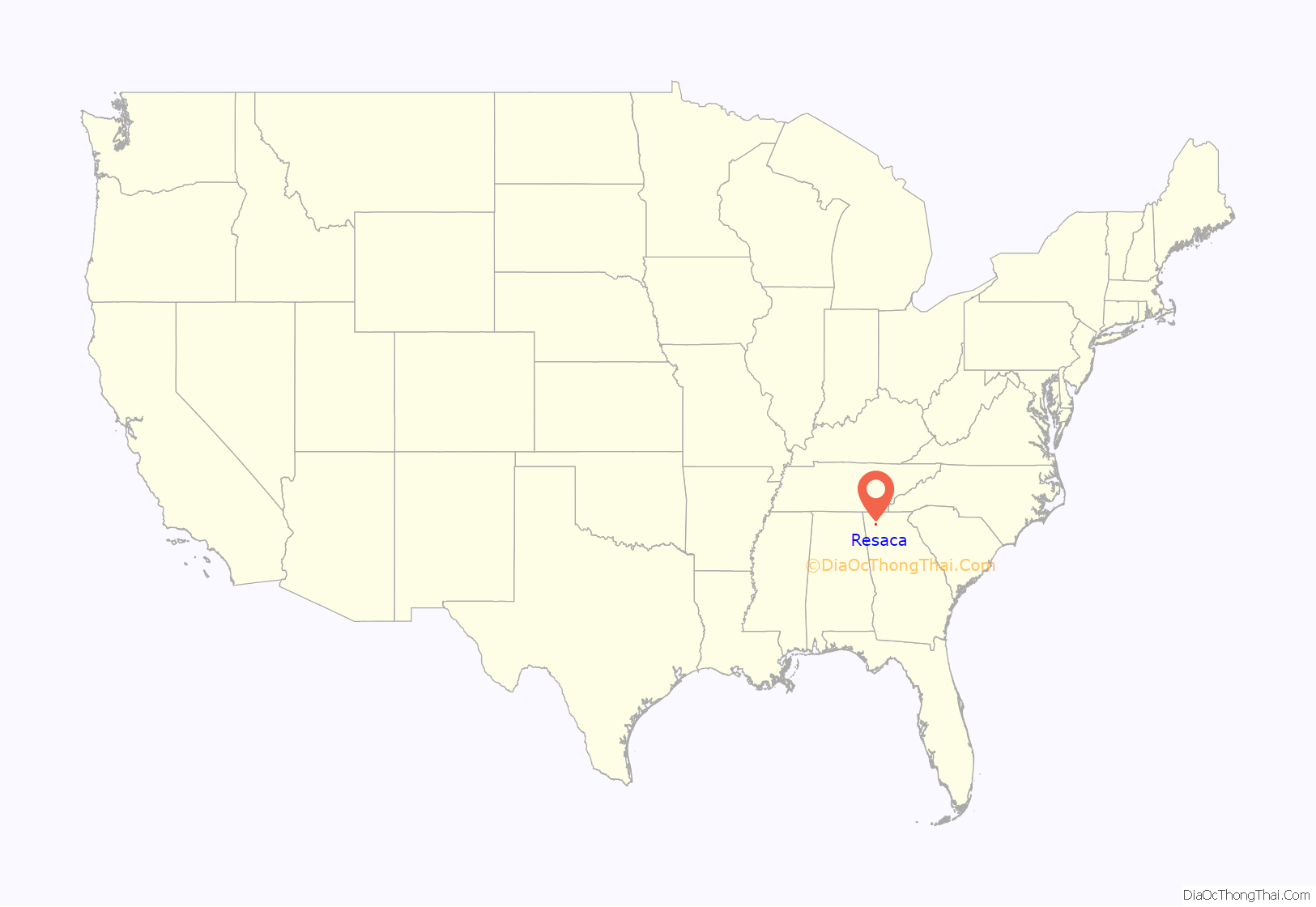
Resaca location map. Where is Resaca town?
History
Resaca, originally known as Dublin, was founded in 1848 with the arrival of the Western and Atlantic Railroad into the area. Dublin was renamed Resacca (with two Cs) when it was incorporated as a town in 1854. In 1871, the spelling of the town was shortened to its present form of Resaca.
The town was named by returning Mexican–American War inductees who fought at the Battle of Resaca de la Palma (translated Dry River Bed of the Palms) in Brownsville, Texas, in 1846.
Civil War era
The Civil War Battle of Resaca was fought in and around Resaca in May 1864. Each year a re-enactment of the Battle of Resaca, the first battle of the Atlanta Campaign, is held on the third weekend of May.
Resaca is also the location of the first Confederate cemetery in the state of Georgia. The story of the cemetery is:
The memory of a Georgia woman, Mary J. Green, who with her own hands gathered and interred the bones and bodies of the Confederate dead left lying on the Resaca Battlefield, should always be sacred to us. The sight that greeted the Green family when they returned to their plantation after the battle was almost more than they could bear. Around the house on all sides were scattered graves of Confederates who had been buried where they fell. The Green daughters conceived the idea of collecting all the bodies and re-interring them in a plot of land to be known as a Confederate cemetery. The one great drawback, however, was that they had no money. In the summer of 1866, Mary began writing to her friends around the state, begging them to try and raise money for the cemetery. Although poverty was rampant in the South, the citizenry responded by giving what they could, be it a nickel, a dime, a quarter, or a dollar. Col. Green gave his daughters 2.5 acres (1.0 ha) of land with rustic bridges spanning the stream through the grounds of their cemetery.
The account of the first Memorial Day, October 25, 1866, written by Mary Green: “The day selected for the dedication … was bright and beautiful, one of those charming days of our Indian summers where no sound was heard save the fluttering of falling leaves – a suitable accompaniment to our sad thoughts, as we stood in the ‘bivouac of the dead.'” This cemetery and one at Winchester, Virginia, were consecrated and dedicated on the same day, each sponsoring group thinking theirs was the first Confederate Cemetery.
Mathew Brady captured several photographs of the battlefield. Scenes of the conflict and.its aftermath were also depicted by various artists including Adolph Metzner.
20th century
The Town of Resaca was incorporated and granted a charter by the State of Georgia in 1981.
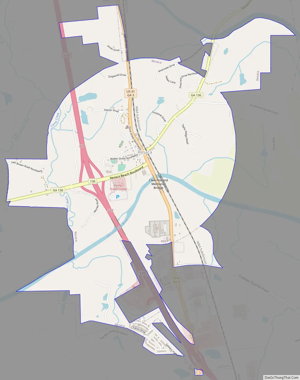
Resaca Road Map
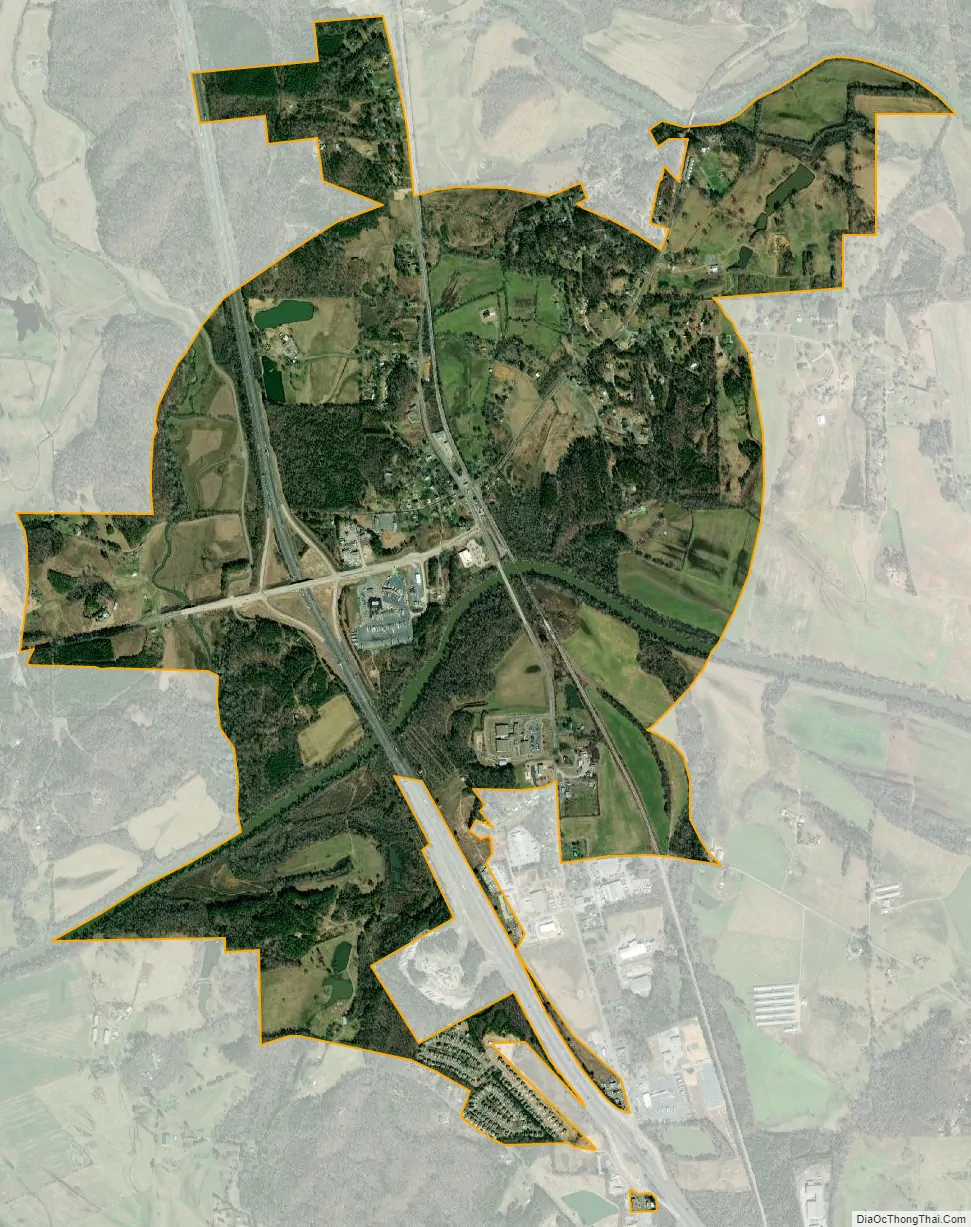
Resaca city Satellite Map
Geography
Resaca is located at 34°34′45″N 84°56′38″W / 34.57917°N 84.94389°W / 34.57917; -84.94389 (34.579116, −84.943989).
According to the United States Census Bureau, the town has a total area of 2.9 square miles (7.5 km), of which 2.8 square miles (7.3 km) is land and 0.1 square miles (0.26 km) (2.47%) is water.
See also
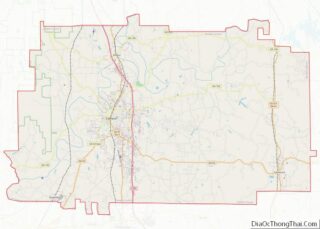
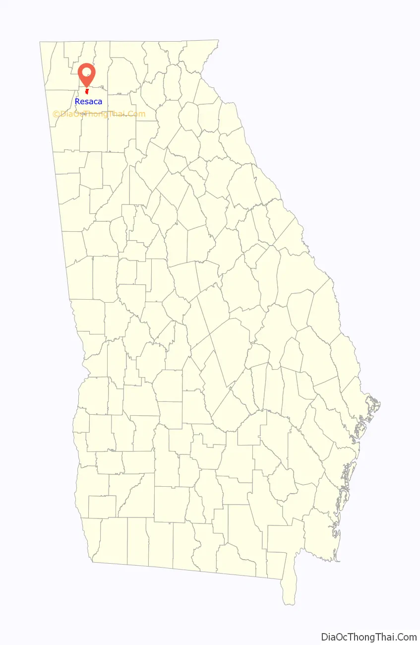
Map of Georgia State and its subdivision:- Appling
- Atkinson
- Bacon
- Baker
- Baldwin
- Banks
- Barrow
- Bartow
- Ben Hill
- Berrien
- Bibb
- Bleckley
- Brantley
- Brooks
- Bryan
- Bulloch
- Burke
- Butts
- Calhoun
- Camden
- Candler
- Carroll
- Catoosa
- Charlton
- Chatham
- Chattahoochee
- Chattooga
- Cherokee
- Clarke
- Clay
- Clayton
- Clinch
- Cobb
- Coffee
- Colquitt
- Columbia
- Cook
- Coweta
- Crawford
- Crisp
- Dade
- Dawson
- Decatur
- DeKalb
- Dodge
- Dooly
- Dougherty
- Douglas
- Early
- Echols
- Effingham
- Elbert
- Emanuel
- Evans
- Fannin
- Fayette
- Floyd
- Forsyth
- Franklin
- Fulton
- Gilmer
- Glascock
- Glynn
- Gordon
- Grady
- Greene
- Gwinnett
- Habersham
- Hall
- Hancock
- Haralson
- Harris
- Hart
- Heard
- Henry
- Houston
- Irwin
- Jackson
- Jasper
- Jeff Davis
- Jefferson
- Jenkins
- Johnson
- Jones
- Lamar
- Lanier
- Laurens
- Lee
- Liberty
- Lincoln
- Long
- Lowndes
- Lumpkin
- Macon
- Madison
- Marion
- McDuffie
- McIntosh
- Meriwether
- Miller
- Mitchell
- Monroe
- Montgomery
- Morgan
- Murray
- Muscogee
- Newton
- Oconee
- Oglethorpe
- Paulding
- Peach
- Pickens
- Pierce
- Pike
- Polk
- Pulaski
- Putnam
- Quitman
- Rabun
- Randolph
- Richmond
- Rockdale
- Schley
- Screven
- Seminole
- Spalding
- Stephens
- Stewart
- Sumter
- Talbot
- Taliaferro
- Tattnall
- Taylor
- Telfair
- Terrell
- Thomas
- Tift
- Toombs
- Towns
- Treutlen
- Troup
- Turner
- Twiggs
- Union
- Upson
- Walker
- Walton
- Ware
- Warren
- Washington
- Wayne
- Webster
- Wheeler
- White
- Whitfield
- Wilcox
- Wilkes
- Wilkinson
- Worth
- Alabama
- Alaska
- Arizona
- Arkansas
- California
- Colorado
- Connecticut
- Delaware
- District of Columbia
- Florida
- Georgia
- Hawaii
- Idaho
- Illinois
- Indiana
- Iowa
- Kansas
- Kentucky
- Louisiana
- Maine
- Maryland
- Massachusetts
- Michigan
- Minnesota
- Mississippi
- Missouri
- Montana
- Nebraska
- Nevada
- New Hampshire
- New Jersey
- New Mexico
- New York
- North Carolina
- North Dakota
- Ohio
- Oklahoma
- Oregon
- Pennsylvania
- Rhode Island
- South Carolina
- South Dakota
- Tennessee
- Texas
- Utah
- Vermont
- Virginia
- Washington
- West Virginia
- Wisconsin
- Wyoming