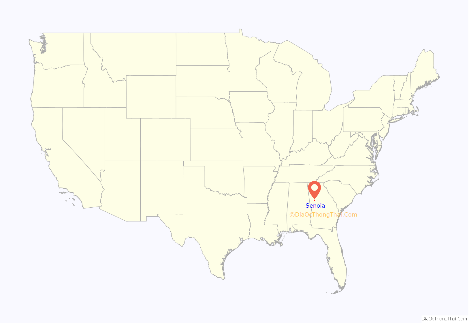
Senoia (/səˈnɔɪə/, locally /səˈnɔɪ/) is a city located 35 minutes south of Atlanta in Coweta County, Georgia, United States. It is part of the Atlanta metropolitan area. Its population was 5,016 at the 2020 census.
| Name: | Senoia city |
|---|---|
| LSAD Code: | 25 |
| LSAD Description: | city (suffix) |
| State: | Georgia |
| County: | Coweta County |
| Elevation: | 889 ft (271 m) |
| Total Area: | 6.30 sq mi (16.32 km²) |
| Land Area: | 6.16 sq mi (15.96 km²) |
| Water Area: | 0.14 sq mi (0.36 km²) |
| Total Population: | 5,016 |
| Population Density: | 814.15/sq mi (314.34/km²) |
| ZIP code: | 30276 |
| Area code: | 678 |
| FIPS code: | 1369672 |
| GNISfeature ID: | 0322710 |
| Website: | www.senoia.com |
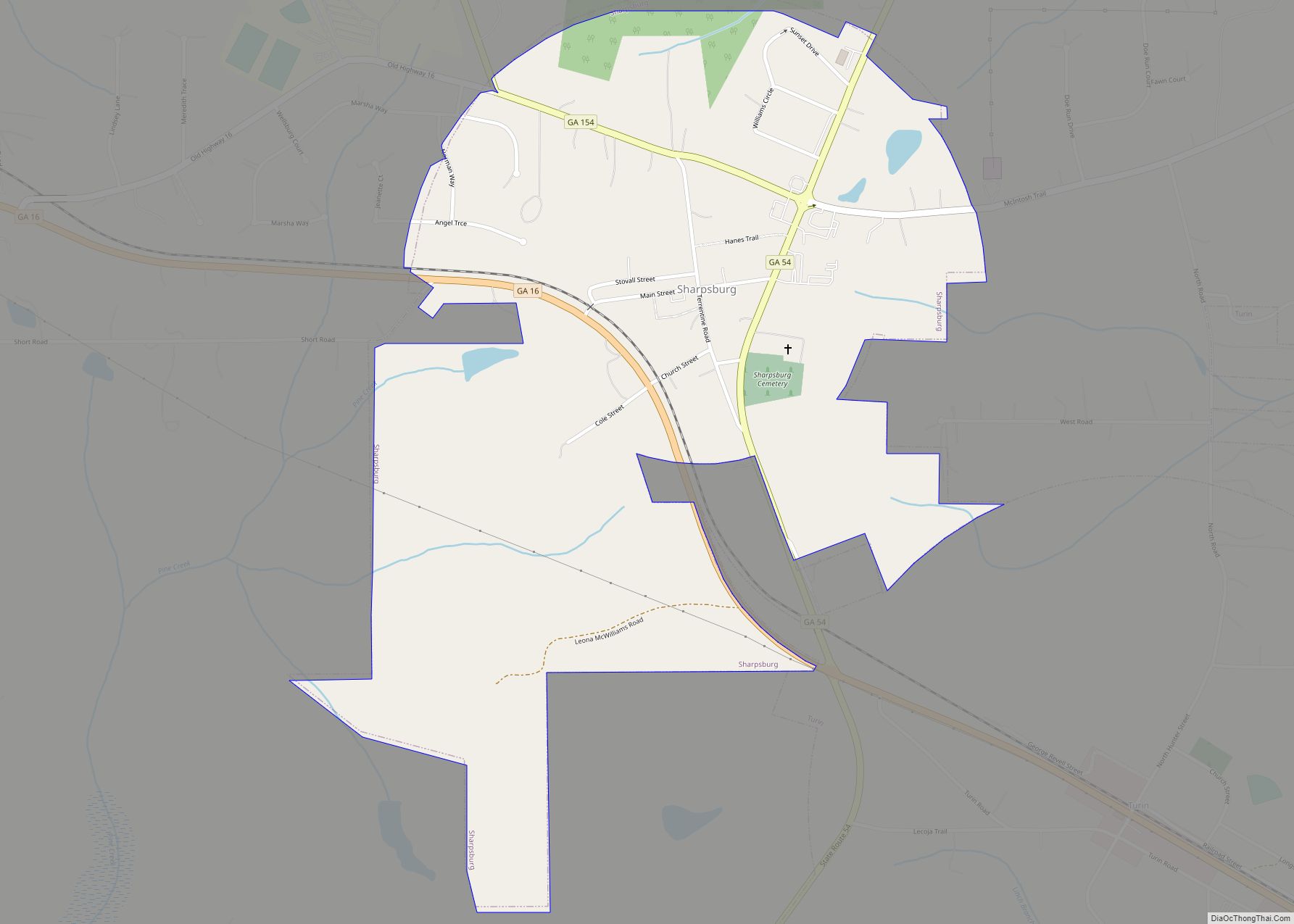
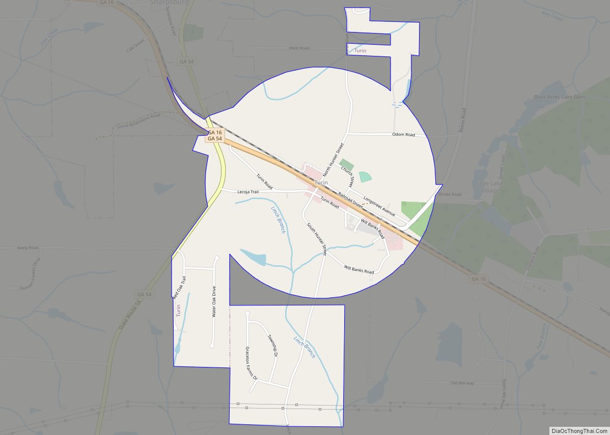
Online Interactive Map
Click on ![]() to view map in "full screen" mode.
to view map in "full screen" mode.
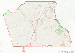
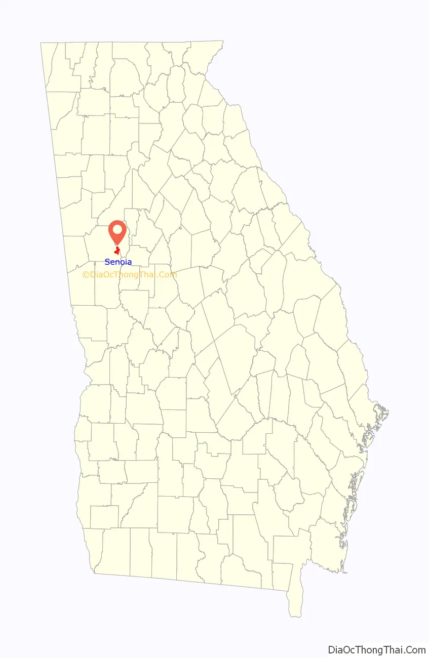
Senoia location map. Where is Senoia city?
History
The first permanent settlement in the area was made in 1860 by Rev. Francis Warren Baggarly. In 1864, around the time residents of the nearby Willow Dell community began to arrive, the settlement was named Senoia. A number of the area’s first structures appeared this year, such as a mercantile building known as the Rock House and a Methodist Episcopal church led by Baggarly. A high school would opened in 1865. Senoia was officially incorporated as a city on December 12, 1866.
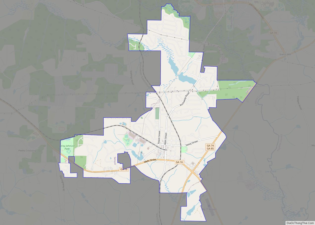
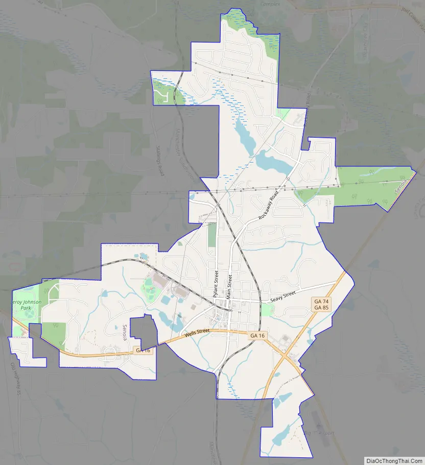
Senoia Road Map
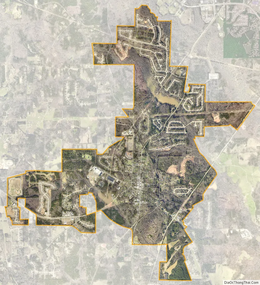
Senoia city Satellite Map
Geography
Senoia is located in southeastern Coweta County at 33°18′7″N 84°33′12″W / 33.30194°N 84.55333°W / 33.30194; -84.55333 (33.301849, -84.553450). It is bordered to the north by Peachtree City in Fayette County.
According to the United States Census Bureau, Senoia has a total area of 5.4 square miles (14.1 km), of which 5.4 square miles (13.9 km) is land and 0.12 square miles (0.3 km), or 2.03%, is water.
See also
Map of Georgia State and its subdivision:- Appling
- Atkinson
- Bacon
- Baker
- Baldwin
- Banks
- Barrow
- Bartow
- Ben Hill
- Berrien
- Bibb
- Bleckley
- Brantley
- Brooks
- Bryan
- Bulloch
- Burke
- Butts
- Calhoun
- Camden
- Candler
- Carroll
- Catoosa
- Charlton
- Chatham
- Chattahoochee
- Chattooga
- Cherokee
- Clarke
- Clay
- Clayton
- Clinch
- Cobb
- Coffee
- Colquitt
- Columbia
- Cook
- Coweta
- Crawford
- Crisp
- Dade
- Dawson
- Decatur
- DeKalb
- Dodge
- Dooly
- Dougherty
- Douglas
- Early
- Echols
- Effingham
- Elbert
- Emanuel
- Evans
- Fannin
- Fayette
- Floyd
- Forsyth
- Franklin
- Fulton
- Gilmer
- Glascock
- Glynn
- Gordon
- Grady
- Greene
- Gwinnett
- Habersham
- Hall
- Hancock
- Haralson
- Harris
- Hart
- Heard
- Henry
- Houston
- Irwin
- Jackson
- Jasper
- Jeff Davis
- Jefferson
- Jenkins
- Johnson
- Jones
- Lamar
- Lanier
- Laurens
- Lee
- Liberty
- Lincoln
- Long
- Lowndes
- Lumpkin
- Macon
- Madison
- Marion
- McDuffie
- McIntosh
- Meriwether
- Miller
- Mitchell
- Monroe
- Montgomery
- Morgan
- Murray
- Muscogee
- Newton
- Oconee
- Oglethorpe
- Paulding
- Peach
- Pickens
- Pierce
- Pike
- Polk
- Pulaski
- Putnam
- Quitman
- Rabun
- Randolph
- Richmond
- Rockdale
- Schley
- Screven
- Seminole
- Spalding
- Stephens
- Stewart
- Sumter
- Talbot
- Taliaferro
- Tattnall
- Taylor
- Telfair
- Terrell
- Thomas
- Tift
- Toombs
- Towns
- Treutlen
- Troup
- Turner
- Twiggs
- Union
- Upson
- Walker
- Walton
- Ware
- Warren
- Washington
- Wayne
- Webster
- Wheeler
- White
- Whitfield
- Wilcox
- Wilkes
- Wilkinson
- Worth
- Alabama
- Alaska
- Arizona
- Arkansas
- California
- Colorado
- Connecticut
- Delaware
- District of Columbia
- Florida
- Georgia
- Hawaii
- Idaho
- Illinois
- Indiana
- Iowa
- Kansas
- Kentucky
- Louisiana
- Maine
- Maryland
- Massachusetts
- Michigan
- Minnesota
- Mississippi
- Missouri
- Montana
- Nebraska
- Nevada
- New Hampshire
- New Jersey
- New Mexico
- New York
- North Carolina
- North Dakota
- Ohio
- Oklahoma
- Oregon
- Pennsylvania
- Rhode Island
- South Carolina
- South Dakota
- Tennessee
- Texas
- Utah
- Vermont
- Virginia
- Washington
- West Virginia
- Wisconsin
- Wyoming