Stockbridge is a city in Henry County, Georgia, United States. As of the 2010 census, the population was 25,637, up from 9,853 in 2000.
Stockbridge is part of the Atlanta metropolitan area.
| Name: | Stockbridge city |
|---|---|
| LSAD Code: | 25 |
| LSAD Description: | city (suffix) |
| State: | Georgia |
| County: | Henry County |
| Elevation: | 801 ft (244 m) |
| Total Area: | 13.82 sq mi (35.79 km²) |
| Land Area: | 13.70 sq mi (35.48 km²) |
| Water Area: | 0.12 sq mi (0.31 km²) |
| Total Population: | 28,973 |
| Population Density: | 2,114.97/sq mi (816.59/km²) |
| ZIP code: | 30281 |
| Area code: | 770/678/470 |
| FIPS code: | 1373704 |
| GNISfeature ID: | 0342357 |
| Website: | www.cityofstockbridge.com |
Online Interactive Map
Click on ![]() to view map in "full screen" mode.
to view map in "full screen" mode.
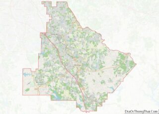
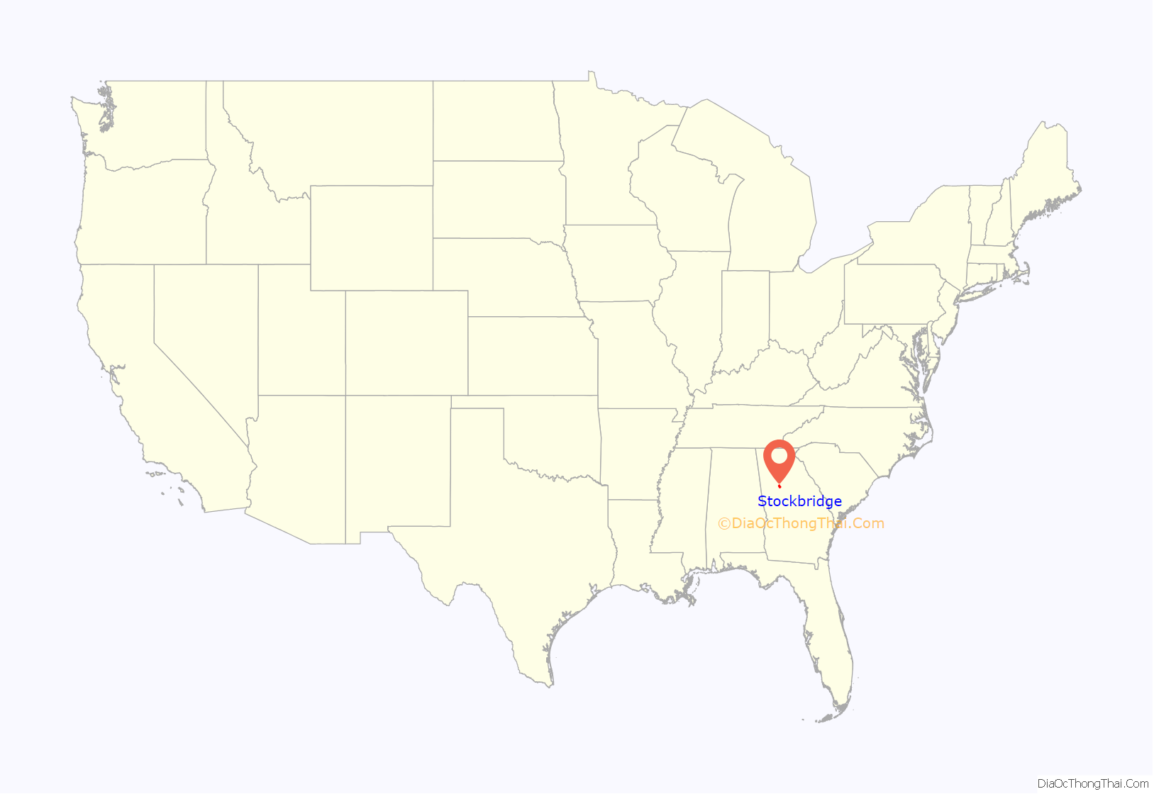
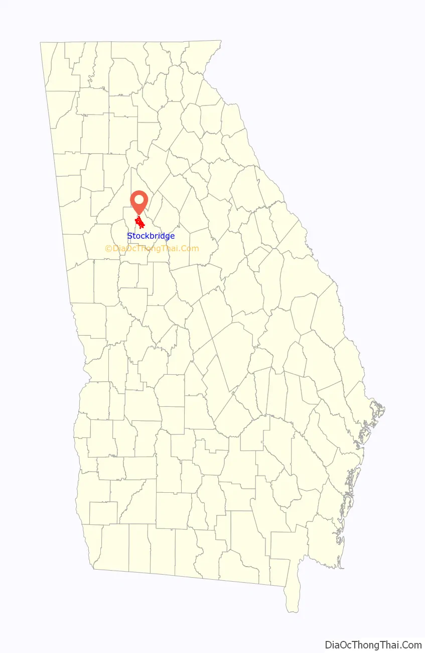
Stockbridge location map. Where is Stockbridge city?
History
The area was settled in 1829 when Concord Methodist Church was organized near present-day Old Stagecoach Road. It was granted a post office on April 5, 1847, named for a traveling professor, Levi Stockbridge, who passed through the area many times before the post office was built. He was said to be well known and respected in his namesake community. Others contend that the city was named after Thomas Stocks, who was State Surveyor and president of the Georgia State Senate in the 1820s.
In 1881, the East Tennessee, Virginia and Georgia Railroad was to pass through Stockbridge between Macon and Atlanta. The settlers who owned the land about Old Stockbridge asked such a high price for their land that two prominent Atlanta citizens, John W. Grant and George W. Adair, bought a tract about a mile south of Old Stockbridge and offered lots at a reasonable price. Here the railroad built their depot and many lots were sold. The depot was located about 600 feet (180 m) north of what is now North Henry Blvd but was destroyed by the Southern Railway in the early 1980s.
Stockbridge was incorporated as a town in 1895 and as a city on August 6, 1920, turning 100 years old on August 6, 2020.
The Aaron and Margaret Parker Jr. House and Walden-Turner House in Stockbridge are listed on the National Register of Historic Places.
Naming mystery
On May 6, 1992, Mayor Segio received a letter from John Stockbridge of South Carolina requesting a letter of “Greeting” from the City of Stockbridge to the attendees of the first reunion of the Stockbridge family. In his letter, he mentioned that he grew up in Georgia and had been told as a child that the city of Stockbridge was named after his great-great-grandfather Levi Stockbridge, who had traveled back and forth from the North to his property in Florida and stopped here on his journey.
Levi Stockbridge was born on March 13, 1820, and fits the time frame just prior to the Civil War. Levi would have been 27 years of age when Stockbridge was assigned a post office in 1847.
Until May 6, 1992, there had never been a name other than Professor Stockbridge. At that time, Levi Stockbridge was mentioned as the person for whom the city may have been named.
It is not certain that Levi Stockbridge was the individual for whom the citizens of the community named their post office and village. However, through John Stockbridge’s letters and many conversations with him, it is believed that this is the rightful Professor Stockbridge who had been unknown for 146 years.
Recent history
In late 2005 the City of Stockbridge engaged in a controversial preemptive use of eminent domain to buy over 16 acres (65,000 m) of land near the current city hall running along East Atlanta Road. The city reportedly wanted to build a new city hall, park/square, and a small tract of land for new and more desirable business to incorporate a new image for the city. Stockbridge became the focus of national news and was also one of the largest issues in the 2006 Georgia General Assembly and their efforts to prevent abuse of eminent domain.
Many of the citizens of Stockbridge and Henry County were surprised by the apparent abuse of eminent domain by the city. Early in 2006, a protest was organized by the NAACP and supported by the Republican and Libertarian parties from the county. Syndicated Atlanta talk show host Neal Boortz said during his show, “Private property rights are dead in Stockbridge, Georgia,” and called members of the Stockbridge City Council “sorry bastards”.
The Henry County Board of Commissioners took a stance on the issue by unanimously approving a non-binding resolution that the county would not take land for economic development purposes. However, the county legally has no say in what the City of Stockbridge can do with its land and its use of eminent domain. Many have said this was just a political strategy, as Henry County has been shown in recent voting history to be one of the most conservative counties in the Atlanta metro area, consistently voting Republican in early 21st century presidential elections. (However, as the population grew, the county voted Democratic in the 2016 and 2020 elections.)
The conflict between the city and the property owners came to an end on February 2, 2007, as the Georgia Court of Appeals threw out the condemnation. Only one store, a local florist, beat the eminent domain and was allowed to keep its store and property. A brick fence was erected around the florist shop to separate it from the new City Hall.
After February 2007, the city had plans drawn up to build the new city hall. The plans called for the new city hall, park, and green space to be built around the florist’s shop that started the now famous eminent domain lawsuit.
The city said that the new development would strengthen the old and worn-down downtown business district. Stockbridge City Manager Ted Strickland said that the new city hall was absolutely necessary, because some current city employees were working out of closets and supply rooms.
Secession movement
A group of residents in Stockbridge attempted to secede to form their own community called Eagle’s Landing in the 2018 general election. The referendum was defeated.
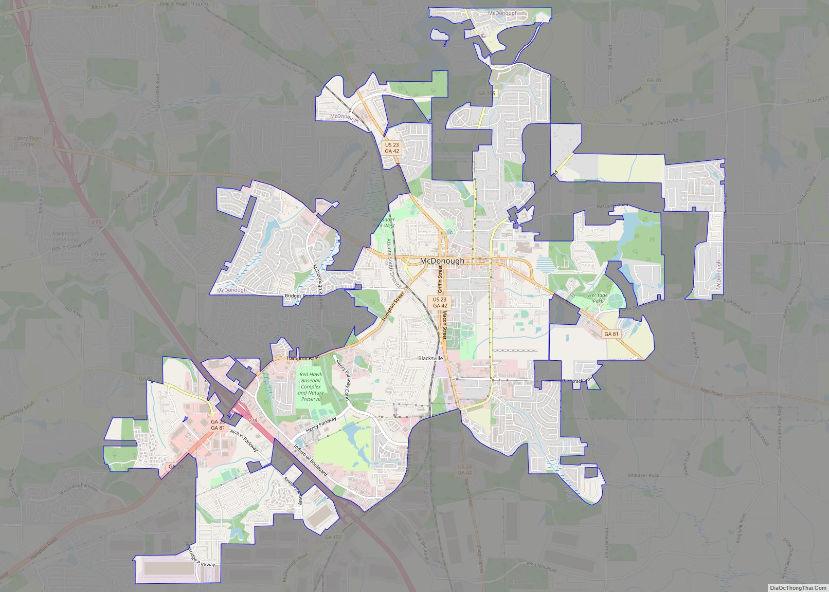
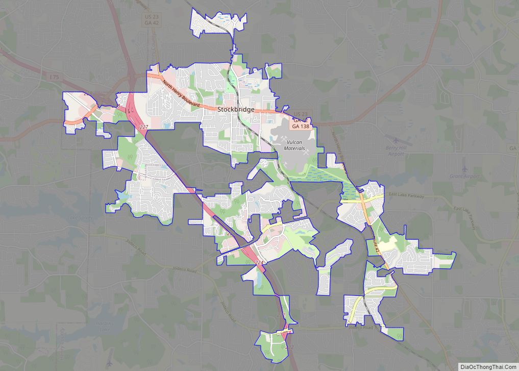
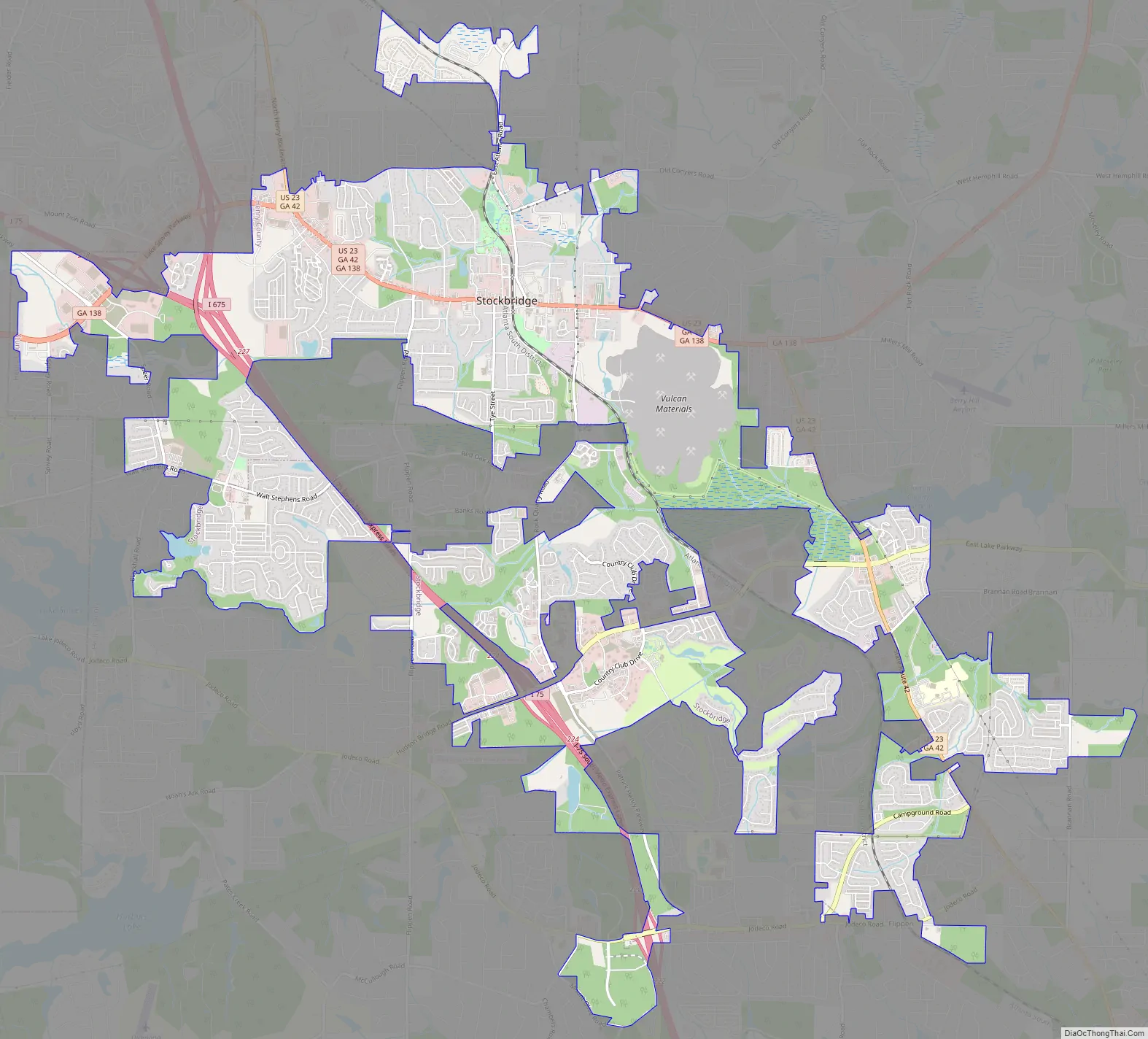
Stockbridge Road Map
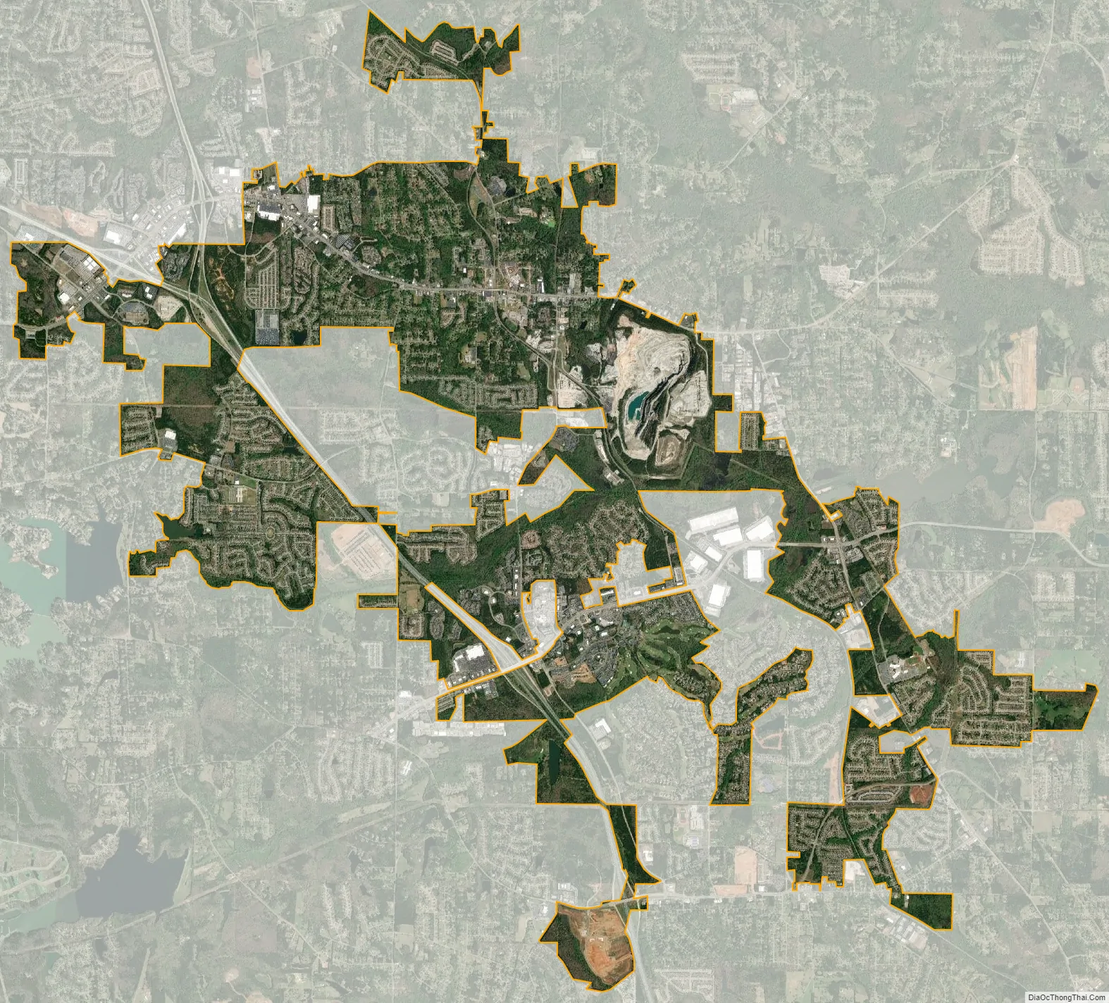
Stockbridge city Satellite Map
Geography
Stockbridge is located in northwestern Henry County at 33°32′3″N 84°13′52″W / 33.53417°N 84.23111°W / 33.53417; -84.23111 (33.534068, -84.231185). Its northwestern border follows the Clayton County line. Some unincorporated areas in Rockdale County have a Stockbridge mailing address, without actually being a part of the City of Stockbridge.
U.S. Route 23 is the main road through the center of the city, leading northwest 20 miles (32 km) to downtown Atlanta and southeast 9 miles (14 km) to McDonough, the Henry County seat. Interstate 75 passes through the southwest side of the city, with access from Exits 222, 224, and 228. I-75 leads northwest to Atlanta and southeast 64 miles (103 km) to Macon. Interstate 675 splits from I-75 in northwestern Stockbridge and provides access to the city from its Exit 1.
According to the United States Census Bureau, Stockbridge has a total area of 13.4 square miles (34.8 km), of which 13.3 square miles (34.5 km) are land and 0.1 square miles (0.3 km), or 0.97%, are water.
See also
Map of Georgia State and its subdivision:- Appling
- Atkinson
- Bacon
- Baker
- Baldwin
- Banks
- Barrow
- Bartow
- Ben Hill
- Berrien
- Bibb
- Bleckley
- Brantley
- Brooks
- Bryan
- Bulloch
- Burke
- Butts
- Calhoun
- Camden
- Candler
- Carroll
- Catoosa
- Charlton
- Chatham
- Chattahoochee
- Chattooga
- Cherokee
- Clarke
- Clay
- Clayton
- Clinch
- Cobb
- Coffee
- Colquitt
- Columbia
- Cook
- Coweta
- Crawford
- Crisp
- Dade
- Dawson
- Decatur
- DeKalb
- Dodge
- Dooly
- Dougherty
- Douglas
- Early
- Echols
- Effingham
- Elbert
- Emanuel
- Evans
- Fannin
- Fayette
- Floyd
- Forsyth
- Franklin
- Fulton
- Gilmer
- Glascock
- Glynn
- Gordon
- Grady
- Greene
- Gwinnett
- Habersham
- Hall
- Hancock
- Haralson
- Harris
- Hart
- Heard
- Henry
- Houston
- Irwin
- Jackson
- Jasper
- Jeff Davis
- Jefferson
- Jenkins
- Johnson
- Jones
- Lamar
- Lanier
- Laurens
- Lee
- Liberty
- Lincoln
- Long
- Lowndes
- Lumpkin
- Macon
- Madison
- Marion
- McDuffie
- McIntosh
- Meriwether
- Miller
- Mitchell
- Monroe
- Montgomery
- Morgan
- Murray
- Muscogee
- Newton
- Oconee
- Oglethorpe
- Paulding
- Peach
- Pickens
- Pierce
- Pike
- Polk
- Pulaski
- Putnam
- Quitman
- Rabun
- Randolph
- Richmond
- Rockdale
- Schley
- Screven
- Seminole
- Spalding
- Stephens
- Stewart
- Sumter
- Talbot
- Taliaferro
- Tattnall
- Taylor
- Telfair
- Terrell
- Thomas
- Tift
- Toombs
- Towns
- Treutlen
- Troup
- Turner
- Twiggs
- Union
- Upson
- Walker
- Walton
- Ware
- Warren
- Washington
- Wayne
- Webster
- Wheeler
- White
- Whitfield
- Wilcox
- Wilkes
- Wilkinson
- Worth
- Alabama
- Alaska
- Arizona
- Arkansas
- California
- Colorado
- Connecticut
- Delaware
- District of Columbia
- Florida
- Georgia
- Hawaii
- Idaho
- Illinois
- Indiana
- Iowa
- Kansas
- Kentucky
- Louisiana
- Maine
- Maryland
- Massachusetts
- Michigan
- Minnesota
- Mississippi
- Missouri
- Montana
- Nebraska
- Nevada
- New Hampshire
- New Jersey
- New Mexico
- New York
- North Carolina
- North Dakota
- Ohio
- Oklahoma
- Oregon
- Pennsylvania
- Rhode Island
- South Carolina
- South Dakota
- Tennessee
- Texas
- Utah
- Vermont
- Virginia
- Washington
- West Virginia
- Wisconsin
- Wyoming