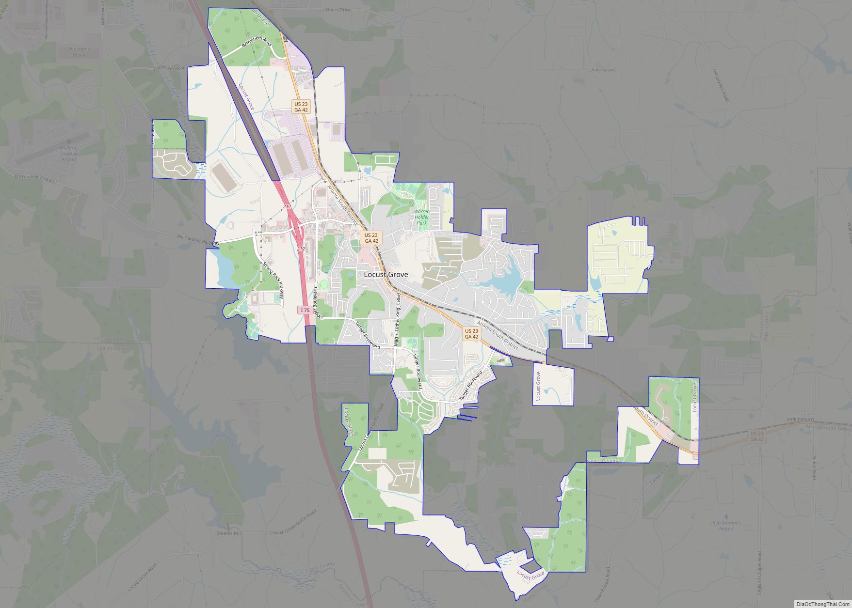
Locust Grove is a city in Henry County, Georgia, United States. The population was 5,402 at the 2010 census, up from 2,322 in 2000. Some unincorporated communities such as Luella and many rural areas surround Locust Grove, and those communities have Locust Grove postal addresses.
Locust Grove has experienced a growth in population and in businesses coming into the area. In 1900 the population of the city was 254 and is now over 5,000.
| Name: | Locust Grove city |
|---|---|
| LSAD Code: | 25 |
| LSAD Description: | city (suffix) |
| State: | Georgia |
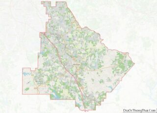
| County: | Henry County |
| Elevation: | 837 ft (255 m) |
| Total Area: | 11.78 sq mi (30.51 km²) |
| Land Area: | 11.59 sq mi (30.02 km²) |
| Water Area: | 0.19 sq mi (0.49 km²) |
| Total Population: | 8,947 |
| Population Density: | 771.89/sq mi (298.04/km²) |
| ZIP code: | 30248 |
| Area code: | 770/678/470 |
| FIPS code: | 1347140 |
| GNISfeature ID: | 0332253 |
| Website: | www.locustgrove-ga.gov |
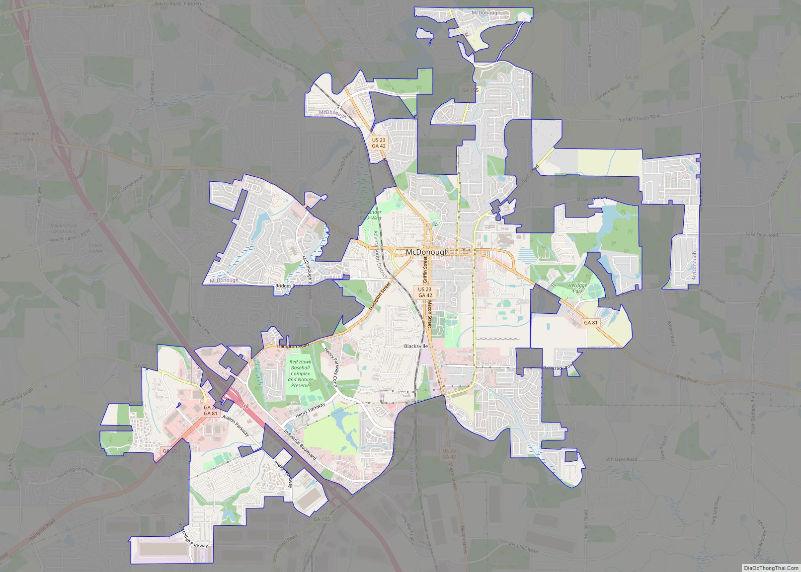
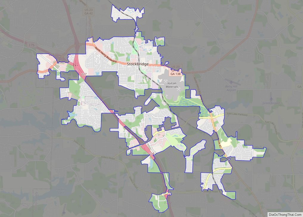
Online Interactive Map
Click on ![]() to view map in "full screen" mode.
to view map in "full screen" mode.
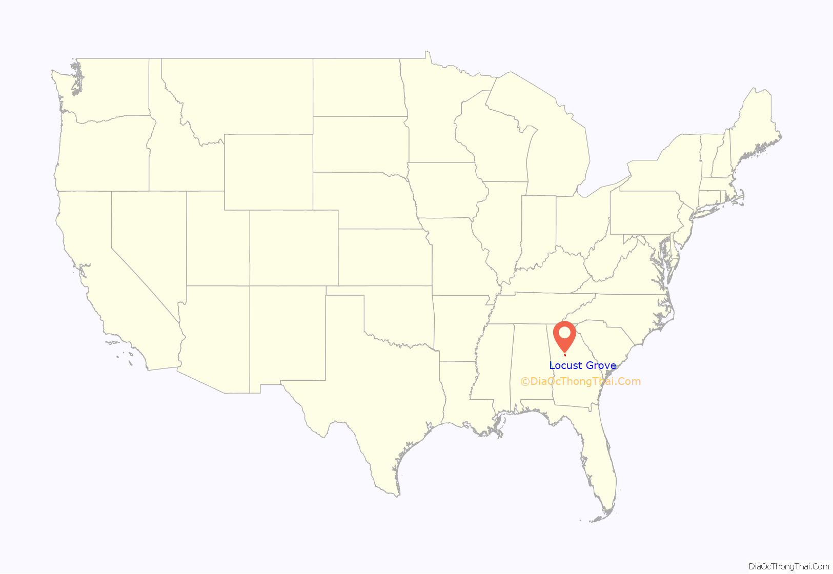
Locust Grove location map. Where is Locust Grove city?

History
The community was named for a grove of locust trees near the original town site. Georgia General Assembly incorporated Locust Grove in 1893.
Locust Grove Road Map

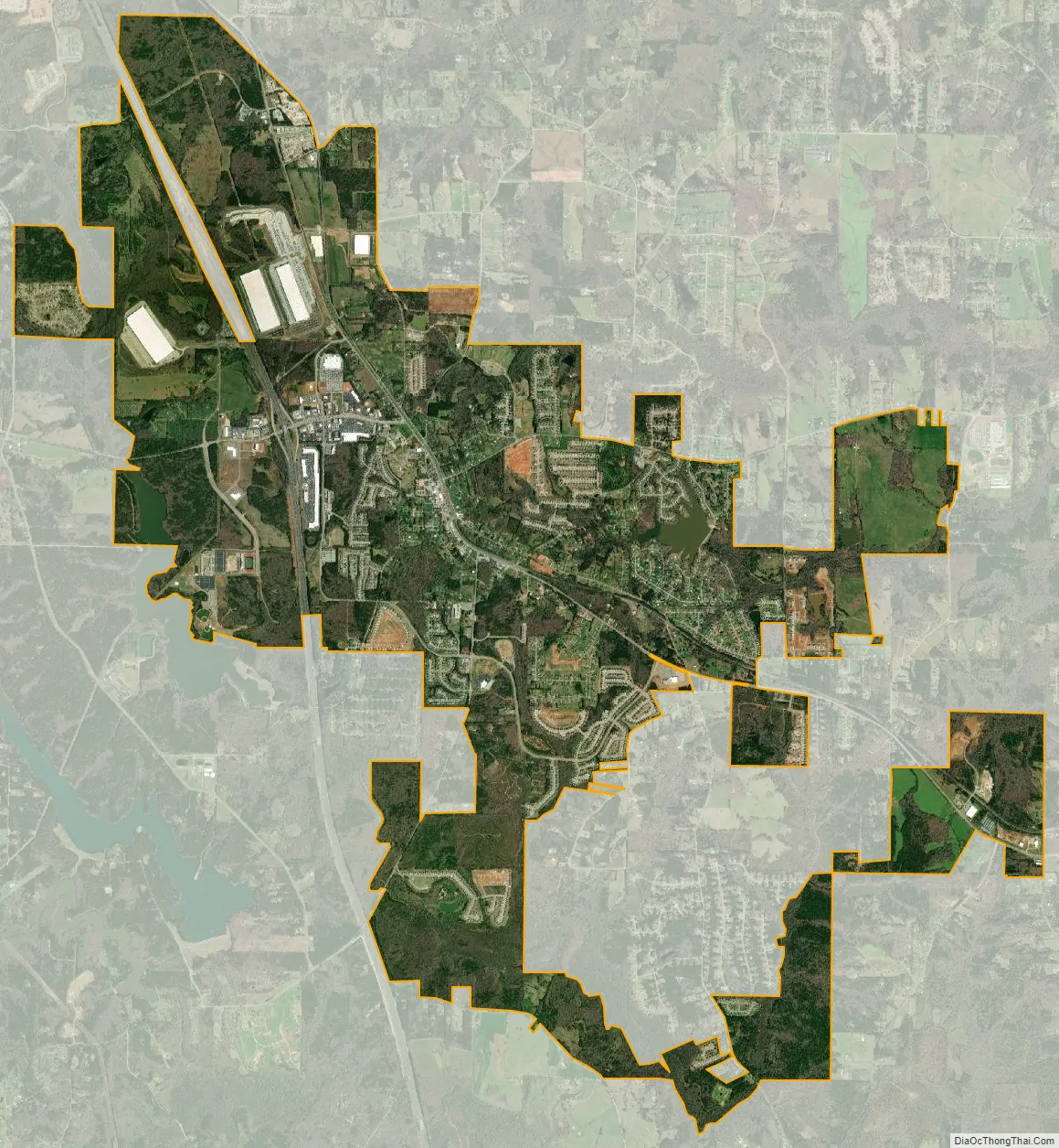
Locust Grove city Satellite Map
Geography
Locust Grove is located in southern Henry County at 33°20′44″N 84°6′18″W / 33.34556°N 84.10500°W / 33.34556; -84.10500 (33.345499, -84.104991). U.S. Route 23 passes through the center of town, leading north 7 miles (11 km) to McDonough, the county seat, and southeast 10 miles (16 km) to Jackson. Interstate 75 passes through the western portion of Locust Grove, with access from Exit 212 (Bill Gardner Parkway). I-75 leads northwest 36 miles (58 km) to downtown Atlanta and southeast 49 miles (79 km) to Macon.
According to the United States Census Bureau, the city has a total area of 10.8 square miles (28.1 km), of which 10.7 square miles (27.6 km) are land and 0.2 square miles (0.5 km), or 1.67%, are water.
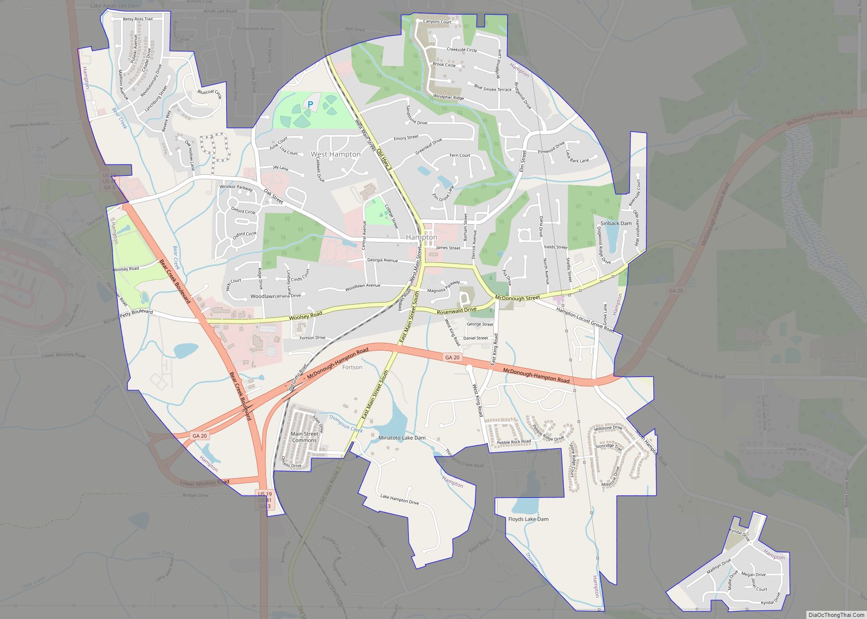
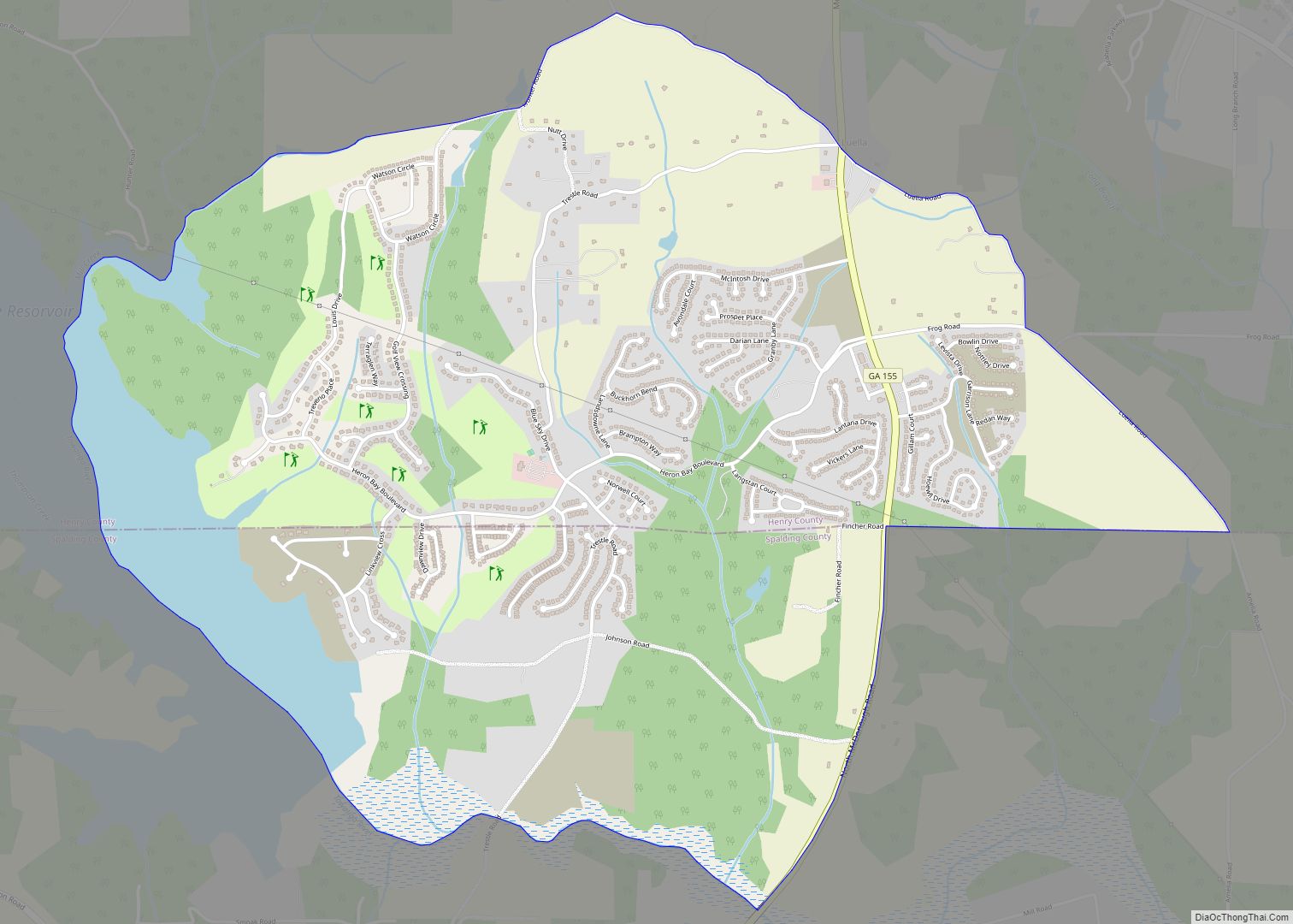
The unincorporated community of Luella, located 5 miles (8 km) west of the city, uses a “Locust Grove” mailing address.
Major highways
- Interstate 75
- U.S. Highway 23
- Georgia State Route 42
- Georgia State Route 155
- Georgia State Route 401
See also
Map of Georgia State and its subdivision:- Appling
- Atkinson
- Bacon
- Baker
- Baldwin
- Banks
- Barrow
- Bartow
- Ben Hill
- Berrien
- Bibb
- Bleckley
- Brantley
- Brooks
- Bryan
- Bulloch
- Burke
- Butts
- Calhoun
- Camden
- Candler
- Carroll
- Catoosa
- Charlton
- Chatham
- Chattahoochee
- Chattooga
- Cherokee
- Clarke
- Clay
- Clayton
- Clinch
- Cobb
- Coffee
- Colquitt
- Columbia
- Cook
- Coweta
- Crawford
- Crisp
- Dade
- Dawson
- Decatur
- DeKalb
- Dodge
- Dooly
- Dougherty
- Douglas
- Early
- Echols
- Effingham
- Elbert
- Emanuel
- Evans
- Fannin
- Fayette
- Floyd
- Forsyth
- Franklin
- Fulton
- Gilmer
- Glascock
- Glynn
- Gordon
- Grady
- Greene
- Gwinnett
- Habersham
- Hall
- Hancock
- Haralson
- Harris
- Hart
- Heard
- Henry
- Houston
- Irwin
- Jackson
- Jasper
- Jeff Davis
- Jefferson
- Jenkins
- Johnson
- Jones
- Lamar
- Lanier
- Laurens
- Lee
- Liberty
- Lincoln
- Long
- Lowndes
- Lumpkin
- Macon
- Madison
- Marion
- McDuffie
- McIntosh
- Meriwether
- Miller
- Mitchell
- Monroe
- Montgomery
- Morgan
- Murray
- Muscogee
- Newton
- Oconee
- Oglethorpe
- Paulding
- Peach
- Pickens
- Pierce
- Pike
- Polk
- Pulaski
- Putnam
- Quitman
- Rabun
- Randolph
- Richmond
- Rockdale
- Schley
- Screven
- Seminole
- Spalding
- Stephens
- Stewart
- Sumter
- Talbot
- Taliaferro
- Tattnall
- Taylor
- Telfair
- Terrell
- Thomas
- Tift
- Toombs
- Towns
- Treutlen
- Troup
- Turner
- Twiggs
- Union
- Upson
- Walker
- Walton
- Ware
- Warren
- Washington
- Wayne
- Webster
- Wheeler
- White
- Whitfield
- Wilcox
- Wilkes
- Wilkinson
- Worth
- Alabama
- Alaska
- Arizona
- Arkansas
- California
- Colorado
- Connecticut
- Delaware
- District of Columbia
- Florida
- Georgia
- Hawaii
- Idaho
- Illinois
- Indiana
- Iowa
- Kansas
- Kentucky
- Louisiana
- Maine
- Maryland
- Massachusetts
- Michigan
- Minnesota
- Mississippi
- Missouri
- Montana
- Nebraska
- Nevada
- New Hampshire
- New Jersey
- New Mexico
- New York
- North Carolina
- North Dakota
- Ohio
- Oklahoma
- Oregon
- Pennsylvania
- Rhode Island
- South Carolina
- South Dakota
- Tennessee
- Texas
- Utah
- Vermont
- Virginia
- Washington
- West Virginia
- Wisconsin
- Wyoming