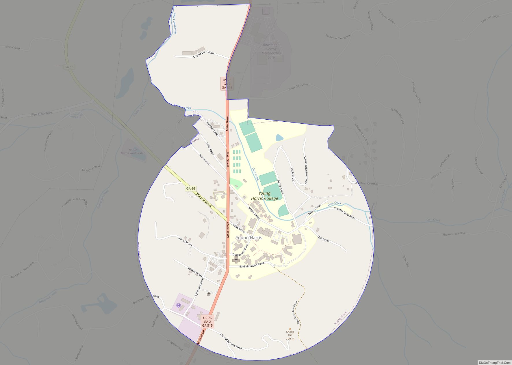
Young Harris is a city in Towns County, Georgia, United States. The population was 899 at the 2010 census. Young Harris is home to Young Harris College, after which it was named.
| Name: | Young Harris city |
|---|---|
| LSAD Code: | 25 |
| LSAD Description: | city (suffix) |
| State: | Georgia |
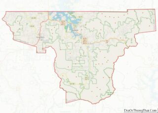
| County: | Towns County |
| Elevation: | 1,896 ft (578 m) |
| Total Area: | 0.95 sq mi (2.45 km²) |
| Land Area: | 0.95 sq mi (2.45 km²) |
| Water Area: | 0.00 sq mi (0.00 km²) |
| Total Population: | 1,098 |
| Population Density: | 1,159.45/sq mi (447.85/km²) |
| ZIP code: | 30582 |
| Area code: | 706 |
| FIPS code: | 1384960 |
| GNISfeature ID: | 2405072 |
| Website: | http://www.youngharrisga.net/ |
Online Interactive Map
Click on ![]() to view map in "full screen" mode.
to view map in "full screen" mode.
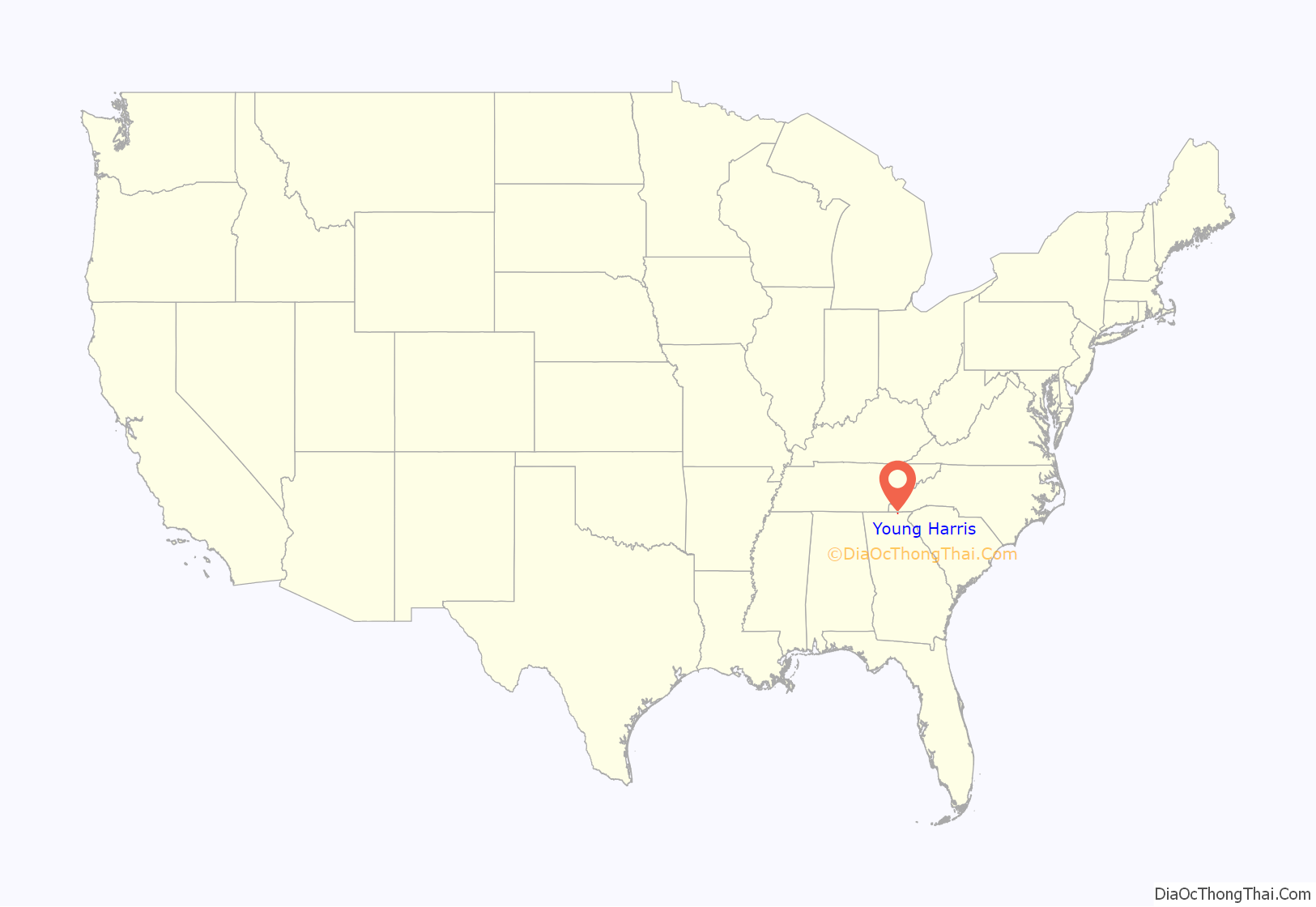
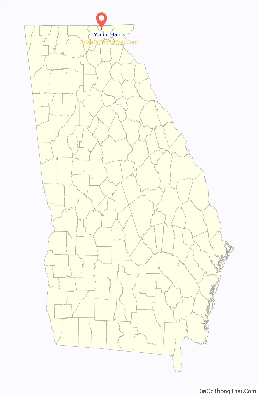
Young Harris location map. Where is Young Harris city?
History
Young Harris was originally named “McTyeire”, after Bishop Holland McTyeire. It was later renamed to honor Judge Young Harris, the benefactor of McTyeire Institute (which was also renamed to Young Harris College).
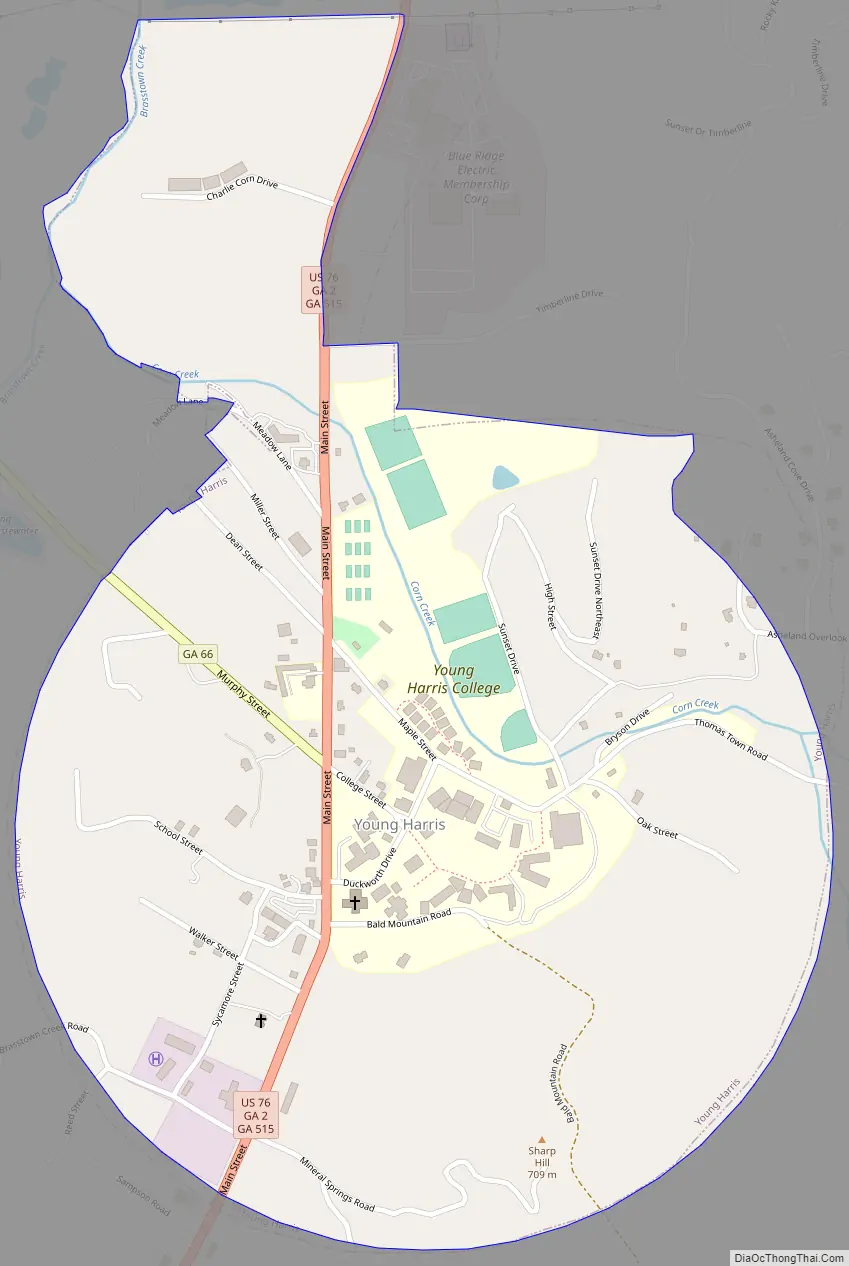
Young Harris Road Map
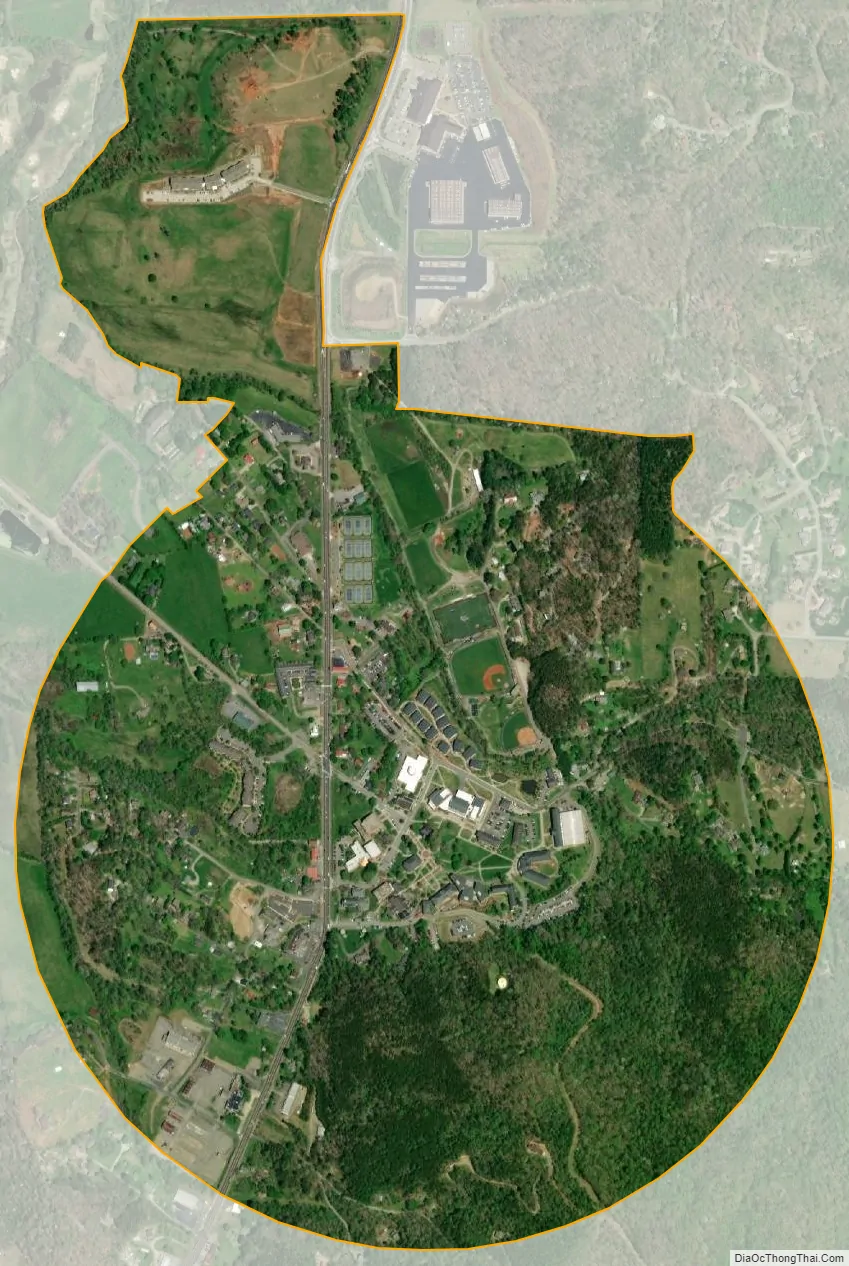
Young Harris city Satellite Map
Geography
Young Harris is located at 34°56′3″N 83°50′52″W / 34.93417°N 83.84778°W / 34.93417; -83.84778 (34.934233, -83.847681).
The city is located at the junction of U.S. Route 76/Georgia State Route 515 (Zell Miller Mountain Parkway) and Georgia State Route 66. U.S. 76/GA-515 run through the center of town from west to east, with GA-515 splitting off to the north in the eastern part of the city from U.S. 76. U.S. 76 leads east 8 miles (13 km) to Hiawassee, the Towns County seat, and southwest (with GA-515) 9 miles (14 km) to Blairsville. GA-66 leads northwest from Young Harris 5 miles (8.0 km) to its end at the Georgia-North Carolina state line.
According to the United States Census Bureau, the city has a total area of 1.0 square mile (2.6 km), all land.
Adjacent cities
These are cities within an approximate 15 mile radius of Young Harris.
See also
Map of Georgia State and its subdivision:- Appling
- Atkinson
- Bacon
- Baker
- Baldwin
- Banks
- Barrow
- Bartow
- Ben Hill
- Berrien
- Bibb
- Bleckley
- Brantley
- Brooks
- Bryan
- Bulloch
- Burke
- Butts
- Calhoun
- Camden
- Candler
- Carroll
- Catoosa
- Charlton
- Chatham
- Chattahoochee
- Chattooga
- Cherokee
- Clarke
- Clay
- Clayton
- Clinch
- Cobb
- Coffee
- Colquitt
- Columbia
- Cook
- Coweta
- Crawford
- Crisp
- Dade
- Dawson
- Decatur
- DeKalb
- Dodge
- Dooly
- Dougherty
- Douglas
- Early
- Echols
- Effingham
- Elbert
- Emanuel
- Evans
- Fannin
- Fayette
- Floyd
- Forsyth
- Franklin
- Fulton
- Gilmer
- Glascock
- Glynn
- Gordon
- Grady
- Greene
- Gwinnett
- Habersham
- Hall
- Hancock
- Haralson
- Harris
- Hart
- Heard
- Henry
- Houston
- Irwin
- Jackson
- Jasper
- Jeff Davis
- Jefferson
- Jenkins
- Johnson
- Jones
- Lamar
- Lanier
- Laurens
- Lee
- Liberty
- Lincoln
- Long
- Lowndes
- Lumpkin
- Macon
- Madison
- Marion
- McDuffie
- McIntosh
- Meriwether
- Miller
- Mitchell
- Monroe
- Montgomery
- Morgan
- Murray
- Muscogee
- Newton
- Oconee
- Oglethorpe
- Paulding
- Peach
- Pickens
- Pierce
- Pike
- Polk
- Pulaski
- Putnam
- Quitman
- Rabun
- Randolph
- Richmond
- Rockdale
- Schley
- Screven
- Seminole
- Spalding
- Stephens
- Stewart
- Sumter
- Talbot
- Taliaferro
- Tattnall
- Taylor
- Telfair
- Terrell
- Thomas
- Tift
- Toombs
- Towns
- Treutlen
- Troup
- Turner
- Twiggs
- Union
- Upson
- Walker
- Walton
- Ware
- Warren
- Washington
- Wayne
- Webster
- Wheeler
- White
- Whitfield
- Wilcox
- Wilkes
- Wilkinson
- Worth
- Alabama
- Alaska
- Arizona
- Arkansas
- California
- Colorado
- Connecticut
- Delaware
- District of Columbia
- Florida
- Georgia
- Hawaii
- Idaho
- Illinois
- Indiana
- Iowa
- Kansas
- Kentucky
- Louisiana
- Maine
- Maryland
- Massachusetts
- Michigan
- Minnesota
- Mississippi
- Missouri
- Montana
- Nebraska
- Nevada
- New Hampshire
- New Jersey
- New Mexico
- New York
- North Carolina
- North Dakota
- Ohio
- Oklahoma
- Oregon
- Pennsylvania
- Rhode Island
- South Carolina
- South Dakota
- Tennessee
- Texas
- Utah
- Vermont
- Virginia
- Washington
- West Virginia
- Wisconsin
- Wyoming