Blairsville is a city and the county seat of Union County, on the northern border of Georgia, United States. It was founded near the Nottely River, which was dammed in 1942 as part of the Tennessee Valley Authority project, forming Lake Nottely. As of the 2020 census, the city had a population of 616.
| Name: | Blairsville city |
|---|---|
| LSAD Code: | 25 |
| LSAD Description: | city (suffix) |
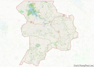
| State: | Georgia |
| County: | Union County |
| Elevation: | 1,893 ft (577 m) |
| Total Area: | 1.11 sq mi (2.88 km²) |
| Land Area: | 1.11 sq mi (2.86 km²) |
| Water Area: | 0.01 sq mi (0.02 km²) |
| Total Population: | 616 |
| Population Density: | 556.96/sq mi (215.08/km²) |
| ZIP code: | 30512, 30514 |
| Area code: | 706 |
| FIPS code: | 1308480 |
| GNISfeature ID: | 2403875 |
| Website: | www.blairsville-ga.gov |
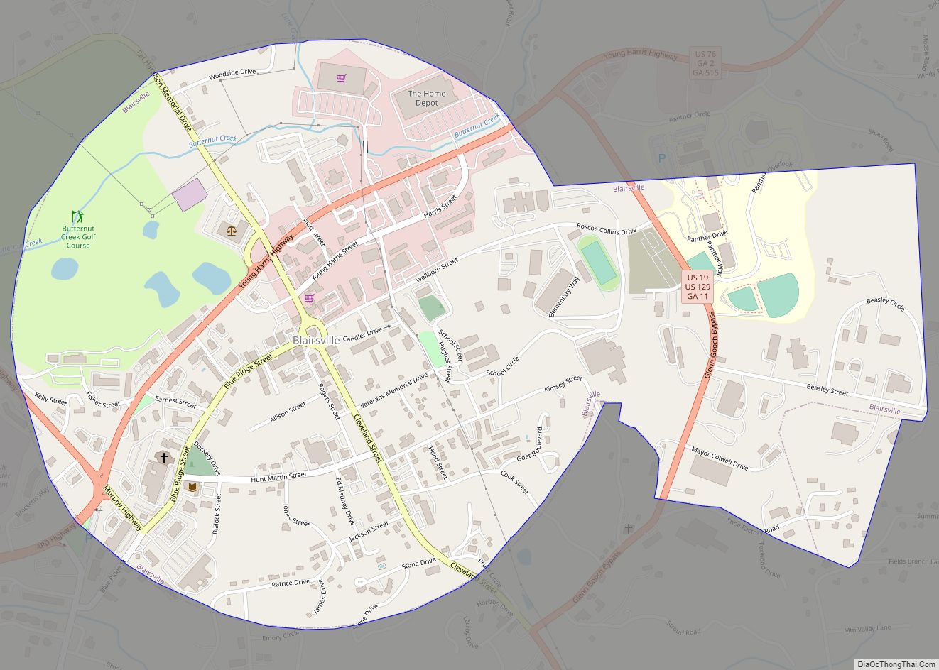
Online Interactive Map
Click on ![]() to view map in "full screen" mode.
to view map in "full screen" mode.
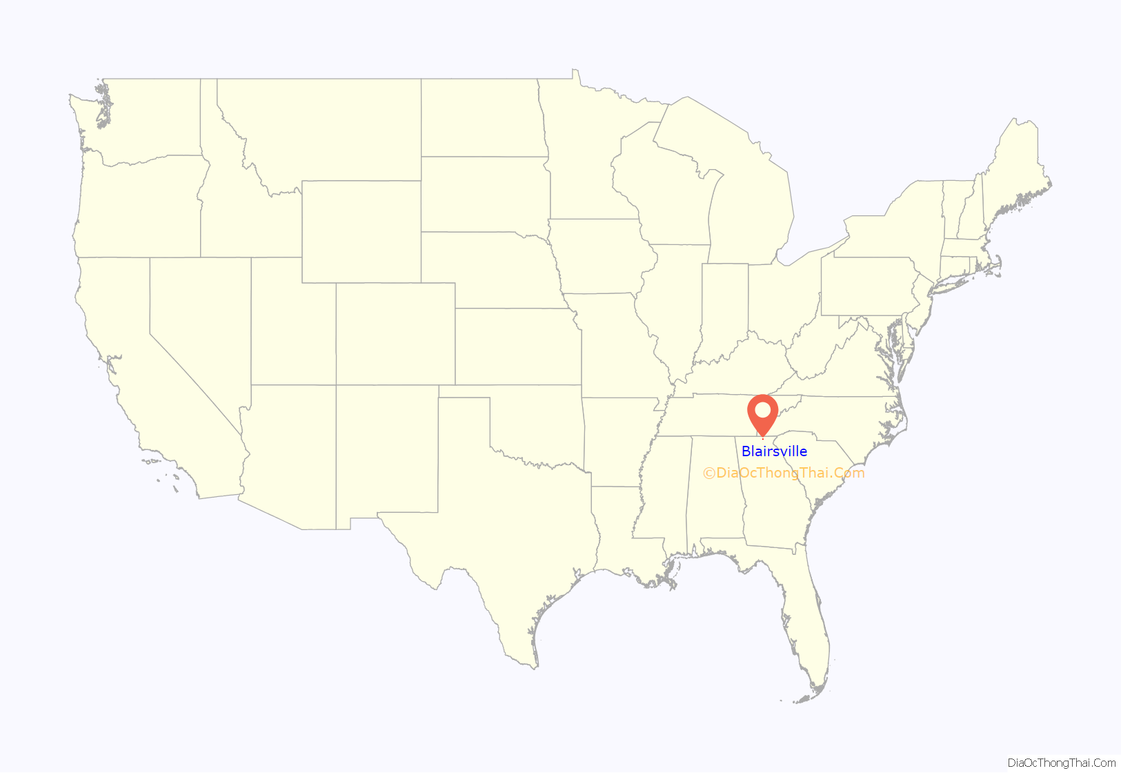
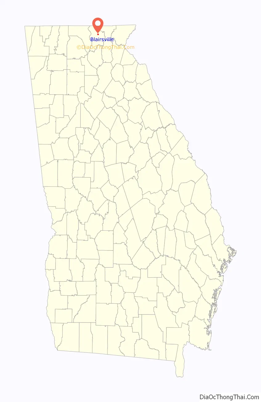
Blairsville location map. Where is Blairsville city?
History
During the 1830s, the United States conducted Indian Removal of the Cherokee Nation and other Southeast tribes, to what was designated as Indian Territory west of the Mississippi River. This area along the Nottely River was part of the large Cherokee territory and the leader Goingsnake was born here in 1758.
After American settlers moved into this area, in 1835 the Georgia General Assembly designated Blairsville as the Union County seat. The town is named after American Revolutionary War veteran James Blair.
The neighboring city of Dahlonega was known as the first site of gold in the United States, but the Blairsville area was known to have the purest gold in the mountains of northern Georgia. Assayers in Washington, D.C. could tell by looking that gold ore was from the Coosa Mines because it was “the yellowest gold” submitted and its brilliant color set it apart.
This area of northern Georgia was still rural and isolated before World War II. During the Great Depression, under the President Franklin D. Roosevelt administration, the Nottely River was selected as part of the Tennessee Valley Authority projects. The river was dammed in order to form a reservoir to generate hydroelectric power. It also created a lake with recreational opportunities. This was one of the projects that produced electrification in a rural area.
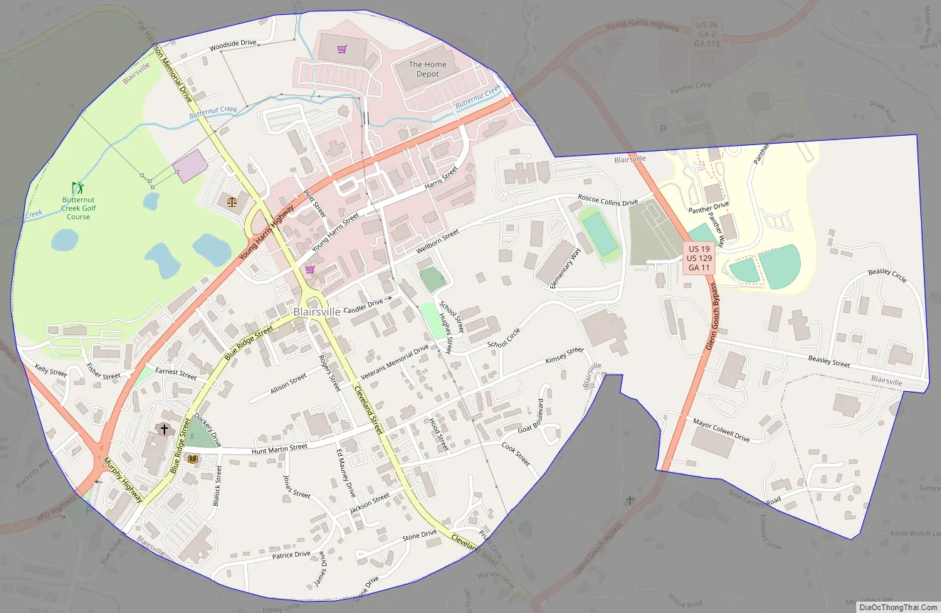
Blairsville Road Map
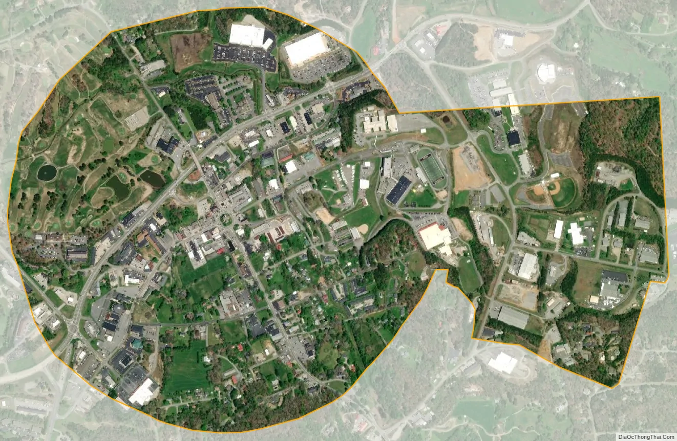
Blairsville city Satellite Map
Geography
U.S. Routes 19 and 76, as well as Georgia State Route 515 (Zell Miller Mountain Parkway), are the main highways through the city. U.S. 19 leads north 21 mi (34 km) to Murphy, North Carolina and south 34 mi (55 km) to Dahlonega. U.S. 76 and GA-515 run through the city together, leading northeast 8 mi (13 km) to Young Harris and west 23 mi (37 km) to Blue Ridge. Atlanta is 99 mi (159 km) to the south via U.S. 19.
According to the United States Census Bureau, the city has a total area of 1.1 square miles (2.8 km), all land.
Climate
Blairsville has a humid subtropical climate, yet due to its elevation of 1,883 feet (574 m), typically records far lower temperatures at night than what is encountered in much of the Southeastern U.S., and has slightly higher precipitation totals (56 inches or 1,420 millimetres annually) than most locations in the state; the average diurnal temperature variation exceeds 25 °F (14 °C) in each of the spring and autumn months. Snow usually occurs several times every year. The average annual snowfall is 4 inches. The monthly daily mean temperature ranges from 36.8 °F (2.7 °C) in January to 73.3 °F (22.9 °C) in July. There are 7.6 days of 90 °F (32 °C) highs and 4.6 days where the high fails to rise above freezing annually.
See also
Map of Georgia State and its subdivision:- Appling
- Atkinson
- Bacon
- Baker
- Baldwin
- Banks
- Barrow
- Bartow
- Ben Hill
- Berrien
- Bibb
- Bleckley
- Brantley
- Brooks
- Bryan
- Bulloch
- Burke
- Butts
- Calhoun
- Camden
- Candler
- Carroll
- Catoosa
- Charlton
- Chatham
- Chattahoochee
- Chattooga
- Cherokee
- Clarke
- Clay
- Clayton
- Clinch
- Cobb
- Coffee
- Colquitt
- Columbia
- Cook
- Coweta
- Crawford
- Crisp
- Dade
- Dawson
- Decatur
- DeKalb
- Dodge
- Dooly
- Dougherty
- Douglas
- Early
- Echols
- Effingham
- Elbert
- Emanuel
- Evans
- Fannin
- Fayette
- Floyd
- Forsyth
- Franklin
- Fulton
- Gilmer
- Glascock
- Glynn
- Gordon
- Grady
- Greene
- Gwinnett
- Habersham
- Hall
- Hancock
- Haralson
- Harris
- Hart
- Heard
- Henry
- Houston
- Irwin
- Jackson
- Jasper
- Jeff Davis
- Jefferson
- Jenkins
- Johnson
- Jones
- Lamar
- Lanier
- Laurens
- Lee
- Liberty
- Lincoln
- Long
- Lowndes
- Lumpkin
- Macon
- Madison
- Marion
- McDuffie
- McIntosh
- Meriwether
- Miller
- Mitchell
- Monroe
- Montgomery
- Morgan
- Murray
- Muscogee
- Newton
- Oconee
- Oglethorpe
- Paulding
- Peach
- Pickens
- Pierce
- Pike
- Polk
- Pulaski
- Putnam
- Quitman
- Rabun
- Randolph
- Richmond
- Rockdale
- Schley
- Screven
- Seminole
- Spalding
- Stephens
- Stewart
- Sumter
- Talbot
- Taliaferro
- Tattnall
- Taylor
- Telfair
- Terrell
- Thomas
- Tift
- Toombs
- Towns
- Treutlen
- Troup
- Turner
- Twiggs
- Union
- Upson
- Walker
- Walton
- Ware
- Warren
- Washington
- Wayne
- Webster
- Wheeler
- White
- Whitfield
- Wilcox
- Wilkes
- Wilkinson
- Worth
- Alabama
- Alaska
- Arizona
- Arkansas
- California
- Colorado
- Connecticut
- Delaware
- District of Columbia
- Florida
- Georgia
- Hawaii
- Idaho
- Illinois
- Indiana
- Iowa
- Kansas
- Kentucky
- Louisiana
- Maine
- Maryland
- Massachusetts
- Michigan
- Minnesota
- Mississippi
- Missouri
- Montana
- Nebraska
- Nevada
- New Hampshire
- New Jersey
- New Mexico
- New York
- North Carolina
- North Dakota
- Ohio
- Oklahoma
- Oregon
- Pennsylvania
- Rhode Island
- South Carolina
- South Dakota
- Tennessee
- Texas
- Utah
- Vermont
- Virginia
- Washington
- West Virginia
- Wisconsin
- Wyoming