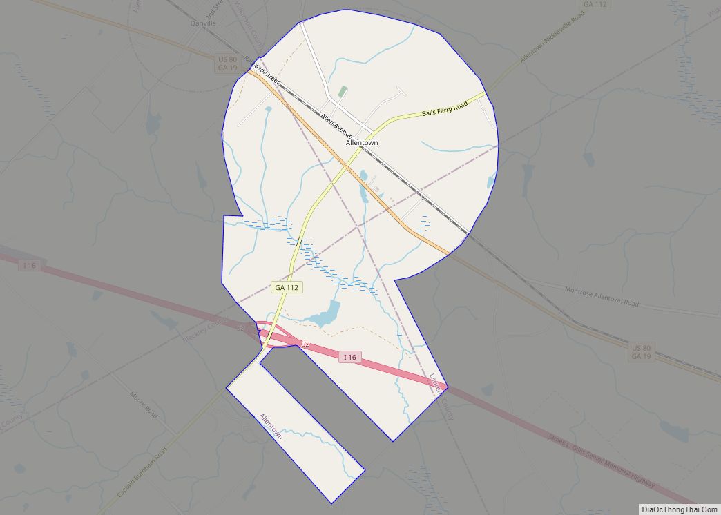
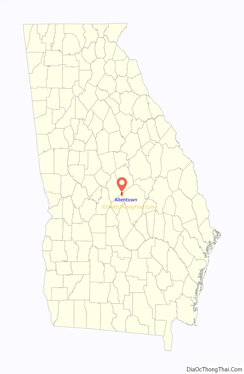
Allentown is a city in Bleckley, Laurens, Twiggs, and Wilkinson counties in the U.S. state of Georgia, primarily in Wilkinson County. As of the 2010 census, the city had a population of 169, down from 287 at the 2000 census. The Twiggs County portion is part of the Macon Metropolitan Statistical Area, while the Laurens County portion is part of the Dublin Micropolitan Statistical Area. The remaining Wilkinson and Bleckley County portions are not part of any metropolitan or micropolitan area.
| Name: | Allentown city |
|---|---|
| LSAD Code: | 25 |
| LSAD Description: | city (suffix) |
| State: | Georgia |
| County: | Bleckley County, Laurens County, Twiggs County, Wilkinson County |
| Elevation: | 430 ft (130 m) |
| Total Area: | 4.60 sq mi (11.92 km²) |
| Land Area: | 4.58 sq mi (11.86 km²) |
| Water Area: | 0.03 sq mi (0.07 km²) |
| Total Population: | 195 |
| Population Density: | 42.60/sq mi (16.45/km²) |
| ZIP code: | 31003 |
| Area code: | 478 |
| FIPS code: | 1301500 |
| GNISfeature ID: | 0310468 |
| Website: | cityofallentownga.org |
Online Interactive Map
Click on ![]() to view map in "full screen" mode.
to view map in "full screen" mode.
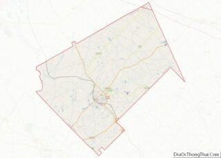
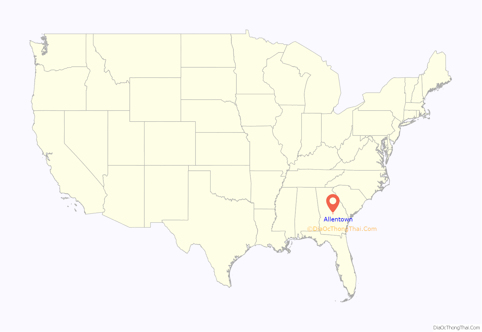
Allentown location map. Where is Allentown city?
History
Allentown was named in 1891 when the Macon, Dublin & Savannah Railroad was extended to that point. John Allen, an early postmaster, gave the town his last name. Allentown was incorporated in 1901.
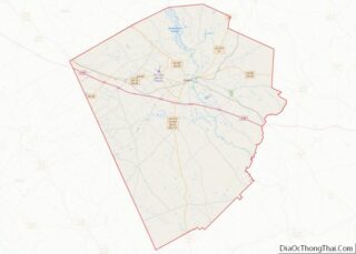
Allentown Road Map
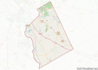
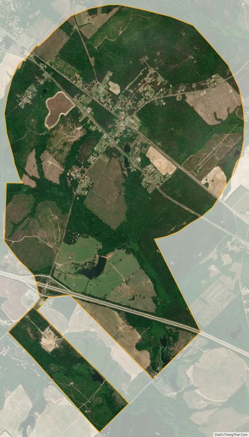
Allentown city Satellite Map
Geography
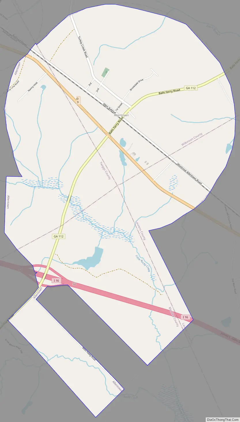
The center of Allentown and most of the buildings are in the southern corner of Wilkinson County, but the city limits extend west into Twiggs County, south into Bleckley County, and southeast into Laurens County.
U.S. Route 80 passes through the center of town, leading northwest 10 miles (16 km) to Jeffersonville and southeast 20 miles (32 km) to Dublin. Interstate 16 passes through the south end of the city, with access from Exit 32 (State Route 112). I-16 leads northwest 31 miles (50 km) to Macon and southeast 134 miles (216 km) to Savannah. State Route 112 passes through the center of Allentown as Balls Ferry Road, leading northeast 10 miles (16 km) to U.S. Route 441 at Nicklesville and southwest 18 miles (29 km) to Cochran.
According to the United States Census Bureau, Allentown has a total area of 4.6 square miles (11.9 km), of which 0.03 square miles (0.07 km), or 0.55%, are water.
The north side of Allentown drains to Devils Branch, a tributary of Turkey Creek and part of the Oconee River watershed. The south side drains to Little Rocky Creek, a tributary of Rocky Creek, then Turkey Creek and the Oconee.
See also
Map of Georgia State and its subdivision:- Appling
- Atkinson
- Bacon
- Baker
- Baldwin
- Banks
- Barrow
- Bartow
- Ben Hill
- Berrien
- Bibb
- Bleckley
- Brantley
- Brooks
- Bryan
- Bulloch
- Burke
- Butts
- Calhoun
- Camden
- Candler
- Carroll
- Catoosa
- Charlton
- Chatham
- Chattahoochee
- Chattooga
- Cherokee
- Clarke
- Clay
- Clayton
- Clinch
- Cobb
- Coffee
- Colquitt
- Columbia
- Cook
- Coweta
- Crawford
- Crisp
- Dade
- Dawson
- Decatur
- DeKalb
- Dodge
- Dooly
- Dougherty
- Douglas
- Early
- Echols
- Effingham
- Elbert
- Emanuel
- Evans
- Fannin
- Fayette
- Floyd
- Forsyth
- Franklin
- Fulton
- Gilmer
- Glascock
- Glynn
- Gordon
- Grady
- Greene
- Gwinnett
- Habersham
- Hall
- Hancock
- Haralson
- Harris
- Hart
- Heard
- Henry
- Houston
- Irwin
- Jackson
- Jasper
- Jeff Davis
- Jefferson
- Jenkins
- Johnson
- Jones
- Lamar
- Lanier
- Laurens
- Lee
- Liberty
- Lincoln
- Long
- Lowndes
- Lumpkin
- Macon
- Madison
- Marion
- McDuffie
- McIntosh
- Meriwether
- Miller
- Mitchell
- Monroe
- Montgomery
- Morgan
- Murray
- Muscogee
- Newton
- Oconee
- Oglethorpe
- Paulding
- Peach
- Pickens
- Pierce
- Pike
- Polk
- Pulaski
- Putnam
- Quitman
- Rabun
- Randolph
- Richmond
- Rockdale
- Schley
- Screven
- Seminole
- Spalding
- Stephens
- Stewart
- Sumter
- Talbot
- Taliaferro
- Tattnall
- Taylor
- Telfair
- Terrell
- Thomas
- Tift
- Toombs
- Towns
- Treutlen
- Troup
- Turner
- Twiggs
- Union
- Upson
- Walker
- Walton
- Ware
- Warren
- Washington
- Wayne
- Webster
- Wheeler
- White
- Whitfield
- Wilcox
- Wilkes
- Wilkinson
- Worth
- Alabama
- Alaska
- Arizona
- Arkansas
- California
- Colorado
- Connecticut
- Delaware
- District of Columbia
- Florida
- Georgia
- Hawaii
- Idaho
- Illinois
- Indiana
- Iowa
- Kansas
- Kentucky
- Louisiana
- Maine
- Maryland
- Massachusetts
- Michigan
- Minnesota
- Mississippi
- Missouri
- Montana
- Nebraska
- Nevada
- New Hampshire
- New Jersey
- New Mexico
- New York
- North Carolina
- North Dakota
- Ohio
- Oklahoma
- Oregon
- Pennsylvania
- Rhode Island
- South Carolina
- South Dakota
- Tennessee
- Texas
- Utah
- Vermont
- Virginia
- Washington
- West Virginia
- Wisconsin
- Wyoming