Cadwell is a town in Laurens County, Georgia, United States. The population was 528 at the 2010 census, up from 329 at the 2000 census. It is part of the Dublin Micropolitan Statistical Area.
| Name: | Cadwell town |
|---|---|
| LSAD Code: | 43 |
| LSAD Description: | town (suffix) |
| State: | Georgia |
| County: | Laurens County |
| Elevation: | 394 ft (120 m) |
| Total Area: | 1.28 sq mi (3.33 km²) |
| Land Area: | 1.25 sq mi (3.25 km²) |
| Water Area: | 0.03 sq mi (0.08 km²) |
| Total Population: | 381 |
| Population Density: | 304.07/sq mi (117.37/km²) |
| ZIP code: | 31009 |
| Area code: | 478 |
| FIPS code: | 1312344 |
| GNISfeature ID: | 0331305 |
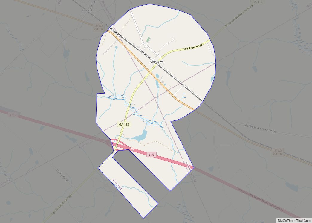
Online Interactive Map
Click on ![]() to view map in "full screen" mode.
to view map in "full screen" mode.
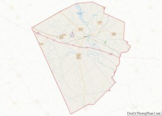
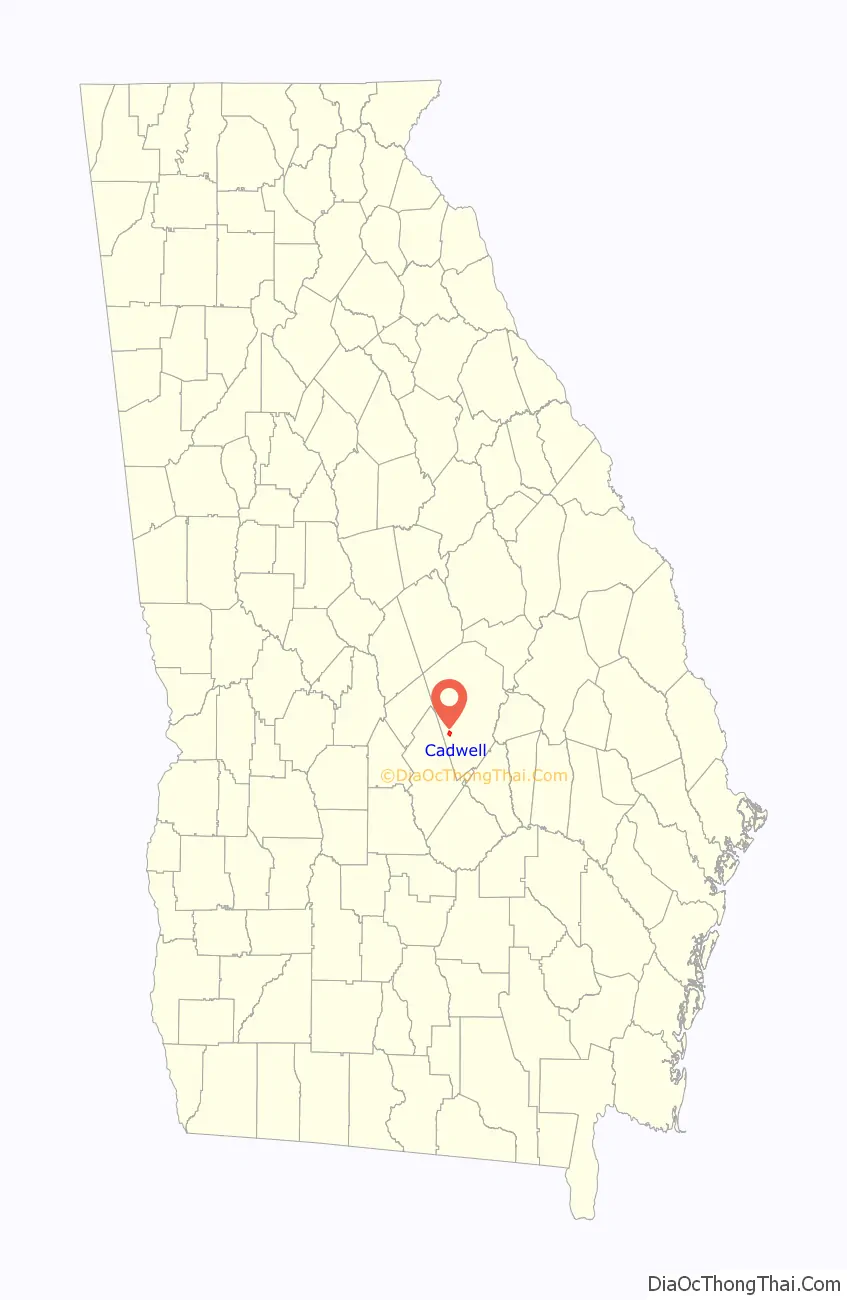
Cadwell location map. Where is Cadwell town?

History
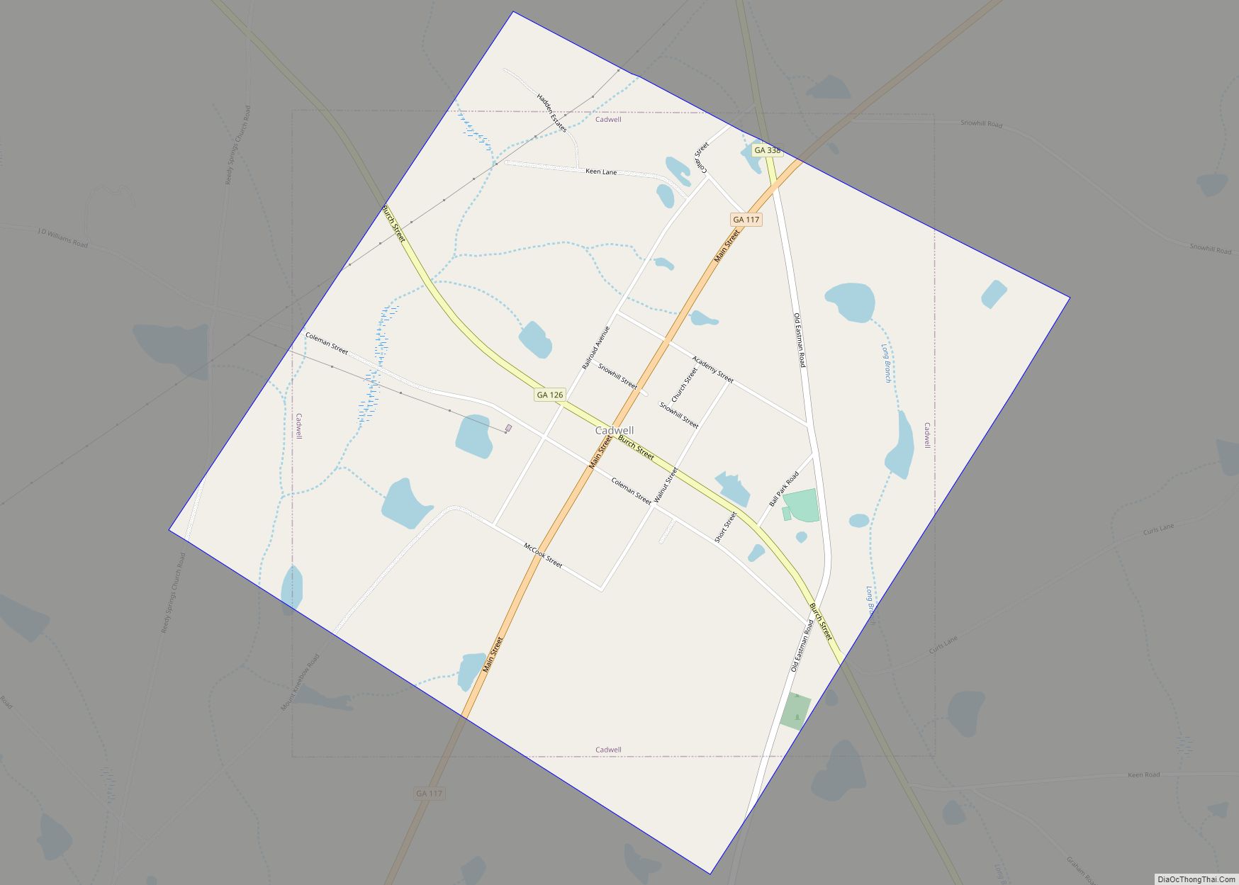
The Georgia General Assembly incorporated the place as the “Town of Cadwell” in 1907. The community was named after Matthew and Rebecca Cadwell, the original owners of the town site.
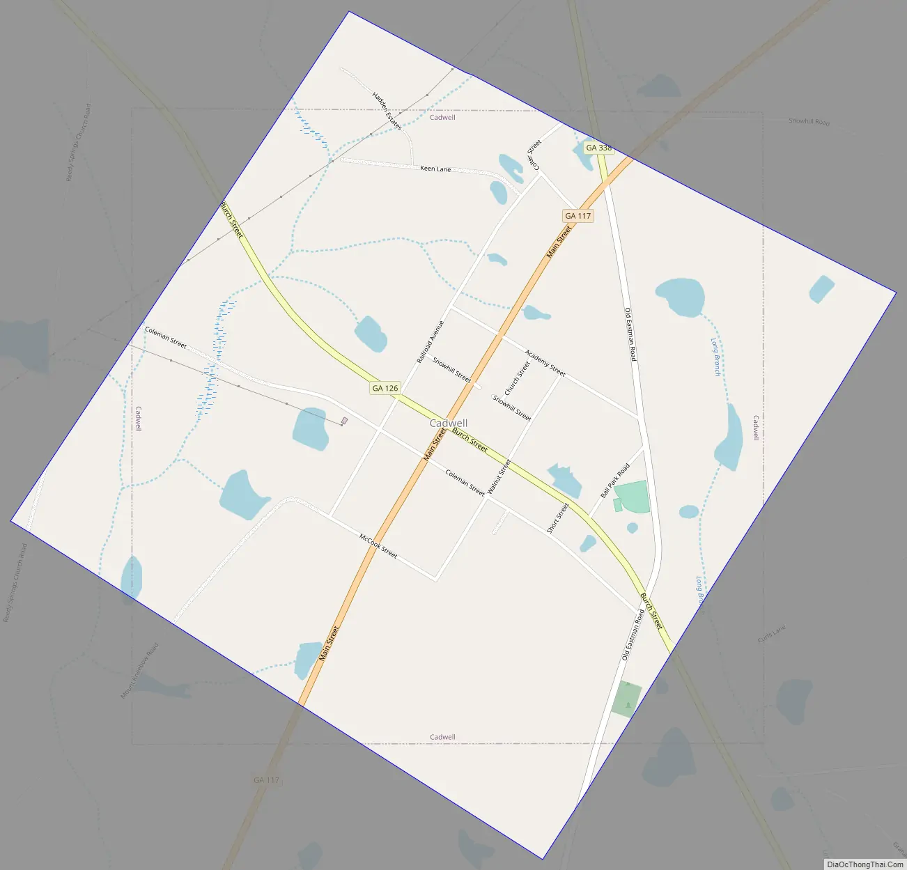
Cadwell Road Map
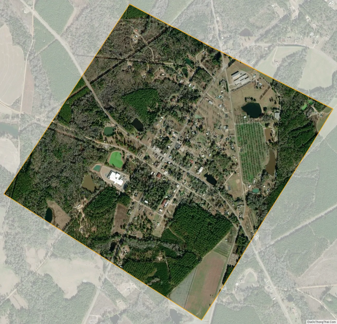
Cadwell city Satellite Map
Geography
Cadwell is located in southwestern Laurens County at 32°20′25″N 83°2′33″W / 32.34028°N 83.04250°W / 32.34028; -83.04250 (32.340353, -83.042462). Georgia State Route 117 passes through the town as its Main Street; via SR 117 it is 17 miles (27 km) northeast to Dublin, the county seat, and 13 miles (21 km) southwest to Eastman. State Route 126 passes through the center of Cadwell as Burch Street; it leads northwest 8 miles (13 km) to Chester and southeast 22 miles (35 km) to Alamo.
According to the United States Census Bureau, Cadwell has a total area of 1.3 square miles (3.3 km), of which 0.03 square miles (0.08 km), or 2.52%, are water. The west side of the town drains to Bay Creek, a south-flowing tributary of Alligator Creek and part of the Ocmulgee River watershed. The east side drains via Long Branch to Lime Sink Creek, a tributary of Alligator Creek and the Ocmulgee.
See also
Map of Georgia State and its subdivision:- Appling
- Atkinson
- Bacon
- Baker
- Baldwin
- Banks
- Barrow
- Bartow
- Ben Hill
- Berrien
- Bibb
- Bleckley
- Brantley
- Brooks
- Bryan
- Bulloch
- Burke
- Butts
- Calhoun
- Camden
- Candler
- Carroll
- Catoosa
- Charlton
- Chatham
- Chattahoochee
- Chattooga
- Cherokee
- Clarke
- Clay
- Clayton
- Clinch
- Cobb
- Coffee
- Colquitt
- Columbia
- Cook
- Coweta
- Crawford
- Crisp
- Dade
- Dawson
- Decatur
- DeKalb
- Dodge
- Dooly
- Dougherty
- Douglas
- Early
- Echols
- Effingham
- Elbert
- Emanuel
- Evans
- Fannin
- Fayette
- Floyd
- Forsyth
- Franklin
- Fulton
- Gilmer
- Glascock
- Glynn
- Gordon
- Grady
- Greene
- Gwinnett
- Habersham
- Hall
- Hancock
- Haralson
- Harris
- Hart
- Heard
- Henry
- Houston
- Irwin
- Jackson
- Jasper
- Jeff Davis
- Jefferson
- Jenkins
- Johnson
- Jones
- Lamar
- Lanier
- Laurens
- Lee
- Liberty
- Lincoln
- Long
- Lowndes
- Lumpkin
- Macon
- Madison
- Marion
- McDuffie
- McIntosh
- Meriwether
- Miller
- Mitchell
- Monroe
- Montgomery
- Morgan
- Murray
- Muscogee
- Newton
- Oconee
- Oglethorpe
- Paulding
- Peach
- Pickens
- Pierce
- Pike
- Polk
- Pulaski
- Putnam
- Quitman
- Rabun
- Randolph
- Richmond
- Rockdale
- Schley
- Screven
- Seminole
- Spalding
- Stephens
- Stewart
- Sumter
- Talbot
- Taliaferro
- Tattnall
- Taylor
- Telfair
- Terrell
- Thomas
- Tift
- Toombs
- Towns
- Treutlen
- Troup
- Turner
- Twiggs
- Union
- Upson
- Walker
- Walton
- Ware
- Warren
- Washington
- Wayne
- Webster
- Wheeler
- White
- Whitfield
- Wilcox
- Wilkes
- Wilkinson
- Worth
- Alabama
- Alaska
- Arizona
- Arkansas
- California
- Colorado
- Connecticut
- Delaware
- District of Columbia
- Florida
- Georgia
- Hawaii
- Idaho
- Illinois
- Indiana
- Iowa
- Kansas
- Kentucky
- Louisiana
- Maine
- Maryland
- Massachusetts
- Michigan
- Minnesota
- Mississippi
- Missouri
- Montana
- Nebraska
- Nevada
- New Hampshire
- New Jersey
- New Mexico
- New York
- North Carolina
- North Dakota
- Ohio
- Oklahoma
- Oregon
- Pennsylvania
- Rhode Island
- South Carolina
- South Dakota
- Tennessee
- Texas
- Utah
- Vermont
- Virginia
- Washington
- West Virginia
- Wisconsin
- Wyoming