Chattahoochee Hills (formerly Chattahoochee Hill Country) is a city in southern Fulton County, Georgia, United States. As of the 2010 census, it had a population of 2,378 living in an area of just over 32,000 acres (130 km). The population in 2019 was estimated to 3,318 in an area of approximately 37,473 acres (151.65 km) acres after subsequent annexations. It is the incorporated part of a region called “Chattahoochee Hill Country”, an area encompassing approximately 60,000 acres (240 km) southwest of Atlanta, bordered on the northwest side by the Chattahoochee River. Unlike the rest of metro Atlanta, it is still relatively undeveloped, and most of its rural character remains unchanged. The majority of the wider area comprises the west-southwest part of southern Fulton, and smaller adjacent parts of southern Douglas, eastern Carroll, and northern Coweta counties.
| Name: | Chattahoochee Hills city |
|---|---|
| LSAD Code: | 25 |
| LSAD Description: | city (suffix) |
| State: | Georgia |
| County: | Fulton County |
| Elevation: | 876 ft (267 m) |
| Total Area: | 59.27 sq mi (153.50 km²) |
| Land Area: | 58.18 sq mi (150.68 km²) |
| Water Area: | 1.09 sq mi (2.81 km²) |
| Total Population: | 2,950 |
| Population Density: | 50.71/sq mi (19.58/km²) |
| FIPS code: | 1315552 |
| GNISfeature ID: | 2424930 |
| Website: | www.chatthillsga.us |
Online Interactive Map
Click on ![]() to view map in "full screen" mode.
to view map in "full screen" mode.
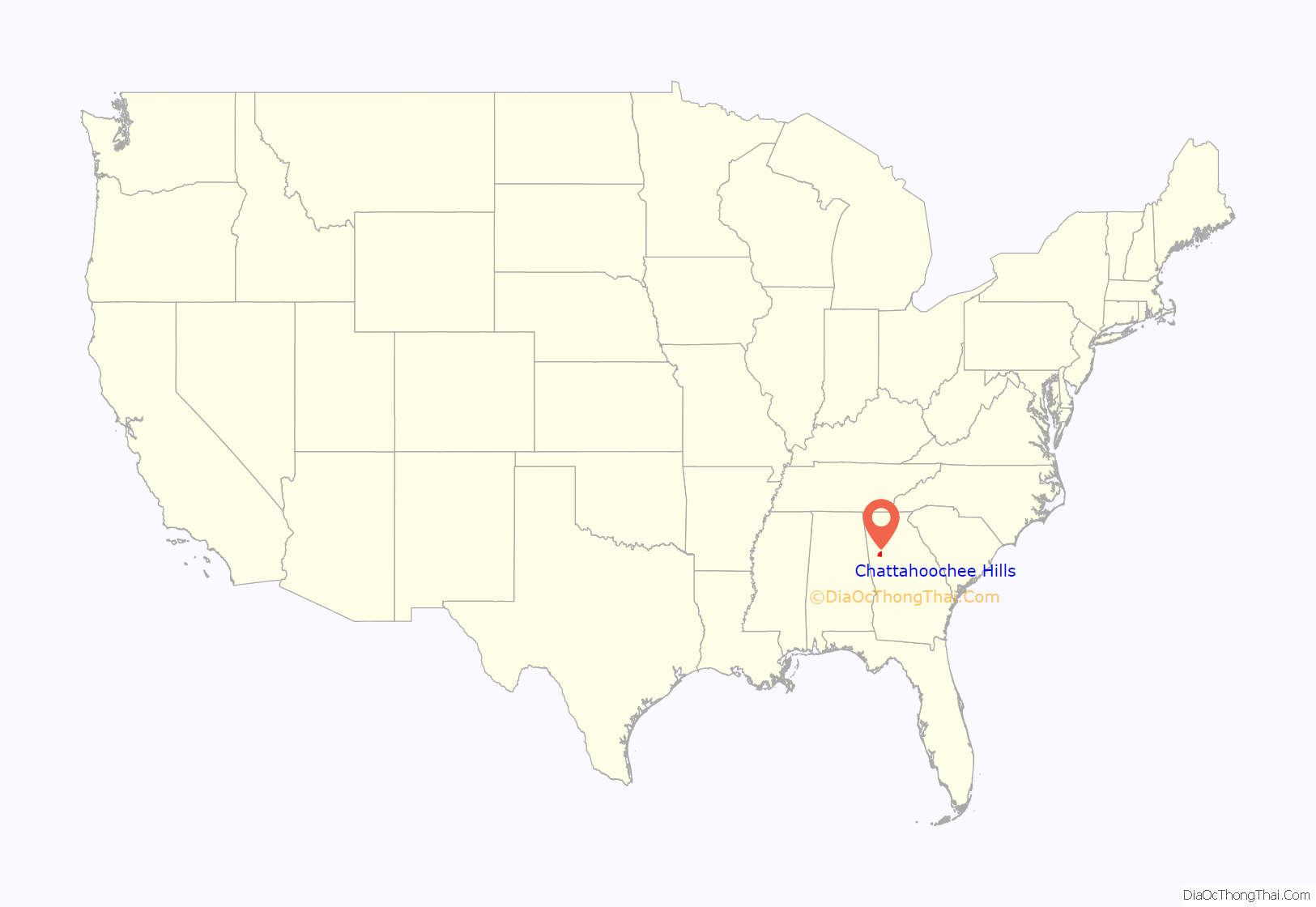
Chattahoochee Hills location map. Where is Chattahoochee Hills city?
History
The area that is now southwest Fulton was originally Campbell County, but it agreed to annexation by neighboring Fulton County on January 1, 1932, to reduce administrative costs.
Historically, much of the west/center of the current city was considered the town of Rico, with other communities, including Goodes, Rivertown, County Line, Campbellton, Pumpkintown, and several other historic communities also within the new city’s boundaries.
The idea of “Chattahoochee Hills” is very recent. This developed from attempts to incorporate all of Fulton County into cities following the 2005 incorporation of Sandy Springs in the north part of the county, as well as local efforts to take control of zoning and land subdivision in the multi-county Chattahoochee Hill Country area.
During the 2006 session, the Georgia General Assembly passed a law allowing the Fulton section of the area to incorporate as a city (the only type of municipality allowed in Georgia), the purpose being the municipalization of that county, and to allow local residents to have local control of zoning, with the goal of preserving as much as possible of the rural character of the community while controlling development. Originally, this was to be implemented by concentrating the majority of the development in three planned villages. The nearby city of Palmetto annexed one of the village sites, leaving a gerrymander-looking arm of Palmetto sticking northwest into the heart of the new city.
On June 19, 2007, residents voted by an 83% to 17% margin in a local referendum to incorporate the 33,000-acre (130 km) portion within Fulton as the city of “Chattahoochee Hill Country”. Later annexation could incorporate the portions remaining in other counties.
Chattahoochee Hill Country became a city on December 1, 2007, with the first elected officials taking office a few days later. On September 23, 2008, the city was renamed by an ordinance as “Chattahoochee Hills”.
Subsequent zoning updates have maintained the vision of preservation, but have decoupled the development from specific landowner sites. The end result foreseen by the zoning will permanently protect 70% of the City’s land as forest and farm, while consolidating the development on the balance of the City’s territory in a variety of hamlet, village and town typologies scattered throughout the preserved land, developed on a ‘first come/first served’ basis. Land will be conserved through a variety of methods, including preservation internal to developments, as well as external preservation through the sale and purchase of Transferable development rights (TDR’s).
In 2014 the City responded to community petitions by annexing approximately 5,473 acres to its north along with several hundred residents (from the unincorporated portion of Fulton County), an area which included the original county seat of historic Campbell County, Campbellton.
In 2014 the City also annexed approximately 180 acres with no residents in Coweta County at the request of the developer of Serenbe, who had property in both counties.
Chattahoochee Hills Road Map
Chattahoochee Hills city Satellite Map
See also
Map of Georgia State and its subdivision:- Appling
- Atkinson
- Bacon
- Baker
- Baldwin
- Banks
- Barrow
- Bartow
- Ben Hill
- Berrien
- Bibb
- Bleckley
- Brantley
- Brooks
- Bryan
- Bulloch
- Burke
- Butts
- Calhoun
- Camden
- Candler
- Carroll
- Catoosa
- Charlton
- Chatham
- Chattahoochee
- Chattooga
- Cherokee
- Clarke
- Clay
- Clayton
- Clinch
- Cobb
- Coffee
- Colquitt
- Columbia
- Cook
- Coweta
- Crawford
- Crisp
- Dade
- Dawson
- Decatur
- DeKalb
- Dodge
- Dooly
- Dougherty
- Douglas
- Early
- Echols
- Effingham
- Elbert
- Emanuel
- Evans
- Fannin
- Fayette
- Floyd
- Forsyth
- Franklin
- Fulton
- Gilmer
- Glascock
- Glynn
- Gordon
- Grady
- Greene
- Gwinnett
- Habersham
- Hall
- Hancock
- Haralson
- Harris
- Hart
- Heard
- Henry
- Houston
- Irwin
- Jackson
- Jasper
- Jeff Davis
- Jefferson
- Jenkins
- Johnson
- Jones
- Lamar
- Lanier
- Laurens
- Lee
- Liberty
- Lincoln
- Long
- Lowndes
- Lumpkin
- Macon
- Madison
- Marion
- McDuffie
- McIntosh
- Meriwether
- Miller
- Mitchell
- Monroe
- Montgomery
- Morgan
- Murray
- Muscogee
- Newton
- Oconee
- Oglethorpe
- Paulding
- Peach
- Pickens
- Pierce
- Pike
- Polk
- Pulaski
- Putnam
- Quitman
- Rabun
- Randolph
- Richmond
- Rockdale
- Schley
- Screven
- Seminole
- Spalding
- Stephens
- Stewart
- Sumter
- Talbot
- Taliaferro
- Tattnall
- Taylor
- Telfair
- Terrell
- Thomas
- Tift
- Toombs
- Towns
- Treutlen
- Troup
- Turner
- Twiggs
- Union
- Upson
- Walker
- Walton
- Ware
- Warren
- Washington
- Wayne
- Webster
- Wheeler
- White
- Whitfield
- Wilcox
- Wilkes
- Wilkinson
- Worth
- Alabama
- Alaska
- Arizona
- Arkansas
- California
- Colorado
- Connecticut
- Delaware
- District of Columbia
- Florida
- Georgia
- Hawaii
- Idaho
- Illinois
- Indiana
- Iowa
- Kansas
- Kentucky
- Louisiana
- Maine
- Maryland
- Massachusetts
- Michigan
- Minnesota
- Mississippi
- Missouri
- Montana
- Nebraska
- Nevada
- New Hampshire
- New Jersey
- New Mexico
- New York
- North Carolina
- North Dakota
- Ohio
- Oklahoma
- Oregon
- Pennsylvania
- Rhode Island
- South Carolina
- South Dakota
- Tennessee
- Texas
- Utah
- Vermont
- Virginia
- Washington
- West Virginia
- Wisconsin
- Wyoming


