Rentz is a city in Laurens County, Georgia, United States. The population was 295 at the 2010 census. It is part of the Dublin Micropolitan Statistical Area.
| Name: | Rentz city |
|---|---|
| LSAD Code: | 25 |
| LSAD Description: | city (suffix) |
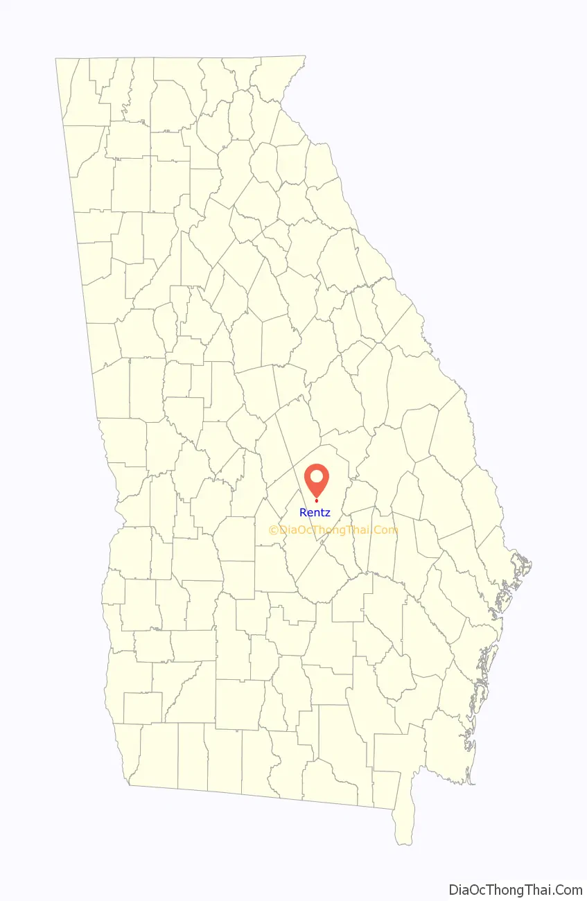
| State: | Georgia |
| County: | Laurens County |
| Elevation: | 305 ft (93 m) |
| Total Area: | 1.06 sq mi (2.74 km²) |
| Land Area: | 1.05 sq mi (2.72 km²) |
| Water Area: | 0.01 sq mi (0.02 km²) |
| Total Population: | 312 |
| Population Density: | 297.14/sq mi (114.74/km²) |
| ZIP code: | 31075 |
| Area code: | 478 |
| FIPS code: | 1364680 |
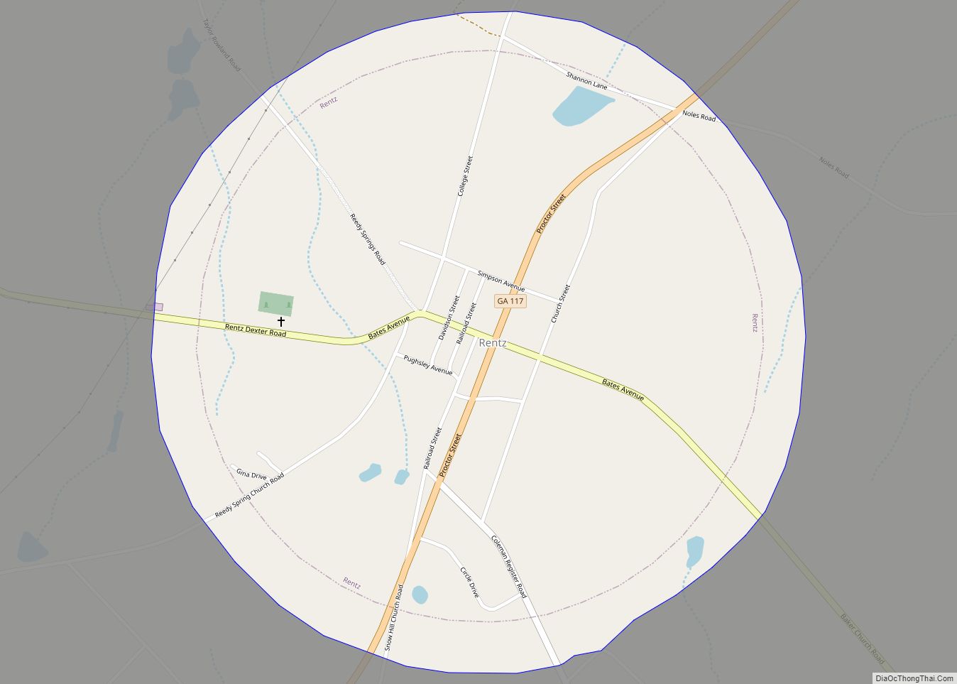
Online Interactive Map
Click on ![]() to view map in "full screen" mode.
to view map in "full screen" mode.
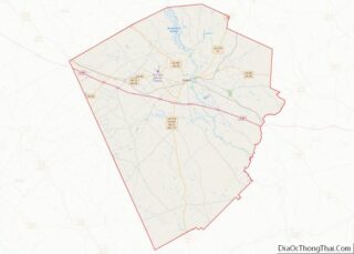
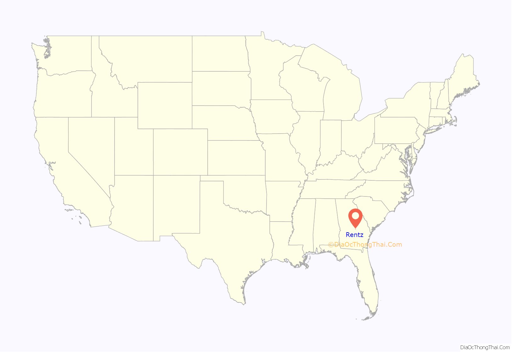
Rentz location map. Where is Rentz city?
History
The Georgia General Assembly incorporated Rentz as a town in 1905. The community was named after E. P. Rentz, a businessperson in the local lumber industry. A post office has been in operation at Rentz since 1905.
Rentz Road Map
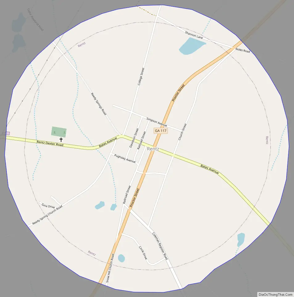
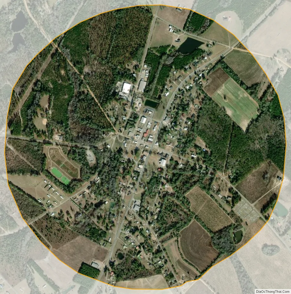
Rentz city Satellite Map
Geography
Rentz is located in southwestern Laurens County at 32°23′3″N 82°59′30″W / 32.38417°N 82.99167°W / 32.38417; -82.99167 (32.384064, -82.991633). Georgia State Route 117 (Proctor Street) runs through the center of town; it leads northeast 4 miles (6 km) to U.S. Route 441 and southwest the same distance to Cadwell. Dublin, the county seat, is 13 miles (21 km) northeast of Rentz via Routes 117 and 441.
According to the United States Census Bureau, Rentz has a total area of 1.0 square mile (2.7 km), of which 0.01 square miles (0.02 km), or 0.67%, are water.
See also
Map of Georgia State and its subdivision:- Appling
- Atkinson
- Bacon
- Baker
- Baldwin
- Banks
- Barrow
- Bartow
- Ben Hill
- Berrien
- Bibb
- Bleckley
- Brantley
- Brooks
- Bryan
- Bulloch
- Burke
- Butts
- Calhoun
- Camden
- Candler
- Carroll
- Catoosa
- Charlton
- Chatham
- Chattahoochee
- Chattooga
- Cherokee
- Clarke
- Clay
- Clayton
- Clinch
- Cobb
- Coffee
- Colquitt
- Columbia
- Cook
- Coweta
- Crawford
- Crisp
- Dade
- Dawson
- Decatur
- DeKalb
- Dodge
- Dooly
- Dougherty
- Douglas
- Early
- Echols
- Effingham
- Elbert
- Emanuel
- Evans
- Fannin
- Fayette
- Floyd
- Forsyth
- Franklin
- Fulton
- Gilmer
- Glascock
- Glynn
- Gordon
- Grady
- Greene
- Gwinnett
- Habersham
- Hall
- Hancock
- Haralson
- Harris
- Hart
- Heard
- Henry
- Houston
- Irwin
- Jackson
- Jasper
- Jeff Davis
- Jefferson
- Jenkins
- Johnson
- Jones
- Lamar
- Lanier
- Laurens
- Lee
- Liberty
- Lincoln
- Long
- Lowndes
- Lumpkin
- Macon
- Madison
- Marion
- McDuffie
- McIntosh
- Meriwether
- Miller
- Mitchell
- Monroe
- Montgomery
- Morgan
- Murray
- Muscogee
- Newton
- Oconee
- Oglethorpe
- Paulding
- Peach
- Pickens
- Pierce
- Pike
- Polk
- Pulaski
- Putnam
- Quitman
- Rabun
- Randolph
- Richmond
- Rockdale
- Schley
- Screven
- Seminole
- Spalding
- Stephens
- Stewart
- Sumter
- Talbot
- Taliaferro
- Tattnall
- Taylor
- Telfair
- Terrell
- Thomas
- Tift
- Toombs
- Towns
- Treutlen
- Troup
- Turner
- Twiggs
- Union
- Upson
- Walker
- Walton
- Ware
- Warren
- Washington
- Wayne
- Webster
- Wheeler
- White
- Whitfield
- Wilcox
- Wilkes
- Wilkinson
- Worth
- Alabama
- Alaska
- Arizona
- Arkansas
- California
- Colorado
- Connecticut
- Delaware
- District of Columbia
- Florida
- Georgia
- Hawaii
- Idaho
- Illinois
- Indiana
- Iowa
- Kansas
- Kentucky
- Louisiana
- Maine
- Maryland
- Massachusetts
- Michigan
- Minnesota
- Mississippi
- Missouri
- Montana
- Nebraska
- Nevada
- New Hampshire
- New Jersey
- New Mexico
- New York
- North Carolina
- North Dakota
- Ohio
- Oklahoma
- Oregon
- Pennsylvania
- Rhode Island
- South Carolina
- South Dakota
- Tennessee
- Texas
- Utah
- Vermont
- Virginia
- Washington
- West Virginia
- Wisconsin
- Wyoming