Eatonton is a city in and county seat of Putnam County, Georgia, United States. As of the 2020 census, the city had a population of 6,307. It was named after William Eaton, an officer and diplomat involved in the First Barbary War. The name consists of his surname with the English suffix “ton,” meaning “town”.
| Name: | Eatonton city |
|---|---|
| LSAD Code: | 25 |
| LSAD Description: | city (suffix) |
| State: | Georgia |
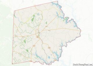
| County: | Putnam County |
| Elevation: | 568 ft (173 m) |
| Total Area: | 20.61 sq mi (53.38 km²) |
| Land Area: | 20.51 sq mi (53.12 km²) |
| Water Area: | 0.10 sq mi (0.27 km²) |
| Total Population: | 6,307 |
| Population Density: | 307.52/sq mi (118.74/km²) |
| ZIP code: | 31024 |
| Area code: | 706 |
| FIPS code: | 1326084 |
| GNISfeature ID: | 0331628 |
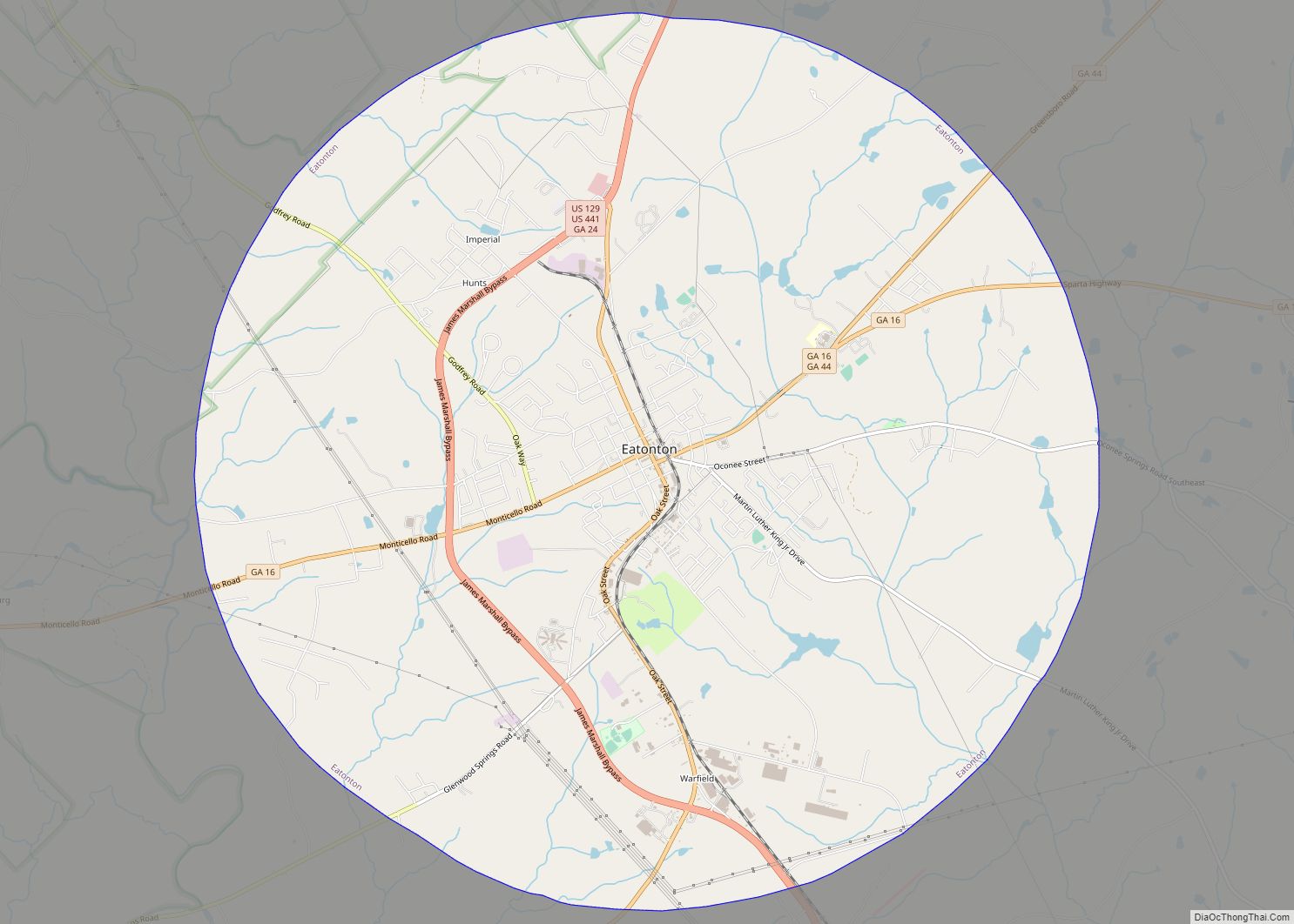
Online Interactive Map
Click on ![]() to view map in "full screen" mode.
to view map in "full screen" mode.
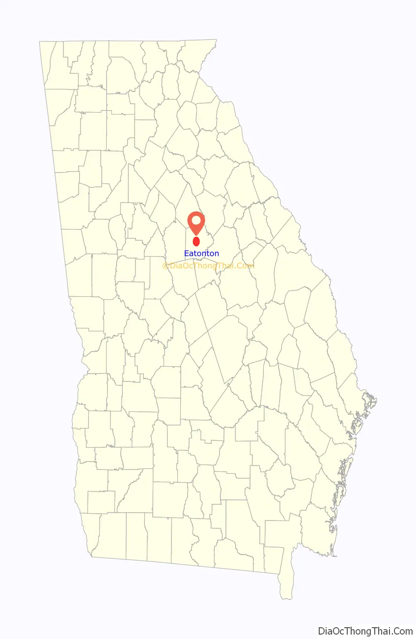
Eatonton location map. Where is Eatonton city?

History
The Rock Eagle Effigy Mound, a Native American archaeological site, is located north of the city. It is one of two such sites east of the Mississippi River; both are in Putnam County. The mound and related earthwork constructions were made by Woodland culture peoples, perhaps as long ago as 1,000 to 3,000 years. The site is situated within a 1500-acre park administered by the University of Georgia, which also maintains a 4-H camp nearby. The Mound has been listed on the National Register of Historic Places.
Following the American Revolutionary War, Eatonton was founded in 1807 as the seat of newly formed Putnam County. After the war, settlers were moving west and settling in the upland Piedmont region to develop cotton plantations. Eatonton was incorporated as a town in 1809 and as a city in 1879.
In a 5-hour period in May 1919, five black churches and two black lodges in Eatonton were burned to the ground, but authorities did not charge anyone with arson.
On November 22, 1992, an F4 tornado with winds up to 260 mph hit the south portions of the city. The storm caused $27,000,000 in damages to houses and businesses. The tornado killed five locals and injured 86 victims.
In the 21st century, Eatonton is known as the “Dairy Capital of Georgia” (in honor of its major industry, dairy farming).
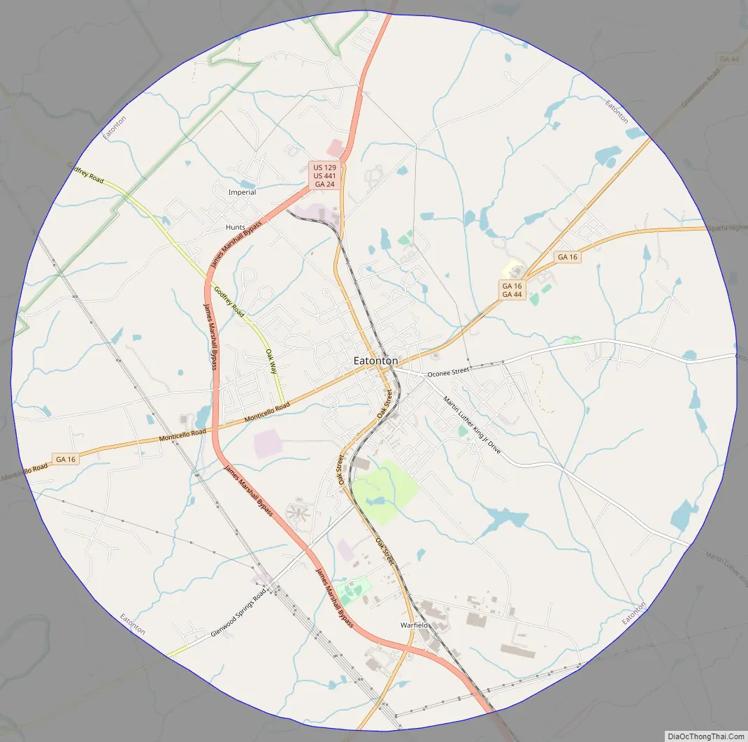
Eatonton Road Map
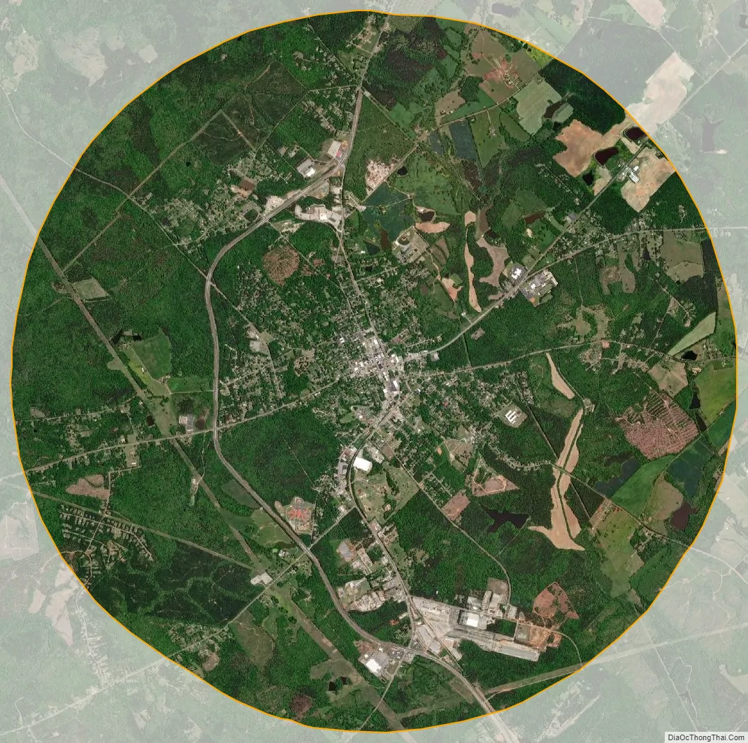
Eatonton city Satellite Map
Geography
Eatonton is located at 33°19′35″N 83°23′16″W / 33.32639°N 83.38778°W / 33.32639; -83.38778 (33.326302, -83.387798).
The city is located in the central part of the state along U.S. Routes 129 and 441, which meet in and form the western boundary of the city. Via U.S. 129/441, Madison is 22 mi (35 km) north. After leaving the city southward, U.S. 129 runs southwest 25 mi (40 km) to Gray and U.S. 441 runs southeast 21 mi (34 km) to Milledgeville. Georgia State Routes 16 and 44 are the main roads through the center of town, with GA-16 leading east 27 mi (43 km) to Sparta and west 18 mi (29 km) to Monticello, and GA-44 leading northeast 23 mi (37 km) to Greensboro.
According to the United States Census Bureau, the city has a total area of 20.7 square miles (54 km), of which 20.6 square miles (53 km) is land and 0.1 square miles (0.26 km) (0.63%) is water.
See also
Map of Georgia State and its subdivision:- Appling
- Atkinson
- Bacon
- Baker
- Baldwin
- Banks
- Barrow
- Bartow
- Ben Hill
- Berrien
- Bibb
- Bleckley
- Brantley
- Brooks
- Bryan
- Bulloch
- Burke
- Butts
- Calhoun
- Camden
- Candler
- Carroll
- Catoosa
- Charlton
- Chatham
- Chattahoochee
- Chattooga
- Cherokee
- Clarke
- Clay
- Clayton
- Clinch
- Cobb
- Coffee
- Colquitt
- Columbia
- Cook
- Coweta
- Crawford
- Crisp
- Dade
- Dawson
- Decatur
- DeKalb
- Dodge
- Dooly
- Dougherty
- Douglas
- Early
- Echols
- Effingham
- Elbert
- Emanuel
- Evans
- Fannin
- Fayette
- Floyd
- Forsyth
- Franklin
- Fulton
- Gilmer
- Glascock
- Glynn
- Gordon
- Grady
- Greene
- Gwinnett
- Habersham
- Hall
- Hancock
- Haralson
- Harris
- Hart
- Heard
- Henry
- Houston
- Irwin
- Jackson
- Jasper
- Jeff Davis
- Jefferson
- Jenkins
- Johnson
- Jones
- Lamar
- Lanier
- Laurens
- Lee
- Liberty
- Lincoln
- Long
- Lowndes
- Lumpkin
- Macon
- Madison
- Marion
- McDuffie
- McIntosh
- Meriwether
- Miller
- Mitchell
- Monroe
- Montgomery
- Morgan
- Murray
- Muscogee
- Newton
- Oconee
- Oglethorpe
- Paulding
- Peach
- Pickens
- Pierce
- Pike
- Polk
- Pulaski
- Putnam
- Quitman
- Rabun
- Randolph
- Richmond
- Rockdale
- Schley
- Screven
- Seminole
- Spalding
- Stephens
- Stewart
- Sumter
- Talbot
- Taliaferro
- Tattnall
- Taylor
- Telfair
- Terrell
- Thomas
- Tift
- Toombs
- Towns
- Treutlen
- Troup
- Turner
- Twiggs
- Union
- Upson
- Walker
- Walton
- Ware
- Warren
- Washington
- Wayne
- Webster
- Wheeler
- White
- Whitfield
- Wilcox
- Wilkes
- Wilkinson
- Worth
- Alabama
- Alaska
- Arizona
- Arkansas
- California
- Colorado
- Connecticut
- Delaware
- District of Columbia
- Florida
- Georgia
- Hawaii
- Idaho
- Illinois
- Indiana
- Iowa
- Kansas
- Kentucky
- Louisiana
- Maine
- Maryland
- Massachusetts
- Michigan
- Minnesota
- Mississippi
- Missouri
- Montana
- Nebraska
- Nevada
- New Hampshire
- New Jersey
- New Mexico
- New York
- North Carolina
- North Dakota
- Ohio
- Oklahoma
- Oregon
- Pennsylvania
- Rhode Island
- South Carolina
- South Dakota
- Tennessee
- Texas
- Utah
- Vermont
- Virginia
- Washington
- West Virginia
- Wisconsin
- Wyoming