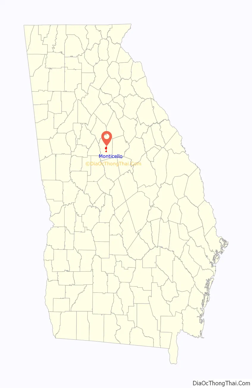
Monticello is the largest city in and the county seat of Jasper County, Georgia, United States. The city includes historic buildings such as the Jasper County Courthouse, Monticello High School and the Monticello Historic District. The population was 2,657 at the 2010 census. It is 56 miles (90 km) southeast of Atlanta.
| Name: | Monticello city |
|---|---|
| LSAD Code: | 25 |
| LSAD Description: | city (suffix) |
| State: | Georgia |
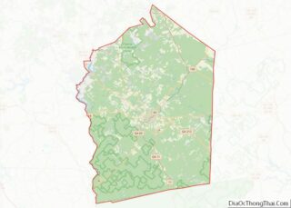
| County: | Jasper County |
| Elevation: | 679 ft (207 m) |
| Total Area: | 4.28 sq mi (11.08 km²) |
| Land Area: | 4.16 sq mi (10.78 km²) |
| Water Area: | 0.12 sq mi (0.30 km²) |
| Total Population: | 2,541 |
| Population Density: | 610.67/sq mi (235.78/km²) |
| ZIP code: | 31064 |
| Area code: | 706 |
| FIPS code: | 1352416 |
| GNISfeature ID: | 0328830 |
| Website: | www.monticelloga.org |
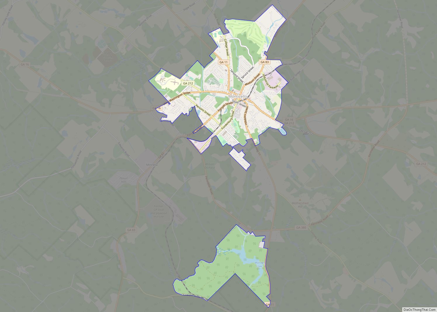
Online Interactive Map
Click on ![]() to view map in "full screen" mode.
to view map in "full screen" mode.
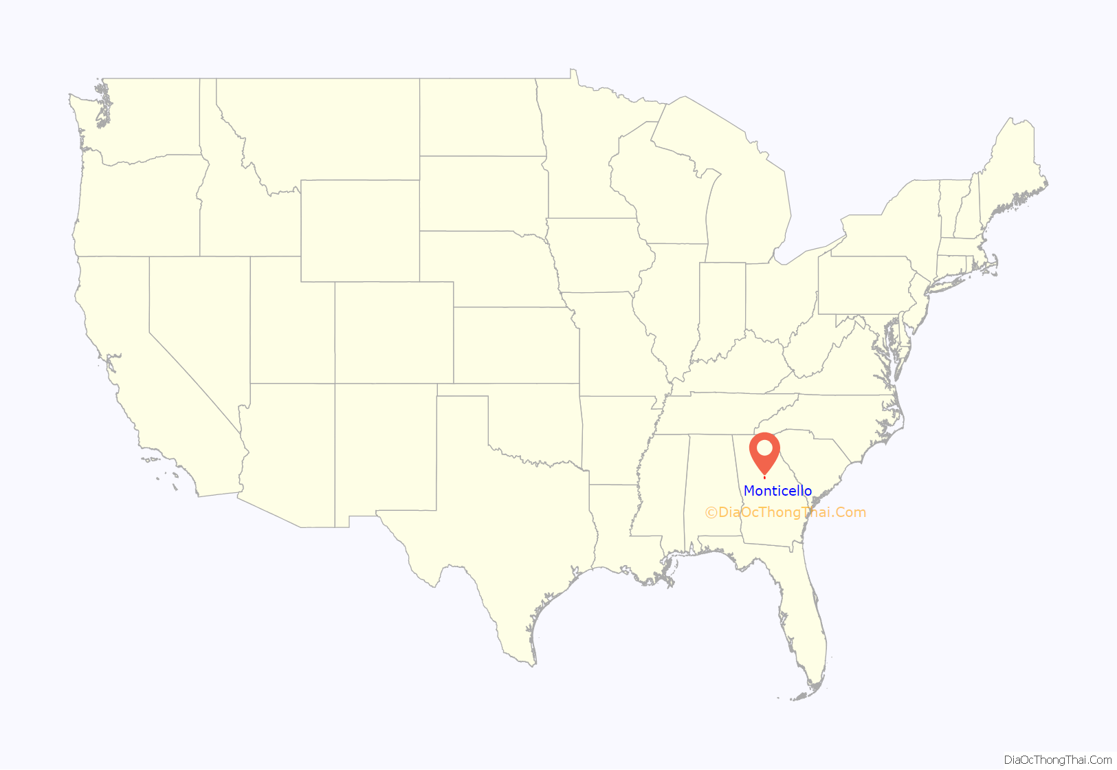
Monticello location map. Where is Monticello city?
History
Monticello was founded in 1808 as seat of the newly formed Jasper County. The city was named after Monticello, the estate of Thomas Jefferson. It was incorporated as a town in 1810 and as a city in 1901.
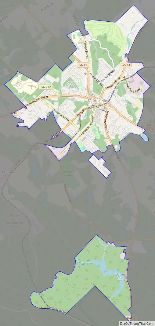
Monticello Road Map
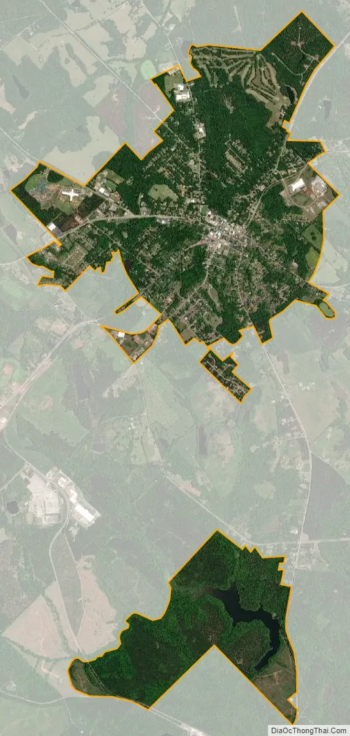
Monticello city Satellite Map
Geography
Monticello is located in the center of Jasper County at 33°18′12″N 83°41′9″W / 33.30333°N 83.68583°W / 33.30333; -83.68583 (33.303247, -83.685766). Georgia State Routes 11, 16, 83, and 212 all meet at the center of town. SR 11 leads north 18 miles (29 km) to Mansfield and south 25 miles (40 km) to Gray, SR 16 leads east 17 miles (27 km) to Eatonton and west the same distance to Jackson, SR 83 leads northeast 9 miles (14 km) to Shady Dale and southwest 26 miles (42 km) to Forsyth, and SR 212 leads northwest 42 miles (68 km) to the outskirts of Atlanta and southeast 32 miles (51 km) to Milledgeville.
According to the United States Census Bureau, the city has a total area of 3.2 square miles (8.4 km), of which 0.03 square miles (0.07 km), or 0.89%, are water. The city is part of the Oconee River watershed.
See also
Map of Georgia State and its subdivision:- Appling
- Atkinson
- Bacon
- Baker
- Baldwin
- Banks
- Barrow
- Bartow
- Ben Hill
- Berrien
- Bibb
- Bleckley
- Brantley
- Brooks
- Bryan
- Bulloch
- Burke
- Butts
- Calhoun
- Camden
- Candler
- Carroll
- Catoosa
- Charlton
- Chatham
- Chattahoochee
- Chattooga
- Cherokee
- Clarke
- Clay
- Clayton
- Clinch
- Cobb
- Coffee
- Colquitt
- Columbia
- Cook
- Coweta
- Crawford
- Crisp
- Dade
- Dawson
- Decatur
- DeKalb
- Dodge
- Dooly
- Dougherty
- Douglas
- Early
- Echols
- Effingham
- Elbert
- Emanuel
- Evans
- Fannin
- Fayette
- Floyd
- Forsyth
- Franklin
- Fulton
- Gilmer
- Glascock
- Glynn
- Gordon
- Grady
- Greene
- Gwinnett
- Habersham
- Hall
- Hancock
- Haralson
- Harris
- Hart
- Heard
- Henry
- Houston
- Irwin
- Jackson
- Jasper
- Jeff Davis
- Jefferson
- Jenkins
- Johnson
- Jones
- Lamar
- Lanier
- Laurens
- Lee
- Liberty
- Lincoln
- Long
- Lowndes
- Lumpkin
- Macon
- Madison
- Marion
- McDuffie
- McIntosh
- Meriwether
- Miller
- Mitchell
- Monroe
- Montgomery
- Morgan
- Murray
- Muscogee
- Newton
- Oconee
- Oglethorpe
- Paulding
- Peach
- Pickens
- Pierce
- Pike
- Polk
- Pulaski
- Putnam
- Quitman
- Rabun
- Randolph
- Richmond
- Rockdale
- Schley
- Screven
- Seminole
- Spalding
- Stephens
- Stewart
- Sumter
- Talbot
- Taliaferro
- Tattnall
- Taylor
- Telfair
- Terrell
- Thomas
- Tift
- Toombs
- Towns
- Treutlen
- Troup
- Turner
- Twiggs
- Union
- Upson
- Walker
- Walton
- Ware
- Warren
- Washington
- Wayne
- Webster
- Wheeler
- White
- Whitfield
- Wilcox
- Wilkes
- Wilkinson
- Worth
- Alabama
- Alaska
- Arizona
- Arkansas
- California
- Colorado
- Connecticut
- Delaware
- District of Columbia
- Florida
- Georgia
- Hawaii
- Idaho
- Illinois
- Indiana
- Iowa
- Kansas
- Kentucky
- Louisiana
- Maine
- Maryland
- Massachusetts
- Michigan
- Minnesota
- Mississippi
- Missouri
- Montana
- Nebraska
- Nevada
- New Hampshire
- New Jersey
- New Mexico
- New York
- North Carolina
- North Dakota
- Ohio
- Oklahoma
- Oregon
- Pennsylvania
- Rhode Island
- South Carolina
- South Dakota
- Tennessee
- Texas
- Utah
- Vermont
- Virginia
- Washington
- West Virginia
- Wisconsin
- Wyoming