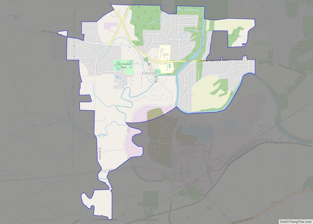
Euharlee is a city in Bartow County, Georgia, United States. The population was 4,136 at the 2010 census, an increase of 29% over the 2000 count of 3,208.
Euharlee is a bedroom community of Cartersville, the Bartow County seat which is located 9 miles (14 km) to the east. They are connected through Euharlee Road, and by a chain of subdivisions and homes. Euharlee is located next to Plant Bowen, which has the second-largest generating capacity of any coal-fired power plant in the United States.
| Name: | Euharlee city |
|---|---|
| LSAD Code: | 25 |
| LSAD Description: | city (suffix) |
| State: | Georgia |
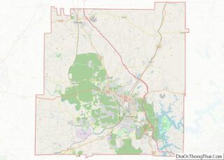
| County: | Bartow County |
| Incorporated: | January 1, 1976 |
| Elevation: | 682 ft (208 m) |
| Total Area: | 5.56 sq mi (14.40 km²) |
| Land Area: | 5.40 sq mi (14.00 km²) |
| Water Area: | 0.16 sq mi (0.40 km²) |
| Total Population: | 4,268 |
| Population Density: | 789.79/sq mi (304.94/km²) |
| ZIP code: | 30120, 30145 |
| Area code: | 770/678/470 |
| FIPS code: | 1327988 |
| GNISfeature ID: | 0313985 |
| Website: | www.euharlee.com |
Online Interactive Map
Click on ![]() to view map in "full screen" mode.
to view map in "full screen" mode.
Euharlee location map. Where is Euharlee city?


History
Euharlee was originally called Burge’s Mill by settlers as early as the 1840s. The town was incorporated as Euharlee by the General Assembly of Georgia on September 16, 1870. “Euharlee” is a name derived from the Cherokee language, meaning “she laughs as she runs”, referring to the sound of the Euharlee Creek.
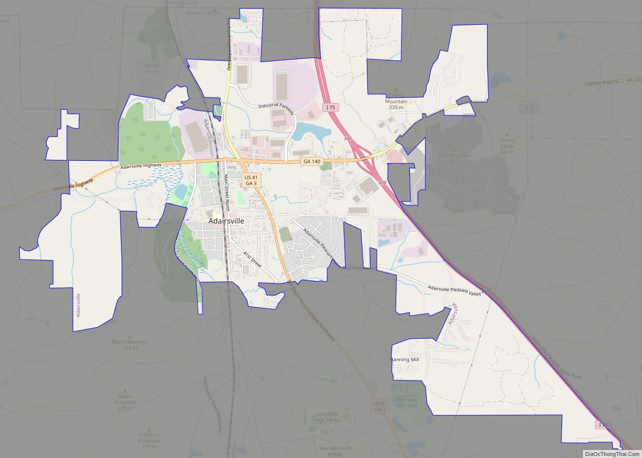
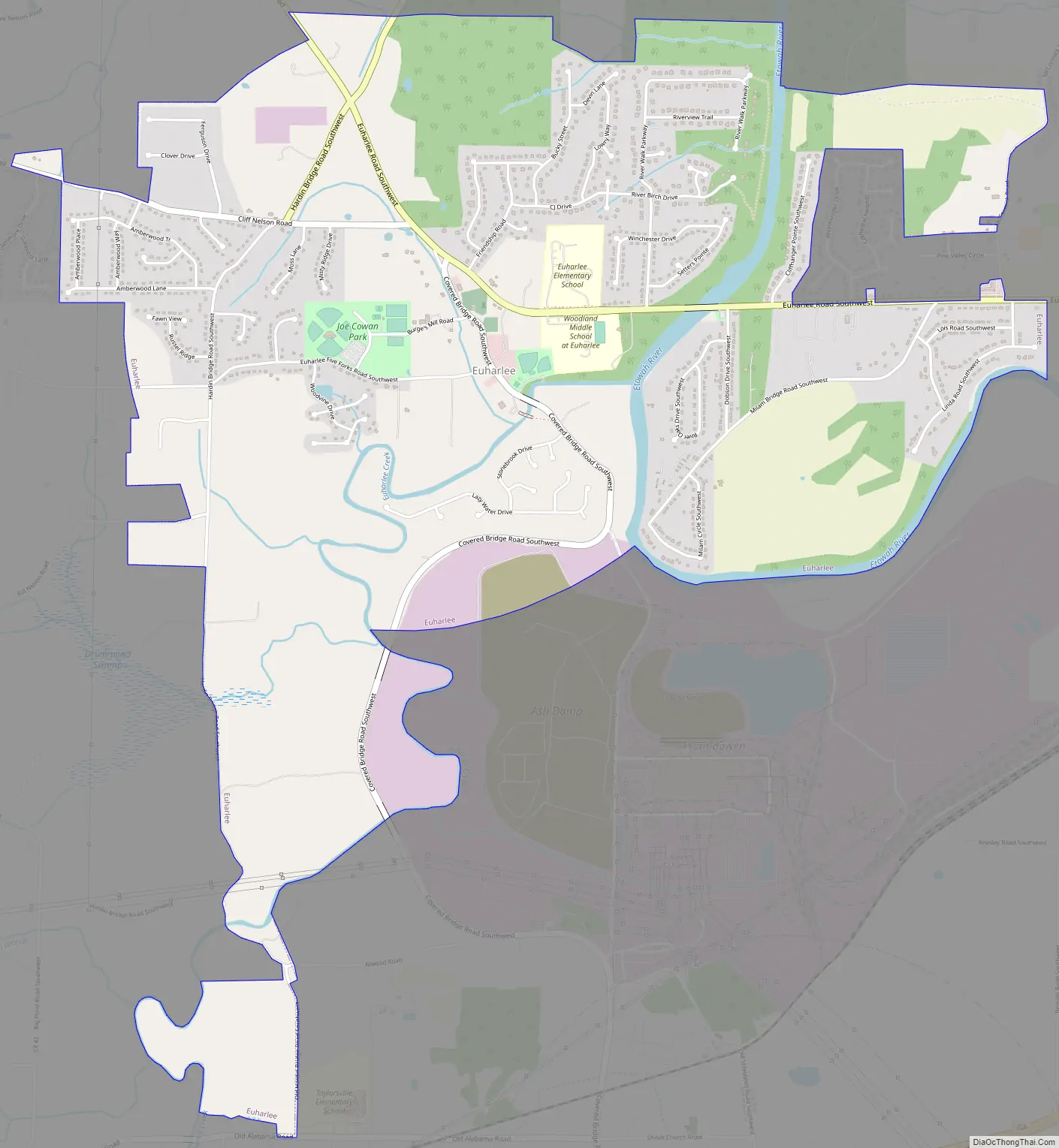
Euharlee Road Map
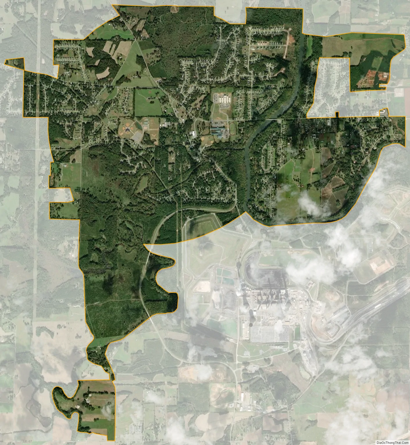
Euharlee city Satellite Map
Geography
Euharlee is located in southwestern Bartow County at 34°8′50″N 84°56′11″W / 34.14722°N 84.93639°W / 34.14722; -84.93639 (34.147174, -84.936445). The Etowah River, part of the Alabama River watershed, flows through the eastern part of the city. Euharlee Creek joins the river just south of the center of town and is crossed by the Euharlee Covered Bridge, one of the oldest covered bridges in Georgia.
According to the United States Census Bureau, the city has a total area of 5.4 square miles (14.1 km), of which 5.3 square miles (13.7 km) is land and 0.15 square miles (0.4 km), or 2.83%, is water.
See also
Map of Georgia State and its subdivision:- Appling
- Atkinson
- Bacon
- Baker
- Baldwin
- Banks
- Barrow
- Bartow
- Ben Hill
- Berrien
- Bibb
- Bleckley
- Brantley
- Brooks
- Bryan
- Bulloch
- Burke
- Butts
- Calhoun
- Camden
- Candler
- Carroll
- Catoosa
- Charlton
- Chatham
- Chattahoochee
- Chattooga
- Cherokee
- Clarke
- Clay
- Clayton
- Clinch
- Cobb
- Coffee
- Colquitt
- Columbia
- Cook
- Coweta
- Crawford
- Crisp
- Dade
- Dawson
- Decatur
- DeKalb
- Dodge
- Dooly
- Dougherty
- Douglas
- Early
- Echols
- Effingham
- Elbert
- Emanuel
- Evans
- Fannin
- Fayette
- Floyd
- Forsyth
- Franklin
- Fulton
- Gilmer
- Glascock
- Glynn
- Gordon
- Grady
- Greene
- Gwinnett
- Habersham
- Hall
- Hancock
- Haralson
- Harris
- Hart
- Heard
- Henry
- Houston
- Irwin
- Jackson
- Jasper
- Jeff Davis
- Jefferson
- Jenkins
- Johnson
- Jones
- Lamar
- Lanier
- Laurens
- Lee
- Liberty
- Lincoln
- Long
- Lowndes
- Lumpkin
- Macon
- Madison
- Marion
- McDuffie
- McIntosh
- Meriwether
- Miller
- Mitchell
- Monroe
- Montgomery
- Morgan
- Murray
- Muscogee
- Newton
- Oconee
- Oglethorpe
- Paulding
- Peach
- Pickens
- Pierce
- Pike
- Polk
- Pulaski
- Putnam
- Quitman
- Rabun
- Randolph
- Richmond
- Rockdale
- Schley
- Screven
- Seminole
- Spalding
- Stephens
- Stewart
- Sumter
- Talbot
- Taliaferro
- Tattnall
- Taylor
- Telfair
- Terrell
- Thomas
- Tift
- Toombs
- Towns
- Treutlen
- Troup
- Turner
- Twiggs
- Union
- Upson
- Walker
- Walton
- Ware
- Warren
- Washington
- Wayne
- Webster
- Wheeler
- White
- Whitfield
- Wilcox
- Wilkes
- Wilkinson
- Worth
- Alabama
- Alaska
- Arizona
- Arkansas
- California
- Colorado
- Connecticut
- Delaware
- District of Columbia
- Florida
- Georgia
- Hawaii
- Idaho
- Illinois
- Indiana
- Iowa
- Kansas
- Kentucky
- Louisiana
- Maine
- Maryland
- Massachusetts
- Michigan
- Minnesota
- Mississippi
- Missouri
- Montana
- Nebraska
- Nevada
- New Hampshire
- New Jersey
- New Mexico
- New York
- North Carolina
- North Dakota
- Ohio
- Oklahoma
- Oregon
- Pennsylvania
- Rhode Island
- South Carolina
- South Dakota
- Tennessee
- Texas
- Utah
- Vermont
- Virginia
- Washington
- West Virginia
- Wisconsin
- Wyoming