Kingston is a city in Bartow County, Georgia, United States. The population was 722 at the 2020 census.
| Name: | Kingston city |
|---|---|
| LSAD Code: | 25 |
| LSAD Description: | city (suffix) |
| State: | Georgia |
| County: | Bartow County |
| Elevation: | 702 ft (214 m) |
| Total Area: | 1.26 sq mi (3.26 km²) |
| Land Area: | 1.26 sq mi (3.26 km²) |
| Water Area: | 0.00 sq mi (0.00 km²) |
| Total Population: | 722 |
| Population Density: | 573.47/sq mi (221.47/km²) |
| ZIP code: | 30145 |
| Area code: | 770/678/470 |
| FIPS code: | 1343668 |
| GNISfeature ID: | 0332152 |
| Website: | www.cityofkingstonga.org |
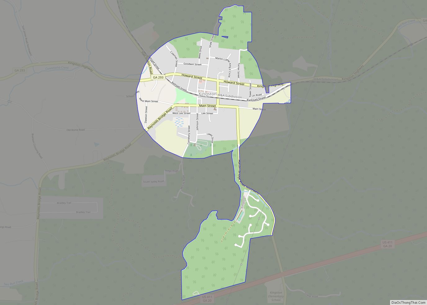
Online Interactive Map
Click on ![]() to view map in "full screen" mode.
to view map in "full screen" mode.
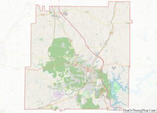
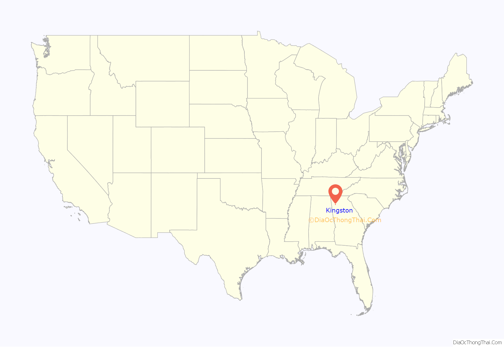
Kingston location map. Where is Kingston city?

History
Native American tribes once inhabited the area. People of the Mississippian culture were in the vicinity until about 1500 AD. Cherokee removal occurred locally by 1838. White settlers were moved in as early as 1832, after a land lottery. The city was named for John Pendleton King, a United States Senator from Georgia.
On April 12, 1862, James J. Andrews with 18 Union soldiers in disguise, and 1 civilian, having seized the locomotive The General at Big Shanty (now Kennesaw) intending to wreck the Western and Atlantic Railroad, were forced to side-track here and wait for the southbound freights to pass. After a long delay The General continued north. Pursuing from Big Shanty, William Allen Fuller (conductor) led a crew which used a push-car and other means and eventually caught the highjackers.
250 Confederate and two Union soldiers died of wounds, disease and sickness in the Confederate hospitals located here during 1862–1864. These men were wounded in the battles of Perryville, Chickamauga, Missionary Ridge, and in the Dalton-Kingston Campaign. The patients were moved to Atlanta in May 1864 to avoid capture by the Union, who later used the hospitals. The dead are buried in unmarked graves nearby.
Atlanta Campaign
Union general William T. Sherman made his headquarters in the Hargis House May 16–19, for reorganization of forces in the campaign that would end at Atlanta. Assuming Johnston’s army had moved, from Adairsville, directly on Kingston and the river crossings south, May 18, led Sherman to concentrate his forces here—only to discover that Johnston had gone directly to Cassville where, without making a stand, he continued to Allatoona on May 20. Sherman countered on May 23, by moving due south.
On May 18, 1864, Lieutenant General William J. Hardee’s corps marched from Adairsville on the road parallel to the Western and Atlantic Railroad en route to Cass Station. He turned east on this road to join General Polk’s and Hood’s Confederate corps at Cassville which had moved on the direct Adairsville – Cassville Road. Sherman erred when he assumed that all of Johnston’s army had marched from Adairsville, as Hardee had, to Kingston. This resulted in his ordering his forces concentrated here—discovering later that the Confederates were 5.5 miles (8.9 km) east at Cassville and not at the Etowah River south of Kingston.
On May 19 Union generals Daniel Butterfield and Joseph Hooker, the new XX Corps, were headquartered at the house of Confederate Colonel Hawkins F. Price, a state senator who had voted for Georgia secession in 1861. Hooker had been ordered from Adairsville to Kingston, on false reports that Johnston had retreated there. South of the Price house Hooker discovered that Johnston had gone to Cassville.
On May 19, 1864, the IV Corps, followed by the XIV Corps, reached Kingston at 8 a.m. The IVth turned east to Cassville. A division of the XIVth sent to Gillem’s bridge over the Etowah River found no retreating Confederates. Johnston’s forces were at Cassville, 5.5 miles (8.9 km) east. McPherson’s XV Corps and XVI Corps, moving south from Barnsley’s, camped on Woolley’s plantation 2 miles (3.2 km) west. The IV Corps, XX Corps and XXIII Corps were at Cassville.
May 19, 1864, McPherson’s army (XVth & XVIth Corps) marched from Barnsley’s and camped on the Woolley Plantation. This right wing of Sherman’s advance, Kingston to Dallas, crossed the river, heading south, on Woolley’s Bridge over the Etowah River, May 23.
On October 11, 1864, while encamped on the Woolley Plantation, the Ohio soldiers of the XXIII Corps voted in a state election.
In 1864, a road southward from Wooley’s Bridge (Etowah River) crossed the road near this point and ran to Van Wert (Rockmart) and Dallas. This was the route of Union Major General James B. McPherson’s Army of the Tennessee (XVth and XVIth Corps), the right wing of forces under Sherman moving from Kingston to the Dallas front, May 23 and 24. At that time, the church stood at the northwestern angle of the crossroads. Another edifice was erected on the site of the present structure, .75 miles (1.21 km) eastward.
Sherman’s forces encamped until May 23, when advance across the Etowah River began.
End of the Civil War
The first Decoration Day, or Memorial Day, was observed in Kingston in late April 1865, and has been a continuous observance here since that day, the only such record held by any community in this nation. The first Decoration Day was observed while Union troops still occupied the town, flowers being placed on both Confederate and Union graves that day.
In 2014, Bellware and Gardiner dismissed this claim in The Genesis of the Memorial Day Holiday in America. They point out that the timing of the observance and locations of General Judah and Wofford during April 1865 make the claim untenable.
On May 12, 1865, Confederate Brigadier General William T. Wofford surrendered 3,000 to 4,000 soldiers to Union Brigadier General Henry M. Judah. These were the last significant Confederate regulars to surrender east of the Mississippi. These were mostly Georgians, not paroled in Virginia, North Carolina, and elsewhere. During final negotiations, Gen. Wofford’s headquarters were at the McCravey – Johnson residence on Church Street. General Judah’s headquarters were at Spring Bank, the home of the Rev. Charles Wallace Howard, 2 miles (3 km) north of Kingston. Rations were supplied to the Confederate soldiery by the Federal commissary.
Kingston Road Map

Kingston city Satellite Map

Geography
Kingston is located in west-central Bartow County at 34°14′9″N 84°56′41″W / 34.23583°N 84.94472°W / 34.23583; -84.94472 (34.235749, -84.944648).
According to the United States Census Bureau, the city has a total area of 1.3 square miles (3.3 km), all land.
Georgia State Route 293 (Kingston Highway) passes through the center of town, leading southeast 11 miles (18 km) to Cartersville and west 13 miles (21 km) to Rome. U.S. Route 411 is a four-lane highway that passes 1 mile (2 km) south of Kingston, connecting the same two larger communities.
See also
Map of Georgia State and its subdivision:- Appling
- Atkinson
- Bacon
- Baker
- Baldwin
- Banks
- Barrow
- Bartow
- Ben Hill
- Berrien
- Bibb
- Bleckley
- Brantley
- Brooks
- Bryan
- Bulloch
- Burke
- Butts
- Calhoun
- Camden
- Candler
- Carroll
- Catoosa
- Charlton
- Chatham
- Chattahoochee
- Chattooga
- Cherokee
- Clarke
- Clay
- Clayton
- Clinch
- Cobb
- Coffee
- Colquitt
- Columbia
- Cook
- Coweta
- Crawford
- Crisp
- Dade
- Dawson
- Decatur
- DeKalb
- Dodge
- Dooly
- Dougherty
- Douglas
- Early
- Echols
- Effingham
- Elbert
- Emanuel
- Evans
- Fannin
- Fayette
- Floyd
- Forsyth
- Franklin
- Fulton
- Gilmer
- Glascock
- Glynn
- Gordon
- Grady
- Greene
- Gwinnett
- Habersham
- Hall
- Hancock
- Haralson
- Harris
- Hart
- Heard
- Henry
- Houston
- Irwin
- Jackson
- Jasper
- Jeff Davis
- Jefferson
- Jenkins
- Johnson
- Jones
- Lamar
- Lanier
- Laurens
- Lee
- Liberty
- Lincoln
- Long
- Lowndes
- Lumpkin
- Macon
- Madison
- Marion
- McDuffie
- McIntosh
- Meriwether
- Miller
- Mitchell
- Monroe
- Montgomery
- Morgan
- Murray
- Muscogee
- Newton
- Oconee
- Oglethorpe
- Paulding
- Peach
- Pickens
- Pierce
- Pike
- Polk
- Pulaski
- Putnam
- Quitman
- Rabun
- Randolph
- Richmond
- Rockdale
- Schley
- Screven
- Seminole
- Spalding
- Stephens
- Stewart
- Sumter
- Talbot
- Taliaferro
- Tattnall
- Taylor
- Telfair
- Terrell
- Thomas
- Tift
- Toombs
- Towns
- Treutlen
- Troup
- Turner
- Twiggs
- Union
- Upson
- Walker
- Walton
- Ware
- Warren
- Washington
- Wayne
- Webster
- Wheeler
- White
- Whitfield
- Wilcox
- Wilkes
- Wilkinson
- Worth
- Alabama
- Alaska
- Arizona
- Arkansas
- California
- Colorado
- Connecticut
- Delaware
- District of Columbia
- Florida
- Georgia
- Hawaii
- Idaho
- Illinois
- Indiana
- Iowa
- Kansas
- Kentucky
- Louisiana
- Maine
- Maryland
- Massachusetts
- Michigan
- Minnesota
- Mississippi
- Missouri
- Montana
- Nebraska
- Nevada
- New Hampshire
- New Jersey
- New Mexico
- New York
- North Carolina
- North Dakota
- Ohio
- Oklahoma
- Oregon
- Pennsylvania
- Rhode Island
- South Carolina
- South Dakota
- Tennessee
- Texas
- Utah
- Vermont
- Virginia
- Washington
- West Virginia
- Wisconsin
- Wyoming