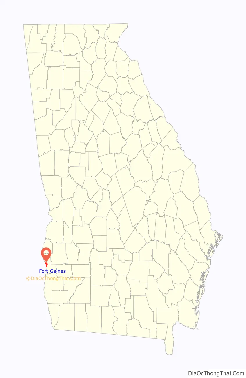
Fort Gaines is a city in Georgia, United States, with a population of 1,107 at the 2010 census. The city is the county seat of Clay County.
| Name: | Fort Gaines city |
|---|---|
| LSAD Code: | 25 |
| LSAD Description: | city (suffix) |
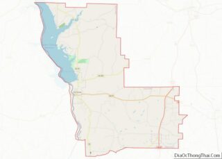
| State: | Georgia |
| County: | Clay County |
| Elevation: | 226 ft (69 m) |
| Total Area: | 7.70 sq mi (19.94 km²) |
| Land Area: | 4.78 sq mi (12.37 km²) |
| Water Area: | 2.92 sq mi (7.58 km²) |
| Total Population: | 995 |
| Population Density: | 208.38/sq mi (80.45/km²) |
| ZIP code: | 39851 |
| Area code: | 229 |
| FIPS code: | 1330816 |
| GNISfeature ID: | 0355877 |
| Website: | www.fortgaines.com |
Online Interactive Map
Click on ![]() to view map in "full screen" mode.
to view map in "full screen" mode.
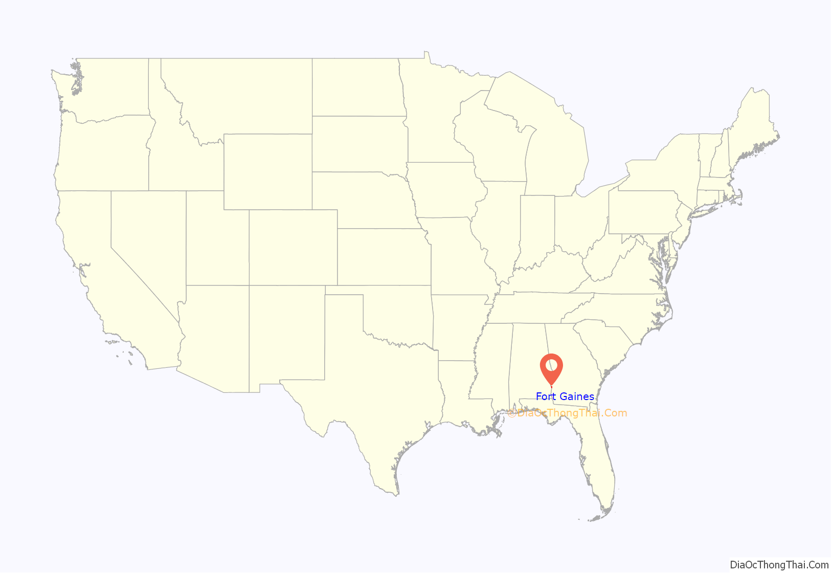
Fort Gaines location map. Where is Fort Gaines city?
History
The present town of Fort Gaines was founded in 1816 as protection against the indigenous Creeks and prospered due to riverboat trade. Though it was named for General Edmund Pendleton Gaines, he did not arrive there with the 4th Infantry of the United States Army until 1816. A fort of the same name had been built in 1814 nearby on the Chattachoochee River. In 1854, Fort Gaines was designated seat of the newly formed Clay County.
According to The Floridian newspaper of 1840, in Fort Gaines were the Chattahoochee Female College and the Independent College for Young Men, boarding schools (not colleges, as that word is traditionally used today). “The writer esteems that the society and location of Fort Gaines for literary purposes, so far as the education of youths is concerned, equal to that of Sparta [Georgia].”
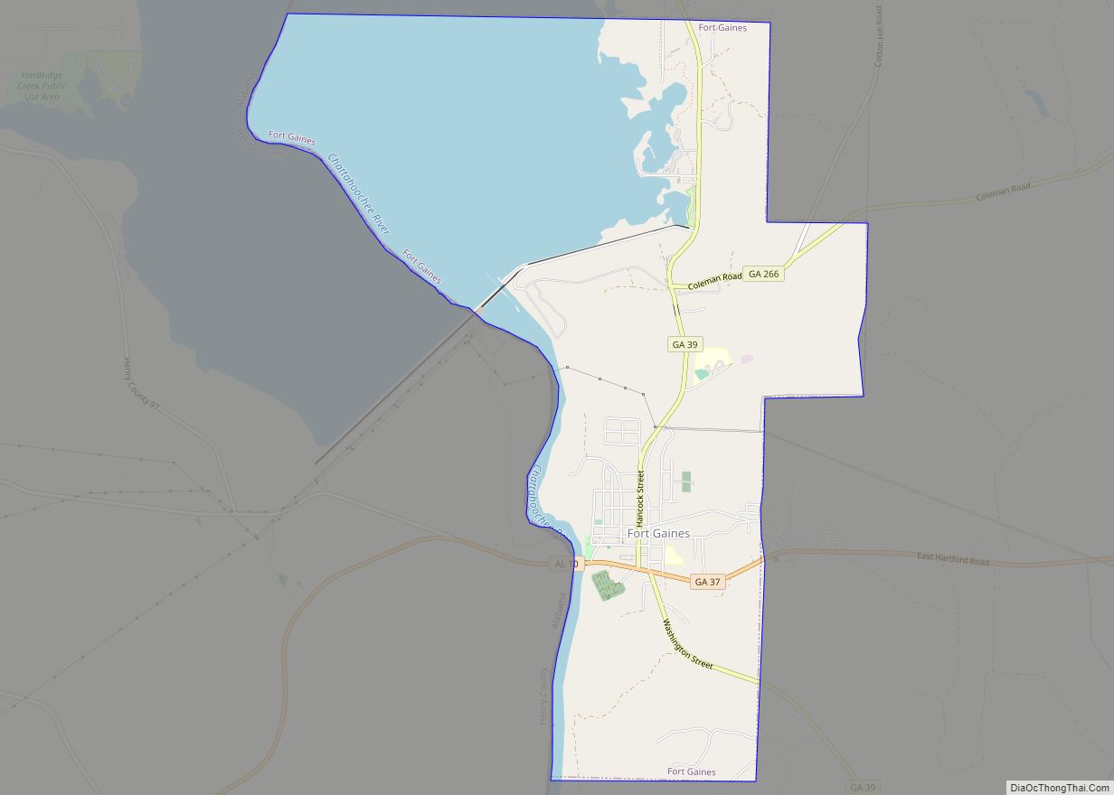
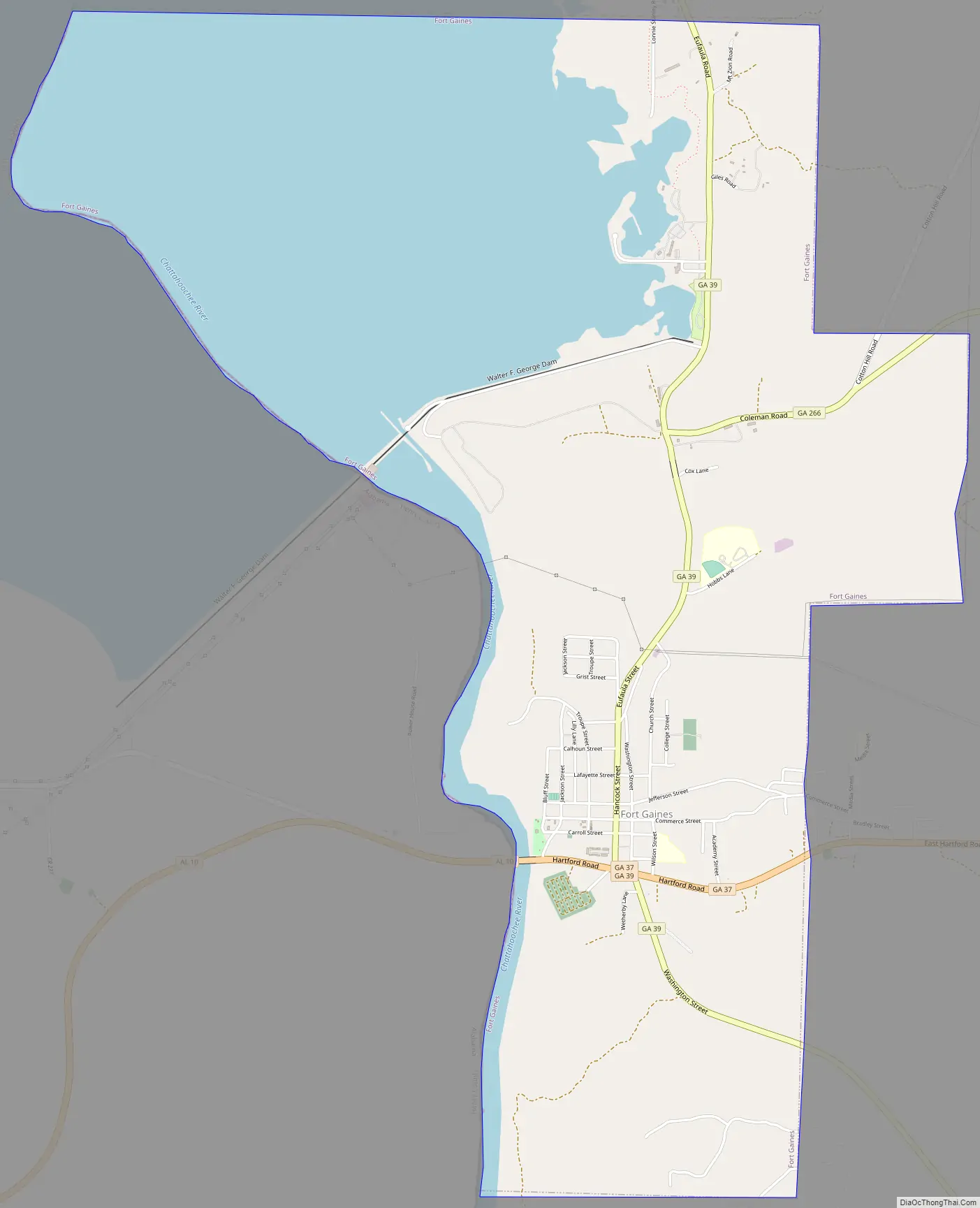
Fort Gaines Road Map
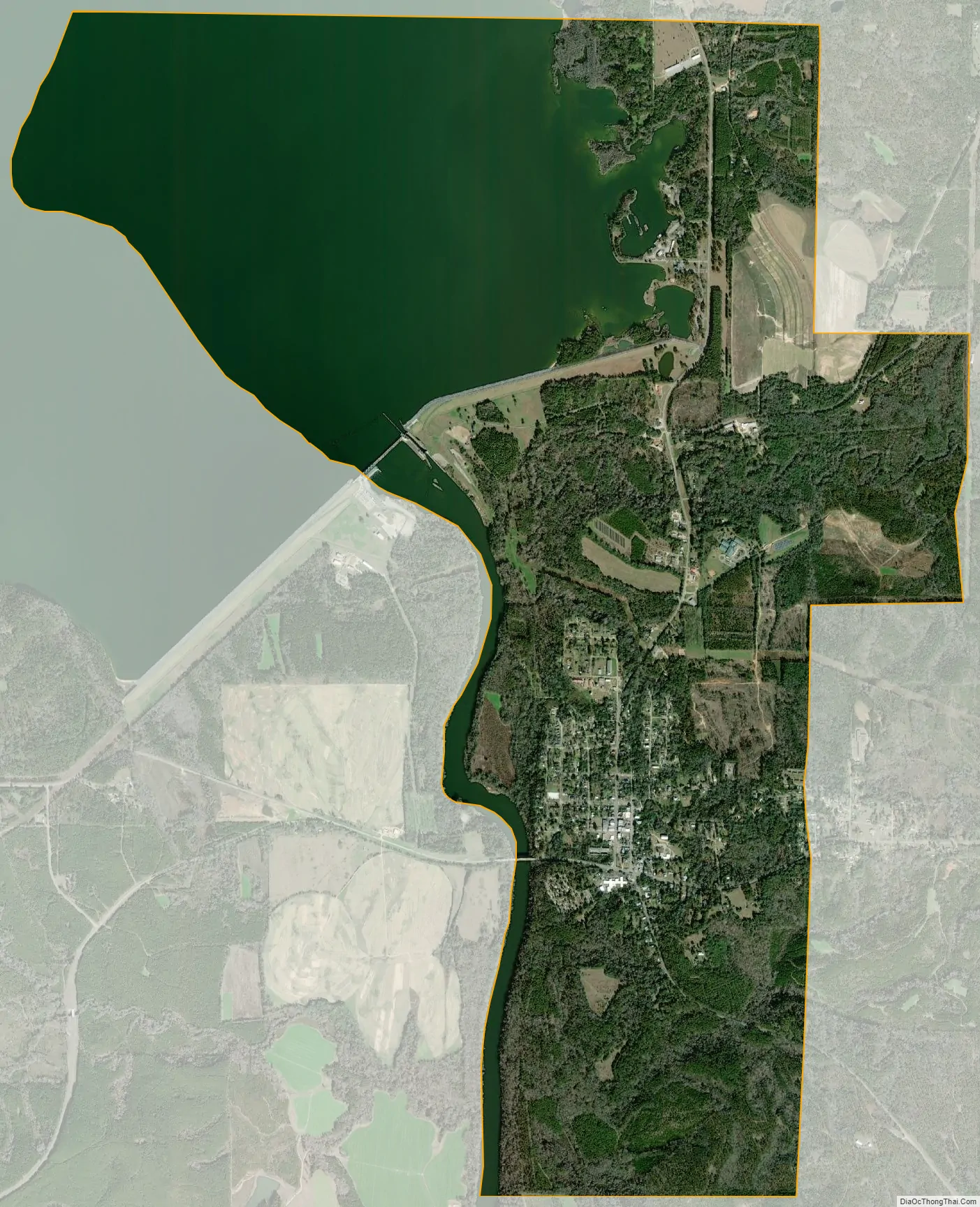
Fort Gaines city Satellite Map
Geography
Fort Gaines is located along the western edge of Clay County at 31°36′51″N 85°2′54″W / 31.61417°N 85.04833°W / 31.61417; -85.04833 (31.614226, -85.048317). Its western boundary is the Chattahoochee River, which is also the state line with Alabama. Walter F. George Lock and Dam crosses the river between the northern side of Fort Gaines and Alabama, forming Walter F. George Lake, also known as Lake Eufaula.
Georgia State Routes 37, 39, and 266 all run through the city. GA-37 runs east-west just south of the downtown area, leading east 20 mi (32 km) to Edison and west 14 mi (23 km) to Abbeville, Alabama (as Alabama State Route 10). GA-39 runs north-south through the center of town as Hancock Street, leading north 23 mi (37 km) to Georgetown and southeast 20 mi (32 km) to Blakely. GA-266 begins just north of the city and leads northeast 22 mi (35 km) to Cuthbert.
According to the United States Census Bureau, Fort Gaines has a total area of 7.7 square miles (19.9 km), of which 4.8 square miles (12.4 km) is land and 2.9 square miles (7.6 km), or 37.99%, is water.
See also
Map of Georgia State and its subdivision:- Appling
- Atkinson
- Bacon
- Baker
- Baldwin
- Banks
- Barrow
- Bartow
- Ben Hill
- Berrien
- Bibb
- Bleckley
- Brantley
- Brooks
- Bryan
- Bulloch
- Burke
- Butts
- Calhoun
- Camden
- Candler
- Carroll
- Catoosa
- Charlton
- Chatham
- Chattahoochee
- Chattooga
- Cherokee
- Clarke
- Clay
- Clayton
- Clinch
- Cobb
- Coffee
- Colquitt
- Columbia
- Cook
- Coweta
- Crawford
- Crisp
- Dade
- Dawson
- Decatur
- DeKalb
- Dodge
- Dooly
- Dougherty
- Douglas
- Early
- Echols
- Effingham
- Elbert
- Emanuel
- Evans
- Fannin
- Fayette
- Floyd
- Forsyth
- Franklin
- Fulton
- Gilmer
- Glascock
- Glynn
- Gordon
- Grady
- Greene
- Gwinnett
- Habersham
- Hall
- Hancock
- Haralson
- Harris
- Hart
- Heard
- Henry
- Houston
- Irwin
- Jackson
- Jasper
- Jeff Davis
- Jefferson
- Jenkins
- Johnson
- Jones
- Lamar
- Lanier
- Laurens
- Lee
- Liberty
- Lincoln
- Long
- Lowndes
- Lumpkin
- Macon
- Madison
- Marion
- McDuffie
- McIntosh
- Meriwether
- Miller
- Mitchell
- Monroe
- Montgomery
- Morgan
- Murray
- Muscogee
- Newton
- Oconee
- Oglethorpe
- Paulding
- Peach
- Pickens
- Pierce
- Pike
- Polk
- Pulaski
- Putnam
- Quitman
- Rabun
- Randolph
- Richmond
- Rockdale
- Schley
- Screven
- Seminole
- Spalding
- Stephens
- Stewart
- Sumter
- Talbot
- Taliaferro
- Tattnall
- Taylor
- Telfair
- Terrell
- Thomas
- Tift
- Toombs
- Towns
- Treutlen
- Troup
- Turner
- Twiggs
- Union
- Upson
- Walker
- Walton
- Ware
- Warren
- Washington
- Wayne
- Webster
- Wheeler
- White
- Whitfield
- Wilcox
- Wilkes
- Wilkinson
- Worth
- Alabama
- Alaska
- Arizona
- Arkansas
- California
- Colorado
- Connecticut
- Delaware
- District of Columbia
- Florida
- Georgia
- Hawaii
- Idaho
- Illinois
- Indiana
- Iowa
- Kansas
- Kentucky
- Louisiana
- Maine
- Maryland
- Massachusetts
- Michigan
- Minnesota
- Mississippi
- Missouri
- Montana
- Nebraska
- Nevada
- New Hampshire
- New Jersey
- New Mexico
- New York
- North Carolina
- North Dakota
- Ohio
- Oklahoma
- Oregon
- Pennsylvania
- Rhode Island
- South Carolina
- South Dakota
- Tennessee
- Texas
- Utah
- Vermont
- Virginia
- Washington
- West Virginia
- Wisconsin
- Wyoming