Ringgold is a city in and the county seat of Catoosa County, Georgia, United States. Its population was 3,414 at the 2020 census. It is part of the Chattanooga, Tennessee–GA Metropolitan Statistical Area.
| Name: | Ringgold city |
|---|---|
| LSAD Code: | 25 |
| LSAD Description: | city (suffix) |
| State: | Georgia |
| County: | Catoosa County |
| Founded: | 1846 |
| Elevation: | 778 ft (237 m) |
| Total Area: | 5.02 sq mi (12.99 km²) |
| Land Area: | 5.02 sq mi (12.99 km²) |
| Water Area: | 0.00 sq mi (0.00 km²) |
| Total Population: | 3,414 |
| Population Density: | 680.49/sq mi (262.76/km²) |
| ZIP code: | 30736 |
| Area code: | 706/762 |
| FIPS code: | 1365324 |
| GNISfeature ID: | 0329441 |
| Website: | www.cityofringgoldga.gov |
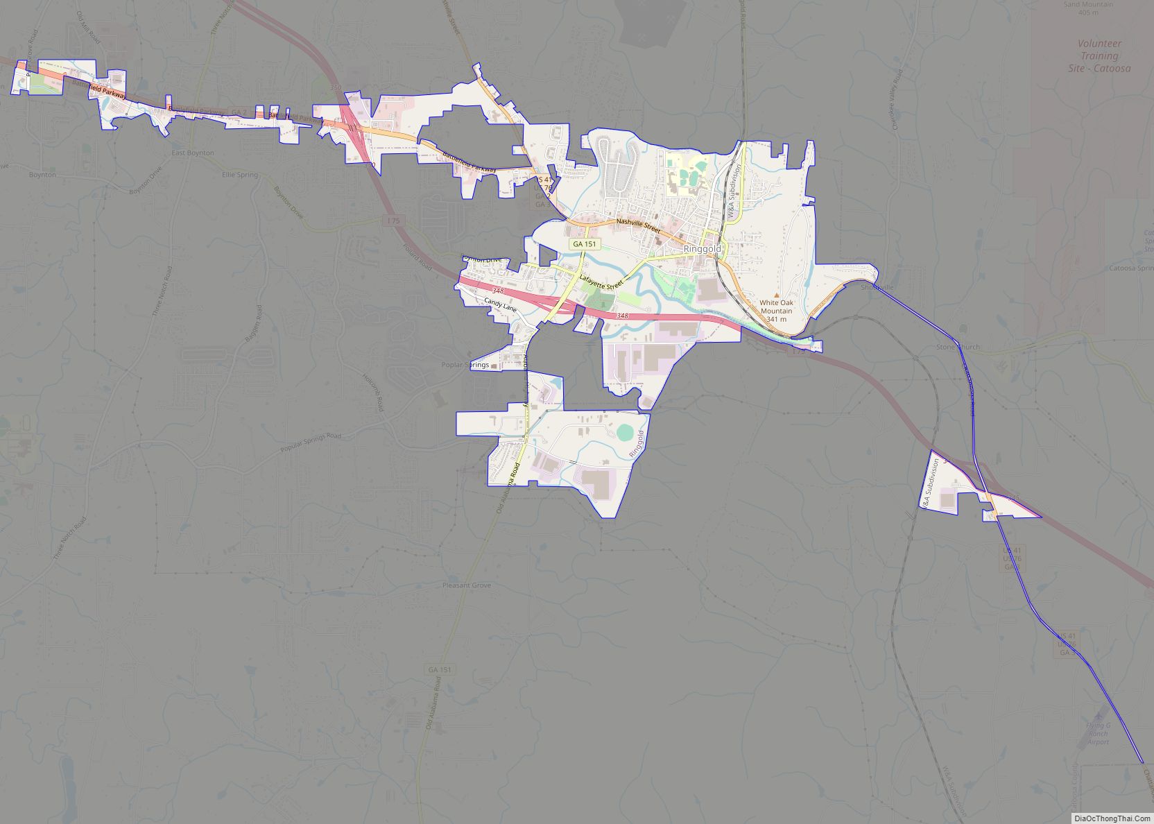
Online Interactive Map
Click on ![]() to view map in "full screen" mode.
to view map in "full screen" mode.
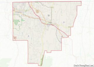
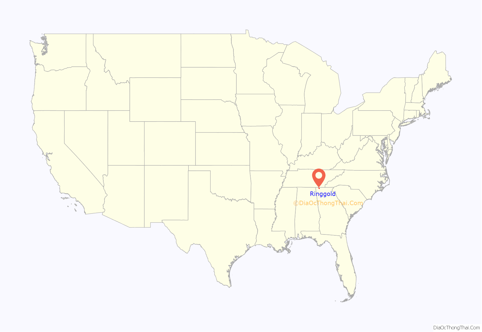
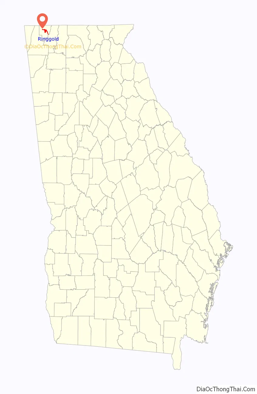
Ringgold location map. Where is Ringgold city?
History
Ringgold was founded in 1846 and incorporated as a city in 1847. It was named after Samuel Ringgold, a hero of the Battle of Palo Alto in the Mexican–American War.
Ringgold is where The General locomotive stopped during the Great Locomotive Chase on April 12, 1862. Ringgold is also home to the historic Ringgold Depot, which still contains bullet marks from the Civil War.
The Battle of Ringgold Gap took place on November 27, 1863. Confederate Major General Patrick Cleburne with 4,100 men used the mountain pass known as the Ringgold Gap to stall the advance of Union Major General Joseph Hooker and his troops. Hooker’s troops were over 12,000 strong. It was a Confederate victory because it allowed Confederate artillery and wagon trains to move safely through the Ringgold Gap unharmed while inflicting high Union casualties.
On March 14, 2002, a sudden heavy fog played havoc with morning traffic and contributed to one of the worst traffic pileups in history; 125 vehicles crashed on Interstate 75 North and four people died.
Tornado
On April 27, 2011, an EF4 tornado touched down in Ringgold and Catoosa County, leaving a path of destruction. The tornado killed twenty people along a 48 miles (77 km) path across Catoosa County and over the state line in Hamilton and Bradley counties. Eight died in Ringgold, including an entire family of four, and at least thirty others were injured. Many homes, businesses, and schools were damaged or destroyed.
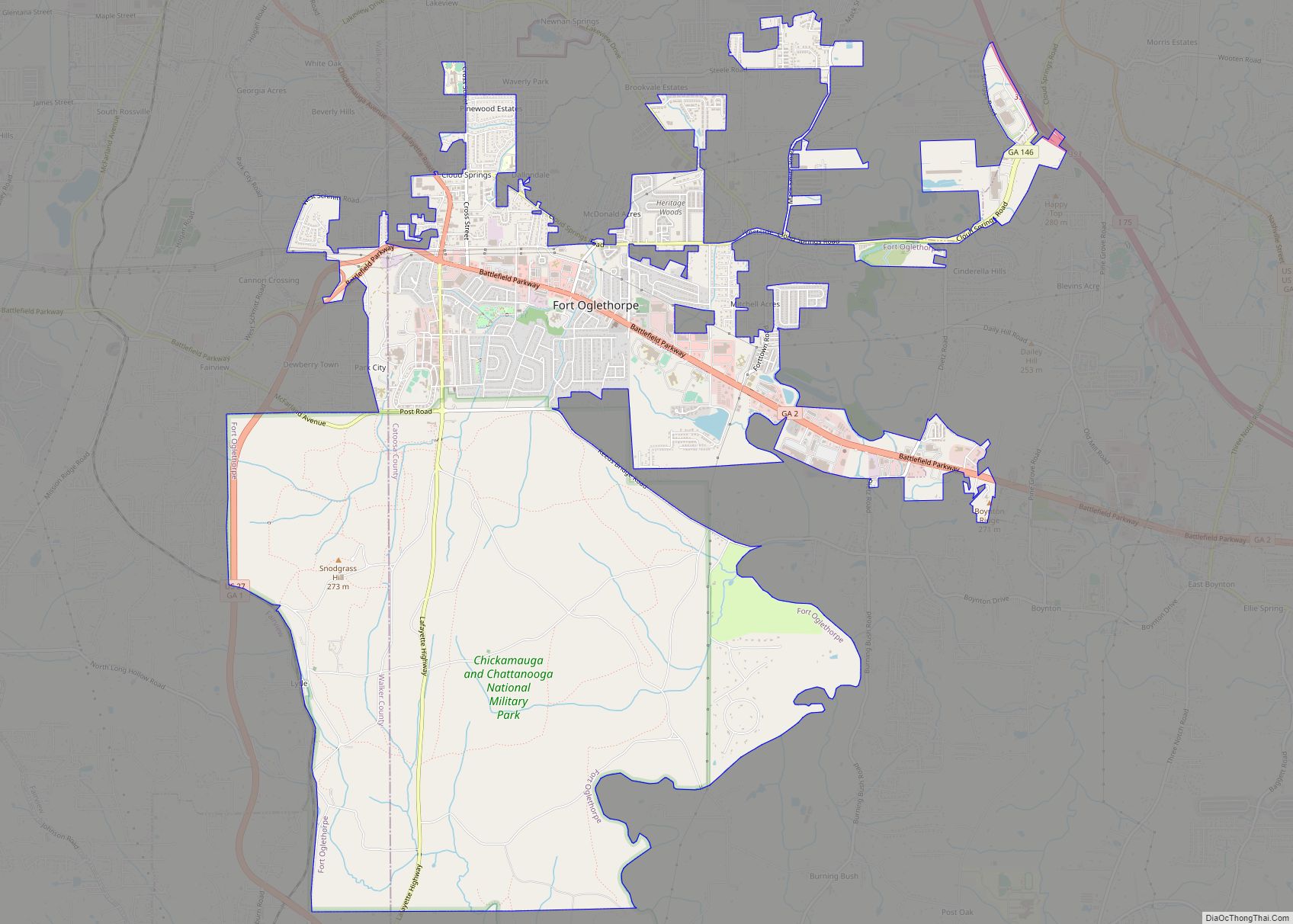
Ringgold Road Map
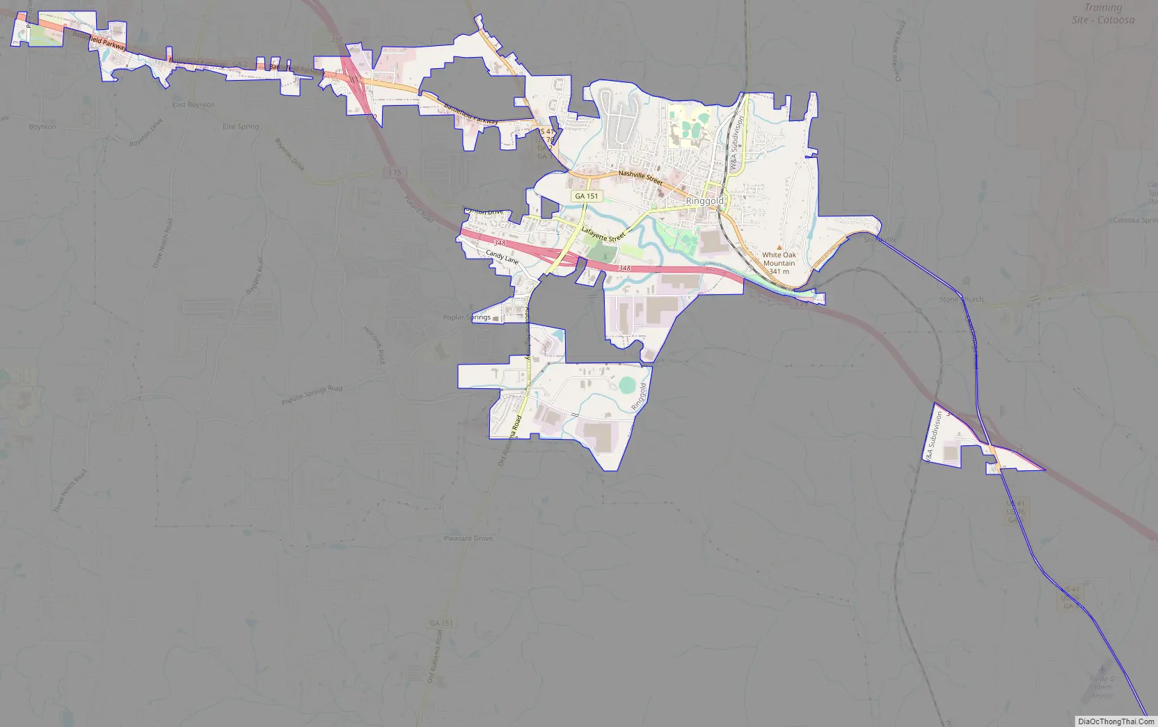
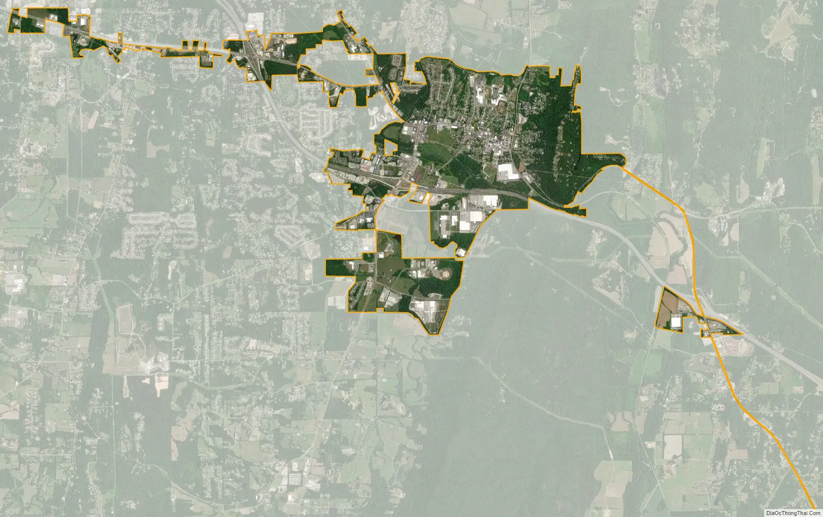
Ringgold city Satellite Map
Geography
Ringgold is located near the center of Catoosa County at 34°55′2″N 85°6′57″W / 34.91722°N 85.11583°W / 34.91722; -85.11583 (34.917170, -85.115698). U.S. Routes 41 and 76 pass through the center of town as Nashville Street, leading northwest 17 miles (27 km) to downtown Chattanooga, Tennessee, and southeast 15 miles (24 km) to Dalton, Georgia. Interstate 75 passes through the southern part of the city with access from 348; the highway leads northwest to Chattanooga and southeast 101 miles (163 km) to Atlanta.
According to the United States Census Bureau, the city has a total area of 4.7 square miles (12.3 km), of which 0.004 square miles (0.01 km), or 0.11%, is water.
Topography
Ringgold is situated in the Valley and Ridge geologic province of the Appalachian Mountains, characterized by long north-northeasterly trending ridges separated by valleys. The topography was formed by the erosion of alternating layers of hard and soft sedimentary rock that were folded and faulted during the building of the Appalachians. Taylor Ridge runs through Ringgold; a gap in the ridge is located just east of the city center, with the part of the ridge running to the south called Taylors Ridge and to the north called White Oak Mountain. South Chickamauga Creek, a tributary of the Tennessee River, runs through Ringgold.
Climate
The climate in this area is characterized by relatively high temperatures and evenly distributed precipitation throughout the year. According to the Köppen Climate Classification system, Ringgold has a humid subtropical climate, abbreviated “Cfa” on climate maps.
See also
Map of Georgia State and its subdivision:- Appling
- Atkinson
- Bacon
- Baker
- Baldwin
- Banks
- Barrow
- Bartow
- Ben Hill
- Berrien
- Bibb
- Bleckley
- Brantley
- Brooks
- Bryan
- Bulloch
- Burke
- Butts
- Calhoun
- Camden
- Candler
- Carroll
- Catoosa
- Charlton
- Chatham
- Chattahoochee
- Chattooga
- Cherokee
- Clarke
- Clay
- Clayton
- Clinch
- Cobb
- Coffee
- Colquitt
- Columbia
- Cook
- Coweta
- Crawford
- Crisp
- Dade
- Dawson
- Decatur
- DeKalb
- Dodge
- Dooly
- Dougherty
- Douglas
- Early
- Echols
- Effingham
- Elbert
- Emanuel
- Evans
- Fannin
- Fayette
- Floyd
- Forsyth
- Franklin
- Fulton
- Gilmer
- Glascock
- Glynn
- Gordon
- Grady
- Greene
- Gwinnett
- Habersham
- Hall
- Hancock
- Haralson
- Harris
- Hart
- Heard
- Henry
- Houston
- Irwin
- Jackson
- Jasper
- Jeff Davis
- Jefferson
- Jenkins
- Johnson
- Jones
- Lamar
- Lanier
- Laurens
- Lee
- Liberty
- Lincoln
- Long
- Lowndes
- Lumpkin
- Macon
- Madison
- Marion
- McDuffie
- McIntosh
- Meriwether
- Miller
- Mitchell
- Monroe
- Montgomery
- Morgan
- Murray
- Muscogee
- Newton
- Oconee
- Oglethorpe
- Paulding
- Peach
- Pickens
- Pierce
- Pike
- Polk
- Pulaski
- Putnam
- Quitman
- Rabun
- Randolph
- Richmond
- Rockdale
- Schley
- Screven
- Seminole
- Spalding
- Stephens
- Stewart
- Sumter
- Talbot
- Taliaferro
- Tattnall
- Taylor
- Telfair
- Terrell
- Thomas
- Tift
- Toombs
- Towns
- Treutlen
- Troup
- Turner
- Twiggs
- Union
- Upson
- Walker
- Walton
- Ware
- Warren
- Washington
- Wayne
- Webster
- Wheeler
- White
- Whitfield
- Wilcox
- Wilkes
- Wilkinson
- Worth
- Alabama
- Alaska
- Arizona
- Arkansas
- California
- Colorado
- Connecticut
- Delaware
- District of Columbia
- Florida
- Georgia
- Hawaii
- Idaho
- Illinois
- Indiana
- Iowa
- Kansas
- Kentucky
- Louisiana
- Maine
- Maryland
- Massachusetts
- Michigan
- Minnesota
- Mississippi
- Missouri
- Montana
- Nebraska
- Nevada
- New Hampshire
- New Jersey
- New Mexico
- New York
- North Carolina
- North Dakota
- Ohio
- Oklahoma
- Oregon
- Pennsylvania
- Rhode Island
- South Carolina
- South Dakota
- Tennessee
- Texas
- Utah
- Vermont
- Virginia
- Washington
- West Virginia
- Wisconsin
- Wyoming