Franklin is a city in Heard County, Georgia, United States. The population was 993 at the 2010 census, up from 902 at the 2000 census. Franklin is the county seat of Heard County. The city is named after Benjamin Franklin.
| Name: | Franklin city |
|---|---|
| LSAD Code: | 25 |
| LSAD Description: | city (suffix) |
| State: | Georgia |
| County: | Heard County |
| Elevation: | 663 ft (202 m) |
| Total Area: | 3.35 sq mi (8.68 km²) |
| Land Area: | 3.21 sq mi (8.31 km²) |
| Water Area: | 0.14 sq mi (0.36 km²) |
| Total Population: | 950 |
| Population Density: | 295.95/sq mi (114.26/km²) |
| ZIP code: | 30217 |
| Area code: | 706 |
| FIPS code: | 1331292 |
| GNISfeature ID: | 0314347 |
| Website: | www.franklingeorgia.com |
Online Interactive Map
Click on ![]() to view map in "full screen" mode.
to view map in "full screen" mode.
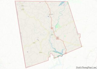
Franklin location map. Where is Franklin city?


History
Franklin was settled in 1770, and was designated seat of the newly formed Heard County in 1831. The town was hit by a tornado just before midnight on March 25, 2021, with multiple areas in downtown being heavily damaged with the most severe damage being rated high-end EF2. The tornado later became violent and hit nearby Newnan, Georgia to the east at EF4 strength, indirectly killing one person.
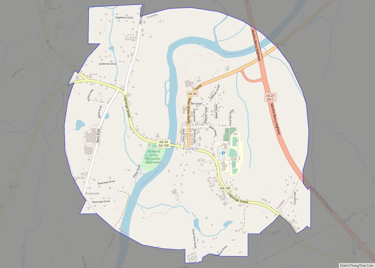
Franklin Road Map

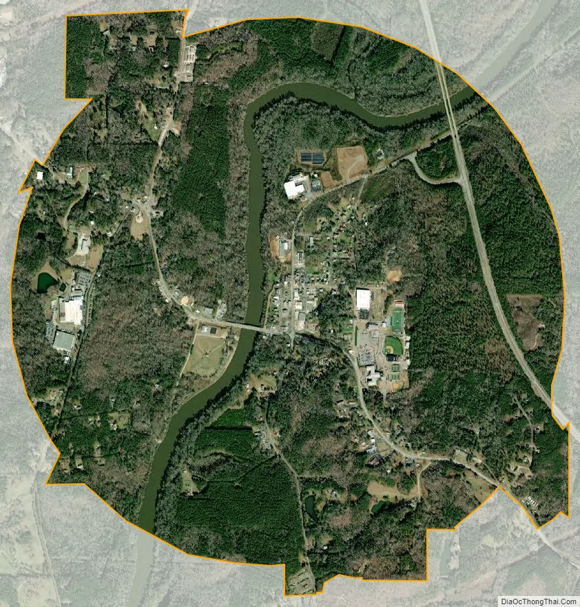
Franklin city Satellite Map
Geography
Franklin is located in central Heard County at 33°16′47″N 85°05′54″W / 33.279788°N 85.098403°W / 33.279788; -85.098403, along the Chattahoochee River. U.S. Route 27 passes through the east side of the city on a bypass, leading north 23 miles (37 km) to Carrollton and south 19 miles (31 km) to LaGrange. Georgia State Route 34 passes through the center of Franklin, leading northeast 20 miles (32 km) to Newnan and southwest 12 miles (19 km) to the Alabama border. Georgia State Route 100 joins SR 34 for part of its path through Franklin, but leads northwest 14 miles (23 km) to Ephesus and southeast 14 miles to Hogansville.
According to the United States Census Bureau, Franklin has a total area of 3.5 square miles (9.0 km), of which 3.4 square miles (8.7 km) are land and 0.2 square miles (0.4 km), or 4.00%, are water.
See also
Map of Georgia State and its subdivision:- Appling
- Atkinson
- Bacon
- Baker
- Baldwin
- Banks
- Barrow
- Bartow
- Ben Hill
- Berrien
- Bibb
- Bleckley
- Brantley
- Brooks
- Bryan
- Bulloch
- Burke
- Butts
- Calhoun
- Camden
- Candler
- Carroll
- Catoosa
- Charlton
- Chatham
- Chattahoochee
- Chattooga
- Cherokee
- Clarke
- Clay
- Clayton
- Clinch
- Cobb
- Coffee
- Colquitt
- Columbia
- Cook
- Coweta
- Crawford
- Crisp
- Dade
- Dawson
- Decatur
- DeKalb
- Dodge
- Dooly
- Dougherty
- Douglas
- Early
- Echols
- Effingham
- Elbert
- Emanuel
- Evans
- Fannin
- Fayette
- Floyd
- Forsyth
- Franklin
- Fulton
- Gilmer
- Glascock
- Glynn
- Gordon
- Grady
- Greene
- Gwinnett
- Habersham
- Hall
- Hancock
- Haralson
- Harris
- Hart
- Heard
- Henry
- Houston
- Irwin
- Jackson
- Jasper
- Jeff Davis
- Jefferson
- Jenkins
- Johnson
- Jones
- Lamar
- Lanier
- Laurens
- Lee
- Liberty
- Lincoln
- Long
- Lowndes
- Lumpkin
- Macon
- Madison
- Marion
- McDuffie
- McIntosh
- Meriwether
- Miller
- Mitchell
- Monroe
- Montgomery
- Morgan
- Murray
- Muscogee
- Newton
- Oconee
- Oglethorpe
- Paulding
- Peach
- Pickens
- Pierce
- Pike
- Polk
- Pulaski
- Putnam
- Quitman
- Rabun
- Randolph
- Richmond
- Rockdale
- Schley
- Screven
- Seminole
- Spalding
- Stephens
- Stewart
- Sumter
- Talbot
- Taliaferro
- Tattnall
- Taylor
- Telfair
- Terrell
- Thomas
- Tift
- Toombs
- Towns
- Treutlen
- Troup
- Turner
- Twiggs
- Union
- Upson
- Walker
- Walton
- Ware
- Warren
- Washington
- Wayne
- Webster
- Wheeler
- White
- Whitfield
- Wilcox
- Wilkes
- Wilkinson
- Worth
- Alabama
- Alaska
- Arizona
- Arkansas
- California
- Colorado
- Connecticut
- Delaware
- District of Columbia
- Florida
- Georgia
- Hawaii
- Idaho
- Illinois
- Indiana
- Iowa
- Kansas
- Kentucky
- Louisiana
- Maine
- Maryland
- Massachusetts
- Michigan
- Minnesota
- Mississippi
- Missouri
- Montana
- Nebraska
- Nevada
- New Hampshire
- New Jersey
- New Mexico
- New York
- North Carolina
- North Dakota
- Ohio
- Oklahoma
- Oregon
- Pennsylvania
- Rhode Island
- South Carolina
- South Dakota
- Tennessee
- Texas
- Utah
- Vermont
- Virginia
- Washington
- West Virginia
- Wisconsin
- Wyoming