Haralson is a town in Coweta and Meriwether counties in the U.S. state of Georgia. The population was 172 at the 2020 census. It is noted for being one of the filming locations for both The Walking Dead and Lawless.
| Name: | Haralson town |
|---|---|
| LSAD Code: | 43 |
| LSAD Description: | town (suffix) |
| State: | Georgia |
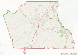
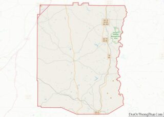
| County: | Coweta County, Meriwether County |
| Elevation: | 837 ft (255 m) |
| Total Area: | 0.79 sq mi (2.04 km²) |
| Land Area: | 0.78 sq mi (2.01 km²) |
| Water Area: | 0.01 sq mi (0.03 km²) |
| Total Population: | 172 |
| Population Density: | 221.08/sq mi (85.38/km²) |
| ZIP code: | 30229 |
| Area code: | 770 |
| FIPS code: | 1336528 |
| GNISfeature ID: | 0356164 |
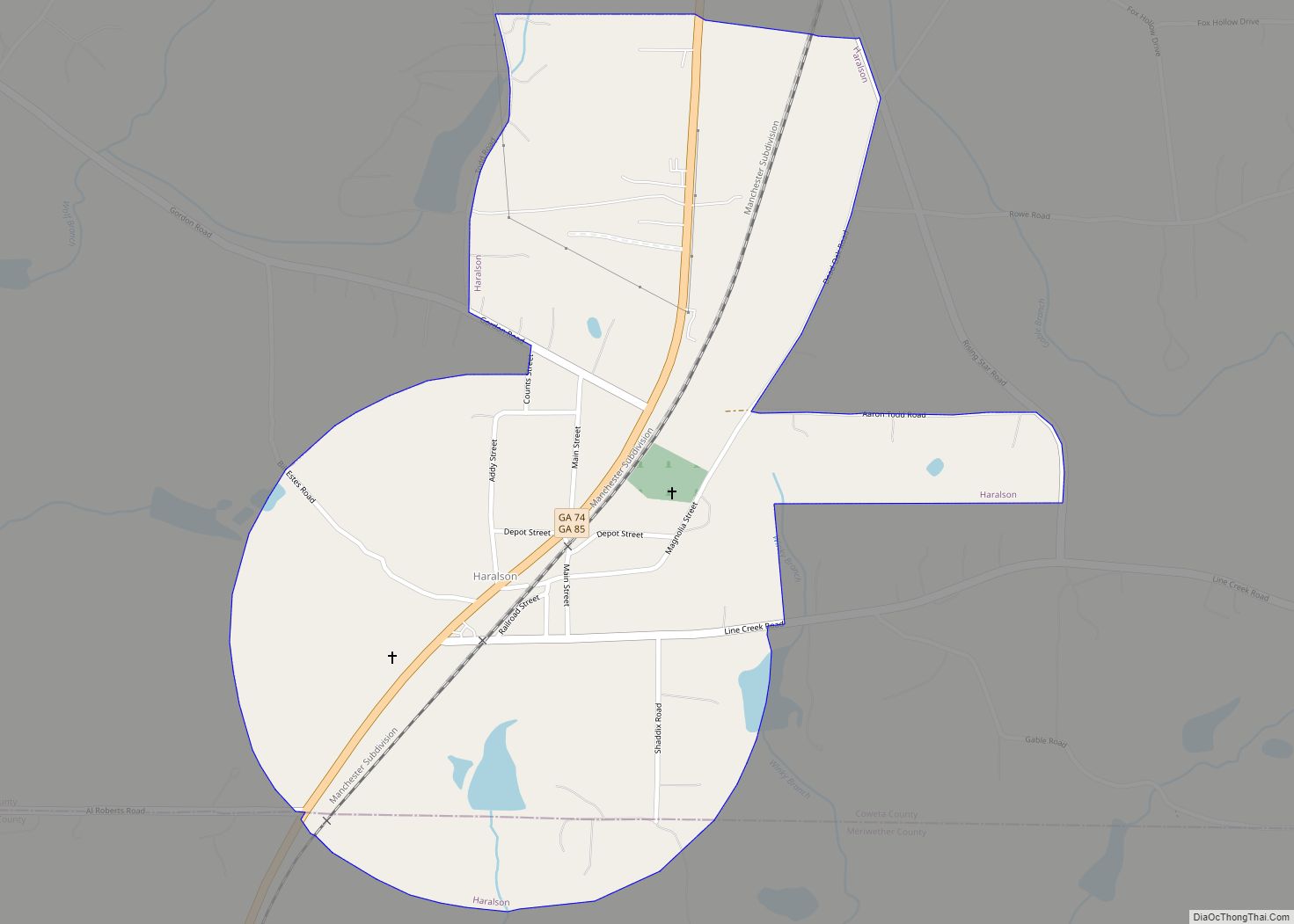
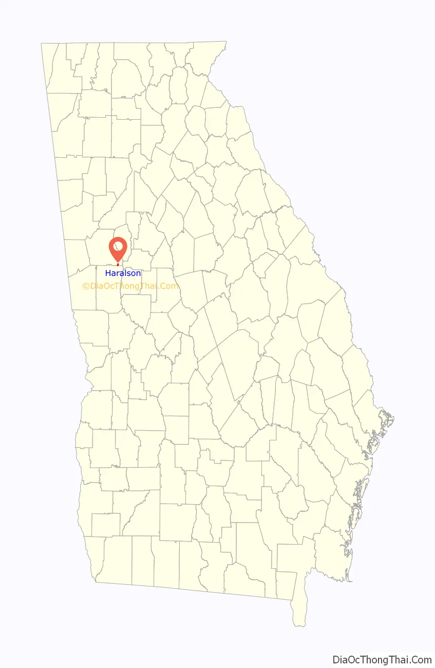
Online Interactive Map
Click on ![]() to view map in "full screen" mode.
to view map in "full screen" mode.
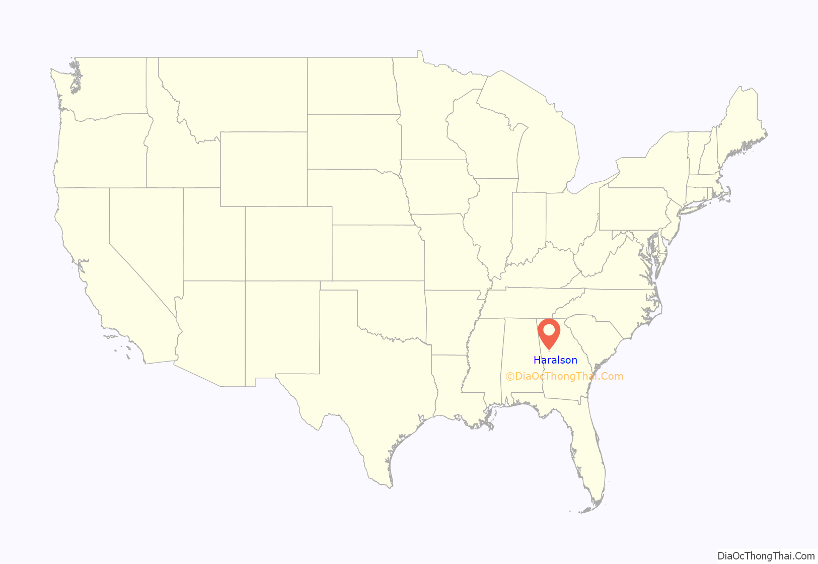
Haralson location map. Where is Haralson town?
History
The first permanent settlement at Haralson was made in the 1820s. Haralson was named for Hugh A. Haralson, a former Georgia congressman, who is also the namesake of Haralson County, Georgia.
The Georgia General Assembly incorporated the place as the Town of Haralson in 1907.
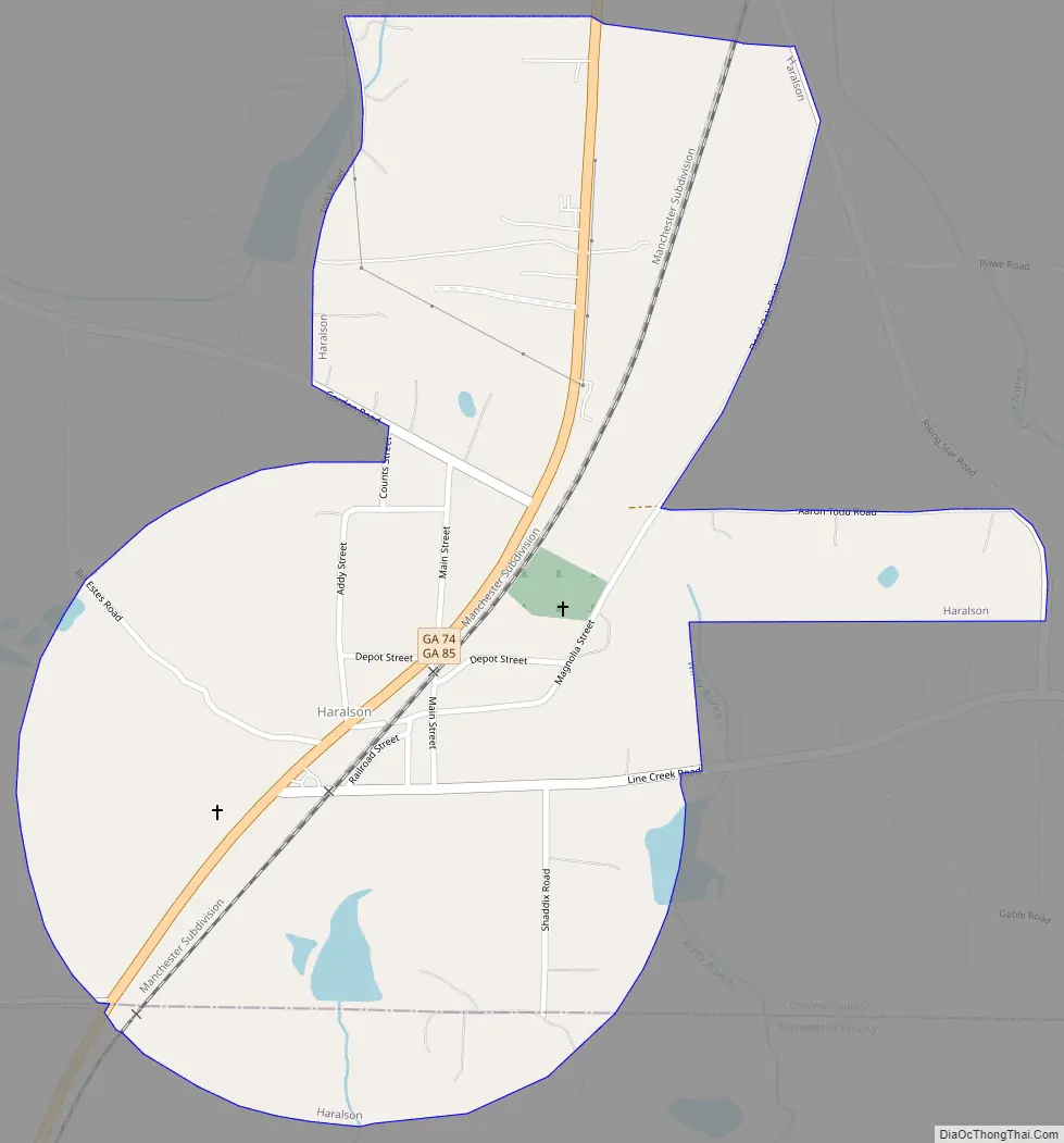
Haralson Road Map
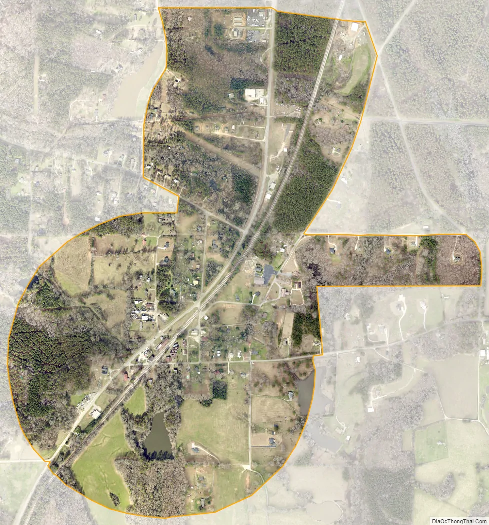
Haralson city Satellite Map
Geography
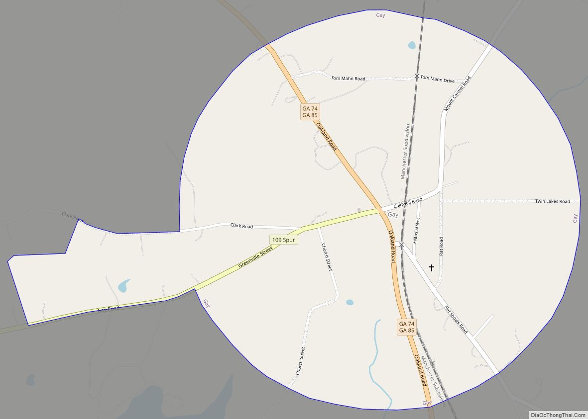
Haralson is located primarily in southeastern Coweta County at 33°13′36″N 84°34′11″W / 33.226581°N 84.569696°W / 33.226581; -84.569696. The city limits extend slightly south into Meriwether County. Georgia State Routes 74 and 85 run concurrently through the town, leading north 6 miles (10 km) to Senoia and south 10 miles (16 km) to Gay.
According to the United States Census Bureau, Haralson has a total area of 0.8 square miles (2.1 km), of which 0.01 square miles (0.0 km), or 1.39%, are water.
See also
Map of Georgia State and its subdivision:- Appling
- Atkinson
- Bacon
- Baker
- Baldwin
- Banks
- Barrow
- Bartow
- Ben Hill
- Berrien
- Bibb
- Bleckley
- Brantley
- Brooks
- Bryan
- Bulloch
- Burke
- Butts
- Calhoun
- Camden
- Candler
- Carroll
- Catoosa
- Charlton
- Chatham
- Chattahoochee
- Chattooga
- Cherokee
- Clarke
- Clay
- Clayton
- Clinch
- Cobb
- Coffee
- Colquitt
- Columbia
- Cook
- Coweta
- Crawford
- Crisp
- Dade
- Dawson
- Decatur
- DeKalb
- Dodge
- Dooly
- Dougherty
- Douglas
- Early
- Echols
- Effingham
- Elbert
- Emanuel
- Evans
- Fannin
- Fayette
- Floyd
- Forsyth
- Franklin
- Fulton
- Gilmer
- Glascock
- Glynn
- Gordon
- Grady
- Greene
- Gwinnett
- Habersham
- Hall
- Hancock
- Haralson
- Harris
- Hart
- Heard
- Henry
- Houston
- Irwin
- Jackson
- Jasper
- Jeff Davis
- Jefferson
- Jenkins
- Johnson
- Jones
- Lamar
- Lanier
- Laurens
- Lee
- Liberty
- Lincoln
- Long
- Lowndes
- Lumpkin
- Macon
- Madison
- Marion
- McDuffie
- McIntosh
- Meriwether
- Miller
- Mitchell
- Monroe
- Montgomery
- Morgan
- Murray
- Muscogee
- Newton
- Oconee
- Oglethorpe
- Paulding
- Peach
- Pickens
- Pierce
- Pike
- Polk
- Pulaski
- Putnam
- Quitman
- Rabun
- Randolph
- Richmond
- Rockdale
- Schley
- Screven
- Seminole
- Spalding
- Stephens
- Stewart
- Sumter
- Talbot
- Taliaferro
- Tattnall
- Taylor
- Telfair
- Terrell
- Thomas
- Tift
- Toombs
- Towns
- Treutlen
- Troup
- Turner
- Twiggs
- Union
- Upson
- Walker
- Walton
- Ware
- Warren
- Washington
- Wayne
- Webster
- Wheeler
- White
- Whitfield
- Wilcox
- Wilkes
- Wilkinson
- Worth
- Alabama
- Alaska
- Arizona
- Arkansas
- California
- Colorado
- Connecticut
- Delaware
- District of Columbia
- Florida
- Georgia
- Hawaii
- Idaho
- Illinois
- Indiana
- Iowa
- Kansas
- Kentucky
- Louisiana
- Maine
- Maryland
- Massachusetts
- Michigan
- Minnesota
- Mississippi
- Missouri
- Montana
- Nebraska
- Nevada
- New Hampshire
- New Jersey
- New Mexico
- New York
- North Carolina
- North Dakota
- Ohio
- Oklahoma
- Oregon
- Pennsylvania
- Rhode Island
- South Carolina
- South Dakota
- Tennessee
- Texas
- Utah
- Vermont
- Virginia
- Washington
- West Virginia
- Wisconsin
- Wyoming