Manchester is a town in Meriwether and Talbot counties in the U.S. state of Georgia, although primarily in Meriwether. The population was 3,584 at the 2020 census, down from 4,230 in 2010. It is the most populous community in Meriwether County. CSX Transportation runs a railroad yard in Manchester.
| Name: | Manchester city |
|---|---|
| LSAD Code: | 25 |
| LSAD Description: | city (suffix) |
| State: | Georgia |
| County: | Meriwether County, Talbot County |
| Elevation: | 883 ft (269 m) |
| Total Area: | 8.05 sq mi (20.85 km²) |
| Land Area: | 8.01 sq mi (20.75 km²) |
| Water Area: | 0.04 sq mi (0.09 km²) |
| Total Population: | 3,584 |
| Population Density: | 447.27/sq mi (172.69/km²) |
| ZIP code: | 31816 |
| Area code: | 706 |
| FIPS code: | 1349532 |
| GNISfeature ID: | 0317652 |
| Website: | manchester-ga.gov |
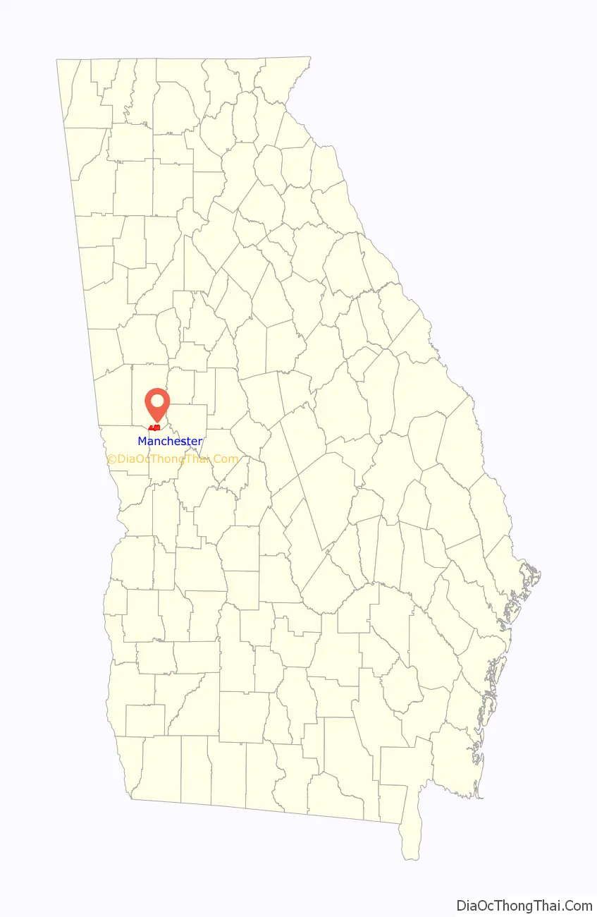
Online Interactive Map
Click on ![]() to view map in "full screen" mode.
to view map in "full screen" mode.
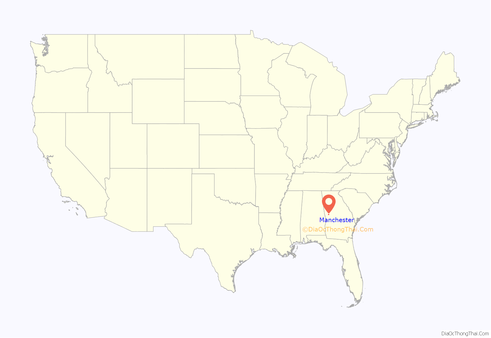
Manchester location map. Where is Manchester city?
History
Manchester was founded in 1907, when the Atlanta, Birmingham and Atlantic Railway was extended northward to that point; it was merged into the Atlantic Coast Line Railroad in 1946. From Manchester the railroad diverged, with one line going to Atlanta and another to Birmingham. The Georgia General Assembly incorporated Manchester as a city in 1909. The city was named after Manchester, in England.
In 2019, CSX Transportation demolished the historic Manchester Yard Office in order to make way for a new, larger, yard facilities building.
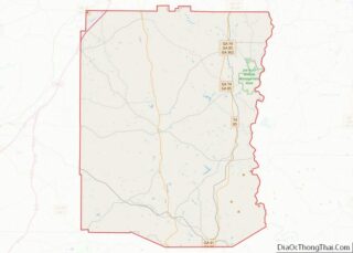
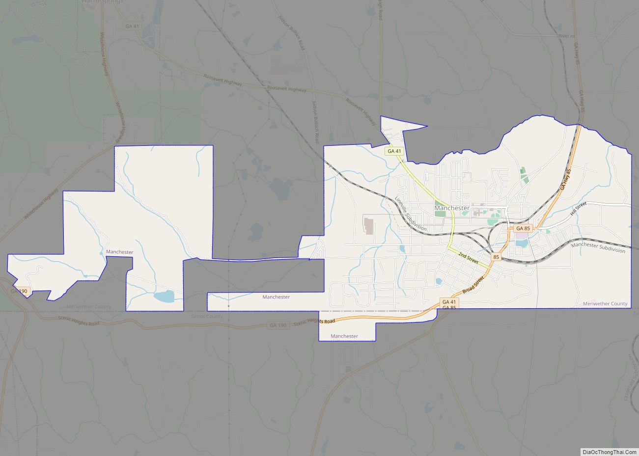
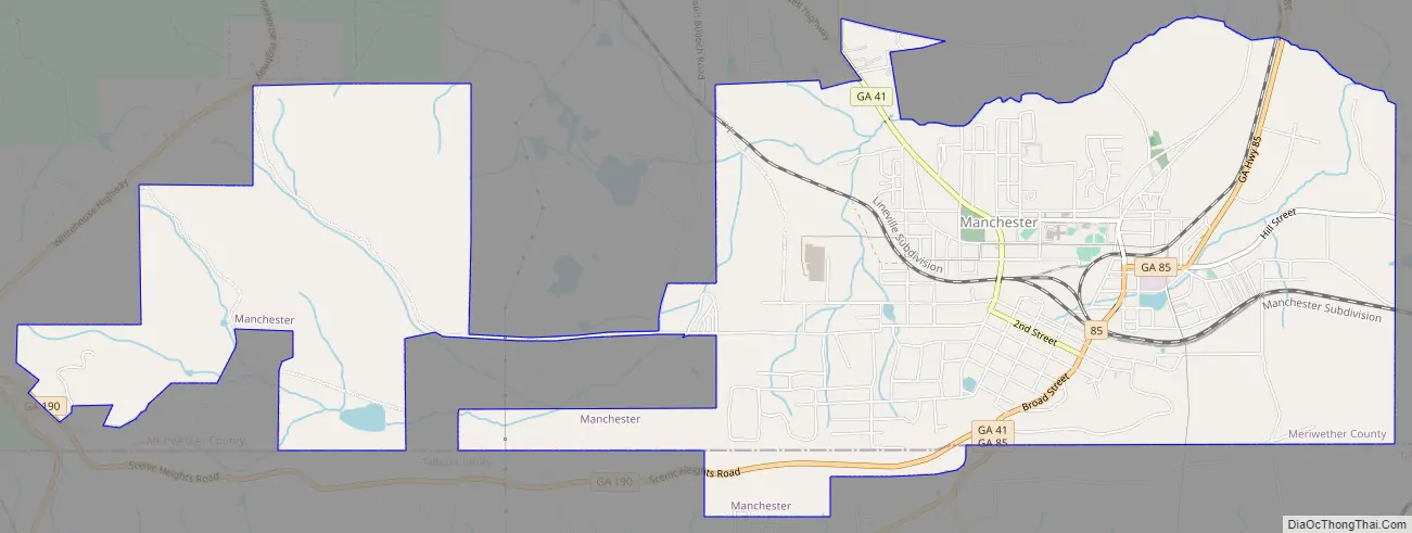
Manchester Road Map
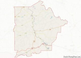
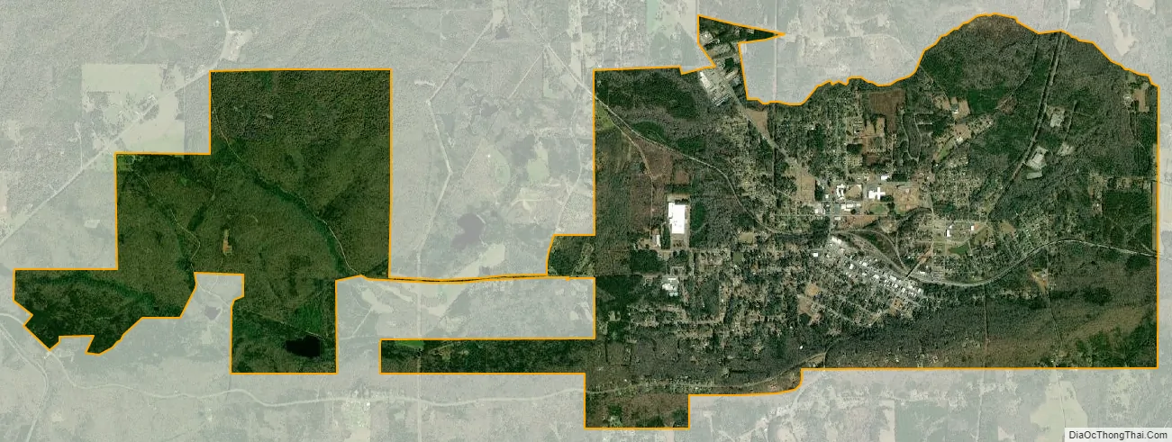
Manchester city Satellite Map
Geography
Manchester is in west central Georgia, in southern Meriwether County, with a small portion extending south into Talbot County. The ridge of Pine Mountain runs along the southern edge of the city, rising 300 feet (91 m) above the city to an elevation of 1,180 feet (360 m) above sea level. Georgia State Route 85 is the main highway through the city, leading southwest 39 miles (63 km) to Columbus and north 10 miles (16 km) to Woodbury. Georgia 85 meets Georgia 190 in the southern part of the city, which leads west 16 miles (26 km) along the crest of Pine Mountain to U.S. Route 27 south of the town of Pine Mountain. Georgia 85 meets Georgia 41 in the center of Manchester, which leads southeast 6 miles (10 km) to Woodland and northwest 5 miles (8 km) to Warm Springs.
According to the U.S. Census Bureau, Manchester has a total area of 8.0 square miles (21 km), of which 0.04 square miles (0.10 km), or 0.45%, are water. Pigeon Creek runs along the northern border of the city and flows east to the Flint River.
See also
Map of Georgia State and its subdivision:- Appling
- Atkinson
- Bacon
- Baker
- Baldwin
- Banks
- Barrow
- Bartow
- Ben Hill
- Berrien
- Bibb
- Bleckley
- Brantley
- Brooks
- Bryan
- Bulloch
- Burke
- Butts
- Calhoun
- Camden
- Candler
- Carroll
- Catoosa
- Charlton
- Chatham
- Chattahoochee
- Chattooga
- Cherokee
- Clarke
- Clay
- Clayton
- Clinch
- Cobb
- Coffee
- Colquitt
- Columbia
- Cook
- Coweta
- Crawford
- Crisp
- Dade
- Dawson
- Decatur
- DeKalb
- Dodge
- Dooly
- Dougherty
- Douglas
- Early
- Echols
- Effingham
- Elbert
- Emanuel
- Evans
- Fannin
- Fayette
- Floyd
- Forsyth
- Franklin
- Fulton
- Gilmer
- Glascock
- Glynn
- Gordon
- Grady
- Greene
- Gwinnett
- Habersham
- Hall
- Hancock
- Haralson
- Harris
- Hart
- Heard
- Henry
- Houston
- Irwin
- Jackson
- Jasper
- Jeff Davis
- Jefferson
- Jenkins
- Johnson
- Jones
- Lamar
- Lanier
- Laurens
- Lee
- Liberty
- Lincoln
- Long
- Lowndes
- Lumpkin
- Macon
- Madison
- Marion
- McDuffie
- McIntosh
- Meriwether
- Miller
- Mitchell
- Monroe
- Montgomery
- Morgan
- Murray
- Muscogee
- Newton
- Oconee
- Oglethorpe
- Paulding
- Peach
- Pickens
- Pierce
- Pike
- Polk
- Pulaski
- Putnam
- Quitman
- Rabun
- Randolph
- Richmond
- Rockdale
- Schley
- Screven
- Seminole
- Spalding
- Stephens
- Stewart
- Sumter
- Talbot
- Taliaferro
- Tattnall
- Taylor
- Telfair
- Terrell
- Thomas
- Tift
- Toombs
- Towns
- Treutlen
- Troup
- Turner
- Twiggs
- Union
- Upson
- Walker
- Walton
- Ware
- Warren
- Washington
- Wayne
- Webster
- Wheeler
- White
- Whitfield
- Wilcox
- Wilkes
- Wilkinson
- Worth
- Alabama
- Alaska
- Arizona
- Arkansas
- California
- Colorado
- Connecticut
- Delaware
- District of Columbia
- Florida
- Georgia
- Hawaii
- Idaho
- Illinois
- Indiana
- Iowa
- Kansas
- Kentucky
- Louisiana
- Maine
- Maryland
- Massachusetts
- Michigan
- Minnesota
- Mississippi
- Missouri
- Montana
- Nebraska
- Nevada
- New Hampshire
- New Jersey
- New Mexico
- New York
- North Carolina
- North Dakota
- Ohio
- Oklahoma
- Oregon
- Pennsylvania
- Rhode Island
- South Carolina
- South Dakota
- Tennessee
- Texas
- Utah
- Vermont
- Virginia
- Washington
- West Virginia
- Wisconsin
- Wyoming