Ludowici /ˌluːdəˈwɪsi/ is a city in Long County, Georgia, United States. The population was 1,703 at the 2010 census and an estimated 2,221 in 2018. The city is the county seat of Long County. It is a part of the Hinesville-Fort Stewart metropolitan statistical area.
The town, which was originally called Johnston Station, had its beginnings in the 1840s when the Atlantic and Gulf Railroad established a stop referred to as “Four and a Half”. The station was constructed across from the house of a landowner named Allen Johnston.
The Long County Courthouse and Ludowici Well Pavilion are listed on the National Register of Historic Places listings in Long County, Georgia.
| Name: | Ludowici city |
|---|---|
| LSAD Code: | 25 |
| LSAD Description: | city (suffix) |
| State: | Georgia |
| County: | Long County |
| Elevation: | 66 ft (20 m) |
| Total Area: | 2.88 sq mi (7.47 km²) |
| Land Area: | 2.87 sq mi (7.44 km²) |
| Water Area: | 0.01 sq mi (0.03 km²) |
| Total Population: | 1,590 |
| Population Density: | 553.81/sq mi (213.82/km²) |
| ZIP code: | 31316 |
| Area code: | 912 |
| FIPS code: | 1347784 |
| GNISfeature ID: | 0356371 |
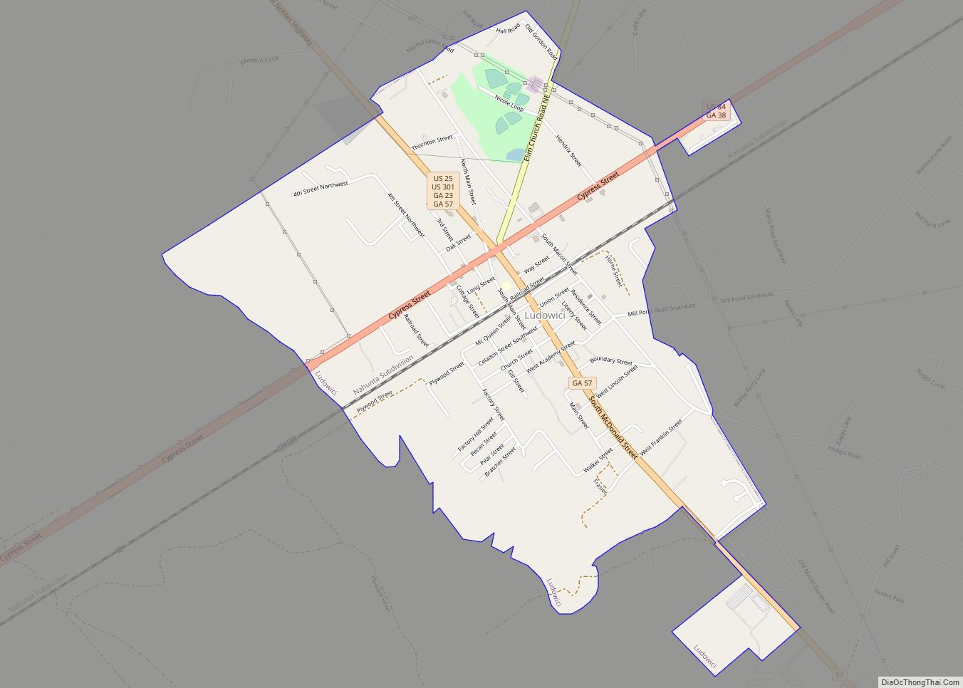
Online Interactive Map
Click on ![]() to view map in "full screen" mode.
to view map in "full screen" mode.
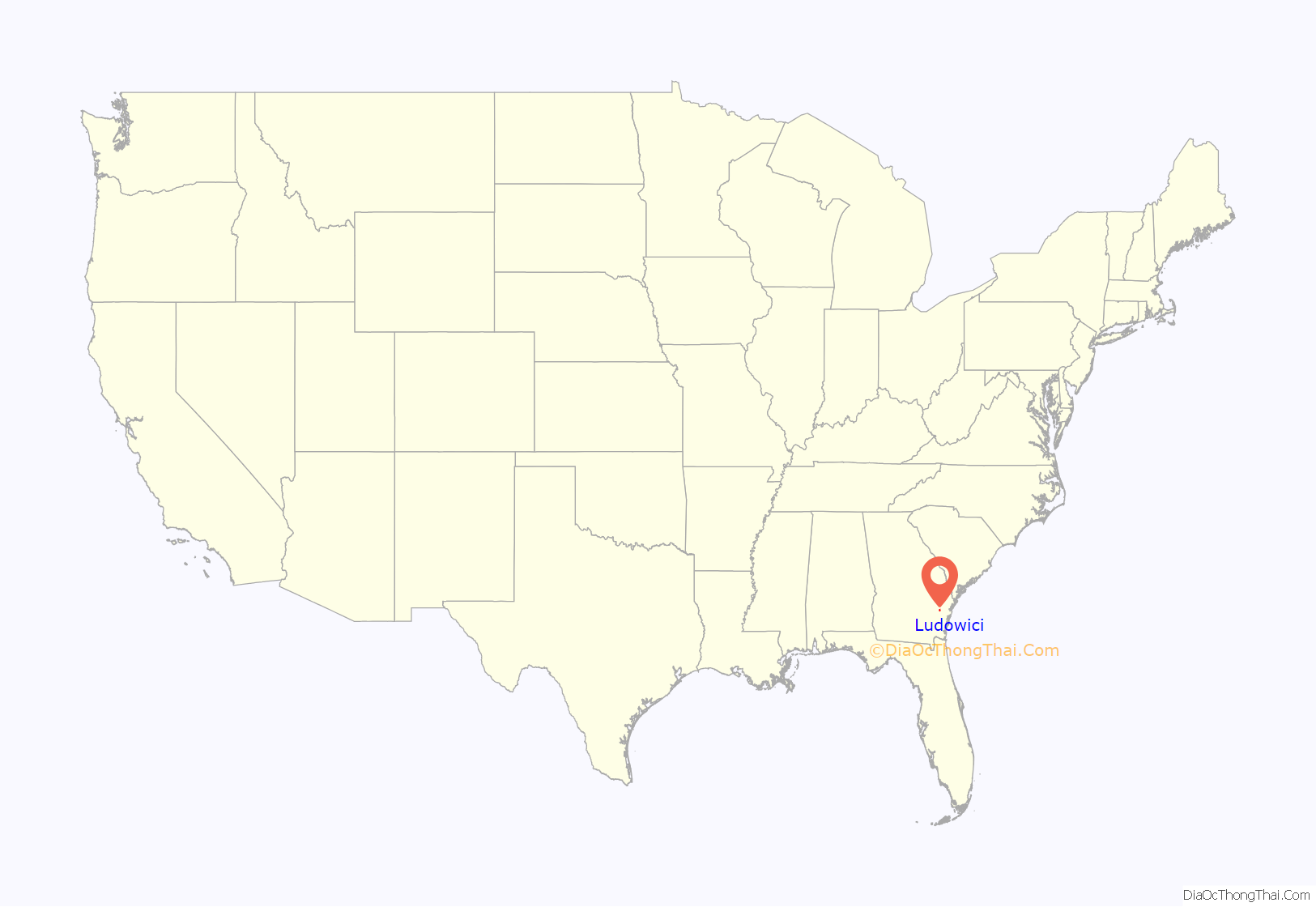
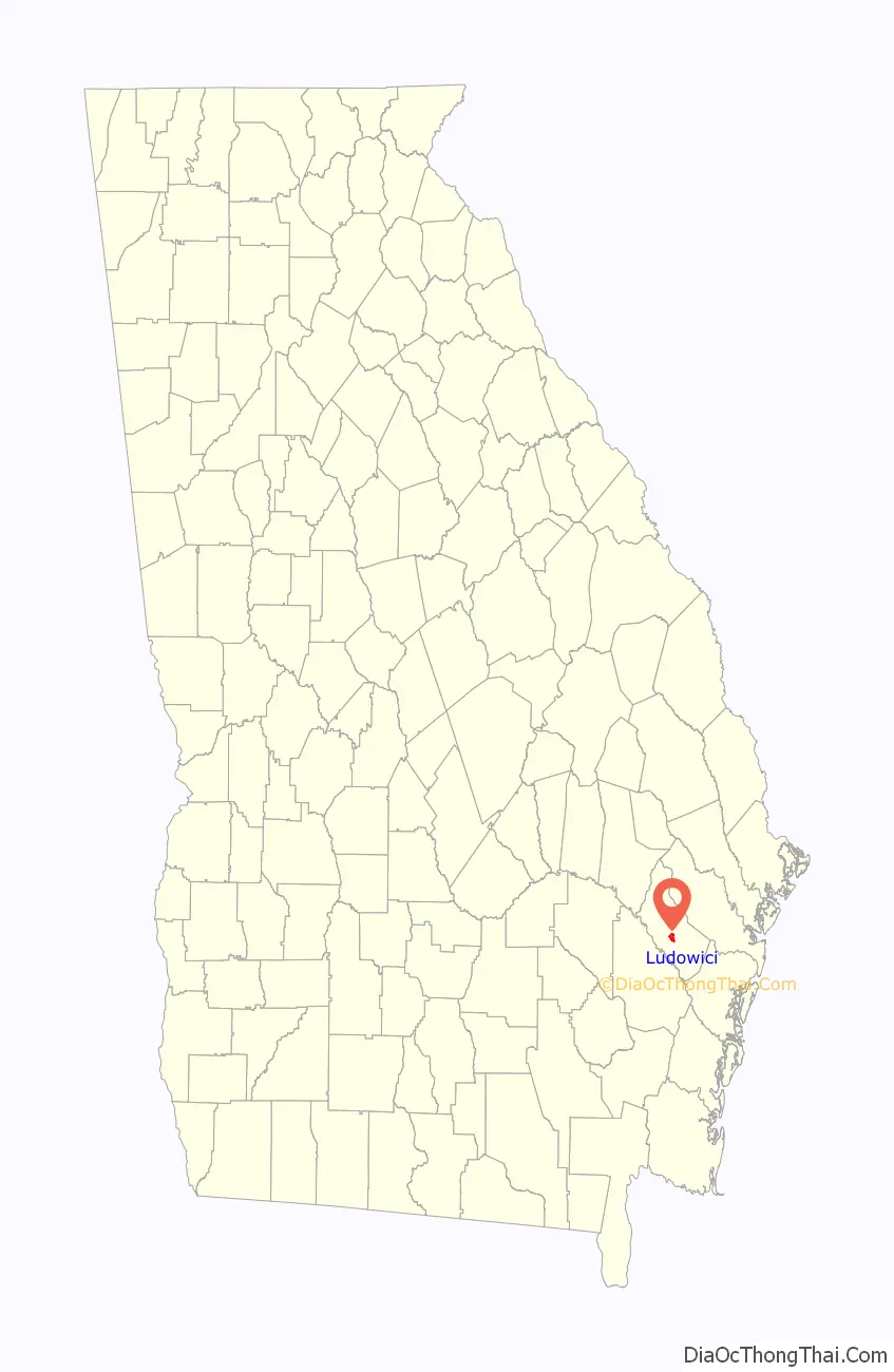
Ludowici location map. Where is Ludowici city?
History
In 1900, the population was about 300 and Johnston Station had a telegraph, post, and express offices. H. F. McKay, an African American Republican, was elected to the Georgia Senate to represent Liberty County the same year. He lived in the area of Johnston Station.
In 1902, the Ludowici Roofing Tile Company built their “Dixie” plant in Johnson Station. In 1905, when the town erected a new high school, the Ludowici company donated towards its construction costs and provided the roofing tile. In return, on August 23, 1905, the town was renamed and incorporated as Ludowici.
The Ludowici Dixie Plant in its heyday covered more than 1,100 acres (450 ha) and employed most people who resided in Long County. Tiles manufactured from this plant were stamped “Ludowici Dixie”. “Dixie” tile can still be found throughout Georgia and Florida, on such prominent buildings as the U.S. Federal Building in Savannah and Flagler College in St. Augustine, Florida, as well as numerous homes in Ludowici and the surrounding communities. The plant closed in 1914. The Ludowici Roof Tile Company still exists, but the company’s plant is in New Lexington, Ohio.
Before interstate highways were constructed, all motorists traveled on regular U.S. highways. Ludowici was at the crossroads of three U.S. highways, Routes 25, 82 and 301. Many vacationers on their way to Florida passed through Ludowici.
Speed Trap Designation
The city gained notoriety during the 1950s and 1960s for its aggressive traffic enforcement policies. The AAA went so far as to specifically label Ludowici as a speed trap. Members of the local police force were allegedly engaging in manipulation of the timing of the traffic signal downtown, so as to catch unsuspecting out-of-area motorists “running” a suddenly changed red light. The switch for the stop light was located in the barber shop. The traffic light was at an intersection that was bypassed by a shortcut (Main Street – see a local map) so that local residents would not even come to the light when making the turn at the light. Thus, all the tickets went to nonresidents without the police having to be selective since no locals would be at the light. A song was also written about the town.
Then-Governor Lester Maddox posted billboards warning tourists to avoid the town because ticket-related corruption was so bad. Word of mouth and media exposure caused many motorists to detour around Ludowici. A 1970 TIME article said that Ludowici was “one of the last remaining speed traps in the country.”
Reason reported that it wasn’t the activity of Governor Maddox that ultimately ended the speed trap activities of the town, but rather that, “In the end, Ludowici was brought down not by Maddox, but by Interstate 95. Tourists no longer had to run a gauntlet of cops and flim-flam men to reach Florida’s sunnier climes, and the town faded into well-deserved obscurity.”
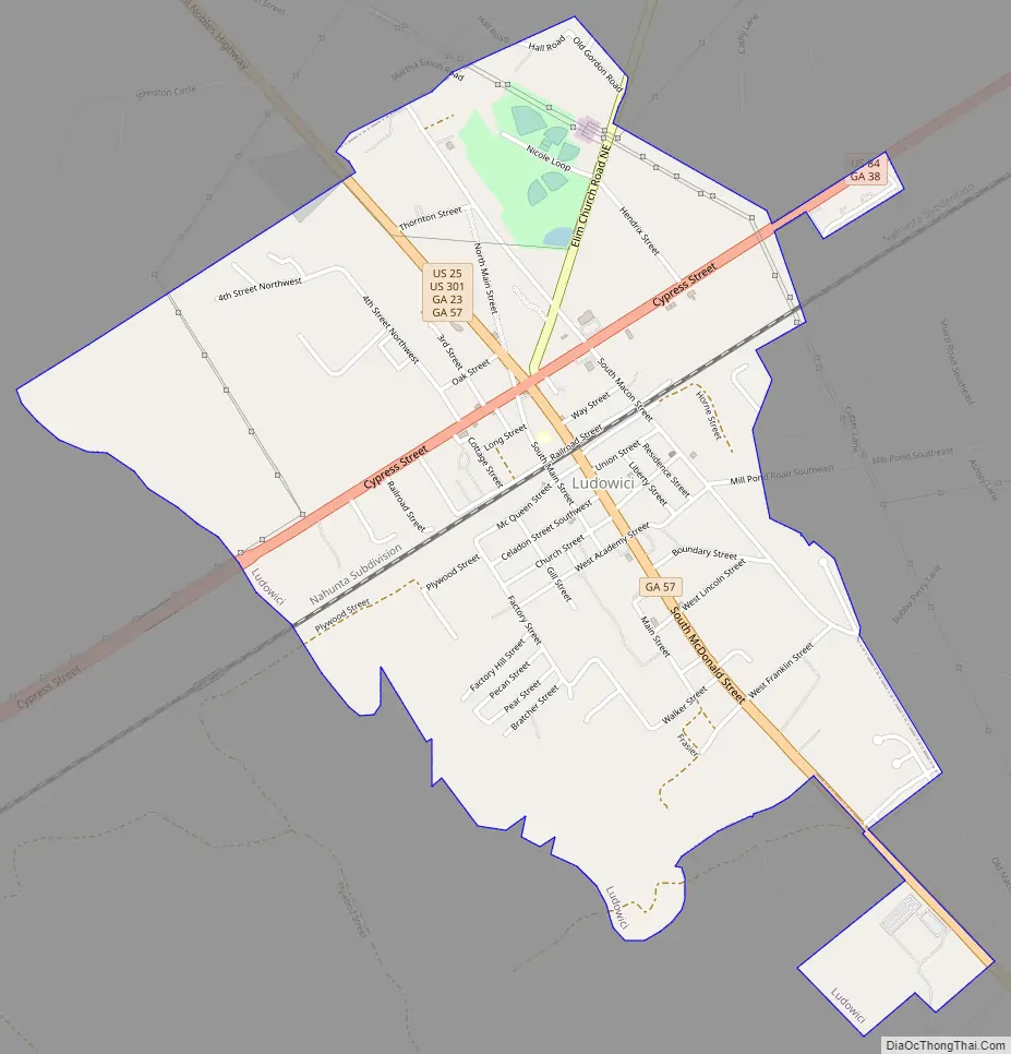
Ludowici Road Map
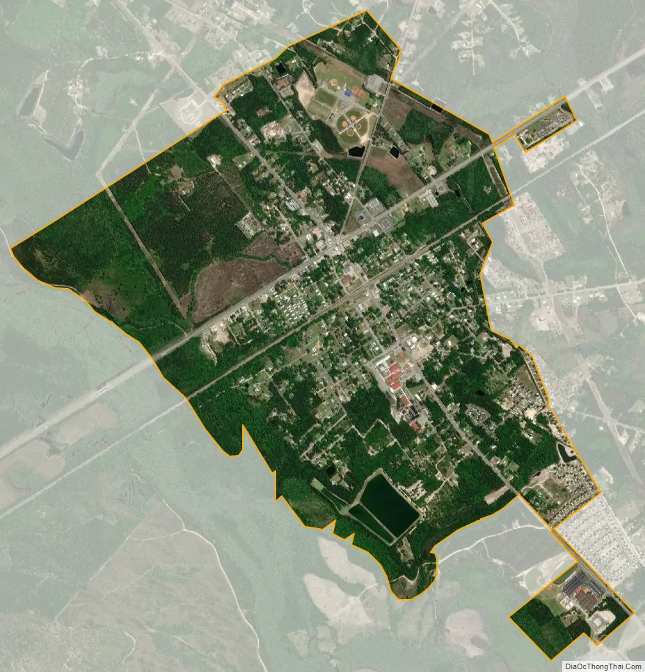
Ludowici city Satellite Map
Geography
Ludowici, in southeast Georgia, is located 30 miles (48 km) from the Atlantic coast. Nearby communities include Jesup 11 miles (18 km) to the southwest via US Routes 301, 84, and 25; Darien 32 miles (51 km) to the southeast via State Route 57; Hinesville/Fort Stewart 15 miles (24 km) to the northeast via US 84; and Glennville 21 miles (34 km) to the northwest via US 301 and 25.
According to the United States Census Bureau, Ludowici has a total area of 2.4 square miles (6.1 km), of which 0.01 square miles (0.03 km), or 0.54%, are water. The city drains west to Jones Creek and east to Doctors Creek, both tributaries of the Altamaha River.
See also
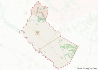
Map of Georgia State and its subdivision:- Appling
- Atkinson
- Bacon
- Baker
- Baldwin
- Banks
- Barrow
- Bartow
- Ben Hill
- Berrien
- Bibb
- Bleckley
- Brantley
- Brooks
- Bryan
- Bulloch
- Burke
- Butts
- Calhoun
- Camden
- Candler
- Carroll
- Catoosa
- Charlton
- Chatham
- Chattahoochee
- Chattooga
- Cherokee
- Clarke
- Clay
- Clayton
- Clinch
- Cobb
- Coffee
- Colquitt
- Columbia
- Cook
- Coweta
- Crawford
- Crisp
- Dade
- Dawson
- Decatur
- DeKalb
- Dodge
- Dooly
- Dougherty
- Douglas
- Early
- Echols
- Effingham
- Elbert
- Emanuel
- Evans
- Fannin
- Fayette
- Floyd
- Forsyth
- Franklin
- Fulton
- Gilmer
- Glascock
- Glynn
- Gordon
- Grady
- Greene
- Gwinnett
- Habersham
- Hall
- Hancock
- Haralson
- Harris
- Hart
- Heard
- Henry
- Houston
- Irwin
- Jackson
- Jasper
- Jeff Davis
- Jefferson
- Jenkins
- Johnson
- Jones
- Lamar
- Lanier
- Laurens
- Lee
- Liberty
- Lincoln
- Long
- Lowndes
- Lumpkin
- Macon
- Madison
- Marion
- McDuffie
- McIntosh
- Meriwether
- Miller
- Mitchell
- Monroe
- Montgomery
- Morgan
- Murray
- Muscogee
- Newton
- Oconee
- Oglethorpe
- Paulding
- Peach
- Pickens
- Pierce
- Pike
- Polk
- Pulaski
- Putnam
- Quitman
- Rabun
- Randolph
- Richmond
- Rockdale
- Schley
- Screven
- Seminole
- Spalding
- Stephens
- Stewart
- Sumter
- Talbot
- Taliaferro
- Tattnall
- Taylor
- Telfair
- Terrell
- Thomas
- Tift
- Toombs
- Towns
- Treutlen
- Troup
- Turner
- Twiggs
- Union
- Upson
- Walker
- Walton
- Ware
- Warren
- Washington
- Wayne
- Webster
- Wheeler
- White
- Whitfield
- Wilcox
- Wilkes
- Wilkinson
- Worth
- Alabama
- Alaska
- Arizona
- Arkansas
- California
- Colorado
- Connecticut
- Delaware
- District of Columbia
- Florida
- Georgia
- Hawaii
- Idaho
- Illinois
- Indiana
- Iowa
- Kansas
- Kentucky
- Louisiana
- Maine
- Maryland
- Massachusetts
- Michigan
- Minnesota
- Mississippi
- Missouri
- Montana
- Nebraska
- Nevada
- New Hampshire
- New Jersey
- New Mexico
- New York
- North Carolina
- North Dakota
- Ohio
- Oklahoma
- Oregon
- Pennsylvania
- Rhode Island
- South Carolina
- South Dakota
- Tennessee
- Texas
- Utah
- Vermont
- Virginia
- Washington
- West Virginia
- Wisconsin
- Wyoming