Moultrie is the county seat and largest city of Colquitt County, Georgia, United States. It is the third largest city in Southwest Georgia, behind Thomasville and Albany. As of the 2020 census, Moultrie’s population was 14,638. It was originally known as Ochlockoney until it was incorporated by the Georgia General Assembly in 1859. Moultrie is an agricultural community set in the Southern Rivers part of Georgia.
Downtown Moultrie contains the Moultrie Commercial Historic District, listed on the National Register of Historic Places. The district includes the Colquitt Theatre.
It is well known for its boutiques and restaurants. Moultrie is the home of former US Senator Saxby Chambliss.
| Name: | Moultrie city |
|---|---|
| LSAD Code: | 25 |
| LSAD Description: | city (suffix) |
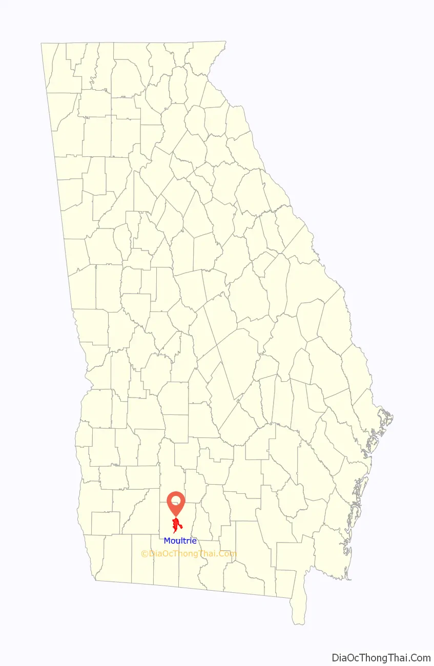
| State: | Georgia |
| County: | Colquitt County |
| Elevation: | 318 ft (97 m) |
| Total Area: | 16.84 sq mi (43.61 km²) |
| Land Area: | 16.67 sq mi (43.18 km²) |
| Water Area: | 0.16 sq mi (0.43 km²) |
| Total Population: | 14,638 |
| Population Density: | 877.95/sq mi (338.99/km²) |
| ZIP code: | 31768, 31776, 31788 |
| Area code: | 229 |
| FIPS code: | 1353060 |
| GNISfeature ID: | 0332427 |
| Website: | http://www.moultriega.com/ |
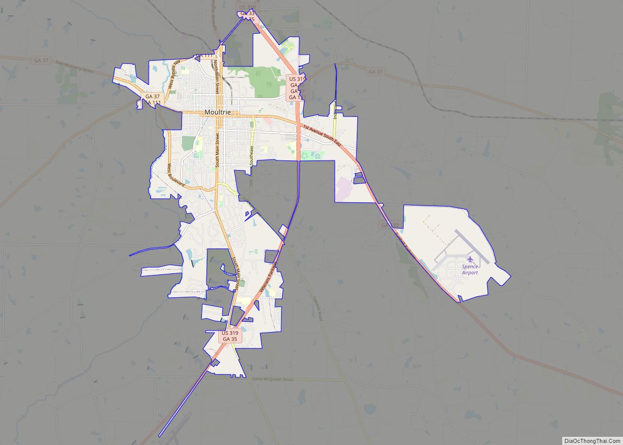
Online Interactive Map
Click on ![]() to view map in "full screen" mode.
to view map in "full screen" mode.
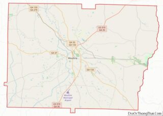
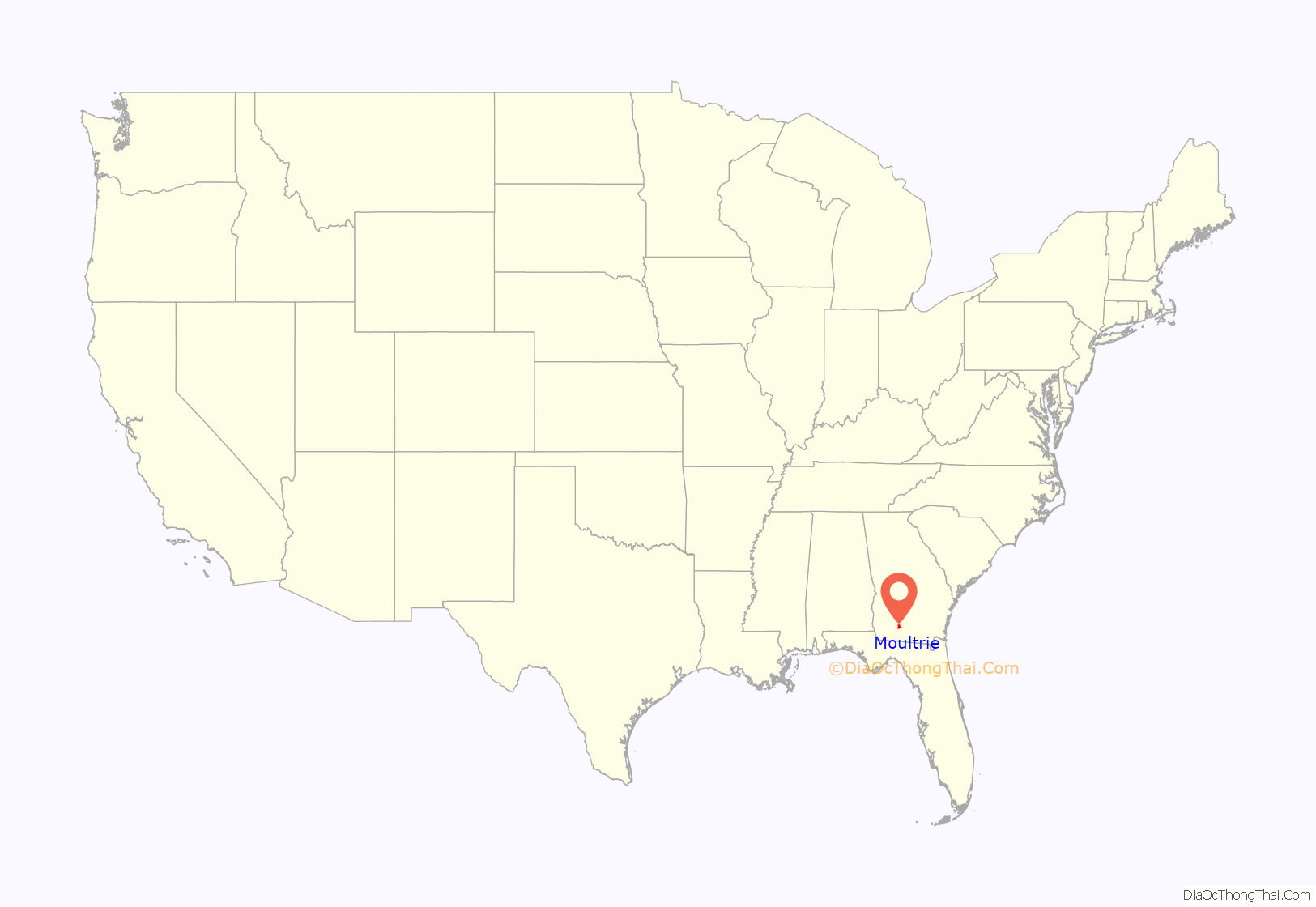
Moultrie location map. Where is Moultrie city?
History
The city was named after Gen. William Moultrie, the Revolutionary War hero after whom Fort Moultrie was named following the successful defense of Charleston, South Carolina, against the British under Peter Parker, an anniversary subsequently celebrated as Carolina Day.
Colquitt County became the 115th county in Georgia by an act of the Legislature on February 25, 1856. It was named after Walter Terry Colquitt, a minister, statesman and lawyer who was a military leader in the mid-1860s. In 1879, a charter was adopted and 50 acres (0.03 km) in the center of the county was declared the county seat.
Founders of naval stores started harvesting timber in the late 1890s. They set up turpentine stills and built tram roads, allowing for the railroad to come into the territory. The Boston & Albany line, which later became the Georgia Northern Railway, was the first through town, bringing with it growth and prosperity for the county. Practically every train brought new residents interested in supplying naval stores or working in the sawmills.
By 1900, through the work of businessmen, bankers and speculators, the county was becoming a farmer’s paradise.
Land was cleared and development companies began dividing the forested area into farm tracts. Experienced farmers from north Georgia and the Carolinas were invited to come and develop the land. The county’s agriculture industry thrives today.
Moultrie Commercial Historic District
Moultrie Commercial Historic District is a historic area of Moultrie with several buildings of historical significance including the Moultrie Colquitt Towers, formerly a hotel called Hotel Colquitt. The district was listed on the National Register of Historic Places on June 3, 1994. The area is generally bounded by northeast First Avenue, southeast Second Avenue, West First Street and East Fourth Street.
The district’s coordinates are 31°10′48″N 83°47′14″W / 31.18°N 83.787222°W / 31.18; -83.787222.
Moultrie Road Map

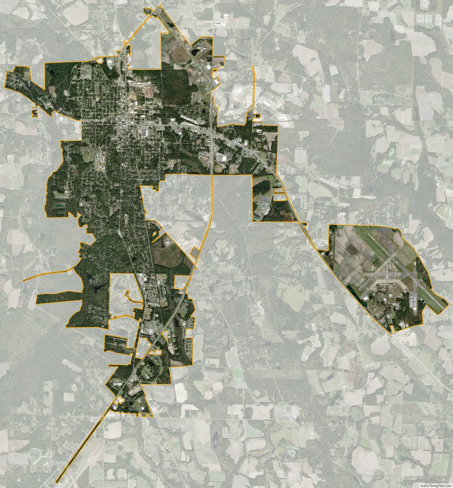
Moultrie city Satellite Map
Geography
Located in southwest Georgia, Moultrie is in the center of Colquitt County, 24 miles (39 km) west of Interstate 75, and about 200 miles (300 km) south of Atlanta and 60 miles (100 km) northeast of Tallahassee, Florida. The city is located between Albany to the northwest, Tifton to the northeast, Thomasville to the southwest, and Valdosta to the southeast.
According to the United States Census Bureau, the city has a total area of 16.5 square miles (42.8 km), of which 16.3 square miles (42.3 km) is land and 0.19 square miles (0.5 km), or 1.15%, is water.
Moultrie is located at 31°10′13″N 83°47′1″W / 31.17028°N 83.78361°W / 31.17028; -83.78361 (31.170188, -83.783601).
See also
Map of Georgia State and its subdivision:- Appling
- Atkinson
- Bacon
- Baker
- Baldwin
- Banks
- Barrow
- Bartow
- Ben Hill
- Berrien
- Bibb
- Bleckley
- Brantley
- Brooks
- Bryan
- Bulloch
- Burke
- Butts
- Calhoun
- Camden
- Candler
- Carroll
- Catoosa
- Charlton
- Chatham
- Chattahoochee
- Chattooga
- Cherokee
- Clarke
- Clay
- Clayton
- Clinch
- Cobb
- Coffee
- Colquitt
- Columbia
- Cook
- Coweta
- Crawford
- Crisp
- Dade
- Dawson
- Decatur
- DeKalb
- Dodge
- Dooly
- Dougherty
- Douglas
- Early
- Echols
- Effingham
- Elbert
- Emanuel
- Evans
- Fannin
- Fayette
- Floyd
- Forsyth
- Franklin
- Fulton
- Gilmer
- Glascock
- Glynn
- Gordon
- Grady
- Greene
- Gwinnett
- Habersham
- Hall
- Hancock
- Haralson
- Harris
- Hart
- Heard
- Henry
- Houston
- Irwin
- Jackson
- Jasper
- Jeff Davis
- Jefferson
- Jenkins
- Johnson
- Jones
- Lamar
- Lanier
- Laurens
- Lee
- Liberty
- Lincoln
- Long
- Lowndes
- Lumpkin
- Macon
- Madison
- Marion
- McDuffie
- McIntosh
- Meriwether
- Miller
- Mitchell
- Monroe
- Montgomery
- Morgan
- Murray
- Muscogee
- Newton
- Oconee
- Oglethorpe
- Paulding
- Peach
- Pickens
- Pierce
- Pike
- Polk
- Pulaski
- Putnam
- Quitman
- Rabun
- Randolph
- Richmond
- Rockdale
- Schley
- Screven
- Seminole
- Spalding
- Stephens
- Stewart
- Sumter
- Talbot
- Taliaferro
- Tattnall
- Taylor
- Telfair
- Terrell
- Thomas
- Tift
- Toombs
- Towns
- Treutlen
- Troup
- Turner
- Twiggs
- Union
- Upson
- Walker
- Walton
- Ware
- Warren
- Washington
- Wayne
- Webster
- Wheeler
- White
- Whitfield
- Wilcox
- Wilkes
- Wilkinson
- Worth
- Alabama
- Alaska
- Arizona
- Arkansas
- California
- Colorado
- Connecticut
- Delaware
- District of Columbia
- Florida
- Georgia
- Hawaii
- Idaho
- Illinois
- Indiana
- Iowa
- Kansas
- Kentucky
- Louisiana
- Maine
- Maryland
- Massachusetts
- Michigan
- Minnesota
- Mississippi
- Missouri
- Montana
- Nebraska
- Nevada
- New Hampshire
- New Jersey
- New Mexico
- New York
- North Carolina
- North Dakota
- Ohio
- Oklahoma
- Oregon
- Pennsylvania
- Rhode Island
- South Carolina
- South Dakota
- Tennessee
- Texas
- Utah
- Vermont
- Virginia
- Washington
- West Virginia
- Wisconsin
- Wyoming