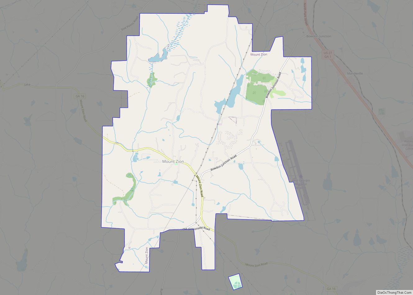
Mount Zion is a city in Carroll County, Georgia, United States. The population was 1,696 at the 2010 census.
| Name: | Mount Zion city |
|---|---|
| LSAD Code: | 25 |
| LSAD Description: | city (suffix) |
| State: | Georgia |
| County: | Carroll County |
| Elevation: | 1,201 ft (366 m) |
| Total Area: | 9.81 sq mi (25.41 km²) |
| Land Area: | 9.71 sq mi (25.14 km²) |
| Water Area: | 0.10 sq mi (0.27 km²) |
| Total Population: | 1,766 |
| Population Density: | 181.93/sq mi (70.25/km²) |
| ZIP code: | 30150 |
| Area code: | 770 |
| FIPS code: | 1353620 |
| GNISfeature ID: | 0332438 |
| Website: | www.cityofmountzion.com |
Online Interactive Map
Click on ![]() to view map in "full screen" mode.
to view map in "full screen" mode.
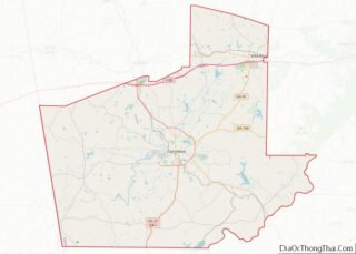
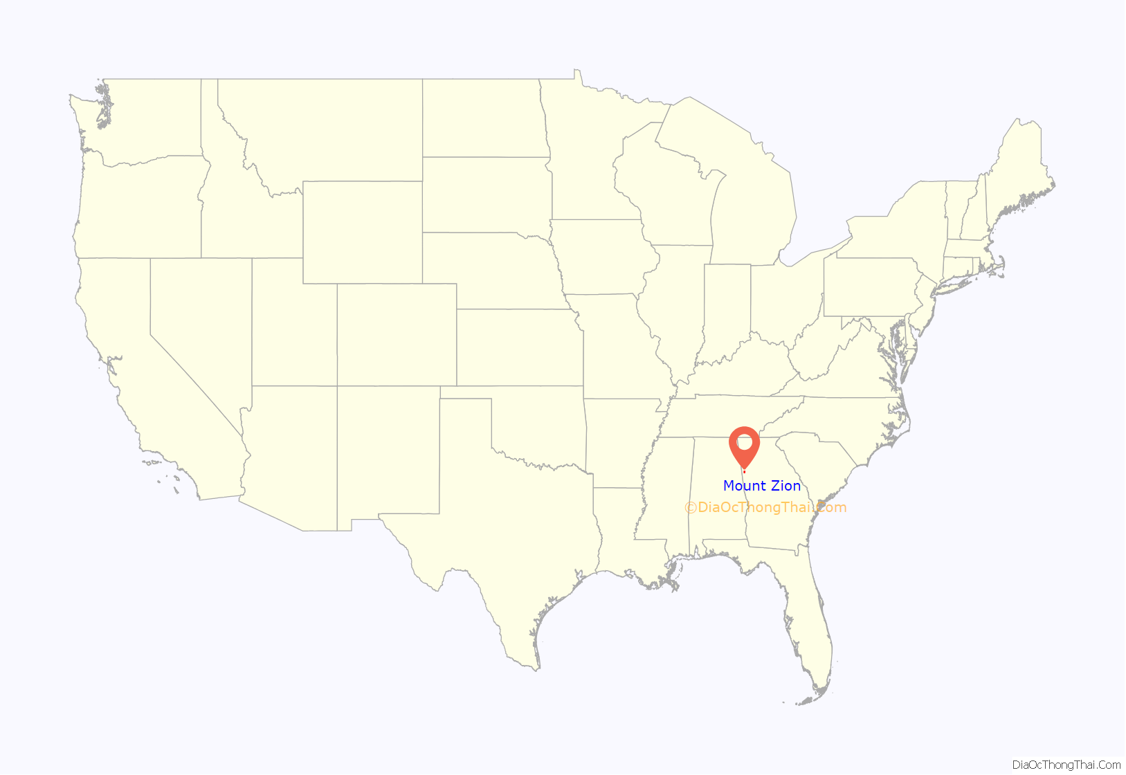
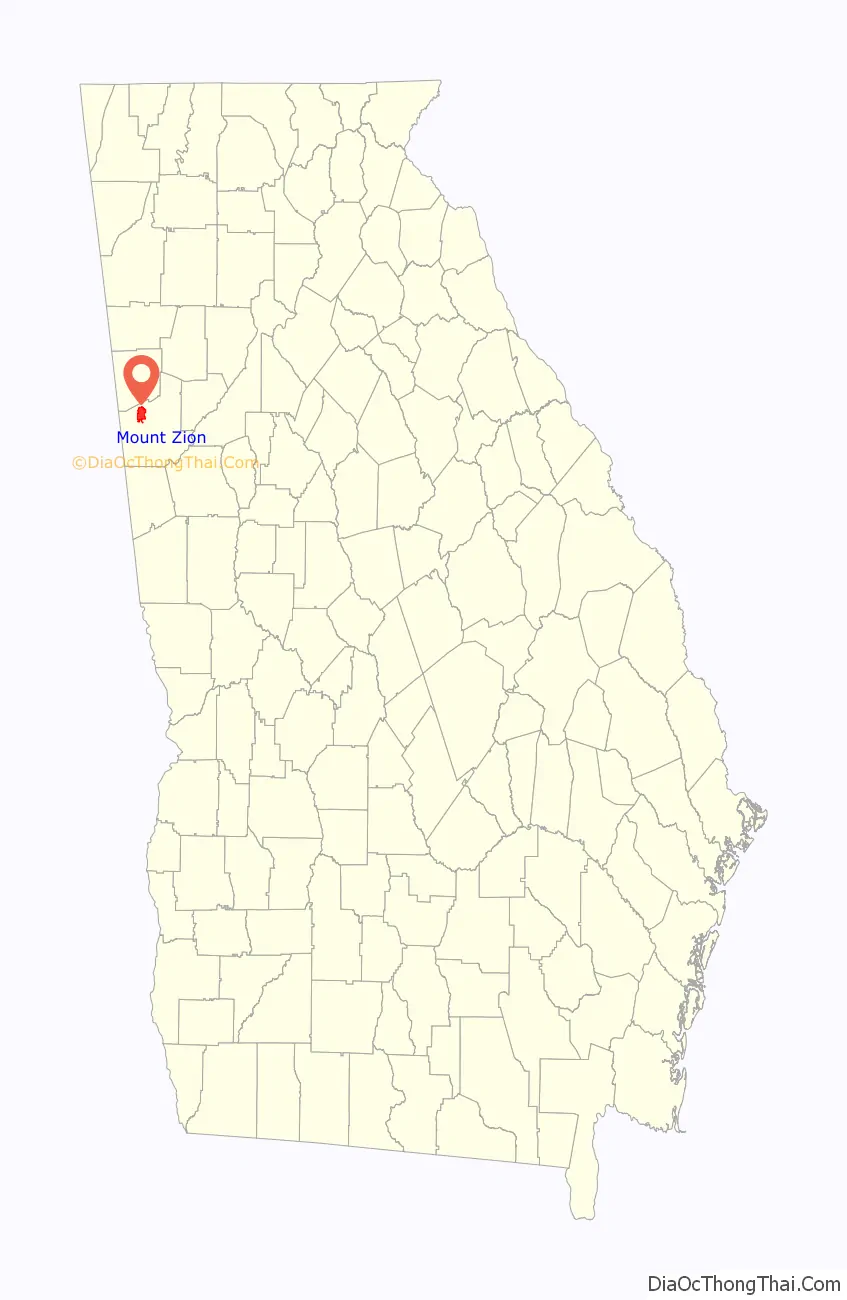
Mount Zion location map. Where is Mount Zion city?
History
The City of Mount Zion was established in 1852 by Reverend Thomas Hicks Martin (March 10, 1822 – June 14, 1914), after his family had settled on land that had once been owned by the Creek Confederacy. It became known as Turkey Creek Mills, the name derived from a large wild turkey population found in the area. The city’s name was later adopted from the local Mount Zion Methodist Episcopal Church, established 1865, which had soon became the center point of the community, and in 1878 the name Turkey Creek Mills was changed to Mount Zion.
In 1877, Reverend James Mitchell took his ministry to Mount Zion and founded the Mount Zion Seminary, the predecessor institution of the current Mount Zion High School.
The Georgia General Assembly incorporated Mount Zion as a town in 1912 and re-chartered in 1953 and again in 1978.
Mount Zion is one of the few cities in Georgia with the Confederate Flag incorporated in its city flag, which is based on the 1956 Georgia state flag and inspired by the Trenton, Georgia city flag that began flying in 2002. The Mount Zion city flag began flying April 10, 2007.
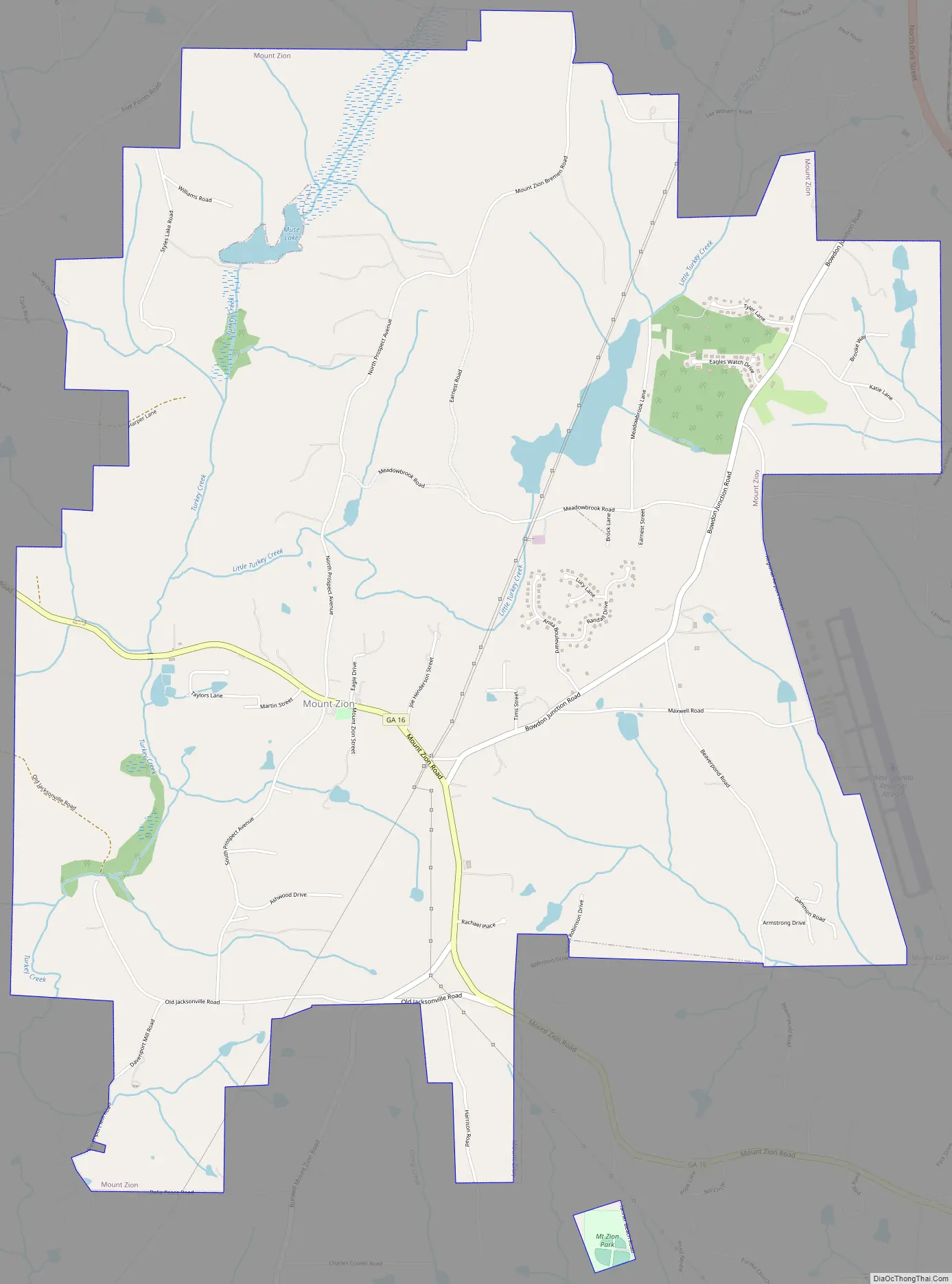
Mount Zion Road Map
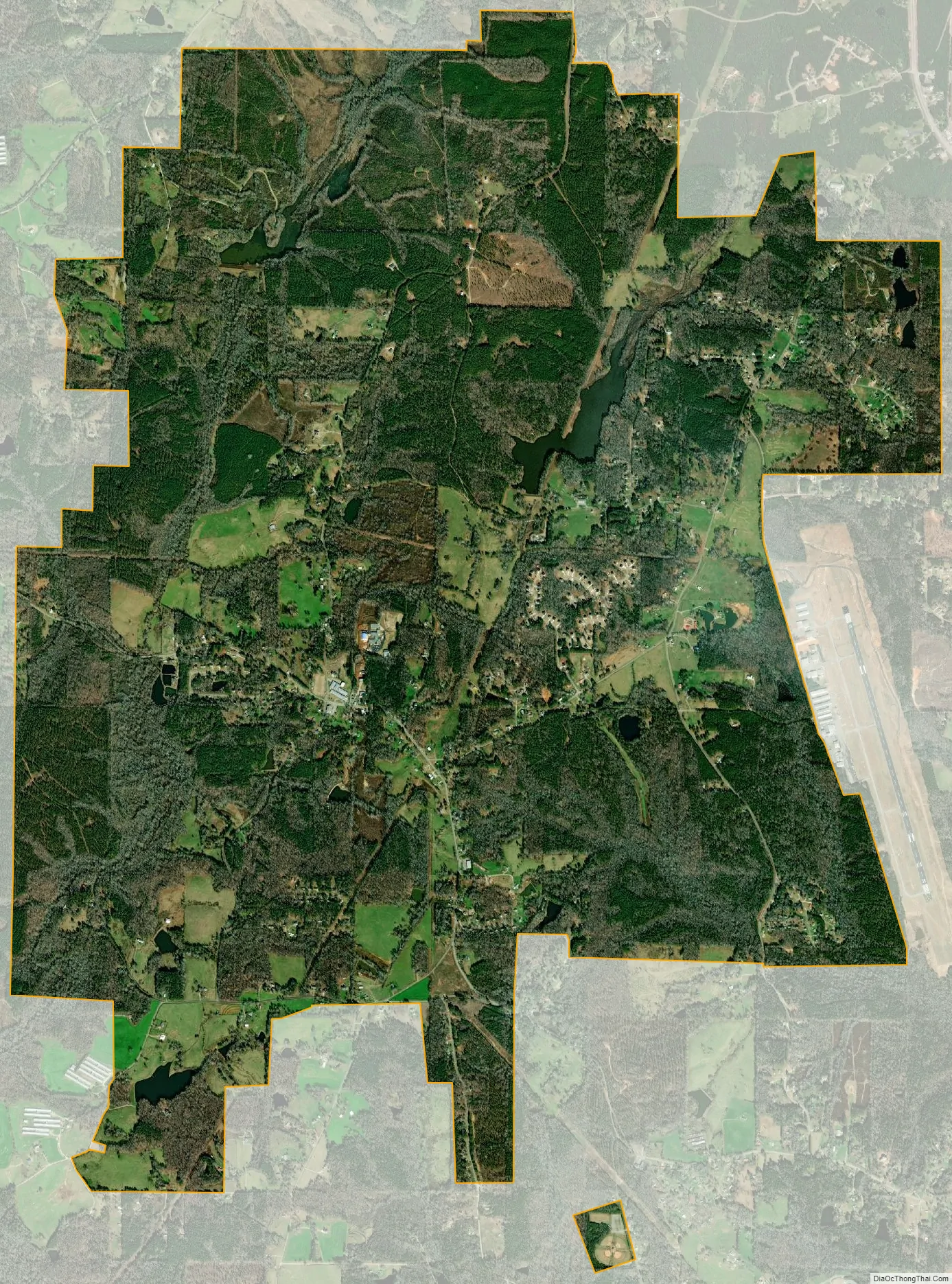
Mount Zion city Satellite Map
Geography
Mount Zion is located in northern Carroll County at 33°37′52″N 85°10′48″W / 33.63111°N 85.18000°W / 33.63111; -85.18000 (33.631113, -85.179868). It is 8 miles (13 km) northwest of Carrollton, the county seat, and 5 miles (8 km) southwest of Interstate 20 in Bremen. John Tanner Park is just south of the city limits off of Highway 16.
According to the United States Census Bureau, Mount Zion has a total area of 9.8 square miles (25.5 km), of which 9.7 square miles (25.1 km) is land and 0.15 square miles (0.4 km), or 1.71%, is water.
See also
Map of Georgia State and its subdivision:- Appling
- Atkinson
- Bacon
- Baker
- Baldwin
- Banks
- Barrow
- Bartow
- Ben Hill
- Berrien
- Bibb
- Bleckley
- Brantley
- Brooks
- Bryan
- Bulloch
- Burke
- Butts
- Calhoun
- Camden
- Candler
- Carroll
- Catoosa
- Charlton
- Chatham
- Chattahoochee
- Chattooga
- Cherokee
- Clarke
- Clay
- Clayton
- Clinch
- Cobb
- Coffee
- Colquitt
- Columbia
- Cook
- Coweta
- Crawford
- Crisp
- Dade
- Dawson
- Decatur
- DeKalb
- Dodge
- Dooly
- Dougherty
- Douglas
- Early
- Echols
- Effingham
- Elbert
- Emanuel
- Evans
- Fannin
- Fayette
- Floyd
- Forsyth
- Franklin
- Fulton
- Gilmer
- Glascock
- Glynn
- Gordon
- Grady
- Greene
- Gwinnett
- Habersham
- Hall
- Hancock
- Haralson
- Harris
- Hart
- Heard
- Henry
- Houston
- Irwin
- Jackson
- Jasper
- Jeff Davis
- Jefferson
- Jenkins
- Johnson
- Jones
- Lamar
- Lanier
- Laurens
- Lee
- Liberty
- Lincoln
- Long
- Lowndes
- Lumpkin
- Macon
- Madison
- Marion
- McDuffie
- McIntosh
- Meriwether
- Miller
- Mitchell
- Monroe
- Montgomery
- Morgan
- Murray
- Muscogee
- Newton
- Oconee
- Oglethorpe
- Paulding
- Peach
- Pickens
- Pierce
- Pike
- Polk
- Pulaski
- Putnam
- Quitman
- Rabun
- Randolph
- Richmond
- Rockdale
- Schley
- Screven
- Seminole
- Spalding
- Stephens
- Stewart
- Sumter
- Talbot
- Taliaferro
- Tattnall
- Taylor
- Telfair
- Terrell
- Thomas
- Tift
- Toombs
- Towns
- Treutlen
- Troup
- Turner
- Twiggs
- Union
- Upson
- Walker
- Walton
- Ware
- Warren
- Washington
- Wayne
- Webster
- Wheeler
- White
- Whitfield
- Wilcox
- Wilkes
- Wilkinson
- Worth
- Alabama
- Alaska
- Arizona
- Arkansas
- California
- Colorado
- Connecticut
- Delaware
- District of Columbia
- Florida
- Georgia
- Hawaii
- Idaho
- Illinois
- Indiana
- Iowa
- Kansas
- Kentucky
- Louisiana
- Maine
- Maryland
- Massachusetts
- Michigan
- Minnesota
- Mississippi
- Missouri
- Montana
- Nebraska
- Nevada
- New Hampshire
- New Jersey
- New Mexico
- New York
- North Carolina
- North Dakota
- Ohio
- Oklahoma
- Oregon
- Pennsylvania
- Rhode Island
- South Carolina
- South Dakota
- Tennessee
- Texas
- Utah
- Vermont
- Virginia
- Washington
- West Virginia
- Wisconsin
- Wyoming