Nelson is a city in Pickens and Cherokee Counties, Georgia, United States. At the 2020 census, the population was 1,145. It is part of the Atlanta metropolitan area.
| Name: | Nelson city |
|---|---|
| LSAD Code: | 25 |
| LSAD Description: | city (suffix) |
| State: | Georgia |
| County: | Cherokee County, Pickens County |
| Elevation: | 1,237 ft (377 m) |
| Total Area: | 1.53 sq mi (3.97 km²) |
| Land Area: | 1.52 sq mi (3.95 km²) |
| Water Area: | 0.01 sq mi (0.02 km²) |
| Total Population: | 1,145 |
| Population Density: | 751.31/sq mi (290.11/km²) |
| ZIP code: | 30151 |
| Area code: | 770 |
| FIPS code: | 1354572 |
| GNISfeature ID: | 0319244 |
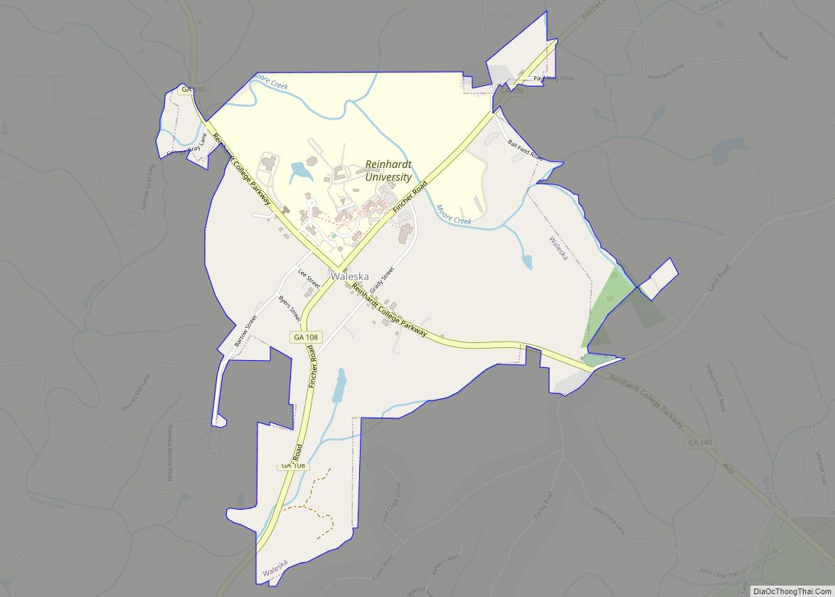
Online Interactive Map
Click on ![]() to view map in "full screen" mode.
to view map in "full screen" mode.
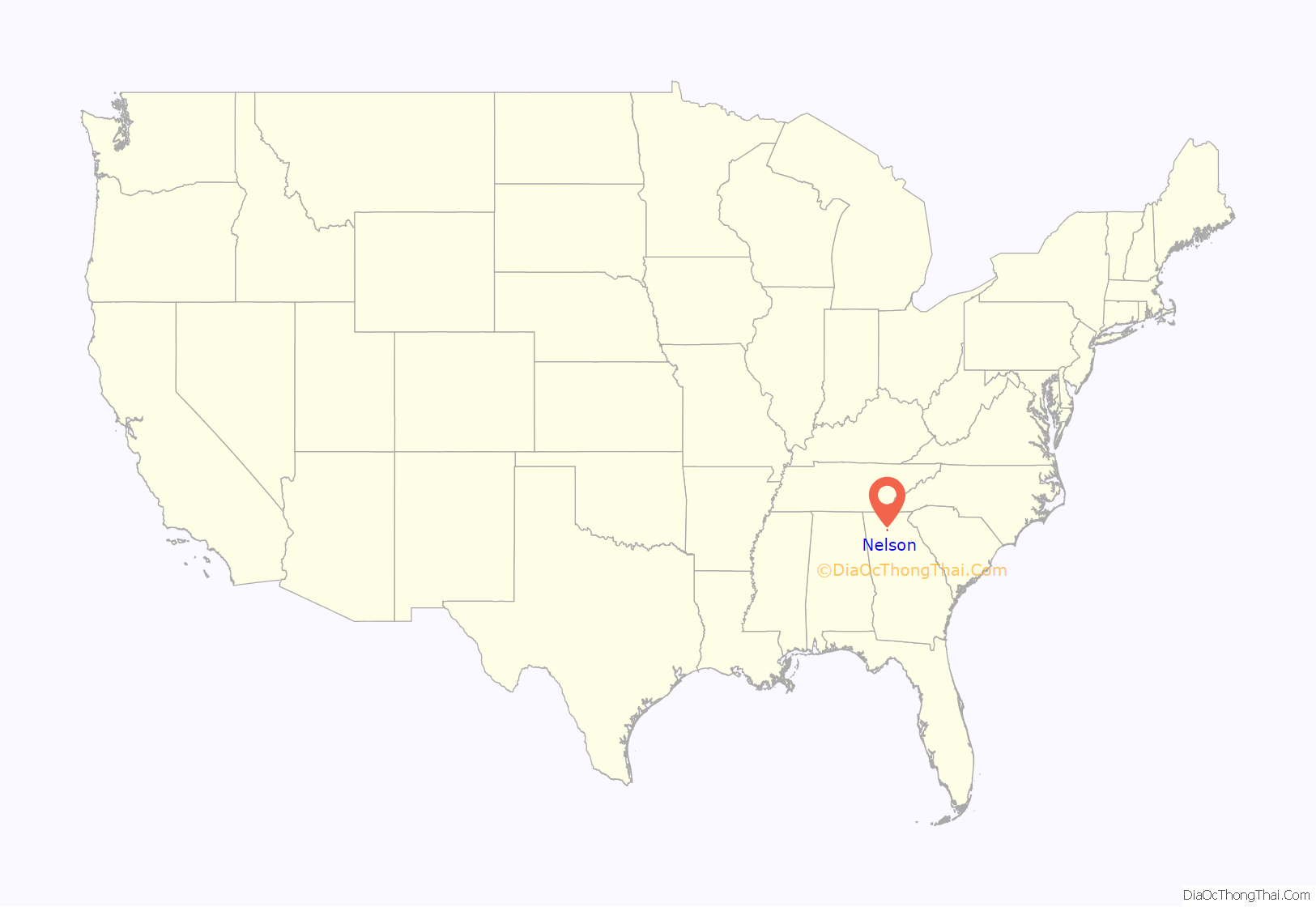
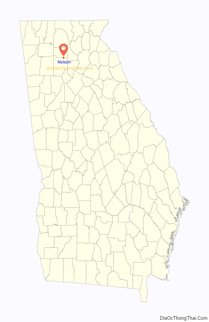
Nelson location map. Where is Nelson city?
History
The city is named for John Nelson, an early landowner, farmer, and rifle maker. The Georgia General Assembly incorporated Nelson as a town in 1891.
The area possesses substantial deposits of marble. The construction of a railway in 1883 made the development of large-scale quarries possible. The quality of the marble has made it favored for federal monuments.
On April 1, 2013, the city council voted unanimously to approve the “Family Protection Ordinance”. Every head of household must own a gun and ammunition to “provide for the emergency management of the city” and to “provide for and protect the safety, security, and general welfare of the city and its inhabitants.” Residents are not required to buy one if they do not have one, and the ordinance does not penalize anyone who does not comply. Convicted felons are exempt.
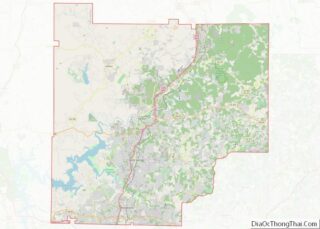
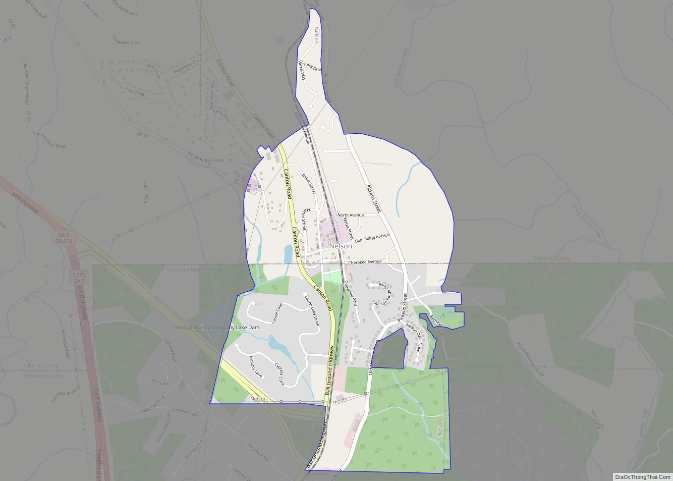
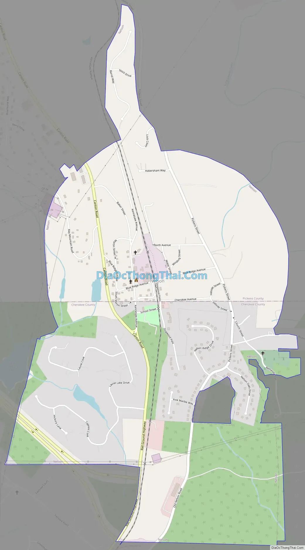
Nelson Road Map
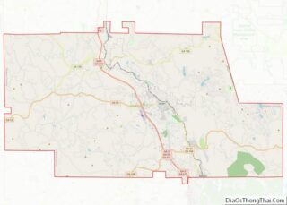
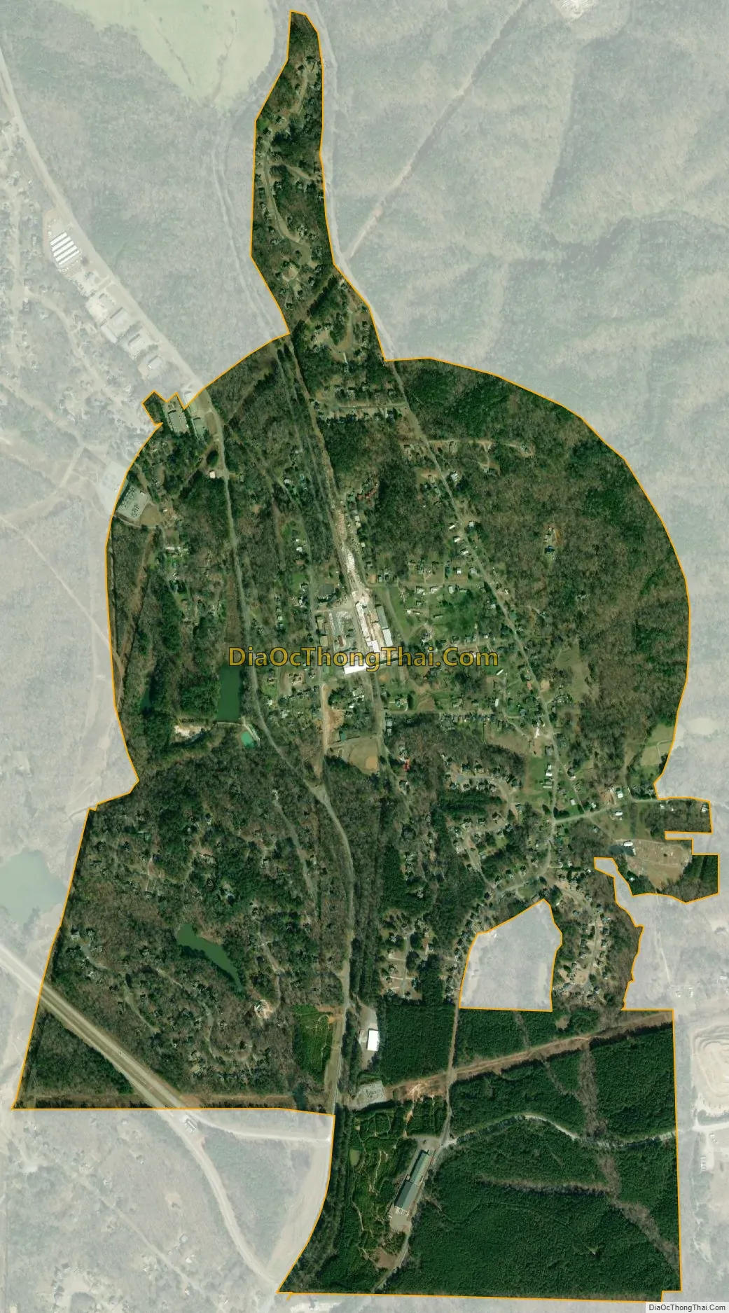
Nelson city Satellite Map
Geography
Nelson is located on the border of Pickens and Cherokee Counties at 34°22′54″N 84°22′17″W / 34.38167°N 84.37139°W / 34.38167; -84.37139 (34.381562, -84.371303). The original city center is located in Pickens County, but the city limits have recently expanded southward so that more of the city is now located in Cherokee County.
According to the United States Census Bureau, the city has a total area of 1.5 square miles (3.8 km), of which 0.008 square miles (0.02 km), or 0.56%, is covered by water.
Nelson is served through its downtown by the Georgia Northeastern Railroad, and by Canton Road, the town’s main street and the former route of Georgia State Route 5. South on old 5 is Ball Ground, and north is Tate. The north end of Interstate 575 and south end of State Route 515 are at the county line just to the west of Nelson. I-575 leads south 52 miles (84 km) to Atlanta, and SR 515 leads north 26 miles (42 km) to Ellijay.
See also
Map of Georgia State and its subdivision:- Appling
- Atkinson
- Bacon
- Baker
- Baldwin
- Banks
- Barrow
- Bartow
- Ben Hill
- Berrien
- Bibb
- Bleckley
- Brantley
- Brooks
- Bryan
- Bulloch
- Burke
- Butts
- Calhoun
- Camden
- Candler
- Carroll
- Catoosa
- Charlton
- Chatham
- Chattahoochee
- Chattooga
- Cherokee
- Clarke
- Clay
- Clayton
- Clinch
- Cobb
- Coffee
- Colquitt
- Columbia
- Cook
- Coweta
- Crawford
- Crisp
- Dade
- Dawson
- Decatur
- DeKalb
- Dodge
- Dooly
- Dougherty
- Douglas
- Early
- Echols
- Effingham
- Elbert
- Emanuel
- Evans
- Fannin
- Fayette
- Floyd
- Forsyth
- Franklin
- Fulton
- Gilmer
- Glascock
- Glynn
- Gordon
- Grady
- Greene
- Gwinnett
- Habersham
- Hall
- Hancock
- Haralson
- Harris
- Hart
- Heard
- Henry
- Houston
- Irwin
- Jackson
- Jasper
- Jeff Davis
- Jefferson
- Jenkins
- Johnson
- Jones
- Lamar
- Lanier
- Laurens
- Lee
- Liberty
- Lincoln
- Long
- Lowndes
- Lumpkin
- Macon
- Madison
- Marion
- McDuffie
- McIntosh
- Meriwether
- Miller
- Mitchell
- Monroe
- Montgomery
- Morgan
- Murray
- Muscogee
- Newton
- Oconee
- Oglethorpe
- Paulding
- Peach
- Pickens
- Pierce
- Pike
- Polk
- Pulaski
- Putnam
- Quitman
- Rabun
- Randolph
- Richmond
- Rockdale
- Schley
- Screven
- Seminole
- Spalding
- Stephens
- Stewart
- Sumter
- Talbot
- Taliaferro
- Tattnall
- Taylor
- Telfair
- Terrell
- Thomas
- Tift
- Toombs
- Towns
- Treutlen
- Troup
- Turner
- Twiggs
- Union
- Upson
- Walker
- Walton
- Ware
- Warren
- Washington
- Wayne
- Webster
- Wheeler
- White
- Whitfield
- Wilcox
- Wilkes
- Wilkinson
- Worth
- Alabama
- Alaska
- Arizona
- Arkansas
- California
- Colorado
- Connecticut
- Delaware
- District of Columbia
- Florida
- Georgia
- Hawaii
- Idaho
- Illinois
- Indiana
- Iowa
- Kansas
- Kentucky
- Louisiana
- Maine
- Maryland
- Massachusetts
- Michigan
- Minnesota
- Mississippi
- Missouri
- Montana
- Nebraska
- Nevada
- New Hampshire
- New Jersey
- New Mexico
- New York
- North Carolina
- North Dakota
- Ohio
- Oklahoma
- Oregon
- Pennsylvania
- Rhode Island
- South Carolina
- South Dakota
- Tennessee
- Texas
- Utah
- Vermont
- Virginia
- Washington
- West Virginia
- Wisconsin
- Wyoming