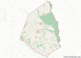
Sylvania is a town in and the county seat of Screven County, Georgia, United States. The population was 2,956 at the 2010 census.
| Name: | Sylvania city |
|---|---|
| LSAD Code: | 25 |
| LSAD Description: | city (suffix) |
| State: | Georgia |
| County: | Screven County |
| Elevation: | 230 ft (70 m) |
| Total Area: | 5.05 sq mi (13.08 km²) |
| Land Area: | 4.98 sq mi (12.89 km²) |
| Water Area: | 0.07 sq mi (0.19 km²) |
| Total Population: | 2,634 |
| Population Density: | 529.13/sq mi (204.31/km²) |
| ZIP code: | 30467 |
| Area code: | 912 |
| FIPS code: | 1375160 |
| GNISfeature ID: | 0323862 |
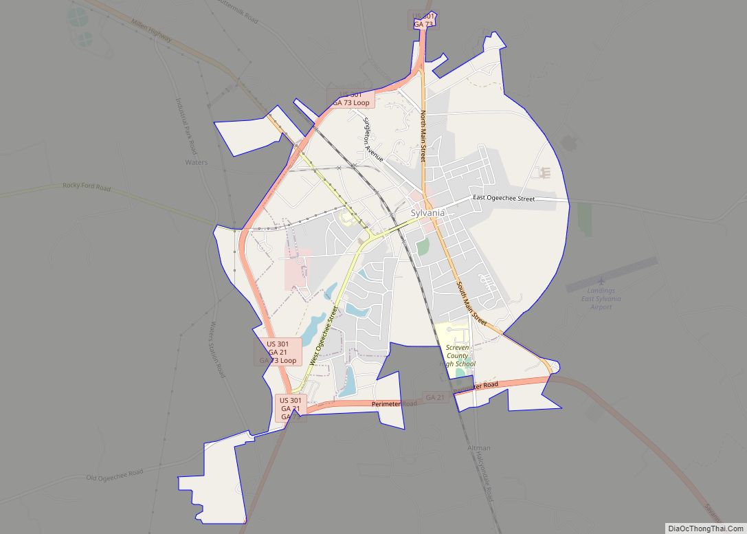
Online Interactive Map
Click on ![]() to view map in "full screen" mode.
to view map in "full screen" mode.
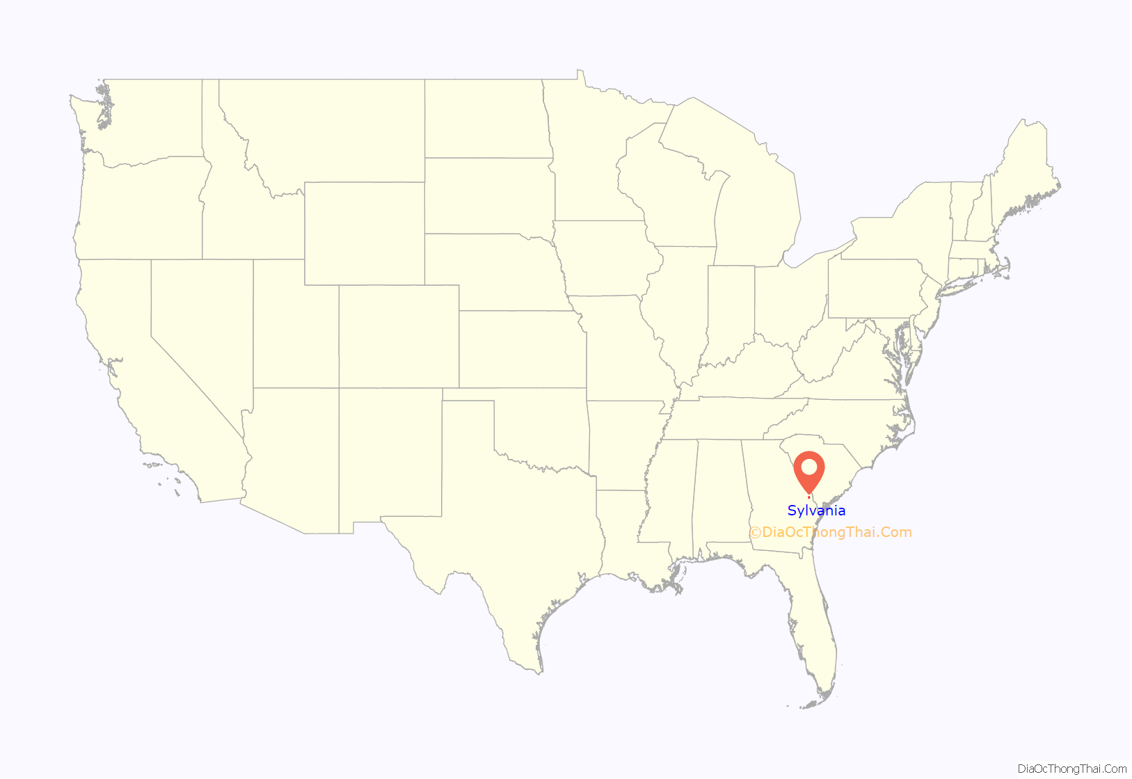
Sylvania location map. Where is Sylvania city?

History
The area was inhabited for thousands of years by various cultures of indigenous peoples. By the time of European encounter, it was occupied by the Yuchi peoples, but some Creeks, the Uchee’s allies, moved into the area during Colonial times.
The town of Sylvania was founded in 1790 by settlers migrating to the area after the American Revolutionary War. The word “Sylvania” comes from the Latin word sylvan or sylva which means “forest land” or “place in the woods.”
Sylvania was part of the Black Belt of Georgia, developed for cultivation after the cotton gin made it easier to handle short-fiber cotton. Cotton was the most important commodity crop until late in the 19th century. Planters imported many enslaved African Americans to cultivate the crops. By 1830 the county was filled with people. The county seat was moved from Jacksonborough to Sylvania in 1847.
As part of the projects of the Works Progress Administration, federally commissioned murals were produced from 1934 to 1943 in the United States through the Section of Painting and Sculpture, later called the Section of Fine Arts, of the Treasury Department. In 1941, Caroline Speare Rohland painted a mural for the post office of Sylvania. The scene depicted was of a farming family and their African American farm hand. In the 1980s, complaints from the local NAACP chapter resulted in the removal of the mural. It was found in a closet of the post office in 1995 and restored. The mural is now on permanent loan from the federal government and is held by Georgia Southern University in Statesboro.
Sherman’s army moved through the area during the Civil War.
Sylvania calls itself the “Azalea and Dogwood City” and the “Welcome Station City.”
Sylvania Road Map
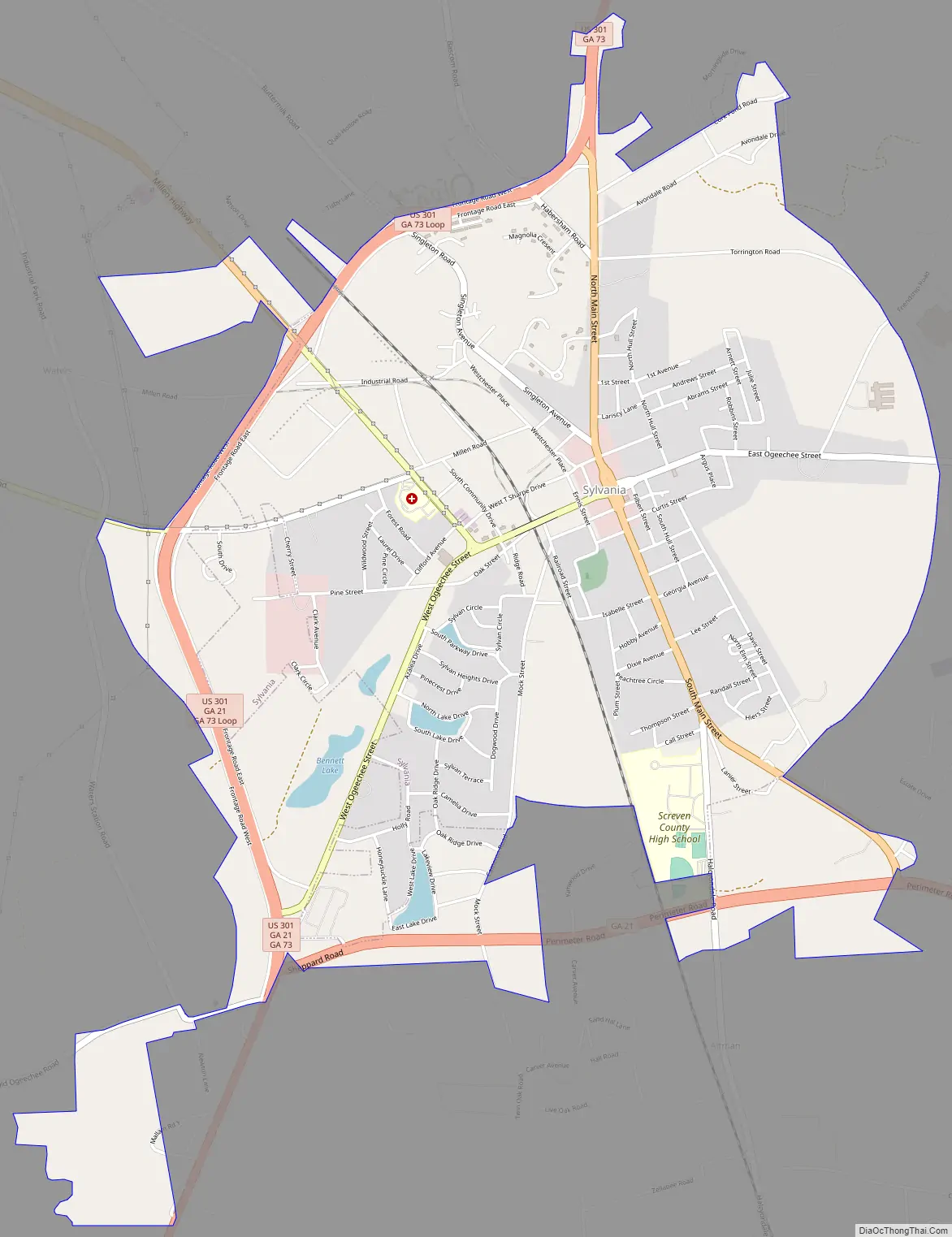
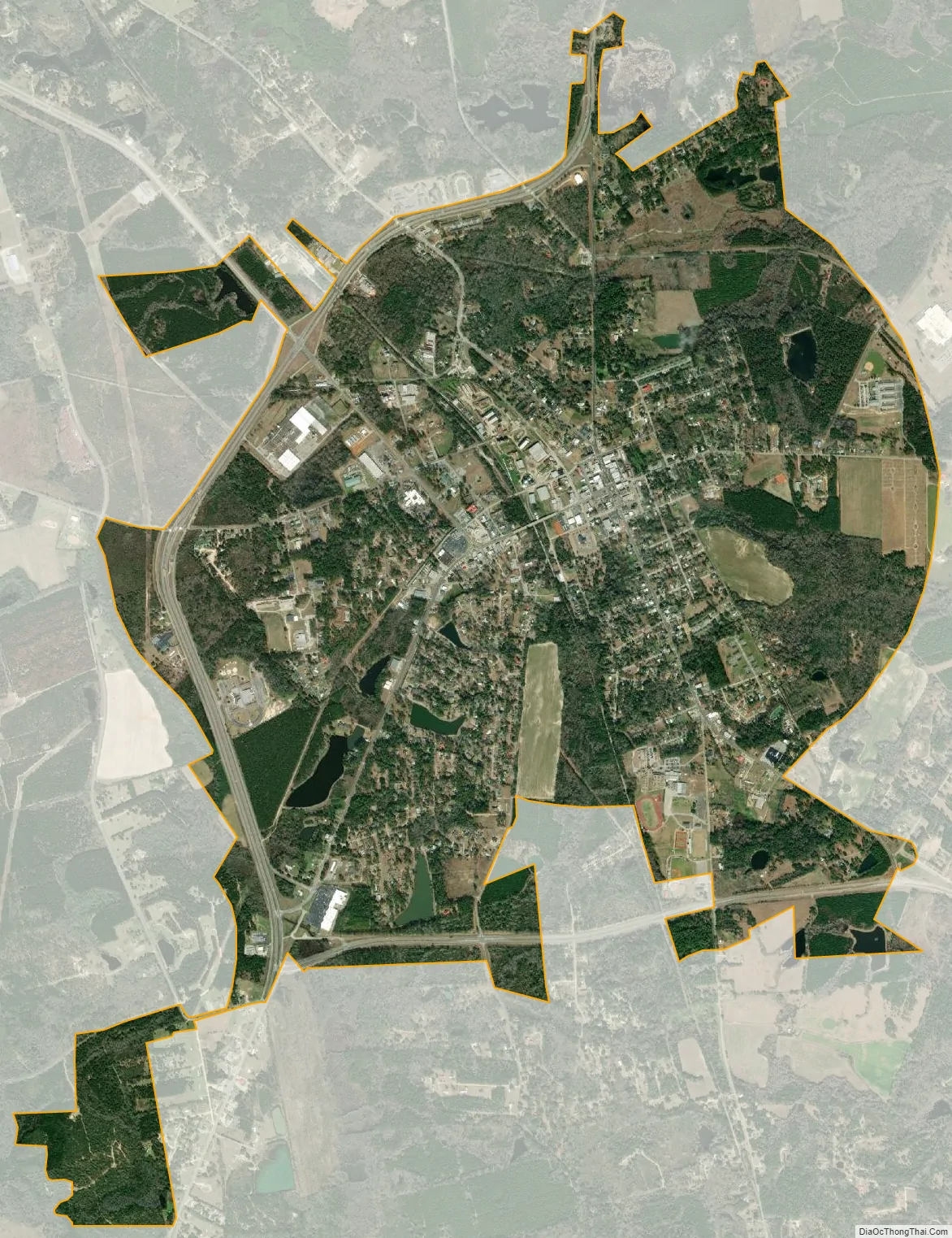
Sylvania city Satellite Map
Geography
Sylvania is located at 32°45′01″N 81°38′23″W / 32.750151°N 81.639590°W / 32.750151; -81.639590.
U.S. Route 301 and Georgia State Route 21 are the main routes through the city. U.S. 301 runs north-south as a western bypass of the downtown area, leading northeast 29 mi (47 km) to Allendale, South Carolina and southwest 23 mi (37 km) to Statesboro. GA-21 runs along the western bypass of the city concurrent with U.S. 301, leading southeast 34 mi (55 km) to Springfield and west 19 mi (31 km) to Millen. Additionally, Georgia State Route 73 runs through the downtown area upon splitting from U.S. 301 south of downtown, but rejoins that route north of the city.
The city is located roughly halfway between the major cities of Savannah and Augusta.
According to the United States Census Bureau, the city has a total area of 3.8 square miles (9.8 km), all land. Sylvania’s elevation is 230 feet and is slightly higher than most of the land throughout Screven County.
The city’s flora include pine, oak, and most notably, dogwood, thus the slogan “The Dogwood City.” Although Spanish moss is not as prevalent as in nearby Savannah, it can still be seen in Sylvania and the surrounding countryside.
See also
Map of Georgia State and its subdivision:- Appling
- Atkinson
- Bacon
- Baker
- Baldwin
- Banks
- Barrow
- Bartow
- Ben Hill
- Berrien
- Bibb
- Bleckley
- Brantley
- Brooks
- Bryan
- Bulloch
- Burke
- Butts
- Calhoun
- Camden
- Candler
- Carroll
- Catoosa
- Charlton
- Chatham
- Chattahoochee
- Chattooga
- Cherokee
- Clarke
- Clay
- Clayton
- Clinch
- Cobb
- Coffee
- Colquitt
- Columbia
- Cook
- Coweta
- Crawford
- Crisp
- Dade
- Dawson
- Decatur
- DeKalb
- Dodge
- Dooly
- Dougherty
- Douglas
- Early
- Echols
- Effingham
- Elbert
- Emanuel
- Evans
- Fannin
- Fayette
- Floyd
- Forsyth
- Franklin
- Fulton
- Gilmer
- Glascock
- Glynn
- Gordon
- Grady
- Greene
- Gwinnett
- Habersham
- Hall
- Hancock
- Haralson
- Harris
- Hart
- Heard
- Henry
- Houston
- Irwin
- Jackson
- Jasper
- Jeff Davis
- Jefferson
- Jenkins
- Johnson
- Jones
- Lamar
- Lanier
- Laurens
- Lee
- Liberty
- Lincoln
- Long
- Lowndes
- Lumpkin
- Macon
- Madison
- Marion
- McDuffie
- McIntosh
- Meriwether
- Miller
- Mitchell
- Monroe
- Montgomery
- Morgan
- Murray
- Muscogee
- Newton
- Oconee
- Oglethorpe
- Paulding
- Peach
- Pickens
- Pierce
- Pike
- Polk
- Pulaski
- Putnam
- Quitman
- Rabun
- Randolph
- Richmond
- Rockdale
- Schley
- Screven
- Seminole
- Spalding
- Stephens
- Stewart
- Sumter
- Talbot
- Taliaferro
- Tattnall
- Taylor
- Telfair
- Terrell
- Thomas
- Tift
- Toombs
- Towns
- Treutlen
- Troup
- Turner
- Twiggs
- Union
- Upson
- Walker
- Walton
- Ware
- Warren
- Washington
- Wayne
- Webster
- Wheeler
- White
- Whitfield
- Wilcox
- Wilkes
- Wilkinson
- Worth
- Alabama
- Alaska
- Arizona
- Arkansas
- California
- Colorado
- Connecticut
- Delaware
- District of Columbia
- Florida
- Georgia
- Hawaii
- Idaho
- Illinois
- Indiana
- Iowa
- Kansas
- Kentucky
- Louisiana
- Maine
- Maryland
- Massachusetts
- Michigan
- Minnesota
- Mississippi
- Missouri
- Montana
- Nebraska
- Nevada
- New Hampshire
- New Jersey
- New Mexico
- New York
- North Carolina
- North Dakota
- Ohio
- Oklahoma
- Oregon
- Pennsylvania
- Rhode Island
- South Carolina
- South Dakota
- Tennessee
- Texas
- Utah
- Vermont
- Virginia
- Washington
- West Virginia
- Wisconsin
- Wyoming