Millen is a city, and the county seat of Jenkins County, Georgia, United States. The population was 3,120 at the 2010 census, down from 3,492 at the 2000 census.
The city is intersected by U.S. Route 25 and State Route 17, and the proposed Interstate 3 will pass nearby.
| Name: | Millen city |
|---|---|
| LSAD Code: | 25 |
| LSAD Description: | city (suffix) |
| State: | Georgia |
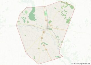
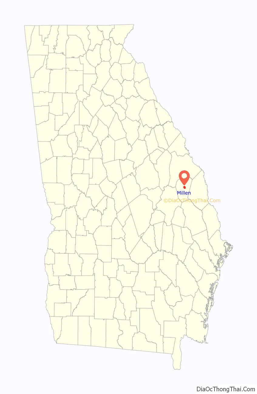
| County: | Jenkins County |
| Incorporated: | 1881 |
| Elevation: | 167 ft (51 m) |
| Total Area: | 3.60 sq mi (9.33 km²) |
| Land Area: | 3.58 sq mi (9.27 km²) |
| Water Area: | 0.02 sq mi (0.06 km²) |
| Total Population: | 2,966 |
| Population Density: | 828.72/sq mi (319.97/km²) |
| ZIP code: | 30442 |
| Area code: | 478 |
| FIPS code: | 1351520 |
| GNISfeature ID: | 0356393 |
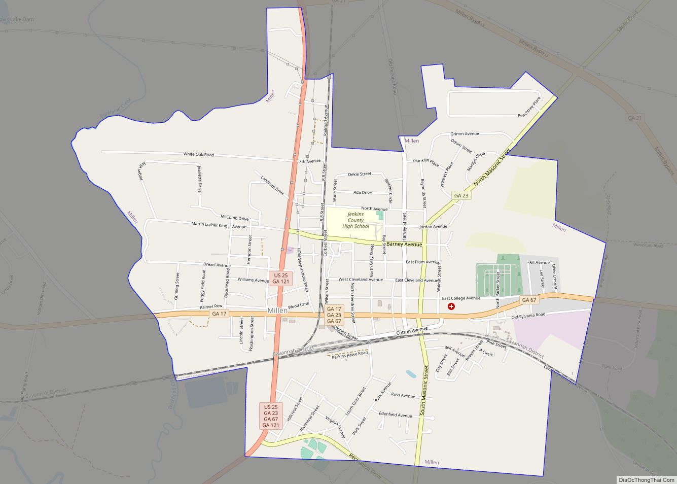
Online Interactive Map
Click on ![]() to view map in "full screen" mode.
to view map in "full screen" mode.
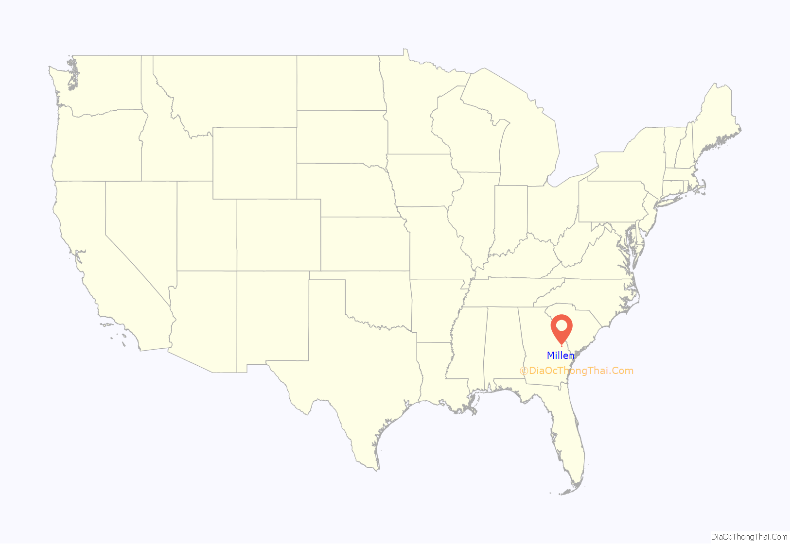
Millen location map. Where is Millen city?
History
Millen was first settled in 1835 along the border of what was then Burke and Screven counties. It was originally named “79” due to its approximate distance in miles from the coastal city of Savannah. Planters cultivated cotton as a commodity crop.
In 1854, the Central of Georgia Railway and the Georgia Railroad connected at 79. The town became known as “Millen’s Junction” after McPherson B. Millen, the superintendent of the Central of Georgia Railway.
During the Civil War, a site for a prisoner-of-war camp to house Union soldiers was chosen about five miles from Millen’s Junction. Camp Lawton included a hospital, fort and officer housing and had about 8,600 prisoners confined there on 14 November 1864, according to a detailed camp map made by a former prisoner. It was built in what is today Magnolia Springs State Park, because the location was favorable due to the springs providing potable water and its proximity to the Augusta and Savannah Railroad. On December 3, 1864, Sherman’s March to the Sea passed through Millen. Prior to the arrival of Union forces, Confederate soldiers evacuated the Camp Lawton prisoners to Savannah. The Union soldiers destroyed Millen’s Junction after finding the prison camp and to avoid use of the railway junction.
The town was rebuilt after the war. In 1881, the city of Millen was incorporated by an act of the Georgia State Legislature, becoming the county seat of the newly created Jenkins County in 1905. The summer of 1919 was called the Red Summer due to a number of race riots throughout America. Millen did not escape this and white mobs burned down and killed a number of people in Millen during the Jenkins County, Georgia, riot of 1919.
The Downtown Millen Historic District was listed on the National Register of Historic Places in 1996. The county is largely rural and agricultural.
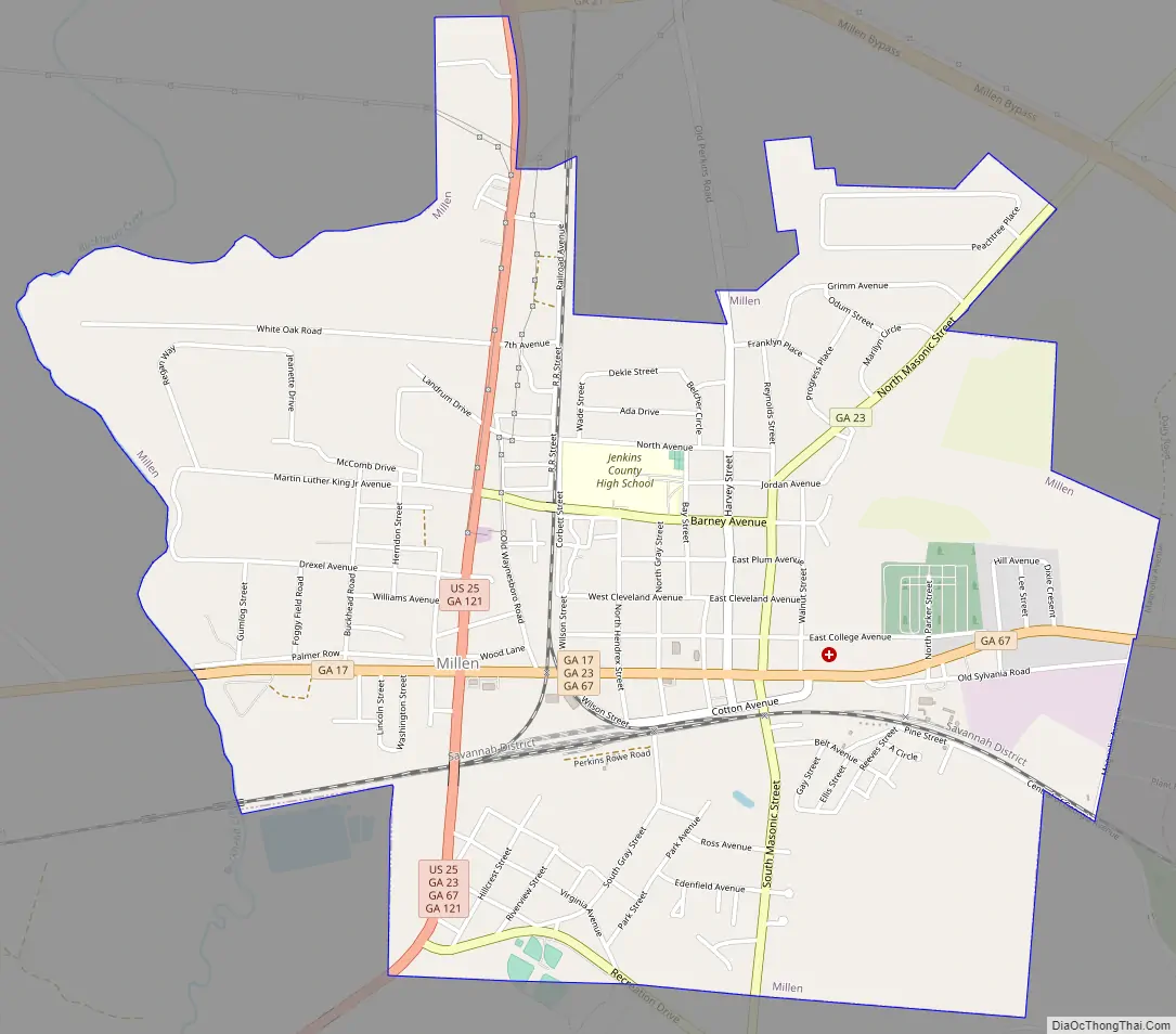
Millen Road Map
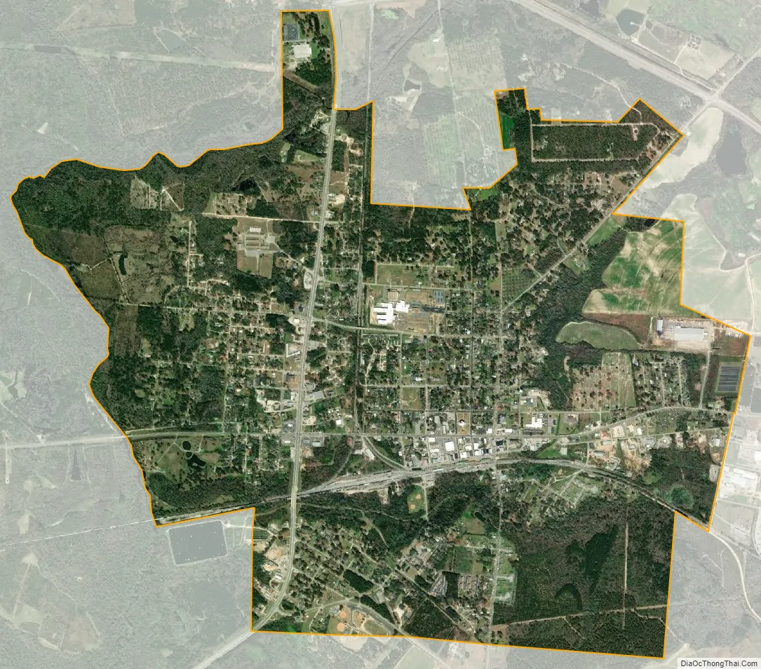
Millen city Satellite Map
Geography
Millen is the only incorporated municipality in Jenkins County. It is located on the east side of the Ogeechee River. U.S. Route 25 passes through the west side of the city, leading north 20 miles (32 km) to Waynesboro and south 29 miles (47 km) to Statesboro. Georgia State Route 17 passes through the center of the city, entering from the west as Winthrope Avenue and leaving to the south as Masonic Street. SR-17 leads northwest 35 miles (56 km) to Louisville and southeast 77 miles (124 km) to Savannah. State Route 21 bypasses Millen to the northeast, ending at US 25 at the northern city limit. SR-21 leads east 20 miles (32 km) to Sylvania.
According to the United States Census Bureau, Millen has a total area of 3.6 square miles (9.3 km), of which 0.02 square miles (0.06 km), or 0.67%, are water.
See also
Map of Georgia State and its subdivision:- Appling
- Atkinson
- Bacon
- Baker
- Baldwin
- Banks
- Barrow
- Bartow
- Ben Hill
- Berrien
- Bibb
- Bleckley
- Brantley
- Brooks
- Bryan
- Bulloch
- Burke
- Butts
- Calhoun
- Camden
- Candler
- Carroll
- Catoosa
- Charlton
- Chatham
- Chattahoochee
- Chattooga
- Cherokee
- Clarke
- Clay
- Clayton
- Clinch
- Cobb
- Coffee
- Colquitt
- Columbia
- Cook
- Coweta
- Crawford
- Crisp
- Dade
- Dawson
- Decatur
- DeKalb
- Dodge
- Dooly
- Dougherty
- Douglas
- Early
- Echols
- Effingham
- Elbert
- Emanuel
- Evans
- Fannin
- Fayette
- Floyd
- Forsyth
- Franklin
- Fulton
- Gilmer
- Glascock
- Glynn
- Gordon
- Grady
- Greene
- Gwinnett
- Habersham
- Hall
- Hancock
- Haralson
- Harris
- Hart
- Heard
- Henry
- Houston
- Irwin
- Jackson
- Jasper
- Jeff Davis
- Jefferson
- Jenkins
- Johnson
- Jones
- Lamar
- Lanier
- Laurens
- Lee
- Liberty
- Lincoln
- Long
- Lowndes
- Lumpkin
- Macon
- Madison
- Marion
- McDuffie
- McIntosh
- Meriwether
- Miller
- Mitchell
- Monroe
- Montgomery
- Morgan
- Murray
- Muscogee
- Newton
- Oconee
- Oglethorpe
- Paulding
- Peach
- Pickens
- Pierce
- Pike
- Polk
- Pulaski
- Putnam
- Quitman
- Rabun
- Randolph
- Richmond
- Rockdale
- Schley
- Screven
- Seminole
- Spalding
- Stephens
- Stewart
- Sumter
- Talbot
- Taliaferro
- Tattnall
- Taylor
- Telfair
- Terrell
- Thomas
- Tift
- Toombs
- Towns
- Treutlen
- Troup
- Turner
- Twiggs
- Union
- Upson
- Walker
- Walton
- Ware
- Warren
- Washington
- Wayne
- Webster
- Wheeler
- White
- Whitfield
- Wilcox
- Wilkes
- Wilkinson
- Worth
- Alabama
- Alaska
- Arizona
- Arkansas
- California
- Colorado
- Connecticut
- Delaware
- District of Columbia
- Florida
- Georgia
- Hawaii
- Idaho
- Illinois
- Indiana
- Iowa
- Kansas
- Kentucky
- Louisiana
- Maine
- Maryland
- Massachusetts
- Michigan
- Minnesota
- Mississippi
- Missouri
- Montana
- Nebraska
- Nevada
- New Hampshire
- New Jersey
- New Mexico
- New York
- North Carolina
- North Dakota
- Ohio
- Oklahoma
- Oregon
- Pennsylvania
- Rhode Island
- South Carolina
- South Dakota
- Tennessee
- Texas
- Utah
- Vermont
- Virginia
- Washington
- West Virginia
- Wisconsin
- Wyoming