Tunnel Hill is a town in northwest Whitfield County and southern Catoosa County, Georgia, United States. It is part of the Dalton Metropolitan Statistical Area. The population was 963 at the 2020 census. The town is named for the Chetoogeta Mountain Tunnel, a 1,497-foot (456 m) railroad tunnel built in the late 1840s.
| Name: | Tunnel Hill city |
|---|---|
| LSAD Code: | 25 |
| LSAD Description: | city (suffix) |
| State: | Georgia |
| County: | Whitfield County |
| Elevation: | 840 ft (256 m) |
| Total Area: | 1.98 sq mi (5.13 km²) |
| Land Area: | 1.97 sq mi (5.11 km²) |
| Water Area: | 0.01 sq mi (0.02 km²) |
| Total Population: | 963 |
| Population Density: | 488.09/sq mi (188.48/km²) |
| ZIP code: | 30755 |
| Area code: | 706/762 |
| FIPS code: | 1377736 |
| GNISfeature ID: | 0333273 |
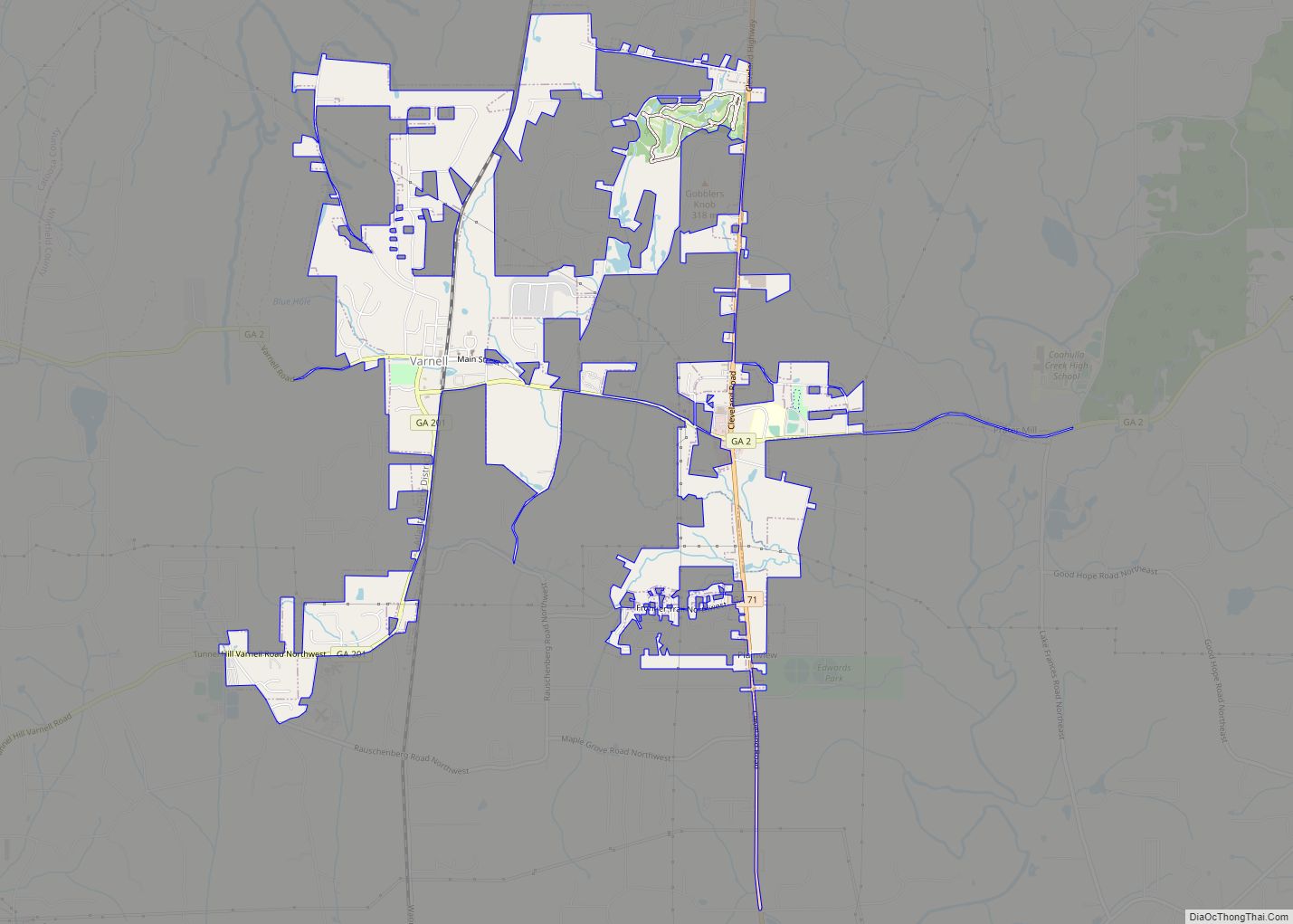
Online Interactive Map
Click on ![]() to view map in "full screen" mode.
to view map in "full screen" mode.
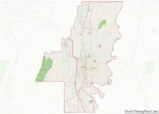
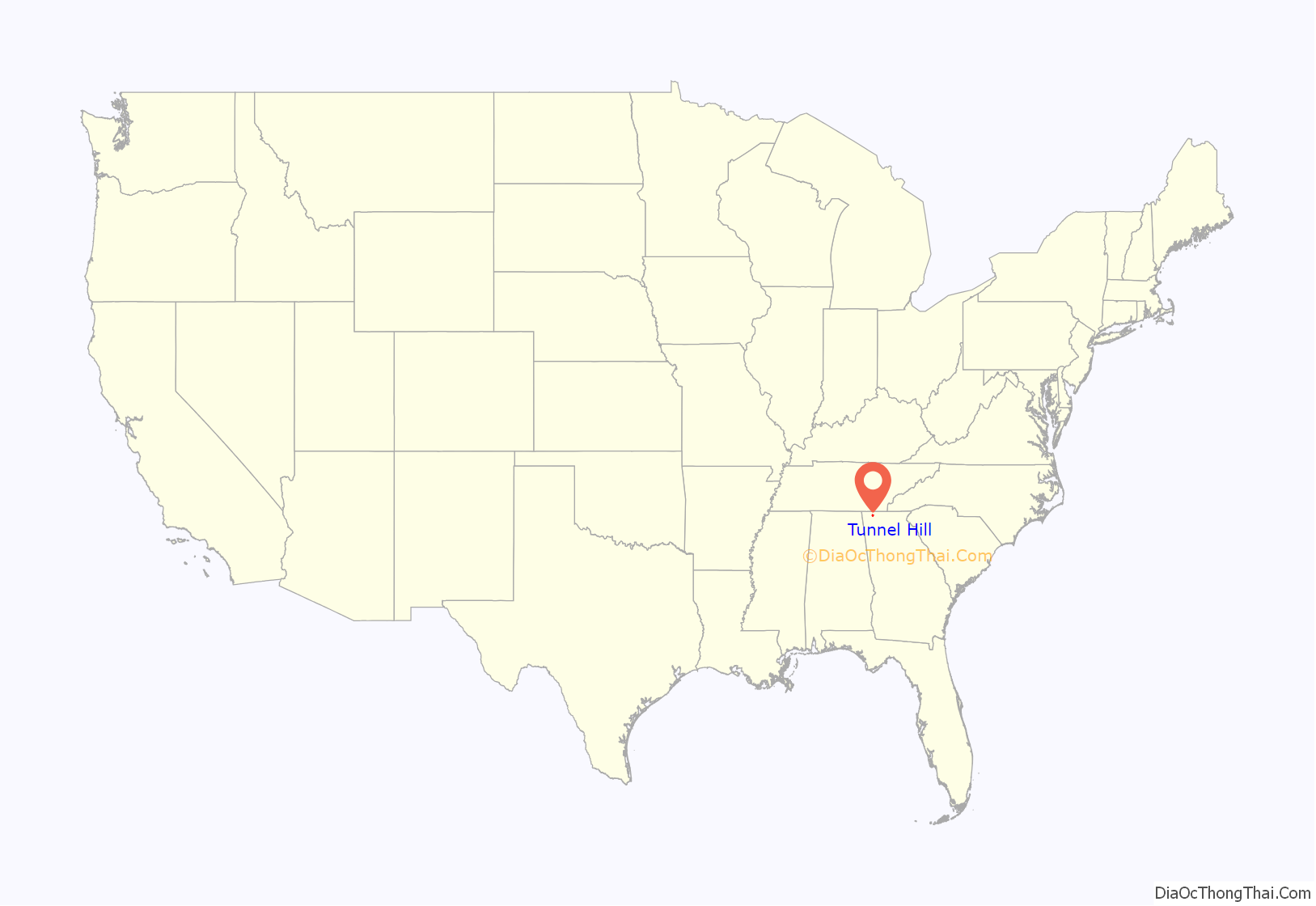
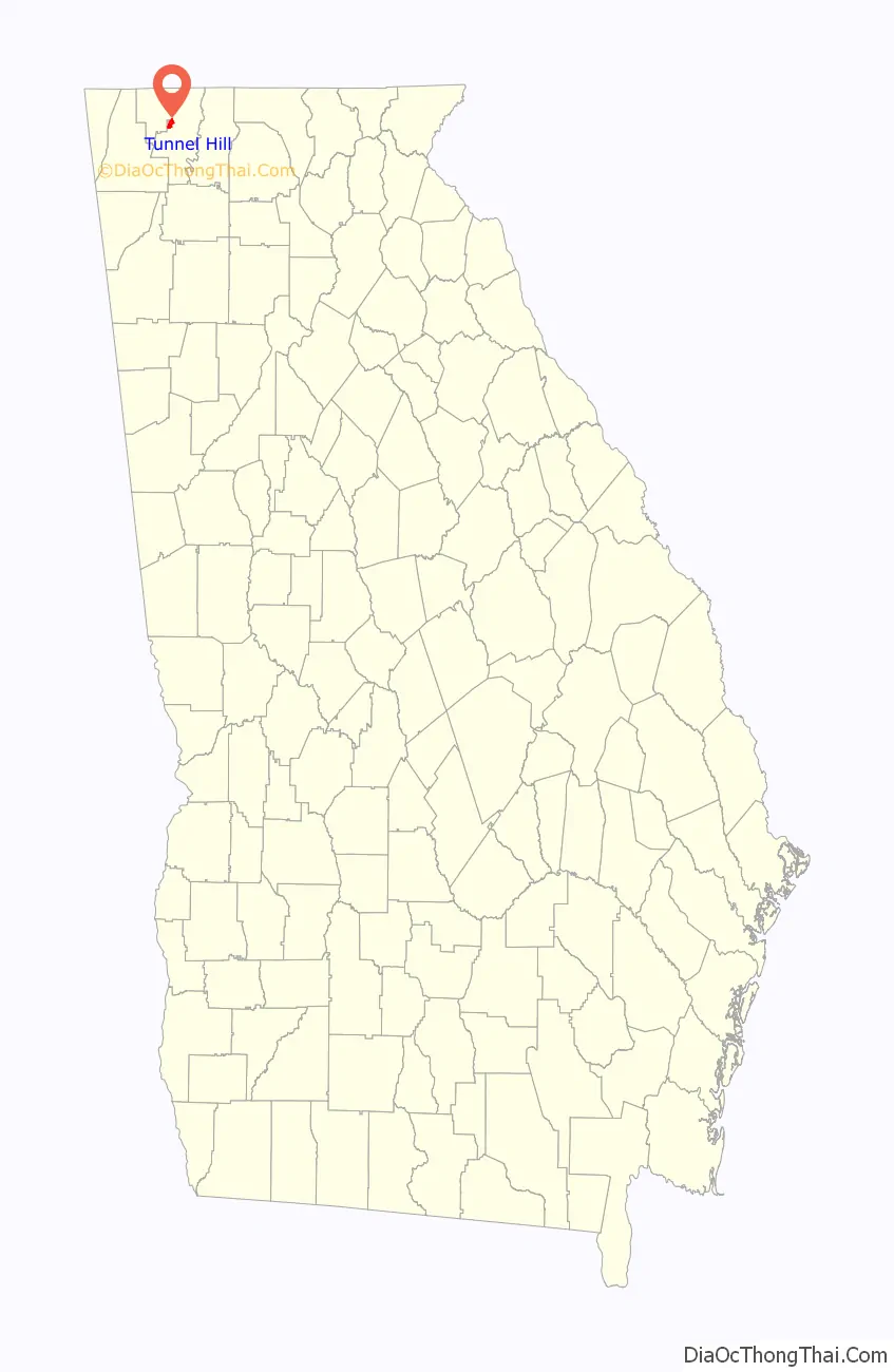
Tunnel Hill location map. Where is Tunnel Hill city?
History
The community was first known as Doe Run. It was incorporated on March 4, 1848, as Tunnelsville, and changed its name in 1856 to Tunnel Hill. Both names refer to the nearby 1,497-foot (456 m) Chetoogeta Mountain Tunnel railroad tunnel cut through Chetoogeta Mountain, officially dedicated on October 31, 1849 by Etowah steel-maker Mark A. Cooper on behalf of the state-owned Western & Atlantic Railroad.
The Georgia General Assembly incorporated Tunnel Hill as a town in 1856.
Throughout the American Civil War, the homes around Tunnel Hill were used as part of a major hospital system. The Clisby Austin House also served as the headquarters for Union Gen. William T. Sherman while he made his plans for attacks against nearby Dalton and Resaca, which became the opening battles of what would later be known as the Atlanta Campaign. The area hosted many engagements and camps throughout the course of the war. These are remembered through an annual Battle Reenactment held in September.
The dates of the actual military engagements were September 11, 1863; February 23, 24-25 1864; May 5–7, 1864; and March 3, 1865.
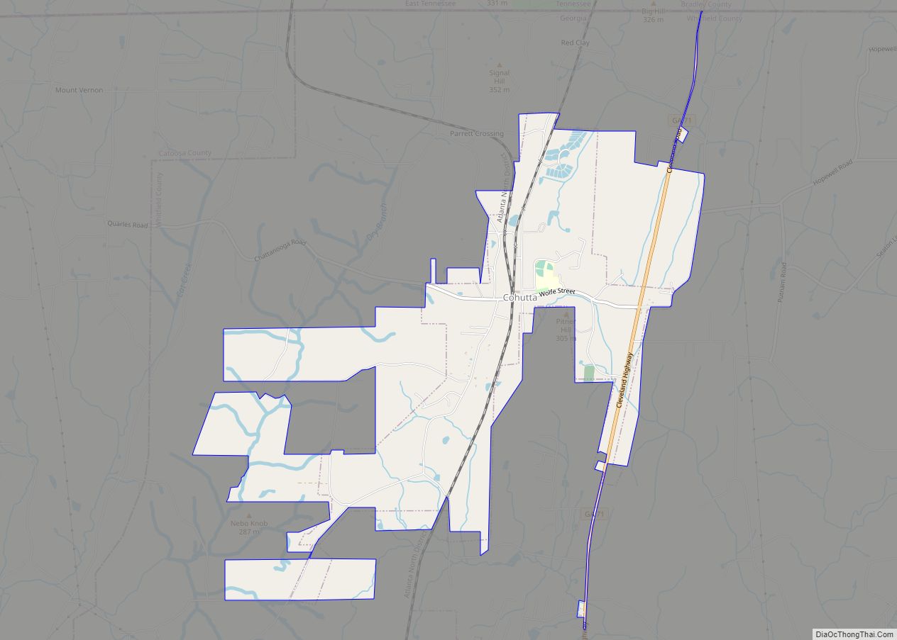
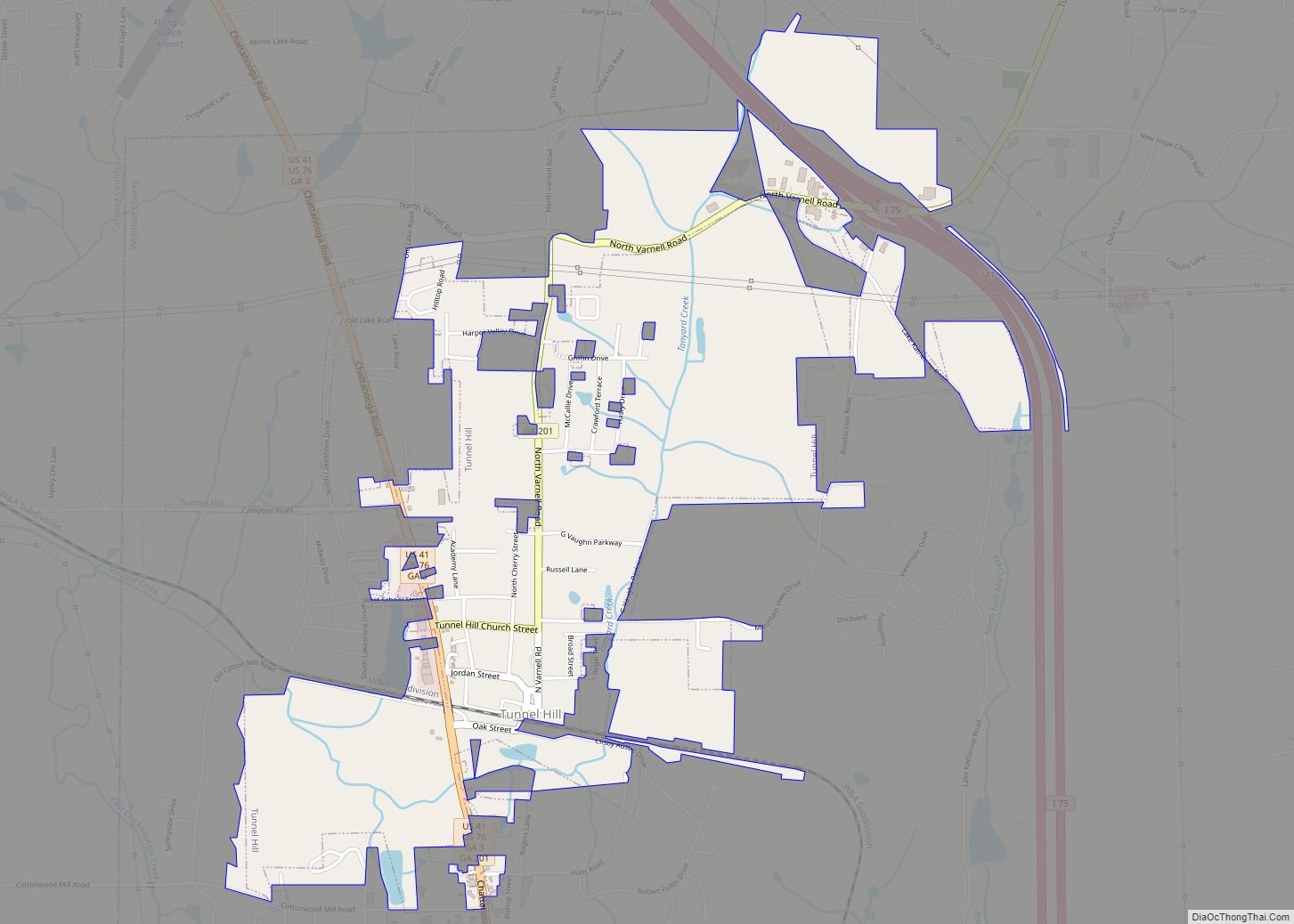
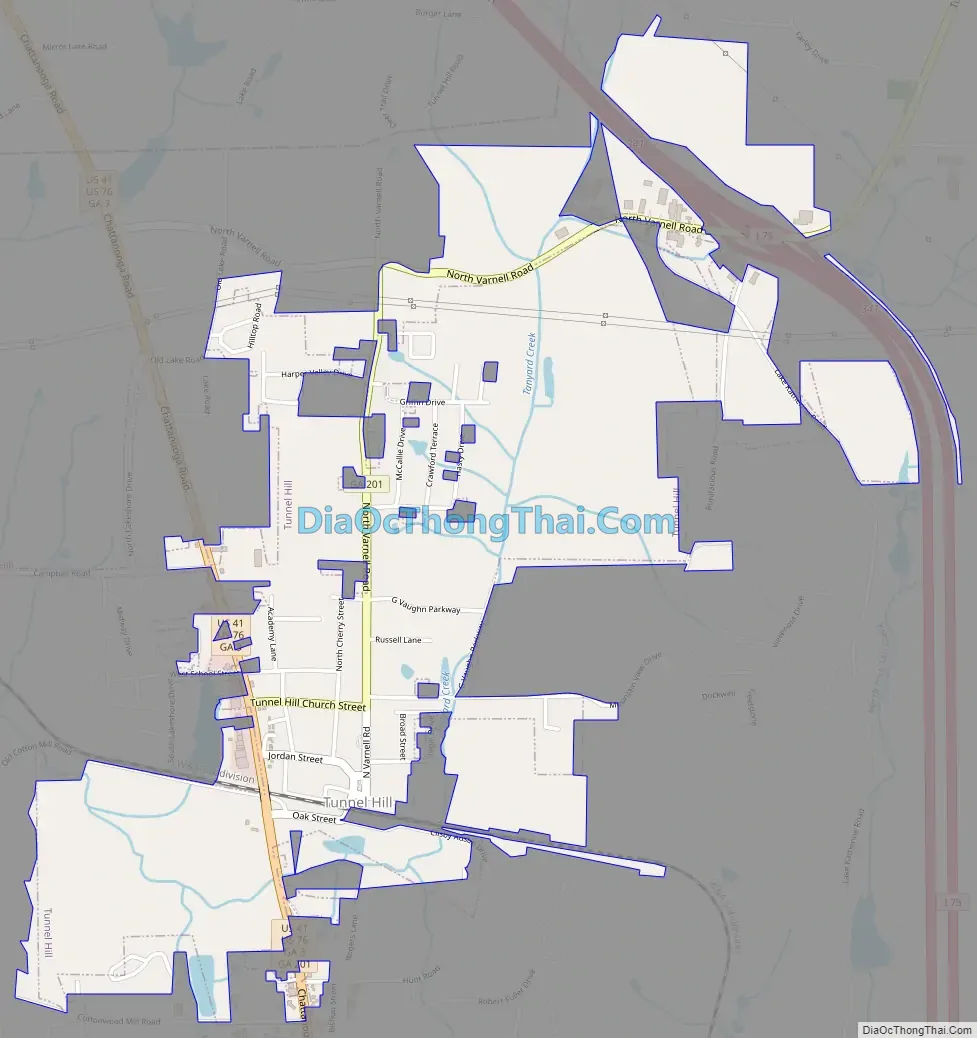
Tunnel Hill Road Map
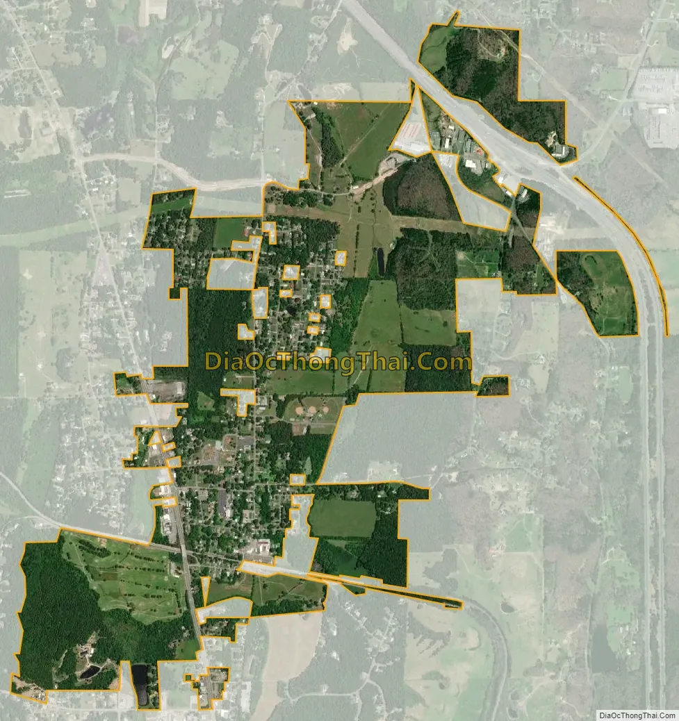
Tunnel Hill city Satellite Map
Geography
Tunnel Hill is located at 34°50′45″N 85°2′35″W / 34.84583°N 85.04306°W / 34.84583; -85.04306 (34.845934, -85.042955). The town is situated in a rugged area along the western base of Chetoogeta Mountain (listed as “Tunnel Hill Ridge” on USGS maps). The Tennessee Valley Divide crosses the top of the ridge, dividing the watersheds of the Tennessee River and the Conasauga River. U.S. Route 41 connects Tunnel Hill to Ringgold to the northwest and Dalton to the southeast. Georgia State Route 201 connects the town with Varnell to the northeast.
According to the United States Census Bureau, the city has a total area of 1.5 square miles (3.9 km), all land.
See also
Map of Georgia State and its subdivision:- Appling
- Atkinson
- Bacon
- Baker
- Baldwin
- Banks
- Barrow
- Bartow
- Ben Hill
- Berrien
- Bibb
- Bleckley
- Brantley
- Brooks
- Bryan
- Bulloch
- Burke
- Butts
- Calhoun
- Camden
- Candler
- Carroll
- Catoosa
- Charlton
- Chatham
- Chattahoochee
- Chattooga
- Cherokee
- Clarke
- Clay
- Clayton
- Clinch
- Cobb
- Coffee
- Colquitt
- Columbia
- Cook
- Coweta
- Crawford
- Crisp
- Dade
- Dawson
- Decatur
- DeKalb
- Dodge
- Dooly
- Dougherty
- Douglas
- Early
- Echols
- Effingham
- Elbert
- Emanuel
- Evans
- Fannin
- Fayette
- Floyd
- Forsyth
- Franklin
- Fulton
- Gilmer
- Glascock
- Glynn
- Gordon
- Grady
- Greene
- Gwinnett
- Habersham
- Hall
- Hancock
- Haralson
- Harris
- Hart
- Heard
- Henry
- Houston
- Irwin
- Jackson
- Jasper
- Jeff Davis
- Jefferson
- Jenkins
- Johnson
- Jones
- Lamar
- Lanier
- Laurens
- Lee
- Liberty
- Lincoln
- Long
- Lowndes
- Lumpkin
- Macon
- Madison
- Marion
- McDuffie
- McIntosh
- Meriwether
- Miller
- Mitchell
- Monroe
- Montgomery
- Morgan
- Murray
- Muscogee
- Newton
- Oconee
- Oglethorpe
- Paulding
- Peach
- Pickens
- Pierce
- Pike
- Polk
- Pulaski
- Putnam
- Quitman
- Rabun
- Randolph
- Richmond
- Rockdale
- Schley
- Screven
- Seminole
- Spalding
- Stephens
- Stewart
- Sumter
- Talbot
- Taliaferro
- Tattnall
- Taylor
- Telfair
- Terrell
- Thomas
- Tift
- Toombs
- Towns
- Treutlen
- Troup
- Turner
- Twiggs
- Union
- Upson
- Walker
- Walton
- Ware
- Warren
- Washington
- Wayne
- Webster
- Wheeler
- White
- Whitfield
- Wilcox
- Wilkes
- Wilkinson
- Worth
- Alabama
- Alaska
- Arizona
- Arkansas
- California
- Colorado
- Connecticut
- Delaware
- District of Columbia
- Florida
- Georgia
- Hawaii
- Idaho
- Illinois
- Indiana
- Iowa
- Kansas
- Kentucky
- Louisiana
- Maine
- Maryland
- Massachusetts
- Michigan
- Minnesota
- Mississippi
- Missouri
- Montana
- Nebraska
- Nevada
- New Hampshire
- New Jersey
- New Mexico
- New York
- North Carolina
- North Dakota
- Ohio
- Oklahoma
- Oregon
- Pennsylvania
- Rhode Island
- South Carolina
- South Dakota
- Tennessee
- Texas
- Utah
- Vermont
- Virginia
- Washington
- West Virginia
- Wisconsin
- Wyoming