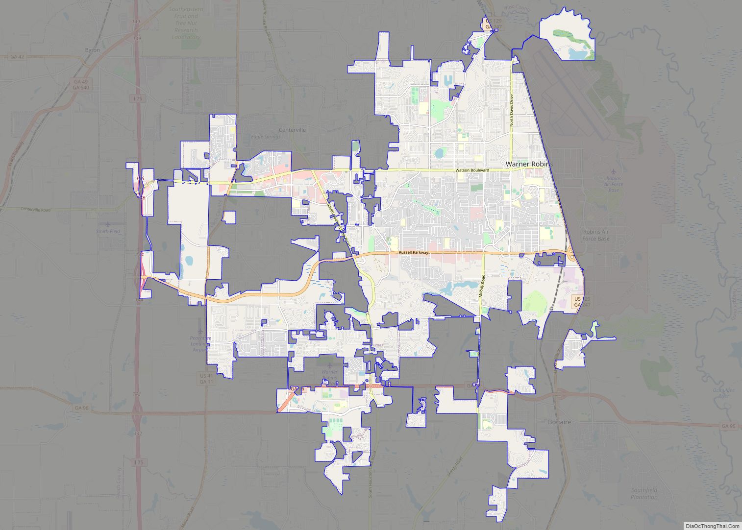
Warner Robins (typically /ˈwɑːrnɜːr ˈrɑːbənz/ wore-nur-RAH-bins) is a city in Houston and Peach counties in the U.S. state of Georgia. It is currently the state’s eleventh-largest incorporated city, with a population of 80,308 in the 2020 Census.
The city is the main component of the Warner Robins Metropolitan Statistical Area, including the entirety of Houston, Peach, and Pulaski counties, which had a census population of 201,469 in 2020; it, in turn, is a component of a larger trade area, the Macon–Warner Robins–Fort Valley Combined Statistical Area, with an estimated 2018 population of 423,572. Robins Air Force Base, a major U.S. Air Force maintenance and logistics complex that was founded as the Warner Robins Air Depot in 1942, is located just east of the city limits; the base’s expansion and the suburbanization of nearby Macon have led to the city’s rapid growth in the post-World War II era.
| Name: | Warner Robins city |
|---|---|
| LSAD Code: | 25 |
| LSAD Description: | city (suffix) |
| State: | Georgia |
| County: | Houston County, Peach County |
| Founded: | September 1, 1942 |
| Elevation: | 365 ft (93 m) |
| Land Area: | 37.78 sq mi (97.85 km²) |
| Water Area: | 0.32 sq mi (0.83 km²) 0.8% |
| Population Density: | 2,100/sq mi (810/km²) |
| Area code: | 478 |
| FIPS code: | 1380508 |
| GNISfeature ID: | 0333366 |
| Website: | wrga.gov |
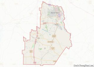
Online Interactive Map
Click on ![]() to view map in "full screen" mode.
to view map in "full screen" mode.
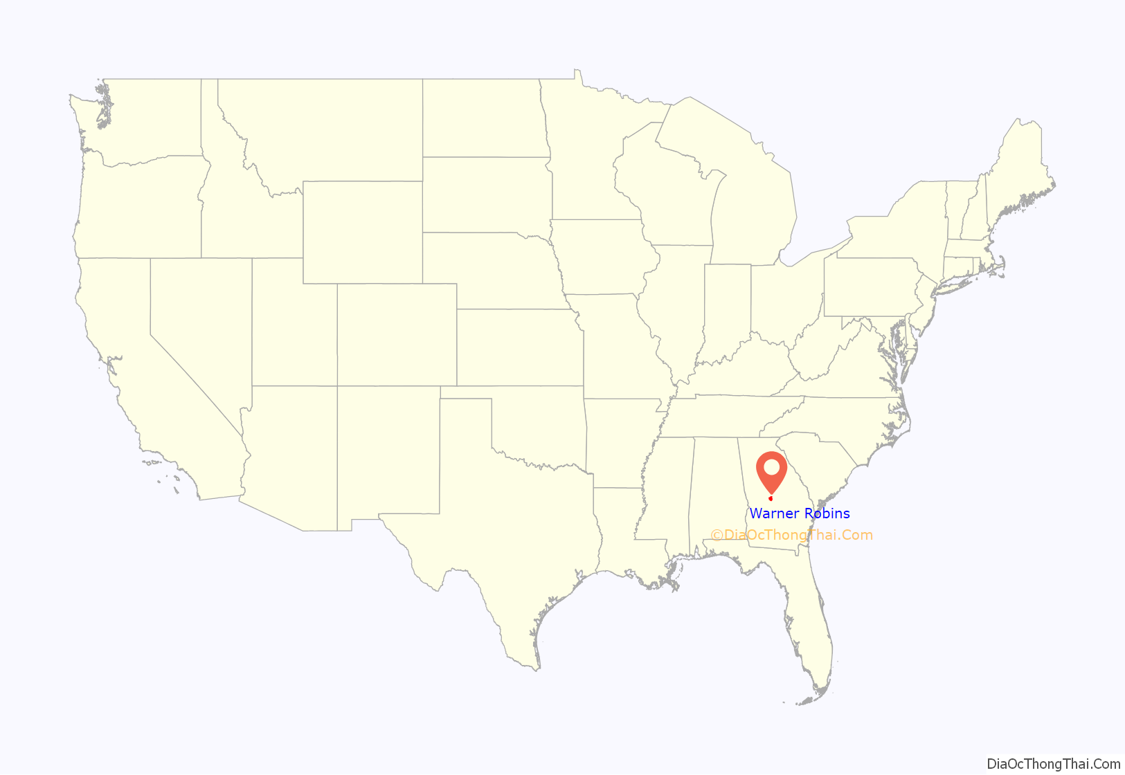
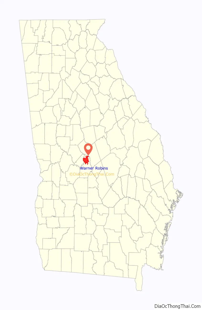
Warner Robins location map. Where is Warner Robins city?
History
Warner Robins was founded in 1942 when the small farming community of Wellston was renamed for General Augustine Warner Robins (1882-1940) of the United States Army Air Corps, which later became the United States Air Force. It was incorporated as a town in 1943 and as a city in 1956.
The 1940 census shows that the community of Wellston was sparsely populated and inhabited primarily by farmers and their families. Its most notable landmark was a stop on the railroad line. Wellston also had a small sawmill and a grocery store. Peach orchards covered parts of the surrounding land.
This changed during World War II. The War Department made plans to build an air depot in the Southeast. With the assistance of influential U.S. Representative Carl Vinson, Wellston community leader Charles Bostic “Boss” Watson worked with officials in Macon to make a bid to locate this air depot in Houston County. In June 1941, the U.S. government accepted this offer, which included 3,108 acres (12.58 km) of land.
This air force base was initially called Wellston Army Air Depot when it opened in 1942. The first commander was Colonel Charles E. Thomas. He wanted to name this depot in honor of his mentor Augustine Warner Robins, who was called by his middle name, Warner. Regulations prevented him from doing this, which required the base to be named after the nearest town. Not deterred by this, Colonel Thomas persuaded Boss Watson and the other community leaders to rename the town of Wellston. So on September 1, 1942, the town was given the new name of Warner Robins. Soon thereafter, on October 14, 1942, the base was renamed to become Warner Robins Army Air Depot. The city has a unique name, shared with no other town in the United States.
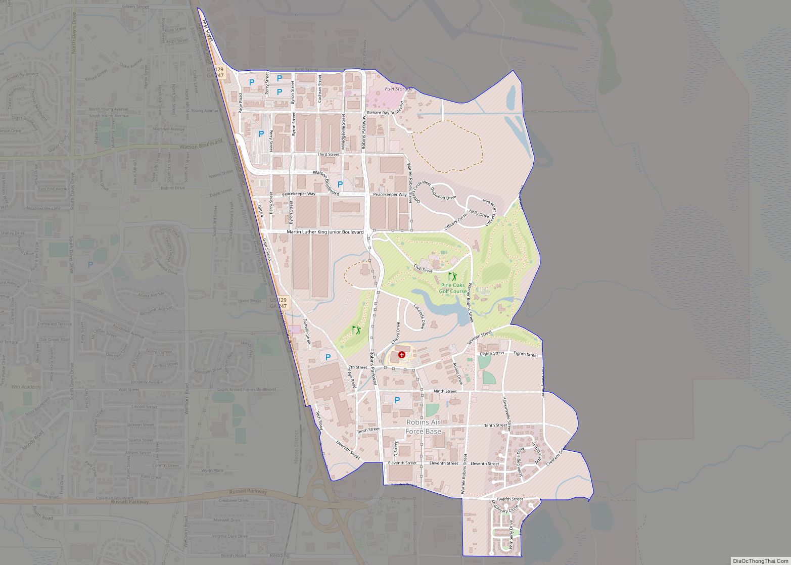
Robins Air Force Base is not within the city limits of the town but is across U.S. Highway 129 (Georgia State Highway 247), which serves as a boundary between the base and the city.
In 2018, First Solar announced a project for a 200-megawatt, 2,000-acre (8.1 km) solar panel facility in Twiggs County east of Warner Robins. The facility would be the largest solar facility in the southeast.
Tornadoes
Tornadoes have continually plagued the city since its inception with the 1950s seeing at least four catastrophic tornadoes strike the area. The first one occurred on April 30, 1953, when an F4 tornado with winds of over 200 mph hit the city and portions of Robins Air Force Base, killing 18 people and injuring 300 more. That same day, a second tornado that was rated F2 damaged the northwest side of town. Just ten months later on March 13, 1954, a long-tracked F1 tornado struck the town, killing one and injuring five. Three years later, on April 5, 1957, a long-tracked F2 tornado family hit the northwest side of the city, causing considerable damage. To date, at least nine tornadoes have hit the town and the surrounding area.
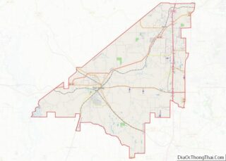
Warner Robins Road Map
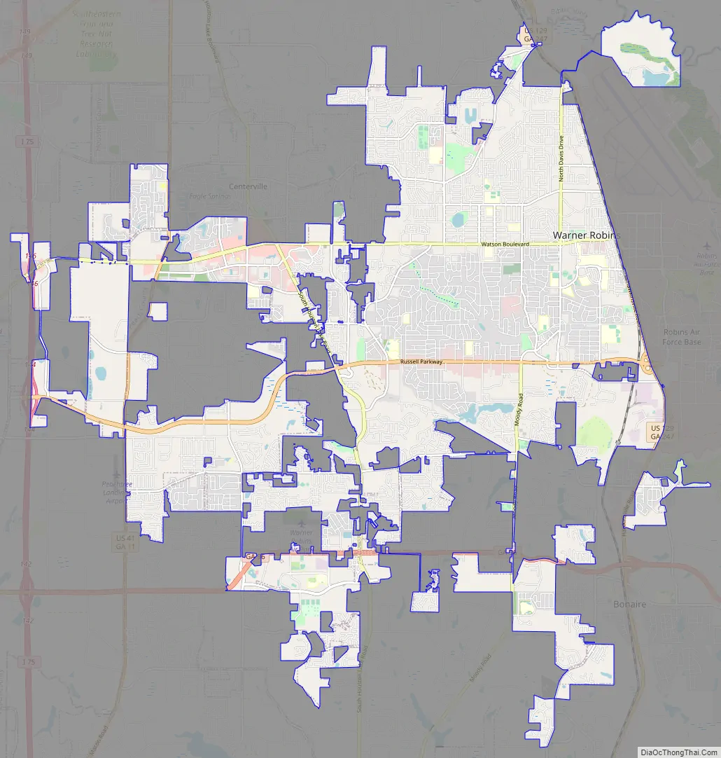
Warner Robins city Satellite Map

Geography
Warner Robins is located at 32°36′31″N 83°38′17″W / 32.60861°N 83.63806°W / 32.60861; -83.63806 (32.608720ºN, −83.638027ºE). It is approximately 20 miles (32 km) south of Macon and 100 miles (160 km) south of Atlanta.
According to the United States Census Bureau, the city has a total area of 35.4 square miles (92 km), of which 35.1 square miles (91 km) is land and 0.3 square miles (0.78 km) (0.82%) is water.
See also
Map of Georgia State and its subdivision:- Appling
- Atkinson
- Bacon
- Baker
- Baldwin
- Banks
- Barrow
- Bartow
- Ben Hill
- Berrien
- Bibb
- Bleckley
- Brantley
- Brooks
- Bryan
- Bulloch
- Burke
- Butts
- Calhoun
- Camden
- Candler
- Carroll
- Catoosa
- Charlton
- Chatham
- Chattahoochee
- Chattooga
- Cherokee
- Clarke
- Clay
- Clayton
- Clinch
- Cobb
- Coffee
- Colquitt
- Columbia
- Cook
- Coweta
- Crawford
- Crisp
- Dade
- Dawson
- Decatur
- DeKalb
- Dodge
- Dooly
- Dougherty
- Douglas
- Early
- Echols
- Effingham
- Elbert
- Emanuel
- Evans
- Fannin
- Fayette
- Floyd
- Forsyth
- Franklin
- Fulton
- Gilmer
- Glascock
- Glynn
- Gordon
- Grady
- Greene
- Gwinnett
- Habersham
- Hall
- Hancock
- Haralson
- Harris
- Hart
- Heard
- Henry
- Houston
- Irwin
- Jackson
- Jasper
- Jeff Davis
- Jefferson
- Jenkins
- Johnson
- Jones
- Lamar
- Lanier
- Laurens
- Lee
- Liberty
- Lincoln
- Long
- Lowndes
- Lumpkin
- Macon
- Madison
- Marion
- McDuffie
- McIntosh
- Meriwether
- Miller
- Mitchell
- Monroe
- Montgomery
- Morgan
- Murray
- Muscogee
- Newton
- Oconee
- Oglethorpe
- Paulding
- Peach
- Pickens
- Pierce
- Pike
- Polk
- Pulaski
- Putnam
- Quitman
- Rabun
- Randolph
- Richmond
- Rockdale
- Schley
- Screven
- Seminole
- Spalding
- Stephens
- Stewart
- Sumter
- Talbot
- Taliaferro
- Tattnall
- Taylor
- Telfair
- Terrell
- Thomas
- Tift
- Toombs
- Towns
- Treutlen
- Troup
- Turner
- Twiggs
- Union
- Upson
- Walker
- Walton
- Ware
- Warren
- Washington
- Wayne
- Webster
- Wheeler
- White
- Whitfield
- Wilcox
- Wilkes
- Wilkinson
- Worth
- Alabama
- Alaska
- Arizona
- Arkansas
- California
- Colorado
- Connecticut
- Delaware
- District of Columbia
- Florida
- Georgia
- Hawaii
- Idaho
- Illinois
- Indiana
- Iowa
- Kansas
- Kentucky
- Louisiana
- Maine
- Maryland
- Massachusetts
- Michigan
- Minnesota
- Mississippi
- Missouri
- Montana
- Nebraska
- Nevada
- New Hampshire
- New Jersey
- New Mexico
- New York
- North Carolina
- North Dakota
- Ohio
- Oklahoma
- Oregon
- Pennsylvania
- Rhode Island
- South Carolina
- South Dakota
- Tennessee
- Texas
- Utah
- Vermont
- Virginia
- Washington
- West Virginia
- Wisconsin
- Wyoming