Georgia is a state in the Southeastern region of the United States, bordered to the north by Tennessee and North Carolina; to the northeast by South Carolina; to the southeast by the Atlantic Ocean; to the south by Florida; and to the west by Alabama. Georgia is the 24th-largest state in area and 8th most populous of the 50 United States. Its 2020 population was 10,711,908, according to the U.S. Census Bureau. Atlanta, a “beta(+)” global city, is both the state’s capital and its largest city. The Atlanta metropolitan area, with a population of more than 6 million people in 2021, is the 8th most populous metropolitan area in the United States and contains about 57% of Georgia’s entire population.
Founded in 1732 as the Province of Georgia and first settled in 1733, Georgia became a British royal colony in 1752. It was the last and southernmost of the original Thirteen Colonies to be established. Named after King George II of Great Britain, the Georgia Colony covered the area from South Carolina south to Spanish Florida and west to French Louisiana at the Mississippi River. On January 2, 1788, Georgia became the fourth state to ratify the United States Constitution. From 1802 to 1804, western Georgia was split to form the Mississippi Territory, which later was admitted as the U.S. states of Alabama and Mississippi. Georgia declared its secession from the Union on January 19, 1861, and was one of the original seven Confederate States. Following the Civil War, it was the last state to be restored to the Union, on July 15, 1870. In the post-Reconstruction era of the late 19th century, Georgia’s economy was transformed as a group of prominent politicians, businessmen, and journalists, led by Henry W. Grady, espoused the “New South” philosophy of sectional reconciliation, industrialization, and white supremacy. During the mid-20th century, several Georgians, most notably Martin Luther King Jr., were prominent leaders during the civil rights movement. Atlanta was selected as host of the 1996 Summer Olympics, which marked the 100th anniversary of the modern Olympic Games. Since 1945, Georgia has seen substantial population and economic growth as part of the broader Sun Belt phenomenon. From 2007 to 2008, 14 of Georgia’s counties ranked among the nation’s 100 fastest-growing.
Georgia is defined by a diversity of landscapes, flora, and fauna. The state’s northernmost regions include the Blue Ridge Mountains, part of the larger Appalachian Mountain system. The Piedmont plateau extends from the foothills of the Blue Ridge south to the Fall Line, an escarpment to the Coastal Plain defining the state’s southern region. Georgia’s highest point is Brasstown Bald at 4,784 feet (1,458 m) above sea level; the lowest is the Atlantic Ocean. With the exception of some high-altitude areas in the Blue Ridge, the entirety of the state has a humid subtropical climate. Of the states entirely east of the Mississippi River, Georgia is the largest in land area.
| Before statehood: | Province of Georgia |
|---|---|
| Admitted to the Union: | January 2, 1788; 235 years ago (1788-01-02) (4th) |
| Capital: | Atlanta |
| Capital – largest city: | largest city |
| Largest metro and urban areas: | Atlanta |
| Elevation: | 600 ft (180 m) |
| Total Area: | 59,425 sq mi (153,909 km) |
| Area Rank: | 24th |
| Total Population: | 10,711,908 |
| Population Rank: | 8th |
| Population Density: | 185.2/sq mi (71.5/km) |
| Population Density Rank: | 18th |
| Median Household Income: | $61,200 |
| Income Rank: | 29th |
| Demonym(s): | Georgian |
| USPS abbreviation: | GA |
| ISO 3166 code: | US-GA |
| Website: | www.georgia.gov |
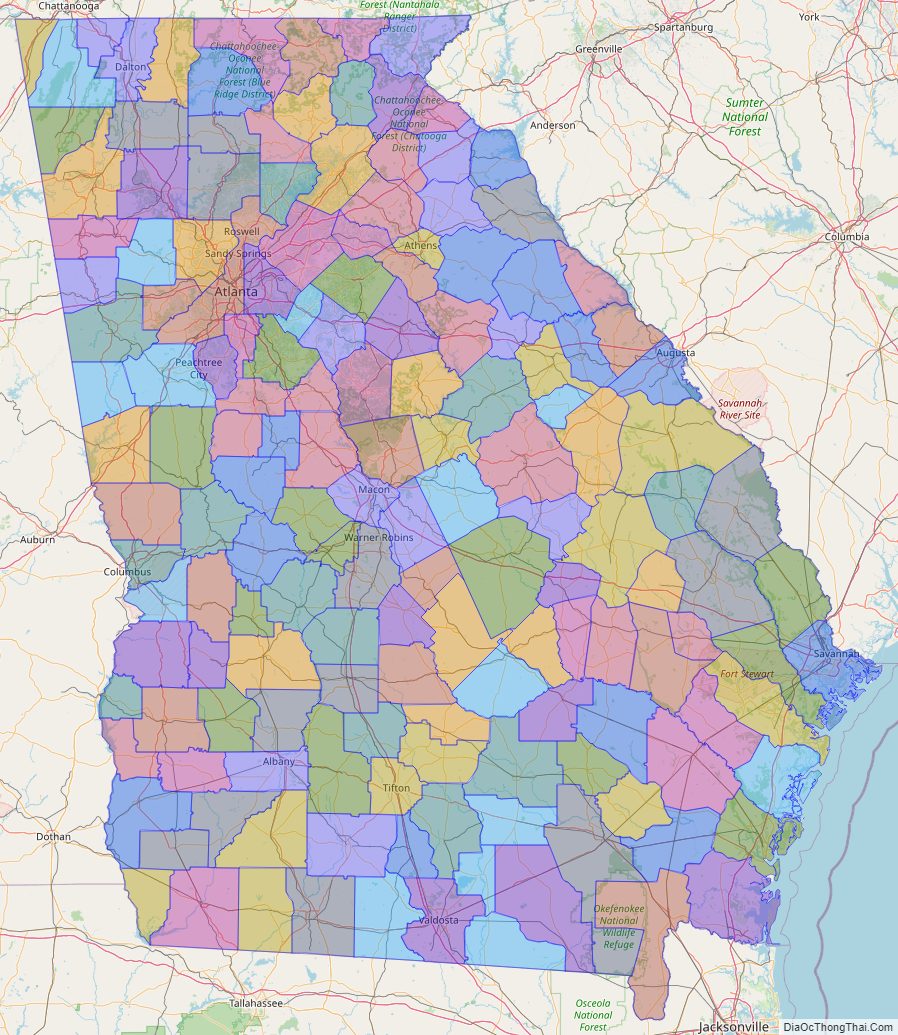
Online Interactive Map
Click on ![]() to view map in "full screen" mode.
to view map in "full screen" mode.
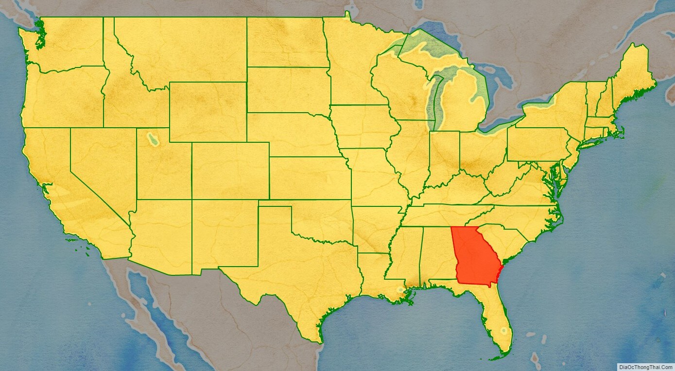
Georgia location map. Where is Georgia state?
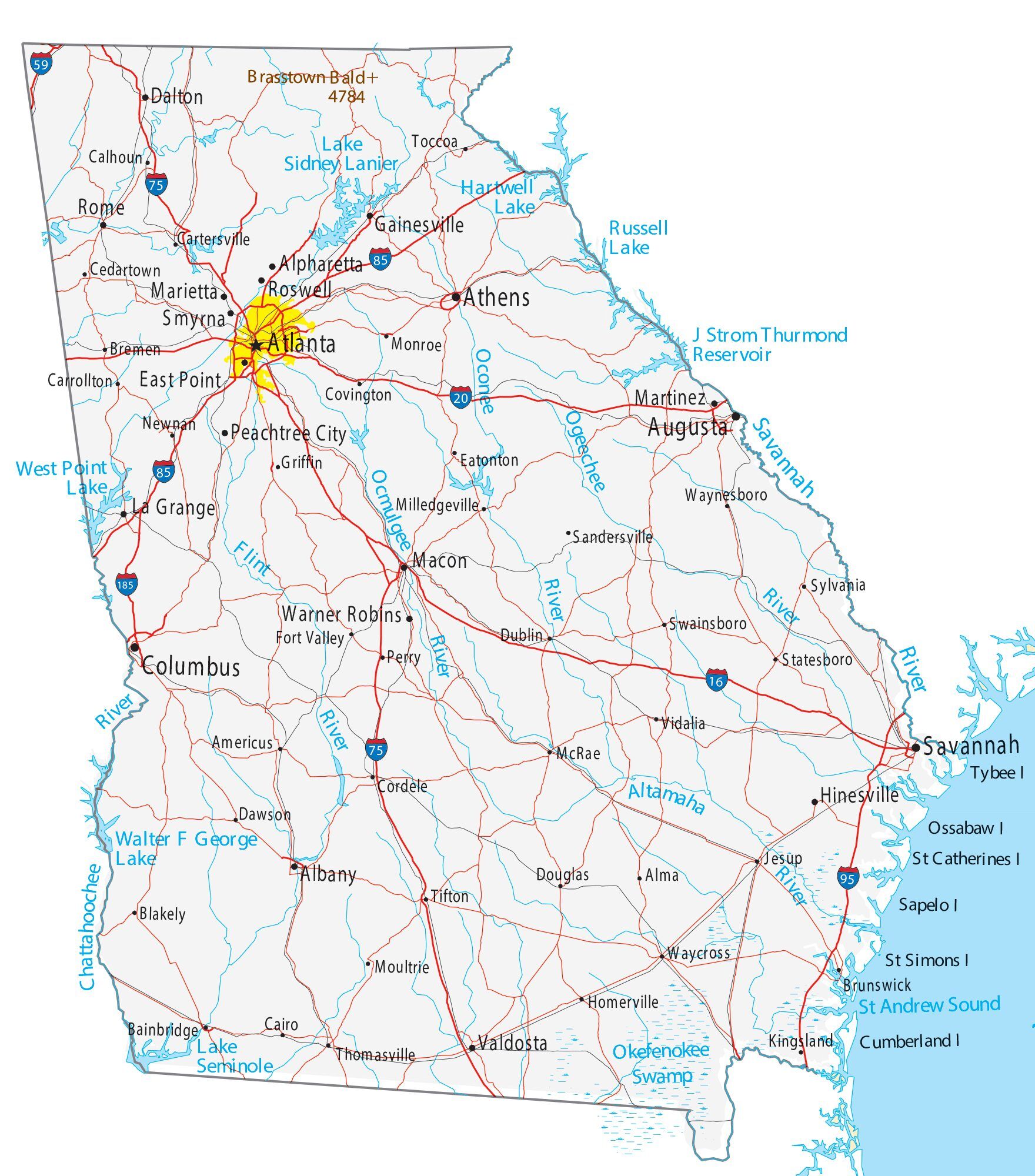
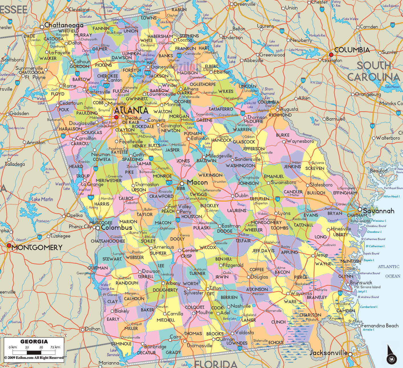
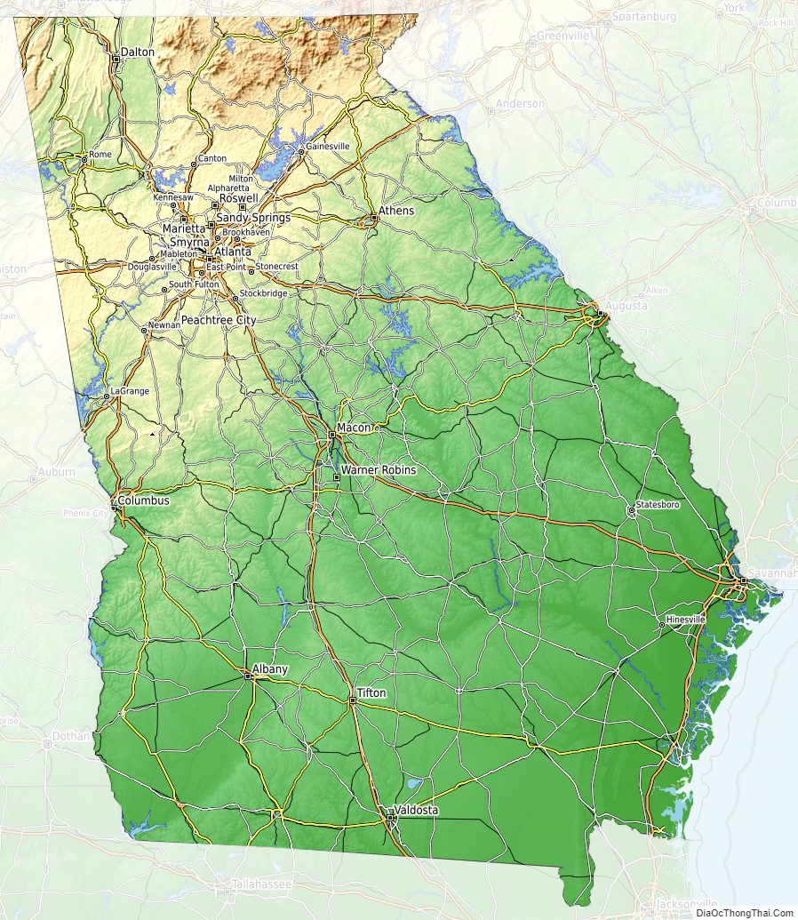
Georgia Road Map
Georgia Map – Roads & Cities
Georgia Street Map
History
Before settlement by Europeans, Georgia was inhabited by the mound building cultures. The British colony of Georgia was founded by James Oglethorpe on February 12, 1733. The colony was administered by the Trustees for the Establishment of the Colony of Georgia in America under a charter issued by (and named for) King George II. The Trustees implemented an elaborate plan for the colony’s settlement, known as the Oglethorpe Plan, which envisioned an agrarian society of yeoman farmers and prohibited slavery. The colony was invaded by the Spanish in 1742, during the War of Jenkins’ Ear. In 1752, after the government failed to renew subsidies that had helped support the colony, the Trustees turned over control to the crown. Georgia became a crown colony, with a governor appointed by the king.
The Province of Georgia was one of the Thirteen Colonies that revolted against British rule in the American Revolution by signing the 1776 Declaration of Independence. The State of Georgia’s first constitution was ratified in February 1777. Georgia was the 10th state to ratify the Articles of Confederation on July 24, 1778, and was the 4th state to ratify the United States Constitution on January 2, 1788.
After the Creek War (1813–1814), General Andrew Jackson forced the Muscogee (Creek) tribes to surrender land to the state of Georgia, including in the Treaty of Fort Jackson (1814), surrendering 21 million acres in what is now southern Georgia and central Alabama, and the Treaty of Indian Springs (1825). In 1829, gold was discovered in the North Georgia mountains leading to the Georgia Gold Rush and establishment of a federal mint in Dahlonega, which continued in operation until 1861. The resulting influx of white settlers put pressure on the government to take land from the Cherokee Nation. In 1830, President Andrew Jackson signed the Indian Removal Act, sending many eastern Native American nations to reservations in present-day Oklahoma, including all of Georgia’s tribes. Despite the Supreme Court’s ruling in Worcester v. Georgia (1832) that U.S. states were not permitted to redraw Indian boundaries, President Jackson and the state of Georgia ignored the ruling. In 1838, his successor, Martin Van Buren, dispatched federal troops to gather the tribes and deport them west of the Mississippi. This forced relocation, known as the Trail of Tears, led to the death of more than four thousand Cherokees.
In early 1861, Georgia joined the Confederacy (with secessionists having a slight majority of delegates) and became a major theater of the Civil War. Major battles took place at Chickamauga, Kennesaw Mountain, and Atlanta. In December 1864, a large swath of the state from Atlanta to Savannah was destroyed during General William Tecumseh Sherman’s March to the Sea. 18,253 Georgian soldiers died in service, roughly one of every five who served. In 1870, following the Reconstruction era, Georgia became the last Confederate state to be restored to the Union.
With white Democrats having regained power in the state legislature, they passed a poll tax in 1877, which disenfranchised many poor black (and some white) people, preventing them from registering. In 1908, the state established a white primary; with the only competitive contests within the Democratic Party, it was another way to exclude black people from politics. They constituted 46.7% of the state’s population in 1900, but the proportion of Georgia’s population that was African American dropped thereafter to 28%, primarily due to tens of thousands leaving the state during the Great Migration. According to the Equal Justice Initiative’s 2015 report on lynching in the United States (1877–1950), Georgia had 531 deaths, the second-highest total of these extralegal executions of any state in the South. The overwhelming number of victims were black and male. Political disfranchisement persisted through the mid-1960s, until after Congress passed the Voting Rights Act of 1965.
An Atlanta-born Baptist minister who was part of the educated middle class that had developed in Atlanta’s African-American community, Martin Luther King Jr., emerged as a national leader in the civil rights movement. King joined with others to form the Southern Christian Leadership Conference (SCLC) in Atlanta in 1957 to provide political leadership for the Civil Rights Movement across the South. The civil rights riots of the 1956 Sugar Bowl would also take place in Atlanta after a clash between Georgia Tech’s president Blake R. Van Leer and Governor Marvin Griffin.
On February 5, 1958, during a training mission flown by a B-47, a Mark 15 nuclear bomb, also known as the Tybee Bomb, was lost off the coast of Tybee Island near Savannah. The bomb was thought by the Department of Energy to lie buried in silt at the bottom of Wassaw Sound.
By the 1960s, the proportion of African Americans in Georgia had declined to 28% of the state’s population, after waves of migration to the North and some immigration by whites. With their voting power diminished, it took some years for African Americans to win a state-wide office. Julian Bond, a noted civil rights leader, was elected to the state House in 1965, and served multiple terms there and in the state senate.
Atlanta Mayor Ivan Allen Jr. testified before Congress in support of the Civil Rights Act, and Governor Carl Sanders worked with the Kennedy administration to ensure the state’s compliance. Ralph McGill, editor and syndicated columnist at the Atlanta Constitution, earned admiration by writing in support of the Civil Rights Movement. In 1970, newly elected Governor Jimmy Carter declared in his inaugural address that the era of racial segregation had ended. In 1972, Georgians elected Andrew Young to Congress as the first African American Congressman since the Reconstruction era.
In 1980, construction was completed on an expansion of what is now named Hartsfield–Jackson Atlanta International Airport (ATL). The busiest and most efficient airport in the world, it accommodates more than a hundred million passengers annually. Employing more than 60,000 people, the airport became a major engine for economic growth. With the advantages of cheap real estate, low taxes, right-to-work laws and a regulatory environment limiting government interference, the Atlanta metropolitan area became a national center of finance, insurance, technology, manufacturing, real estate, logistics, and transportation companies, as well as the film, convention, and trade show businesses. As a testament to the city’s growing international profile, in 1990 the International Olympic Committee selected Atlanta as the site of the 1996 Summer Olympics. Taking advantage of Atlanta’s status as a transportation hub, in 1991 UPS established its headquarters in the suburb of Sandy Springs. In 1992, construction finished on Bank of America Plaza, the tallest building in the U.S. outside of New York or Chicago.
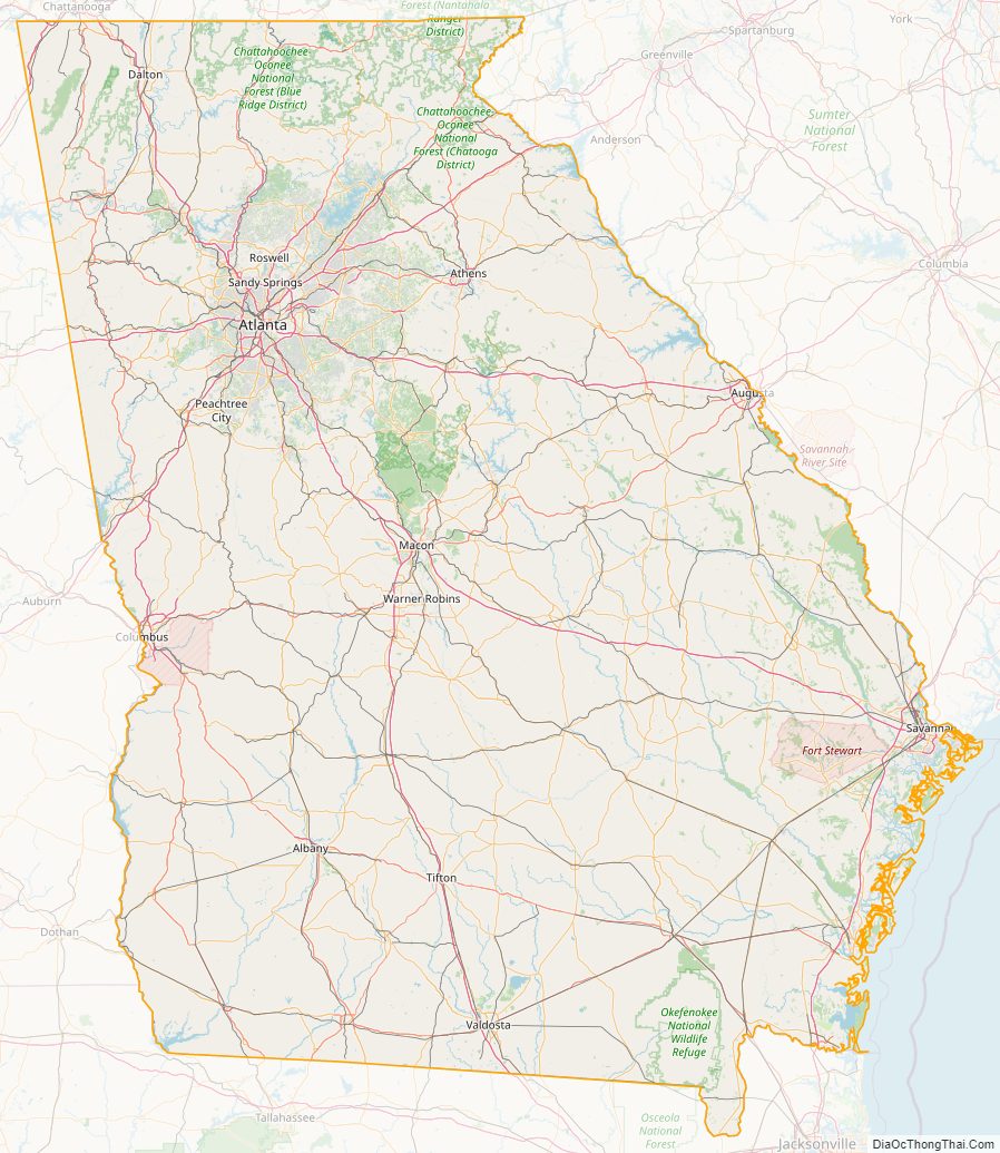
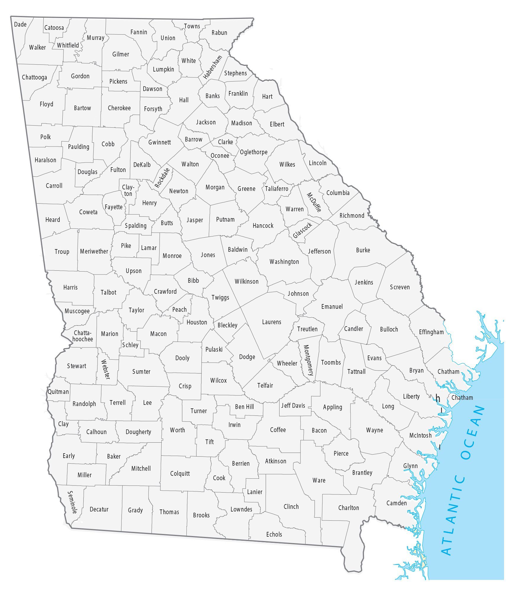
Georgia State Map – Places and Landmarks
Georgia Political Map
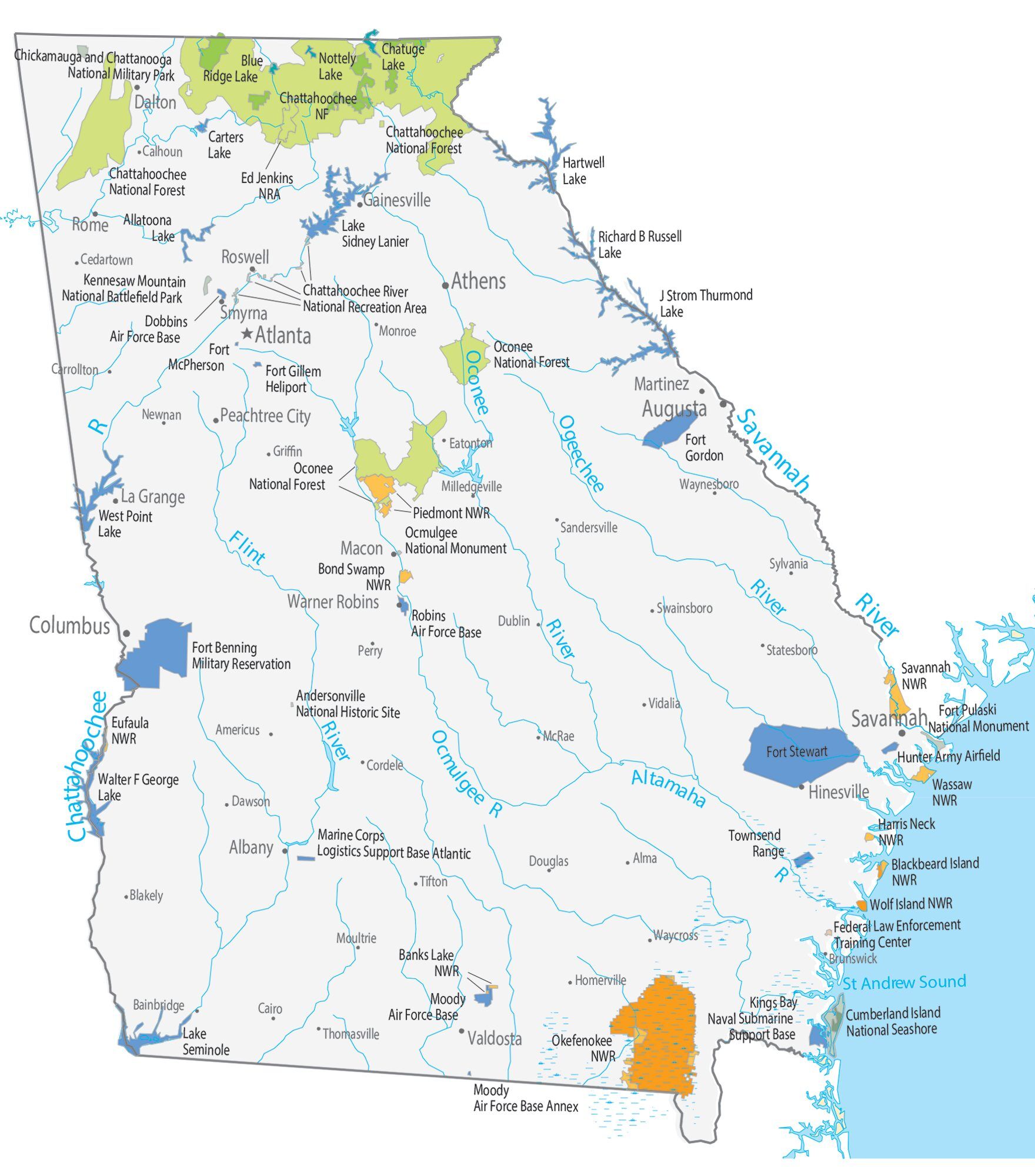
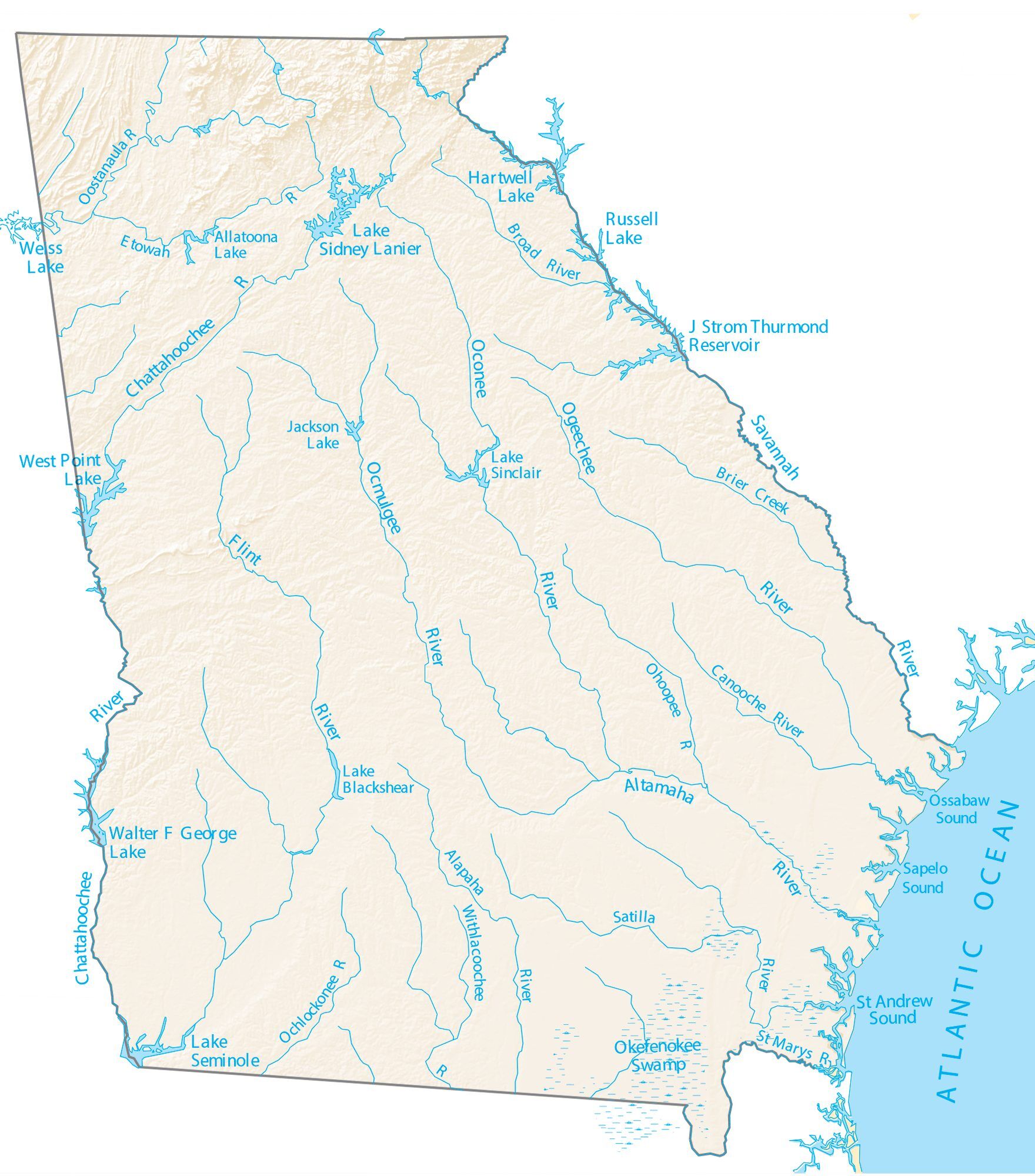
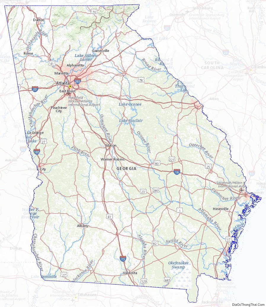
Georgia Lakes and Rivers Map
Geography
Boundaries
Beginning from the Atlantic Ocean, the state’s eastern border with South Carolina runs up the Savannah River, northwest to its origin at the confluence of the Tugaloo and Seneca Rivers. It then continues up the Tugaloo (originally Tugalo) and into the Chattooga River, its most significant tributary. These bounds were decided in the 1797 Treaty of Beaufort, and tested in the U.S. Supreme Court in the two Georgia v. South Carolina cases in 1923 and 1989.
The border then takes a sharp turn around the tip of Rabun County, at latitude 35°N, though from this point it diverges slightly south (due to inaccuracies in the original survey, conducted in 1818). This northern border was originally the Georgia and North Carolina border all the way to the Mississippi River, until Tennessee was divided from North Carolina, and the Yazoo companies induced the legislature of Georgia to pass an act, approved by the governor in 1795, to sell the greater part of Georgia’s territory presently comprising Alabama and Mississippi.
The state’s western border runs in a straight line south-southeastward from a point southwest of Chattanooga, to meet the Chattahoochee River near West Point. It continues downriver to the point where it joins the Flint River (the confluence of the two forming Florida’s Apalachicola River); the southern border goes almost due east and very slightly south, in a straight line to the St. Mary’s River, which then forms the remainder of the boundary back to the ocean.
The water boundaries are still set to be the original thalweg of the rivers. Since then, several have been inundated by lakes created by dams, including the Apalachicola/Chattahoochee/Flint point now under Lake Seminole.
An 1818 survey erroneously placed Georgia’s border with Tennessee one mile (1.6 km) south of the intended location of the 35th parallel north. State legislators still dispute this placement, as correction of this inaccuracy would allow Georgia access to water from the Tennessee River.
Geology and terrain
Georgia consists of five principal physiographic regions: The Cumberland Plateau, Ridge-and-Valley Appalachians, Blue Ridge Mountains, Piedmont, and the Atlantic coastal plain. Each region has its own distinctive characteristics. For instance, the region, which lies in the northwest corner of the state, includes limestone, sandstone, shale, and other sedimentary rocks, which have yielded construction-grade limestone, barite, ocher, and small amounts of coal.
Ecology
The state of Georgia has approximately 250 tree species and 58 protected plants. Georgia’s native trees include red cedar, a variety of pines, oaks, hollies, cypress, sweetgum, scaly-bark and white hickories, and sabal palmetto. East Georgia is in the subtropical coniferous forest biome and conifer species as other broadleaf evergreen flora make up the majority of the southern and coastal regions. Yellow jasmine and mountain laurel make up just a few of the flowering shrubs in the state.
White-tailed deer are found in nearly all counties of Georgia. The northern mockingbird and brown thrasher are among the 160 bird species that live in the state.
Reptiles include the eastern diamondback, copperhead, and cottonmouth snakes as well as alligators; amphibians include salamanders, frogs and toads. There are about 79 species of reptile and 63 amphibians known to live in Georgia. The Argentine black and white tegu is currently an invasive species in Georgia. It poses a problem to local wildlife by chasing down and killing many native species and dominating habitats.
The most popular freshwater game fish are trout, bream, bass, and catfish, all but the last of which are produced in state hatcheries for restocking. Popular saltwater game fish include red drum, spotted seatrout, flounder, and tarpon. Porpoises, whales, shrimp, oysters, and blue crabs are found inshore and offshore of the Georgia coast.
Climate
The majority of the state is primarily a humid subtropical climate. Hot and humid summers are typical, except at the highest elevations. The entire state, including the North Georgia mountains, receives moderate to heavy precipitation, which varies from 45 inches (1,100 mm) in central Georgia to approximately 75 inches (1,900 mm) around the northeast part of the state. The degree to which the weather of a certain region of Georgia is subtropical depends on the latitude, its proximity to the Atlantic Ocean or Gulf of Mexico, and the elevation. The latter factor is felt chiefly in the mountainous areas of the northern part of the state, which are farther away from the ocean and can be 4,500 feet (1,400 m) above sea level. The USDA plant hardiness zones for Georgia range from zone 6b (no colder than −5 °F (−21 °C)) in the Blue Ridge Mountains to zone 8b (no colder than 15 °F (−9 °C) ) along the Atlantic coast and Florida border.
The highest temperature ever recorded is 112 °F (44 °C) in Louisville on July 24, 1952, while the lowest is −17 °F (−27 °C) in northern Floyd County on January 27, 1940. Georgia is one of the leading states in frequency of tornadoes, though they are rarely stronger than EF1. Although tornadoes striking the city are very rare, an EF2 tornado hit downtown Atlanta on March 14, 2008, causing moderate to severe damage to various buildings. With a coastline on the Atlantic Ocean, Georgia is also vulnerable to hurricanes, although direct hurricane strikes were rare during the 20th century. Georgia often is affected by hurricanes that strike the Florida Panhandle, weaken over land, and bring strong tropical storm winds and heavy rain to the interior, a recent example being Hurricane Michael, as well as hurricanes that come close to the Georgia coastline, brushing the coast on their way north without ever making landfall. Hurricane Matthew of 2016 and Hurricane Dorian of 2019 did just that.
Due to anthropogenic climate change, the climate of Georgia is warming. This is already causing major disruption, for example, from sea level rise (Georgia is more vulnerable to it than many other states because its land is sinking) and further warming will increase it.
Major cities
Atlanta, located in north-central Georgia at the Eastern Continental Divide, has been Georgia’s capital city since 1868. It is the most populous city in Georgia, with a 2020 U.S. Census population of just over 498,000.
The Atlanta metropolitan area is the cultural and economic center of the Southeast; its official population in 2020 was over 6 million, or 57% of Georgia’s total. Atlanta is the nation’s ninth largest metropolitan area.
The state has seventeen cities with populations over 50,000, based on official 2020 U.S. Census data.
Along with the rest of the Southeast, Georgia’s population continues to grow rapidly, with primary gains concentrated in urban areas. The U.S. Census Bureau lists fourteen metropolitan areas in the state. The population of the Atlanta metropolitan area added 1.23 million people (24 percent) between 2000 and 2010, and Atlanta rose in rank from the eleventh-largest metropolitan area in the United States to the ninth-largest.
Georgia Physical Map
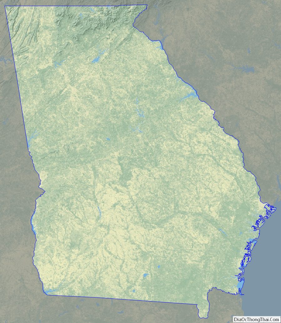

Georgia Topographic Map
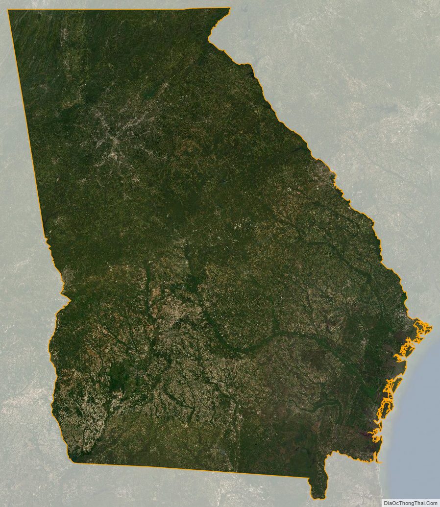
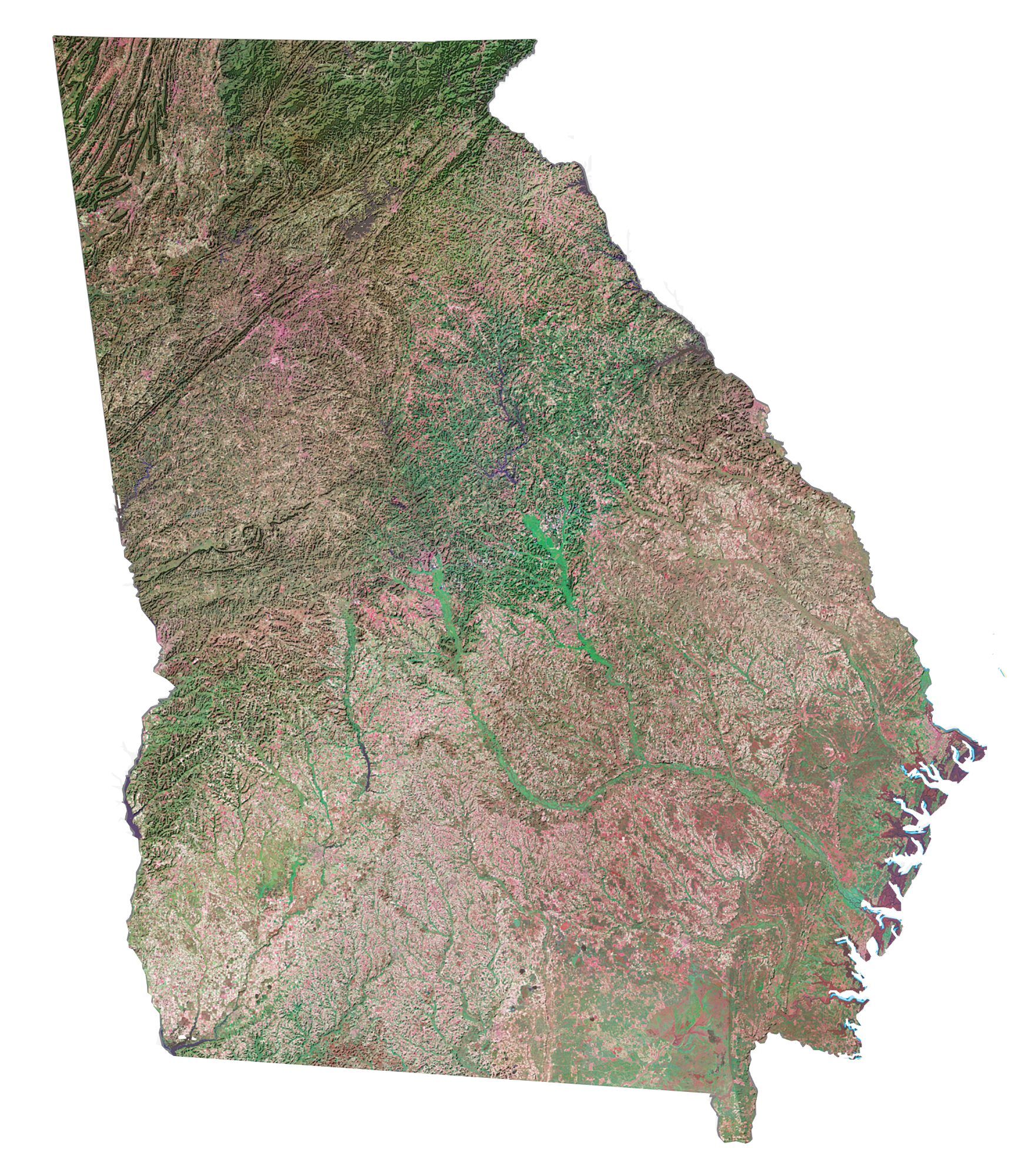
Georgia Satellite Map
Others printable maps
Georgia Outline Map

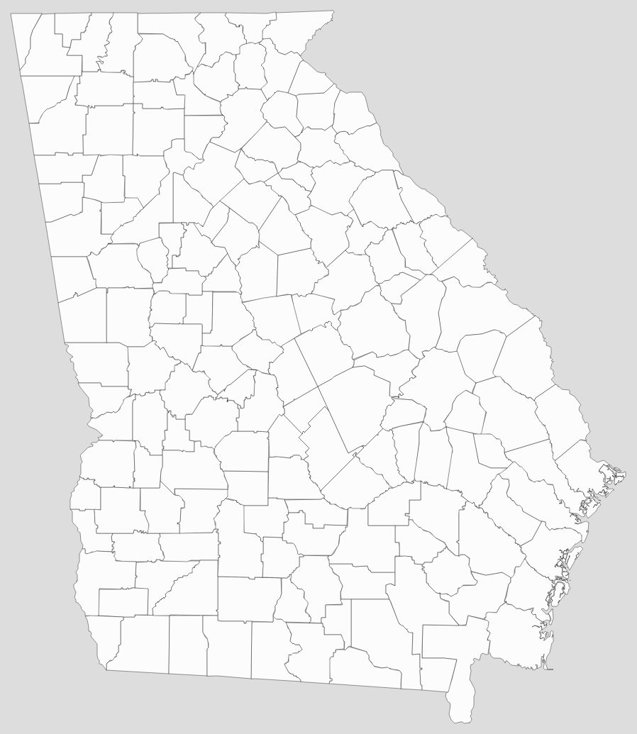
Blank Georgia County Map
See also
Map of Georgia State and its subdivision:- Appling
- Atkinson
- Bacon
- Baker
- Baldwin
- Banks
- Barrow
- Bartow
- Ben Hill
- Berrien
- Bibb
- Bleckley
- Brantley
- Brooks
- Bryan
- Bulloch
- Burke
- Butts
- Calhoun
- Camden
- Candler
- Carroll
- Catoosa
- Charlton
- Chatham
- Chattahoochee
- Chattooga
- Cherokee
- Clarke
- Clay
- Clayton
- Clinch
- Cobb
- Coffee
- Colquitt
- Columbia
- Cook
- Coweta
- Crawford
- Crisp
- Dade
- Dawson
- Decatur
- DeKalb
- Dodge
- Dooly
- Dougherty
- Douglas
- Early
- Echols
- Effingham
- Elbert
- Emanuel
- Evans
- Fannin
- Fayette
- Floyd
- Forsyth
- Franklin
- Fulton
- Gilmer
- Glascock
- Glynn
- Gordon
- Grady
- Greene
- Gwinnett
- Habersham
- Hall
- Hancock
- Haralson
- Harris
- Hart
- Heard
- Henry
- Houston
- Irwin
- Jackson
- Jasper
- Jeff Davis
- Jefferson
- Jenkins
- Johnson
- Jones
- Lamar
- Lanier
- Laurens
- Lee
- Liberty
- Lincoln
- Long
- Lowndes
- Lumpkin
- Macon
- Madison
- Marion
- McDuffie
- McIntosh
- Meriwether
- Miller
- Mitchell
- Monroe
- Montgomery
- Morgan
- Murray
- Muscogee
- Newton
- Oconee
- Oglethorpe
- Paulding
- Peach
- Pickens
- Pierce
- Pike
- Polk
- Pulaski
- Putnam
- Quitman
- Rabun
- Randolph
- Richmond
- Rockdale
- Schley
- Screven
- Seminole
- Spalding
- Stephens
- Stewart
- Sumter
- Talbot
- Taliaferro
- Tattnall
- Taylor
- Telfair
- Terrell
- Thomas
- Tift
- Toombs
- Towns
- Treutlen
- Troup
- Turner
- Twiggs
- Union
- Upson
- Walker
- Walton
- Ware
- Warren
- Washington
- Wayne
- Webster
- Wheeler
- White
- Whitfield
- Wilcox
- Wilkes
- Wilkinson
- Worth
- Alabama
- Alaska
- Arizona
- Arkansas
- California
- Colorado
- Connecticut
- Delaware
- District of Columbia
- Florida
- Georgia
- Hawaii
- Idaho
- Illinois
- Indiana
- Iowa
- Kansas
- Kentucky
- Louisiana
- Maine
- Maryland
- Massachusetts
- Michigan
- Minnesota
- Mississippi
- Missouri
- Montana
- Nebraska
- Nevada
- New Hampshire
- New Jersey
- New Mexico
- New York
- North Carolina
- North Dakota
- Ohio
- Oklahoma
- Oregon
- Pennsylvania
- Rhode Island
- South Carolina
- South Dakota
- Tennessee
- Texas
- Utah
- Vermont
- Virginia
- Washington
- West Virginia
- Wisconsin
- Wyoming


