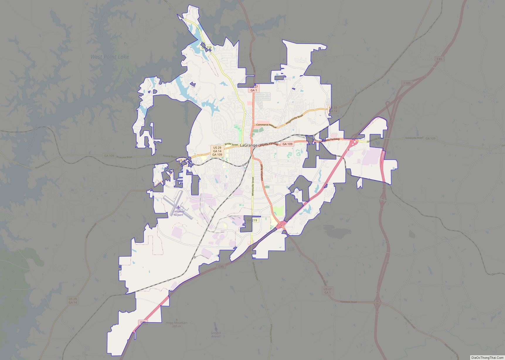
West Point is a city in Troup and Harris counties in the U.S. state of Georgia. It is located approximately halfway between Montgomery, Alabama and Atlanta along Interstate 85. As of the 2010 census, it had a population of 3,474, and in 2015 the estimated population was 3,728. Most of the city is in Troup County, which is part of the LaGrange Micropolitan Statistical Area, and hence part of the Atlanta-Athens-Clarke County-Sandy Springs, GA Combined Statistical Area. A sliver in the south is in Harris County, which is part of the Columbus Metropolitan Statistical Area.
| Name: | West Point city |
|---|---|
| LSAD Code: | 25 |
| LSAD Description: | city (suffix) |
| State: | Georgia |
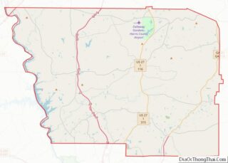
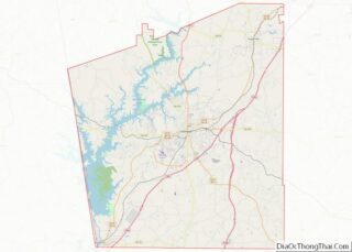
| County: | Harris County, Troup County |
| Elevation: | 568 ft (173 m) |
| Total Area: | 11.85 sq mi (30.69 km²) |
| Land Area: | 11.70 sq mi (30.29 km²) |
| Water Area: | 0.15 sq mi (0.40 km²) |
| Total Population: | 3,719 |
| Population Density: | 318.00/sq mi (122.78/km²) |
| ZIP code: | 31833 |
| Area code: | Area code 706 |
| FIPS code: | 1382132 |
| GNISfeature ID: | 0333394 |
| Website: | www.cityofwestpointga.com |
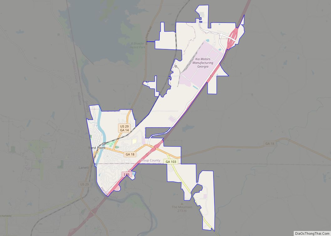
Online Interactive Map
Click on ![]() to view map in "full screen" mode.
to view map in "full screen" mode.
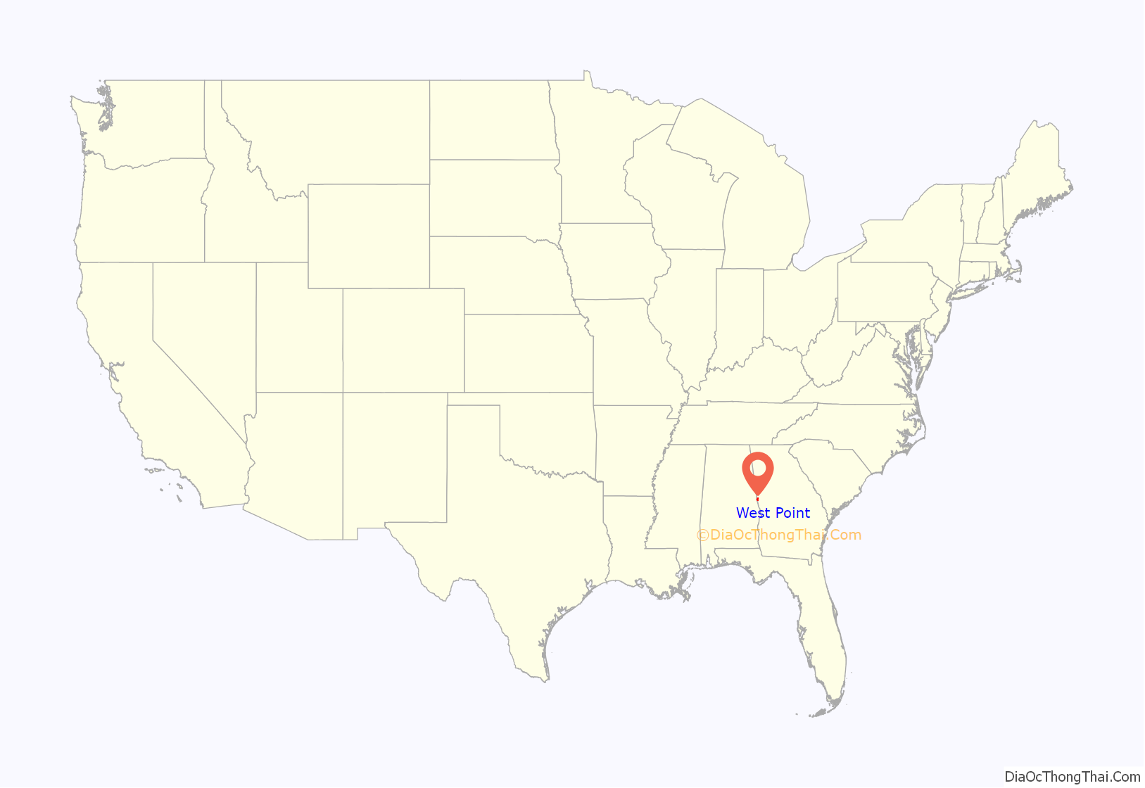
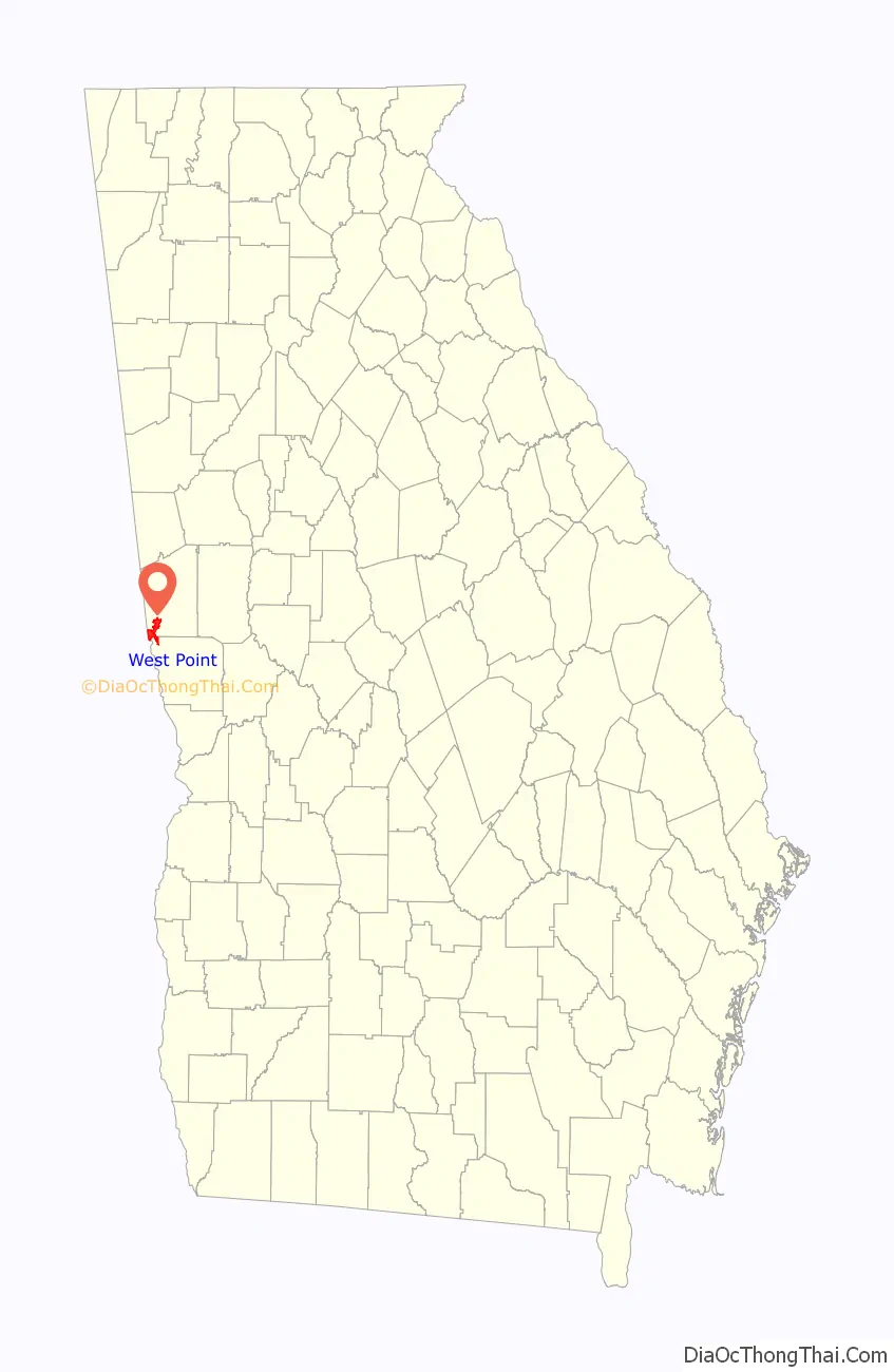
West Point location map. Where is West Point city?
History
The city’s present name comes from its being near the westernmost point of the Chattahoochee River, where the river turns from its southwesterly flow from the Appalachian Mountains to due south – for all practical purposes – and forms the boundary with Alabama. The large nearby reservoir, West Point Lake, was created by the Army Corps of Engineers by the building of the West Point Dam, for water storage and hydroelectric power generation. The reservoir stores water which can be released during dry seasons, in order to maintain the water level of the navigable inland waterway from Columbus, Georgia, south to the Gulf of Mexico.
During the late spring of 2003, there was a flood caused by extremely heavy rainfall and thunderstorms upstream of the West Point Dam; the weather caused the water level in the reservoir to come close to overflowing the top of the dam. There were allegations of poor forecasting by the Corps of Engineers of the reservoir’s water levels. The flood water would have overflowed the dam had a large amount of water not been released through the spillway of the dam. Whereas this prevented the catastrophic failure of the West Point Dam, the city endured a flood much more severe than any other in the time since the dam had been built.
In the mid-19th century, the Atlanta & LaGrange Railroad was established and soon renamed the Atlanta & West Point Railroad, using the name of West Point; the city of East Point, Fulton County, Georgia, received its name for being at the northeastern end of this railroad line. The rail line linked metropolitan Atlanta with the lower reaches of the Chattahoochee River, with Columbus, and with Montgomery, Alabama, via the Montgomery & West Point Railroad.
Passenger service between Atlanta and Montgomery continued, on the “West Point Route”, until approximately the beginning of the Amtrak era, or more than 100 years (circa 1855–circa 1970). The Montgomery-to-West Point rail line was completed in 1851, three years before the West Point-to-Atlanta segment. Rail operations were seriously disrupted during the Civil War (1861–65), as Southern rail lines were subject to Union Army attacks.
Toward the end of the war, West Point was the scene of the Battle of West Point (April 16, 1865, seven days after Lee’s surrender at Appomattox).
West Point Road Map

West Point city Satellite Map

Geography
West Point is located primarily in the southwest corner of Troup County, with a portion extending south into the northwest corner of Harris County. It is bordered to the northeast by the city of LaGrange, the Troup County seat. The city is bordered to the west by the Chattahoochee River, across which are the cities of Lanett and Valley, Alabama. According to the United States Census Bureau, the city has a total area of 11.3 square miles (29.2 km), of which 11.2 square miles (28.9 km) are land and 0.1 square miles (0.3 km), or 1.11%, are water.
Interstate 85 runs northeast to southwest through the city, leading northeast 81 miles (130 km) to Atlanta and southwest 81 miles (130 km) to Montgomery, Alabama. Other highways that run through the city include U.S. Route 29, Georgia State Route 18, and Georgia State Route 103.
Climate
See also
Map of Georgia State and its subdivision:- Appling
- Atkinson
- Bacon
- Baker
- Baldwin
- Banks
- Barrow
- Bartow
- Ben Hill
- Berrien
- Bibb
- Bleckley
- Brantley
- Brooks
- Bryan
- Bulloch
- Burke
- Butts
- Calhoun
- Camden
- Candler
- Carroll
- Catoosa
- Charlton
- Chatham
- Chattahoochee
- Chattooga
- Cherokee
- Clarke
- Clay
- Clayton
- Clinch
- Cobb
- Coffee
- Colquitt
- Columbia
- Cook
- Coweta
- Crawford
- Crisp
- Dade
- Dawson
- Decatur
- DeKalb
- Dodge
- Dooly
- Dougherty
- Douglas
- Early
- Echols
- Effingham
- Elbert
- Emanuel
- Evans
- Fannin
- Fayette
- Floyd
- Forsyth
- Franklin
- Fulton
- Gilmer
- Glascock
- Glynn
- Gordon
- Grady
- Greene
- Gwinnett
- Habersham
- Hall
- Hancock
- Haralson
- Harris
- Hart
- Heard
- Henry
- Houston
- Irwin
- Jackson
- Jasper
- Jeff Davis
- Jefferson
- Jenkins
- Johnson
- Jones
- Lamar
- Lanier
- Laurens
- Lee
- Liberty
- Lincoln
- Long
- Lowndes
- Lumpkin
- Macon
- Madison
- Marion
- McDuffie
- McIntosh
- Meriwether
- Miller
- Mitchell
- Monroe
- Montgomery
- Morgan
- Murray
- Muscogee
- Newton
- Oconee
- Oglethorpe
- Paulding
- Peach
- Pickens
- Pierce
- Pike
- Polk
- Pulaski
- Putnam
- Quitman
- Rabun
- Randolph
- Richmond
- Rockdale
- Schley
- Screven
- Seminole
- Spalding
- Stephens
- Stewart
- Sumter
- Talbot
- Taliaferro
- Tattnall
- Taylor
- Telfair
- Terrell
- Thomas
- Tift
- Toombs
- Towns
- Treutlen
- Troup
- Turner
- Twiggs
- Union
- Upson
- Walker
- Walton
- Ware
- Warren
- Washington
- Wayne
- Webster
- Wheeler
- White
- Whitfield
- Wilcox
- Wilkes
- Wilkinson
- Worth
- Alabama
- Alaska
- Arizona
- Arkansas
- California
- Colorado
- Connecticut
- Delaware
- District of Columbia
- Florida
- Georgia
- Hawaii
- Idaho
- Illinois
- Indiana
- Iowa
- Kansas
- Kentucky
- Louisiana
- Maine
- Maryland
- Massachusetts
- Michigan
- Minnesota
- Mississippi
- Missouri
- Montana
- Nebraska
- Nevada
- New Hampshire
- New Jersey
- New Mexico
- New York
- North Carolina
- North Dakota
- Ohio
- Oklahoma
- Oregon
- Pennsylvania
- Rhode Island
- South Carolina
- South Dakota
- Tennessee
- Texas
- Utah
- Vermont
- Virginia
- Washington
- West Virginia
- Wisconsin
- Wyoming