Roswell is a city in northern Fulton County, Georgia, United States. At the official 2010 census, the city had a population of 88,346. The 2020 estimated population was 94,884, making Roswell the state’s ninth largest city. A close suburb of Atlanta, Roswell has an affluent historic district.
| Name: | Roswell city |
|---|---|
| LSAD Code: | 25 |
| LSAD Description: | city (suffix) |
| State: | Georgia |
| County: | Fulton County |
| Incorporated: | February 16, 1854 |
| Elevation: | 1,050 ft (320 m) |
| Total Area: | 42.00 sq mi (108.77 km²) |
| Land Area: | 40.73 sq mi (105.48 km²) |
| Water Area: | 1.27 sq mi (3.29 km²) 3.1% |
| Total Population: | 92,833 |
| Population Density: | 2,279.40/sq mi (880.08/km²) |
| ZIP code: | 30075-30077 |
| Area code: | 770/678/404 |
| FIPS code: | 1367284 |
| GNISfeature ID: | 2404651 |
| Website: | www.roswellgov.com |
Online Interactive Map
Click on ![]() to view map in "full screen" mode.
to view map in "full screen" mode.
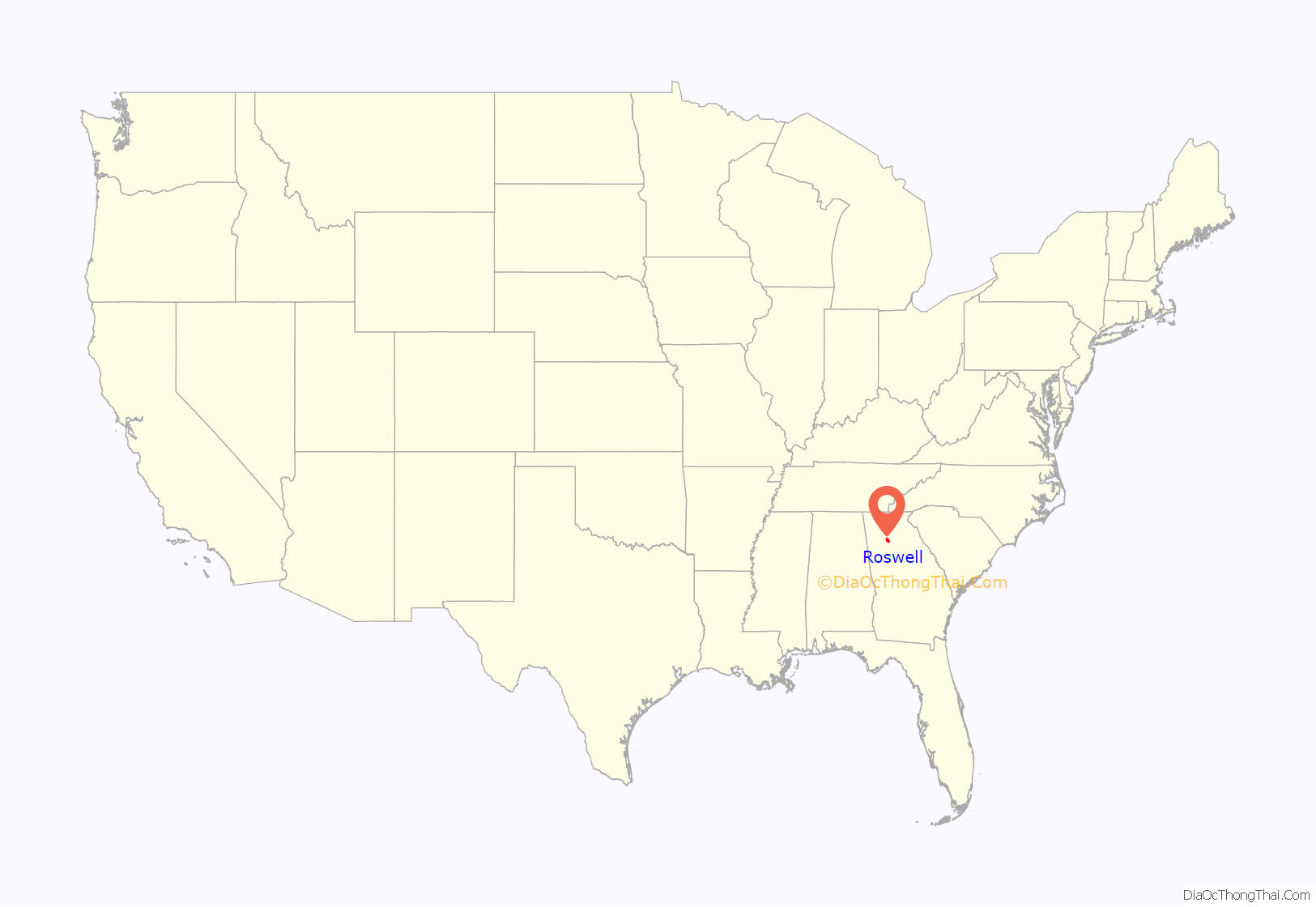
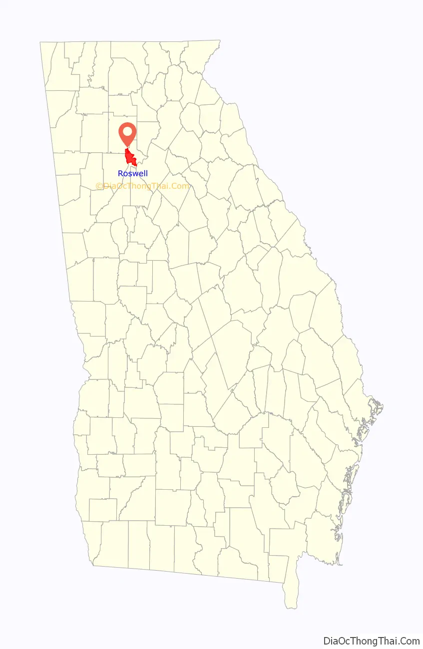
Roswell location map. Where is Roswell city?
History
In 1830, while on a trip to northern Georgia, Roswell King passed through the area of what is now Roswell and observed the great potential for building a cotton mill along Vickery Creek. Since the land nearby was also good for plantations, he planned to put cotton processing near cotton production.
Toward the middle of the 1830s, King returned to build a mill that would soon become the largest in north Georgia – Roswell Mill. He brought with him 36 African slaves from his own coastal plantation, plus another 42 skilled carpenter slaves bought in Savannah to build the mills. The slaves built the mills, infrastructure, houses, mill worker apartments, and supporting buildings for the new town. The Africans brought their unique Geechee culture, language, and religious traditions from the coast to north Georgia.
King invited investors from the coast to join him at the new location. He was also joined by Barrington King, one of his sons, who succeeded his father in the manufacturing company. Archibald Smith was one of the planters who migrated there to establish a new plantation, also bringing enslaved African Americans from the coastal areas.
Shortly after 1832 a survey of the area was conducted by Nathan Crawford Barnett as part of the Cherokee Purchase in preparation for the sixth state administrated land lottery culminating in the Cherokee removal.
Barrington Hall (the home of Barrington King), Smith Plantation (the home of Archibald Smith) and Bulloch Hall (the childhood home of President Theodore Roosevelt’s mother, Mittie Bulloch) have been preserved and restored. They are now open to the public. According to the 1850 Slave Schedules, these three “founding families”, together with the next three largest planters, held 192 slaves, 51% of the total 378 slaves held in Roswell District. Archibald Smith had a 300-acre (1.2 km) cotton plantation. According to the 1850 Census, Barrington King held 70 slaves. Half of these slaves were under the age of 10. These slaves worked in Barrington’s household. Barrington King “leased” or “rented” some of his adult male slaves to the Roswell Manufacturing Company, but they did not work around the mill machinery.
The Roswell area was part of Cobb County when first settled, and the county seat of Marietta was a four-hour (one-way) horseback ride to the west. Since Roswell residents desired a local government, they submitted a city charter for incorporation to the Georgia General Assembly. The charter was approved on February 16, 1854.
By the time of the Civil War, the cotton mills employed more than 400 people, mostly women. Given settlement patterns in the Piedmont region, they were likely of Scots-Irish descent. As the mill increased in production, so did the number of people living in the area.
During the Civil War, the city was captured by Union forces under the leadership of General Kenner Garrard. Under orders of General Sherman, Garrard shipped the mill workers north to prevent them from returning to work if the mills were rebuilt. This was a common tactic of Sherman to economically disrupt the Confederate rebellion. The mill was burned, but the houses were left standing. The ruins of the mill and the 30-foot (9.1 m) dam that was built for power still remain. Most of the town’s property was confiscated by Union forces. The leading families had left the town to go to safer places well before the Civil War, and arranged for the enslaved people to be taken away from advancing Union troops, as was often the practice. Some slaves may have escaped to freedom beyond Union lines.
After the war, Barrington King rebuilt the mills and resumed production. While many freedmen stayed in the area to work as paid labor on plantations or in town, others migrated to Fulton County and Atlanta for new opportunities. The South suffered an agricultural depression resulting from the effects of the war and the end of slavery in the United States.
According to the census, the population of Cobb County decreased slightly from 14,242 in 1860, to 13,814 in 1870. The proportion of African-Americans decreased more, from 27% to 23%. During those years, nearby Fulton County more than doubled in population, from 14,427 to 33,336. The effects of dramatic African-American migration can be seen by the increase in Fulton County from 20.5% slave in 1860 to 45.7% colored (Black) in 1870.
At the end of 1931, the United States was in the midst of the Great Depression. The difficult economic conditions drove Milton County, Roswell’s neighboring county to the north (note: much of what is now Roswell was part of Milton County already), to merge in its entirety with Fulton County, Roswell’s neighboring county to the south. To facilitate the merger, Roswell was ceded from Cobb County to become part of Fulton County. This became effective the 9th day of May in 1932. Roswell filed all legal records, including vital statistics, real estate, and the results of torts with the county clerk of Cobb before this date; with the county clerk of Fulton, after this date.
Lori Henry served as the first woman elected as Mayor of Roswell from 2018 to 2021.
Kurt Wilson is the current Mayor of Roswell. His term began in January 2022 and ends December 31, 2025.
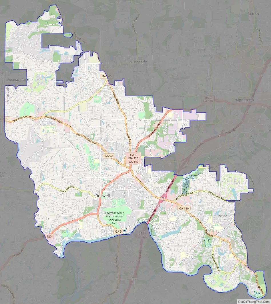
Roswell Road Map
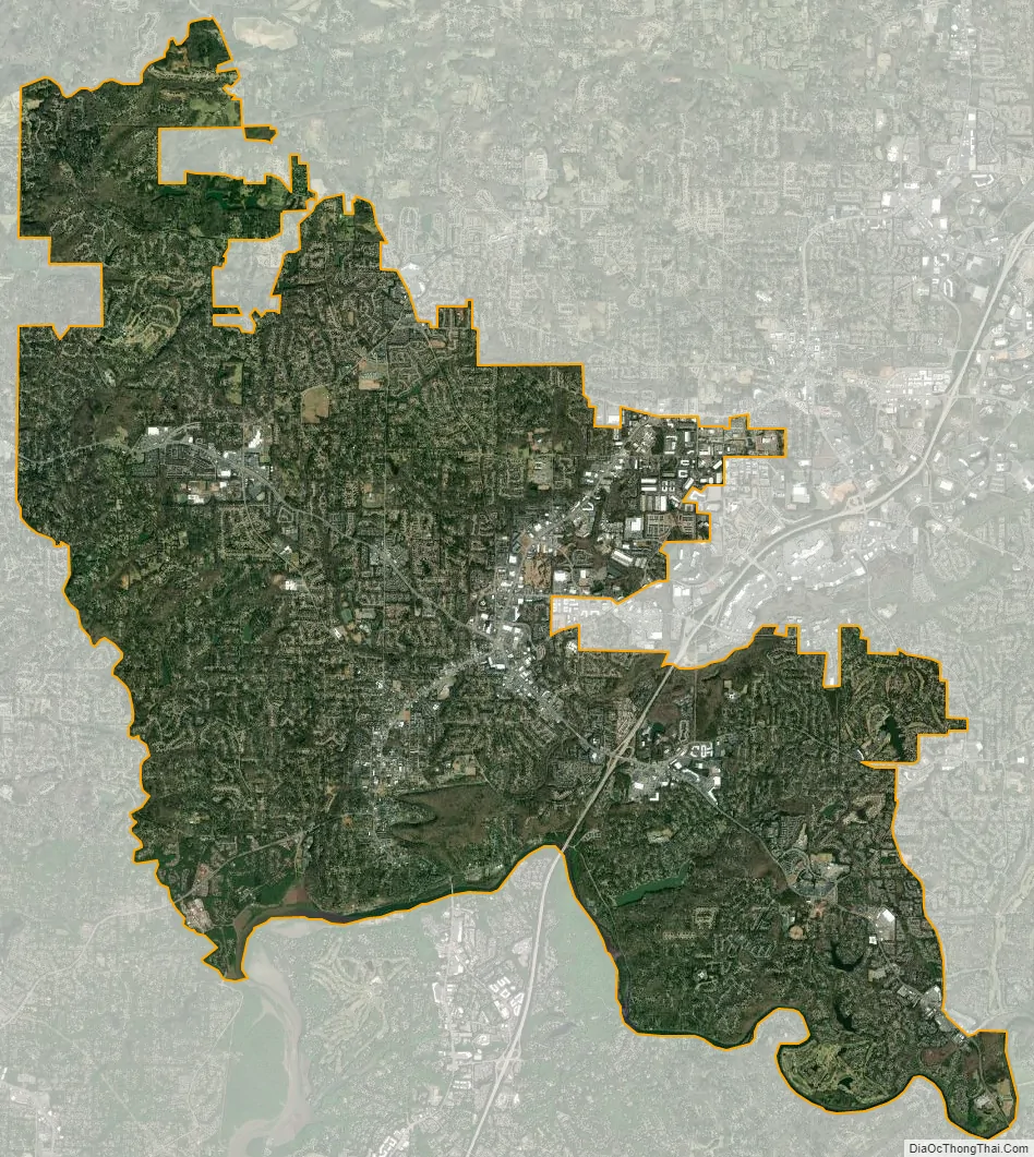
Roswell city Satellite Map
Geography
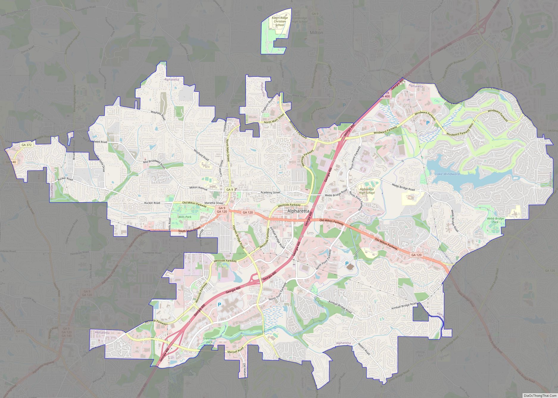
Roswell is located in northern Fulton County. It is bordered to the north by Milton, to the northeast by Alpharetta, to the east by Johns Creek, to the southeast by Peachtree Corners in Gwinnett County, to the south by Sandy Springs, to the west by unincorporated land in Cobb County, and to the northwest by the city of Mountain Park and by unincorporated land in Cherokee County. The southern boundary of the city follows the Chattahoochee River.
According to the United States Census Bureau, Roswell has a total area of 42.0 square miles (108.8 km), of which 40.7 square miles (105.5 km) is land and 1.3 square miles (3.3 km), or 3.06%, is water.
Geographic features
- Big Creek
- Bull Sluice Lake
- Chattahoochee River
- Morgan Falls Dam
- Johns Creek
- Crooked Creek
- Audery Mill Creek
Climate
Roswell features a Humid subtropical climate, which is characterized by abundant precipitation that is spread evenly throughout the year.
See also
Map of Georgia State and its subdivision:- Appling
- Atkinson
- Bacon
- Baker
- Baldwin
- Banks
- Barrow
- Bartow
- Ben Hill
- Berrien
- Bibb
- Bleckley
- Brantley
- Brooks
- Bryan
- Bulloch
- Burke
- Butts
- Calhoun
- Camden
- Candler
- Carroll
- Catoosa
- Charlton
- Chatham
- Chattahoochee
- Chattooga
- Cherokee
- Clarke
- Clay
- Clayton
- Clinch
- Cobb
- Coffee
- Colquitt
- Columbia
- Cook
- Coweta
- Crawford
- Crisp
- Dade
- Dawson
- Decatur
- DeKalb
- Dodge
- Dooly
- Dougherty
- Douglas
- Early
- Echols
- Effingham
- Elbert
- Emanuel
- Evans
- Fannin
- Fayette
- Floyd
- Forsyth
- Franklin
- Fulton
- Gilmer
- Glascock
- Glynn
- Gordon
- Grady
- Greene
- Gwinnett
- Habersham
- Hall
- Hancock
- Haralson
- Harris
- Hart
- Heard
- Henry
- Houston
- Irwin
- Jackson
- Jasper
- Jeff Davis
- Jefferson
- Jenkins
- Johnson
- Jones
- Lamar
- Lanier
- Laurens
- Lee
- Liberty
- Lincoln
- Long
- Lowndes
- Lumpkin
- Macon
- Madison
- Marion
- McDuffie
- McIntosh
- Meriwether
- Miller
- Mitchell
- Monroe
- Montgomery
- Morgan
- Murray
- Muscogee
- Newton
- Oconee
- Oglethorpe
- Paulding
- Peach
- Pickens
- Pierce
- Pike
- Polk
- Pulaski
- Putnam
- Quitman
- Rabun
- Randolph
- Richmond
- Rockdale
- Schley
- Screven
- Seminole
- Spalding
- Stephens
- Stewart
- Sumter
- Talbot
- Taliaferro
- Tattnall
- Taylor
- Telfair
- Terrell
- Thomas
- Tift
- Toombs
- Towns
- Treutlen
- Troup
- Turner
- Twiggs
- Union
- Upson
- Walker
- Walton
- Ware
- Warren
- Washington
- Wayne
- Webster
- Wheeler
- White
- Whitfield
- Wilcox
- Wilkes
- Wilkinson
- Worth
- Alabama
- Alaska
- Arizona
- Arkansas
- California
- Colorado
- Connecticut
- Delaware
- District of Columbia
- Florida
- Georgia
- Hawaii
- Idaho
- Illinois
- Indiana
- Iowa
- Kansas
- Kentucky
- Louisiana
- Maine
- Maryland
- Massachusetts
- Michigan
- Minnesota
- Mississippi
- Missouri
- Montana
- Nebraska
- Nevada
- New Hampshire
- New Jersey
- New Mexico
- New York
- North Carolina
- North Dakota
- Ohio
- Oklahoma
- Oregon
- Pennsylvania
- Rhode Island
- South Carolina
- South Dakota
- Tennessee
- Texas
- Utah
- Vermont
- Virginia
- Washington
- West Virginia
- Wisconsin
- Wyoming