Belvedere Park is a census-designated place (CDP) in DeKalb County, Georgia, United States. The population was 15,152 at the 2010 census.
| Name: | Belvedere Park CDP |
|---|---|
| LSAD Code: | 57 |
| LSAD Description: | CDP (suffix) |
| State: | Georgia |
| County: | DeKalb County |
| Elevation: | 997 ft (304 m) |
| Total Area: | 4.90 sq mi (12.69 km²) |
| Land Area: | 4.90 sq mi (12.68 km²) |
| Water Area: | 0.00 sq mi (0.01 km²) |
| Total Population: | 15,113 |
| Population Density: | 3,085.55/sq mi (1,191.44/km²) |
| FIPS code: | 1306884 |
| GNISfeature ID: | 0331129 |
Online Interactive Map
Click on ![]() to view map in "full screen" mode.
to view map in "full screen" mode.
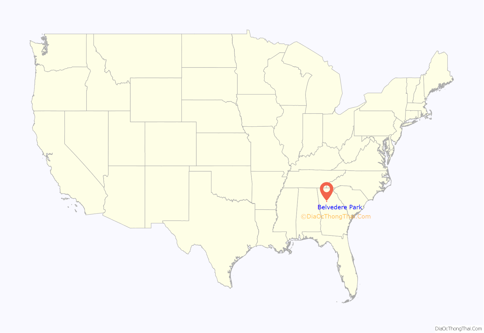
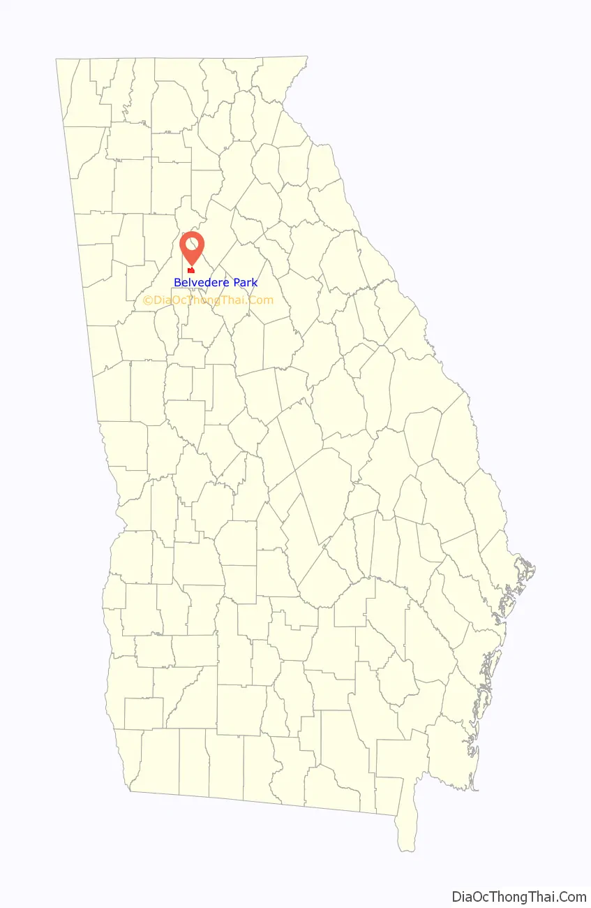
Belvedere Park location map. Where is Belvedere Park CDP?
History
Belvedere Park emerged beginning in 1952 as a planned community with schools, parks, and a shopping center. It continued to grow and expand throughout the decade.
Housing tracts
In 1958, the Atlanta Journal advertised houses in Belvedere Park for between $11,000 and $14,800. One ad proclaimed:
A majority of homes in Belvedere Park are one-story and while some are traditional red brick ranch homes, contemporary style houses were also built. Adair Realty and Loan, a powerful real estate company in Atlanta during the early to mid 20th century, represented Belvedere Park.
Belvedere Motel
The Belvedere Motel, operated by the renowned Dinkler Hotel Corporation, opened with telephones and large screen televisions in every room. The motel claimed to be “dedicated to your traveling comfort” — additional amenities included a playground and a shuffleboard court.
Opening of Rich’s
In 1959, the second branch of Rich’s Department Store was opened in the Belvedere Shopping Center (the first branch was opened at Lenox Square Mall). Rich’s added an air of metropolitan living to the suburbs.
In 1963, Towers High School was opened and is still in operation today. Midway Park on Midway Road is a popular recreational center. It has several fields for baseball and football and a public swimming pool.
Belvedere Park Road Map
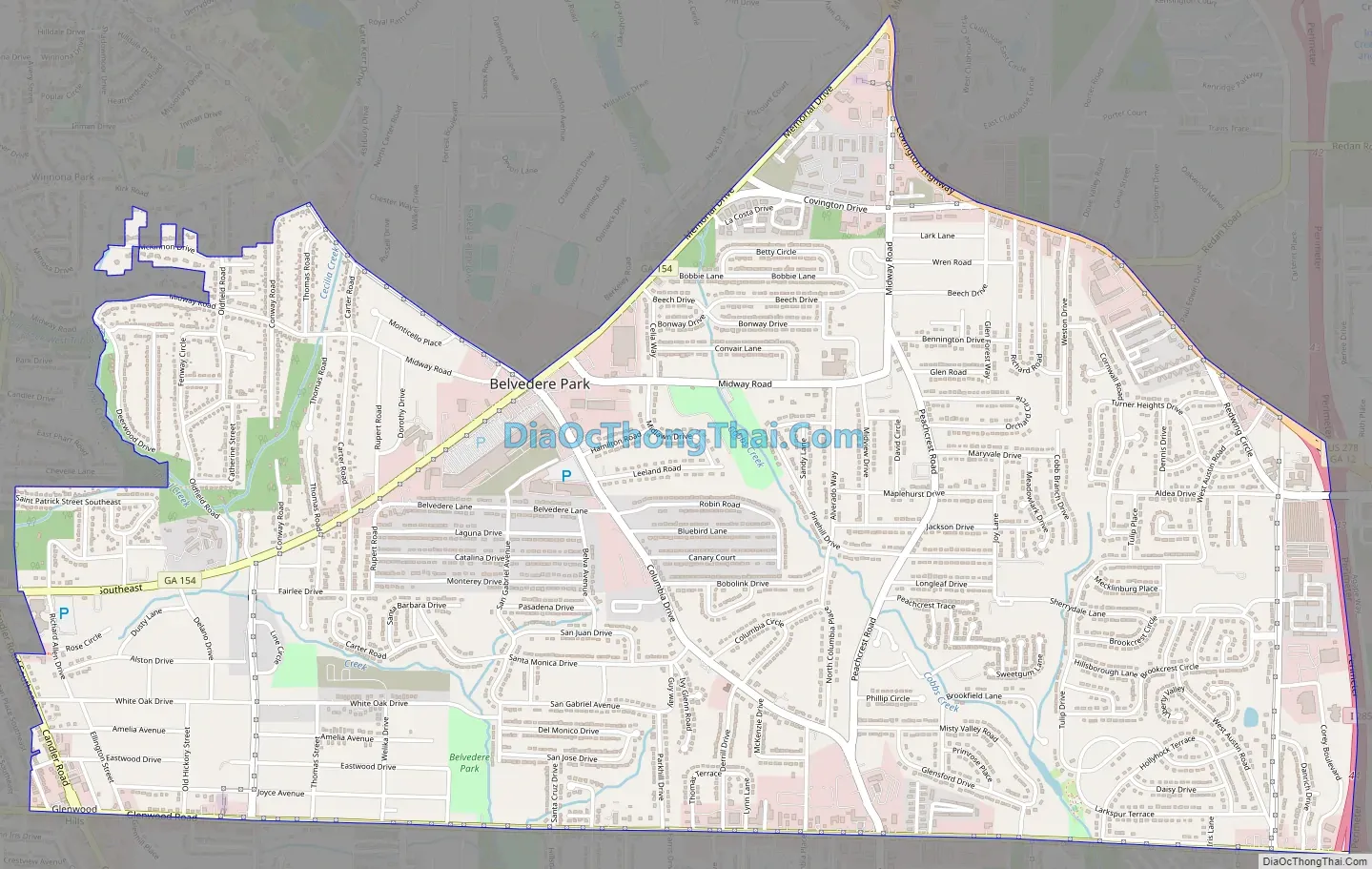
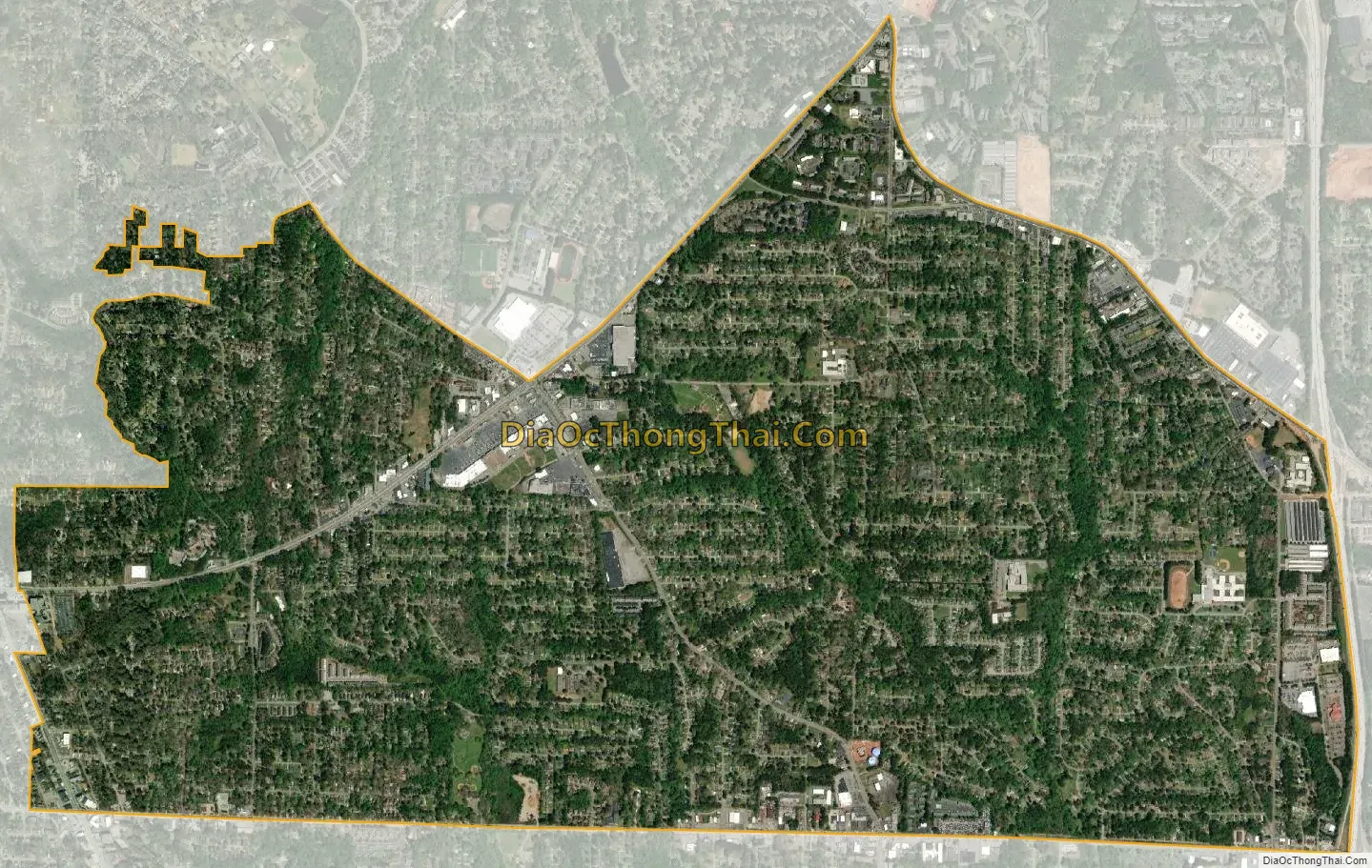
Belvedere Park city Satellite Map
Geography
Belvedere Park is located at 33°44′56″N 84°15′35″W / 33.74889°N 84.25972°W / 33.74889; -84.25972 (33.748855, -84.259617). It is bordered by:
- the Atlanta neighborhood of East Lake to the west
- the cities of Avondale Estates and Decatur to the north
- the Candler-McAfee CDP to the south
According to the United States Census Bureau, Belvedere Park has a total area of 5.0 square miles (13 km), all land.
See also
Map of Georgia State and its subdivision:- Appling
- Atkinson
- Bacon
- Baker
- Baldwin
- Banks
- Barrow
- Bartow
- Ben Hill
- Berrien
- Bibb
- Bleckley
- Brantley
- Brooks
- Bryan
- Bulloch
- Burke
- Butts
- Calhoun
- Camden
- Candler
- Carroll
- Catoosa
- Charlton
- Chatham
- Chattahoochee
- Chattooga
- Cherokee
- Clarke
- Clay
- Clayton
- Clinch
- Cobb
- Coffee
- Colquitt
- Columbia
- Cook
- Coweta
- Crawford
- Crisp
- Dade
- Dawson
- Decatur
- DeKalb
- Dodge
- Dooly
- Dougherty
- Douglas
- Early
- Echols
- Effingham
- Elbert
- Emanuel
- Evans
- Fannin
- Fayette
- Floyd
- Forsyth
- Franklin
- Fulton
- Gilmer
- Glascock
- Glynn
- Gordon
- Grady
- Greene
- Gwinnett
- Habersham
- Hall
- Hancock
- Haralson
- Harris
- Hart
- Heard
- Henry
- Houston
- Irwin
- Jackson
- Jasper
- Jeff Davis
- Jefferson
- Jenkins
- Johnson
- Jones
- Lamar
- Lanier
- Laurens
- Lee
- Liberty
- Lincoln
- Long
- Lowndes
- Lumpkin
- Macon
- Madison
- Marion
- McDuffie
- McIntosh
- Meriwether
- Miller
- Mitchell
- Monroe
- Montgomery
- Morgan
- Murray
- Muscogee
- Newton
- Oconee
- Oglethorpe
- Paulding
- Peach
- Pickens
- Pierce
- Pike
- Polk
- Pulaski
- Putnam
- Quitman
- Rabun
- Randolph
- Richmond
- Rockdale
- Schley
- Screven
- Seminole
- Spalding
- Stephens
- Stewart
- Sumter
- Talbot
- Taliaferro
- Tattnall
- Taylor
- Telfair
- Terrell
- Thomas
- Tift
- Toombs
- Towns
- Treutlen
- Troup
- Turner
- Twiggs
- Union
- Upson
- Walker
- Walton
- Ware
- Warren
- Washington
- Wayne
- Webster
- Wheeler
- White
- Whitfield
- Wilcox
- Wilkes
- Wilkinson
- Worth
- Alabama
- Alaska
- Arizona
- Arkansas
- California
- Colorado
- Connecticut
- Delaware
- District of Columbia
- Florida
- Georgia
- Hawaii
- Idaho
- Illinois
- Indiana
- Iowa
- Kansas
- Kentucky
- Louisiana
- Maine
- Maryland
- Massachusetts
- Michigan
- Minnesota
- Mississippi
- Missouri
- Montana
- Nebraska
- Nevada
- New Hampshire
- New Jersey
- New Mexico
- New York
- North Carolina
- North Dakota
- Ohio
- Oklahoma
- Oregon
- Pennsylvania
- Rhode Island
- South Carolina
- South Dakota
- Tennessee
- Texas
- Utah
- Vermont
- Virginia
- Washington
- West Virginia
- Wisconsin
- Wyoming