Doraville is a city in DeKalb County, Georgia, United States northeast of Atlanta. As of the 2020 census, the city had a population of 10,623.
| Name: | Doraville city |
|---|---|
| LSAD Code: | 25 |
| LSAD Description: | city (suffix) |
| State: | Georgia |
| County: | DeKalb County |
| Elevation: | 1,073 ft (327 m) |
| Total Area: | 5.00 sq mi (12.95 km²) |
| Land Area: | 5.00 sq mi (12.95 km²) |
| Water Area: | 0.00 sq mi (0.00 km²) |
| Total Population: | 10,623 |
| Population Density: | 2,125.03/sq mi (820.44/km²) |
| ZIP code: | 30340, 30360, 30362 |
| Area code: | 770 |
| FIPS code: | 1323536 |
| GNISfeature ID: | 0325924 |
| Website: | doravillega.us |
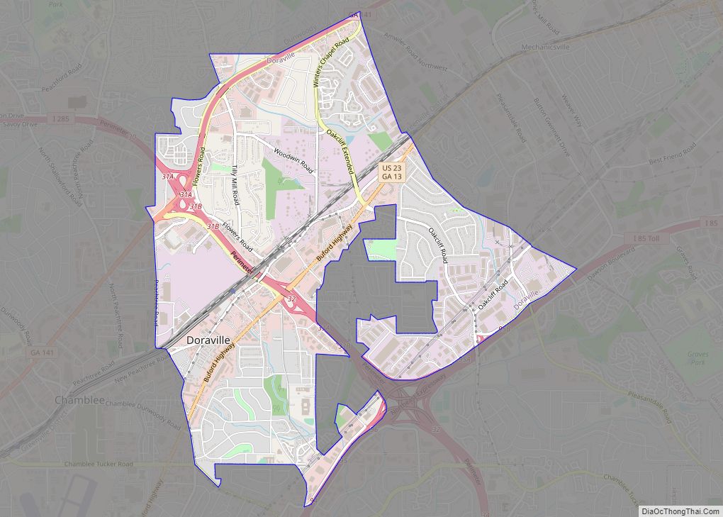
Online Interactive Map
Click on ![]() to view map in "full screen" mode.
to view map in "full screen" mode.
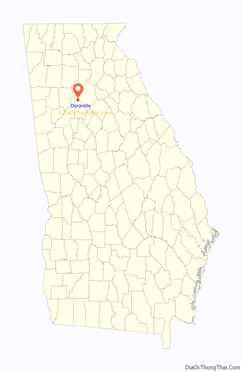
Doraville location map. Where is Doraville city?

History
Doraville was incorporated by an act of the Georgia General Assembly, approved December 15, 1871. From its development until the 1940s, Doraville was a small agricultural community that served the interests of a larger surrounding farming area.
At the end of World War II, Doraville was on a main railroad line and had a new water system. General Motors selected Doraville for a new assembly plant. Doraville grew in the late 1940s and the 1950s as a result. In the late 1940s, plans for Guilford Village, the first subdivision, were announced by Southern Builders and Engineering Company. The 112-home subdivision at Tilly Mill and Flowers Roads was to cover some 58 acres. In 1950, Doraville’s population was 472. By 1964, its population was 6,160 and its land area was 1,722 acres. Part of the population growth during that period was because of the annexation of Northwoods in 1949 and Oakcliff in 1958.
By the 1980s, Doraville and neighboring Chamblee attracted immigrants relocating to the Atlanta area who settled along Buford Highway. The result is one of the largest Asian communities in the country. Many Latin American countries are also represented. 56% of residents speak a language other than English as a first language. The Doraville MARTA Station was built in 1992, destroying the few buildings that remained of Doraville’s downtown. The GM Doraville Assembly Plant closed in 2009 and was demolished in 2015.
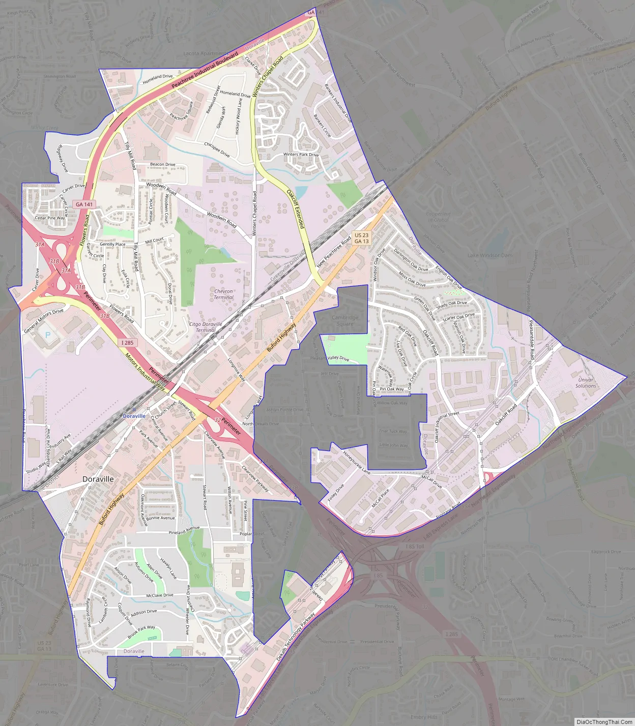
Doraville Road Map
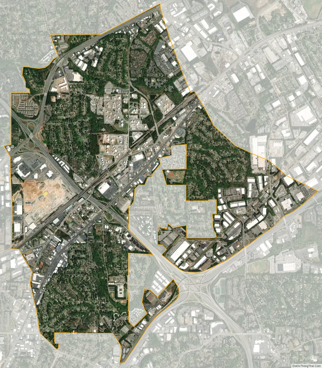
Doraville city Satellite Map
Geography
Doraville is located at 33°54′19″N 84°16′26″W / 33.90528°N 84.27389°W / 33.90528; -84.27389 (33.905302, -84.273870). Doraville is northeast of Chamblee, southeast of Dunwoody, southwest of Norcross and Peachtree Corners, and northwest of Tucker.
According to the United States Census Bureau, the city has a total area of 3.6 square miles (9.3 km), of which 0.004 square miles (0.01 km), or 0.11%, is water. Crooked Creek, a tributary of the Chattahoochee River, runs through Doraville.
The City of Doraville is located in DeKalb County. It has a humid subtropical climate (Cfa) and average monthly high temperatures range from 53° F in January to 90° F in July. [1]
See also
Map of Georgia State and its subdivision:- Appling
- Atkinson
- Bacon
- Baker
- Baldwin
- Banks
- Barrow
- Bartow
- Ben Hill
- Berrien
- Bibb
- Bleckley
- Brantley
- Brooks
- Bryan
- Bulloch
- Burke
- Butts
- Calhoun
- Camden
- Candler
- Carroll
- Catoosa
- Charlton
- Chatham
- Chattahoochee
- Chattooga
- Cherokee
- Clarke
- Clay
- Clayton
- Clinch
- Cobb
- Coffee
- Colquitt
- Columbia
- Cook
- Coweta
- Crawford
- Crisp
- Dade
- Dawson
- Decatur
- DeKalb
- Dodge
- Dooly
- Dougherty
- Douglas
- Early
- Echols
- Effingham
- Elbert
- Emanuel
- Evans
- Fannin
- Fayette
- Floyd
- Forsyth
- Franklin
- Fulton
- Gilmer
- Glascock
- Glynn
- Gordon
- Grady
- Greene
- Gwinnett
- Habersham
- Hall
- Hancock
- Haralson
- Harris
- Hart
- Heard
- Henry
- Houston
- Irwin
- Jackson
- Jasper
- Jeff Davis
- Jefferson
- Jenkins
- Johnson
- Jones
- Lamar
- Lanier
- Laurens
- Lee
- Liberty
- Lincoln
- Long
- Lowndes
- Lumpkin
- Macon
- Madison
- Marion
- McDuffie
- McIntosh
- Meriwether
- Miller
- Mitchell
- Monroe
- Montgomery
- Morgan
- Murray
- Muscogee
- Newton
- Oconee
- Oglethorpe
- Paulding
- Peach
- Pickens
- Pierce
- Pike
- Polk
- Pulaski
- Putnam
- Quitman
- Rabun
- Randolph
- Richmond
- Rockdale
- Schley
- Screven
- Seminole
- Spalding
- Stephens
- Stewart
- Sumter
- Talbot
- Taliaferro
- Tattnall
- Taylor
- Telfair
- Terrell
- Thomas
- Tift
- Toombs
- Towns
- Treutlen
- Troup
- Turner
- Twiggs
- Union
- Upson
- Walker
- Walton
- Ware
- Warren
- Washington
- Wayne
- Webster
- Wheeler
- White
- Whitfield
- Wilcox
- Wilkes
- Wilkinson
- Worth
- Alabama
- Alaska
- Arizona
- Arkansas
- California
- Colorado
- Connecticut
- Delaware
- District of Columbia
- Florida
- Georgia
- Hawaii
- Idaho
- Illinois
- Indiana
- Iowa
- Kansas
- Kentucky
- Louisiana
- Maine
- Maryland
- Massachusetts
- Michigan
- Minnesota
- Mississippi
- Missouri
- Montana
- Nebraska
- Nevada
- New Hampshire
- New Jersey
- New Mexico
- New York
- North Carolina
- North Dakota
- Ohio
- Oklahoma
- Oregon
- Pennsylvania
- Rhode Island
- South Carolina
- South Dakota
- Tennessee
- Texas
- Utah
- Vermont
- Virginia
- Washington
- West Virginia
- Wisconsin
- Wyoming