Dasher is a town in Lowndes County, Georgia, United States. The population was 912 at the 2010 census, up from 834 at the 2000 census.
| Name: | Dasher town |
|---|---|
| LSAD Code: | 43 |
| LSAD Description: | town (suffix) |
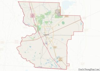
| State: | Georgia |
| County: | Lowndes County |
| Incorporated: | 1968 |
| Elevation: | 180 ft (55 m) |
| Total Area: | 4.96 sq mi (12.85 km²) |
| Land Area: | 4.60 sq mi (11.91 km²) |
| Water Area: | 0.37 sq mi (0.95 km²) |
| Total Population: | 890 |
| Population Density: | 193.60/sq mi (74.75/km²) |
| ZIP code: | 31601 |
| Area code: | 229 |
| FIPS code: | 1321744 |
| GNISfeature ID: | 0313320 |
| Website: | www.dasherga.com |
Online Interactive Map
Click on ![]() to view map in "full screen" mode.
to view map in "full screen" mode.
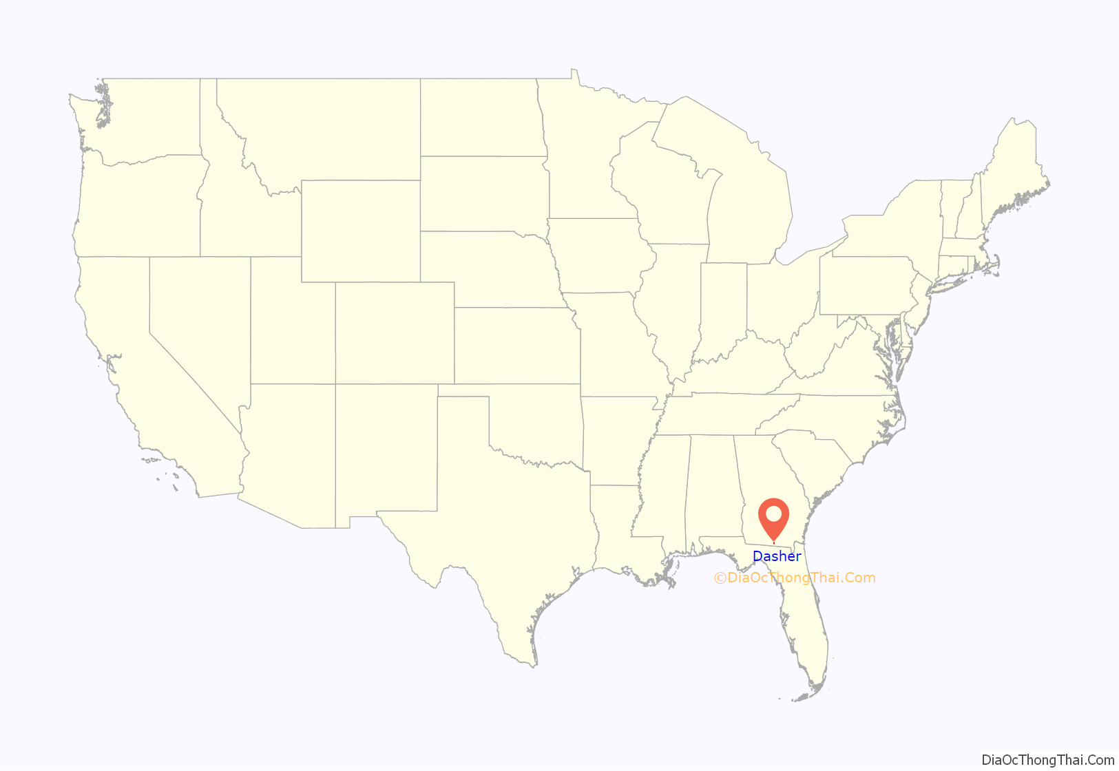
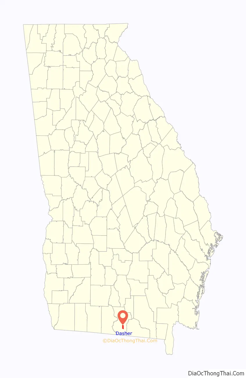
Dasher location map. Where is Dasher town?
History
Dasher was established as a station on the route of the newly completed Georgia Southern and Florida Railway in 1889 at the residence of V. F. Dasher. The Georgia General Assembly incorporated Dasher in 1968.
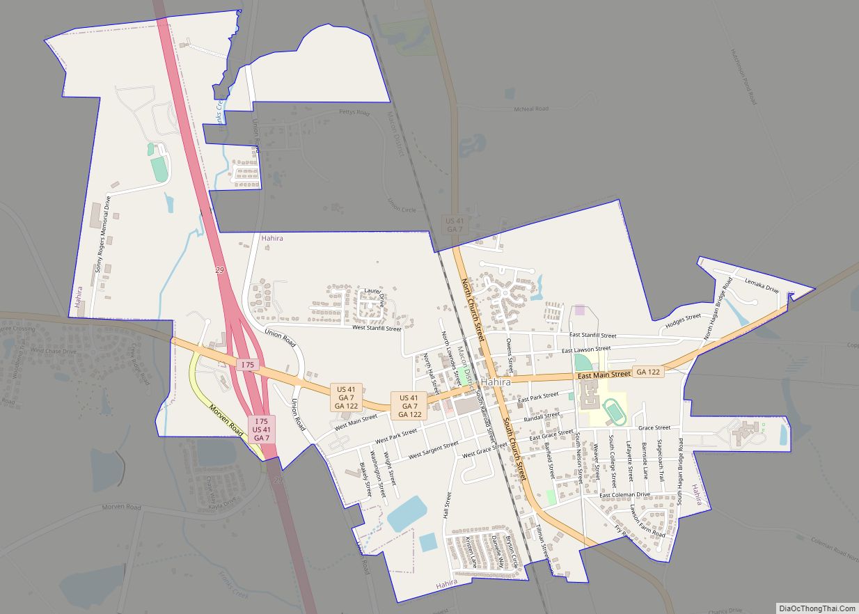
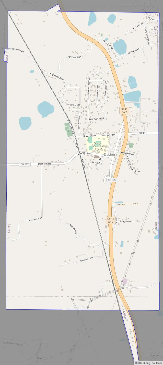
Dasher Road Map
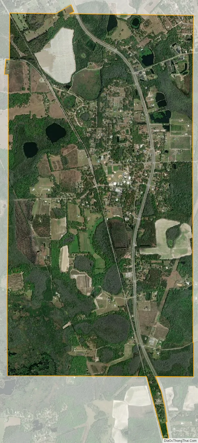
Dasher city Satellite Map
Geography
Dasher is located in southeastern Lowndes County at 30°44′43″N 83°13′23″W / 30.74528°N 83.22306°W / 30.74528; -83.22306 (30.745391, -83.222919). U.S. Route 41 passes through the town, leading northwest 7 miles (11 km) to Valdosta, the county seat, and southeast 6 miles (10 km) to Lake Park.
According to the United States Census Bureau, the town has a total area of 5.0 square miles (12.9 km), of which 4.6 square miles (11.8 km) are land and 0.42 square miles (1.1 km), or 8.44%, are water.
See also
Map of Georgia State and its subdivision:- Appling
- Atkinson
- Bacon
- Baker
- Baldwin
- Banks
- Barrow
- Bartow
- Ben Hill
- Berrien
- Bibb
- Bleckley
- Brantley
- Brooks
- Bryan
- Bulloch
- Burke
- Butts
- Calhoun
- Camden
- Candler
- Carroll
- Catoosa
- Charlton
- Chatham
- Chattahoochee
- Chattooga
- Cherokee
- Clarke
- Clay
- Clayton
- Clinch
- Cobb
- Coffee
- Colquitt
- Columbia
- Cook
- Coweta
- Crawford
- Crisp
- Dade
- Dawson
- Decatur
- DeKalb
- Dodge
- Dooly
- Dougherty
- Douglas
- Early
- Echols
- Effingham
- Elbert
- Emanuel
- Evans
- Fannin
- Fayette
- Floyd
- Forsyth
- Franklin
- Fulton
- Gilmer
- Glascock
- Glynn
- Gordon
- Grady
- Greene
- Gwinnett
- Habersham
- Hall
- Hancock
- Haralson
- Harris
- Hart
- Heard
- Henry
- Houston
- Irwin
- Jackson
- Jasper
- Jeff Davis
- Jefferson
- Jenkins
- Johnson
- Jones
- Lamar
- Lanier
- Laurens
- Lee
- Liberty
- Lincoln
- Long
- Lowndes
- Lumpkin
- Macon
- Madison
- Marion
- McDuffie
- McIntosh
- Meriwether
- Miller
- Mitchell
- Monroe
- Montgomery
- Morgan
- Murray
- Muscogee
- Newton
- Oconee
- Oglethorpe
- Paulding
- Peach
- Pickens
- Pierce
- Pike
- Polk
- Pulaski
- Putnam
- Quitman
- Rabun
- Randolph
- Richmond
- Rockdale
- Schley
- Screven
- Seminole
- Spalding
- Stephens
- Stewart
- Sumter
- Talbot
- Taliaferro
- Tattnall
- Taylor
- Telfair
- Terrell
- Thomas
- Tift
- Toombs
- Towns
- Treutlen
- Troup
- Turner
- Twiggs
- Union
- Upson
- Walker
- Walton
- Ware
- Warren
- Washington
- Wayne
- Webster
- Wheeler
- White
- Whitfield
- Wilcox
- Wilkes
- Wilkinson
- Worth
- Alabama
- Alaska
- Arizona
- Arkansas
- California
- Colorado
- Connecticut
- Delaware
- District of Columbia
- Florida
- Georgia
- Hawaii
- Idaho
- Illinois
- Indiana
- Iowa
- Kansas
- Kentucky
- Louisiana
- Maine
- Maryland
- Massachusetts
- Michigan
- Minnesota
- Mississippi
- Missouri
- Montana
- Nebraska
- Nevada
- New Hampshire
- New Jersey
- New Mexico
- New York
- North Carolina
- North Dakota
- Ohio
- Oklahoma
- Oregon
- Pennsylvania
- Rhode Island
- South Carolina
- South Dakota
- Tennessee
- Texas
- Utah
- Vermont
- Virginia
- Washington
- West Virginia
- Wisconsin
- Wyoming