Hahira (/heɪˈhaɪrə/) is a city in northwest Lowndes County, Georgia, United States. The population was 2,737 at the 2010 census, up from 1,626 at the 2000 census.
Hahira has a mayor-council form of elected government. It is led by Mayor Bruce Cain and the four members of the City Council, elected from single-member districts. The city is mentioned in several songs by comedian/songwriter Ray Stevens, most notably the song “Shriner’s Convention.”
| Name: | Hahira city |
|---|---|
| LSAD Code: | 25 |
| LSAD Description: | city (suffix) |
| State: | Georgia |
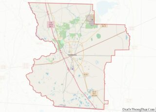
| County: | Lowndes County |
| Elevation: | 225 ft (69 m) |
| Total Area: | 2.80 sq mi (7.26 km²) |
| Land Area: | 2.69 sq mi (6.97 km²) |
| Water Area: | 0.11 sq mi (0.29 km²) |
| Total Population: | 3,384 |
| Population Density: | 1,257.53/sq mi (485.48/km²) |
| ZIP code: | 31632 |
| Area code: | 229 |
| FIPS code: | 1336052 |
| GNISfeature ID: | 0315009 |
| Website: | www.hahiraga.gov |
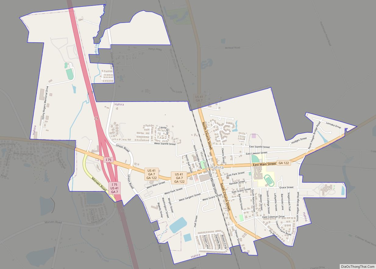
Online Interactive Map
Click on ![]() to view map in "full screen" mode.
to view map in "full screen" mode.
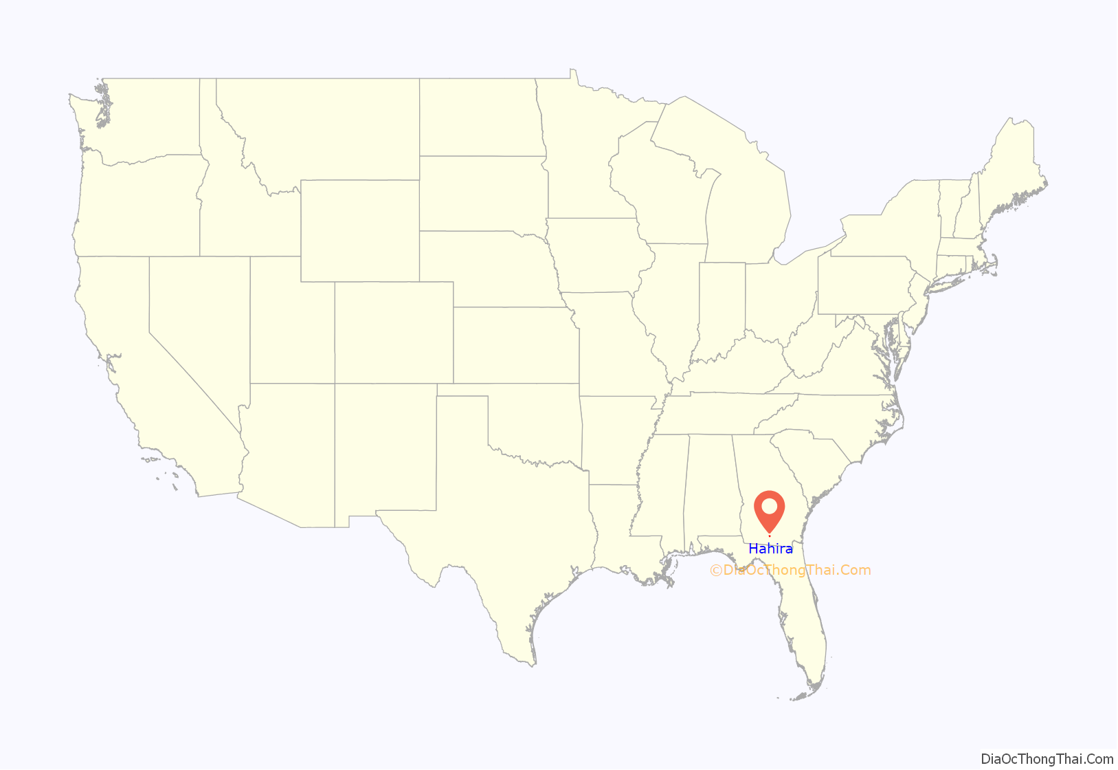
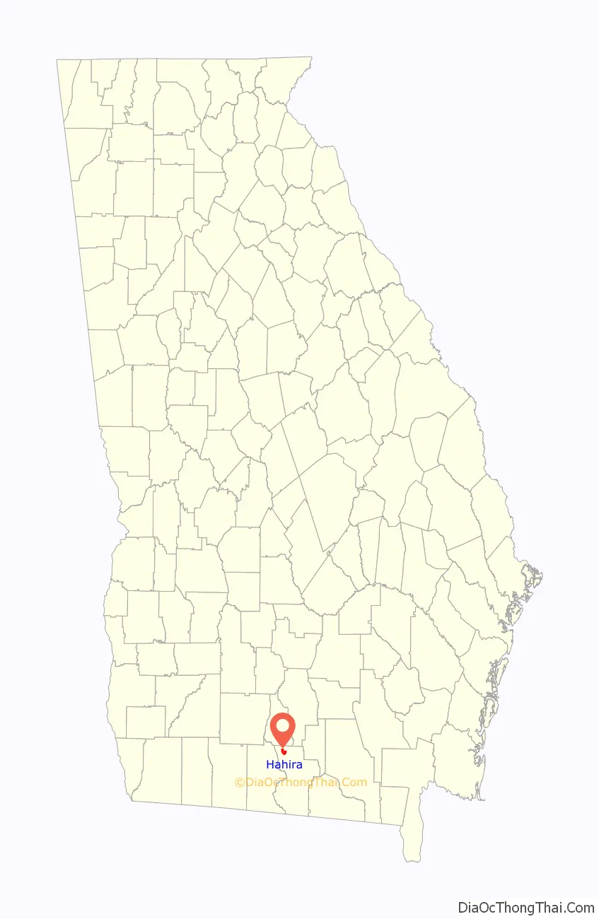
Hahira location map. Where is Hahira city?
History
According to legend, the town of Hahira was named after a local cotton plantation. The planter was said to have named his estate after a West African village, Hairaairee, which was described to him by an English traveler. According to another version, the name may be derived from Hahiroth, a place mentioned in the Hebrew Bible.
The Georgia General Assembly incorporated Hahira in 1891.
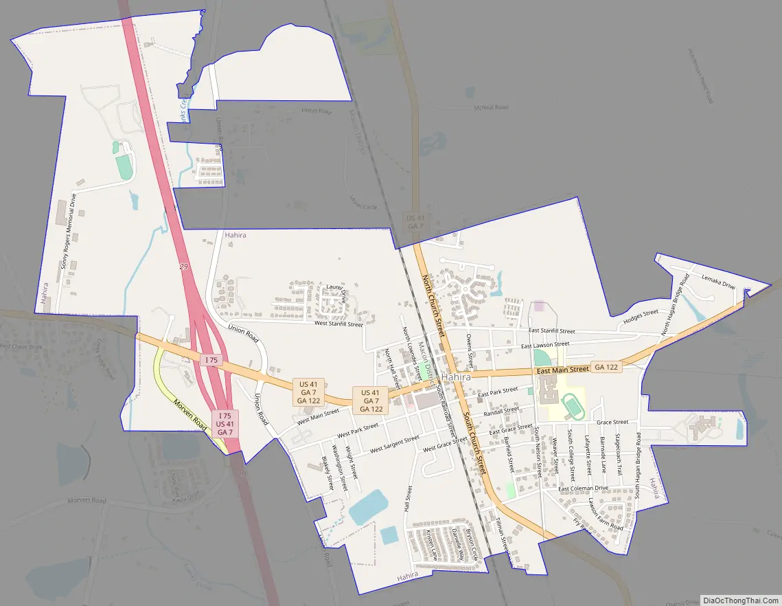
Hahira Road Map
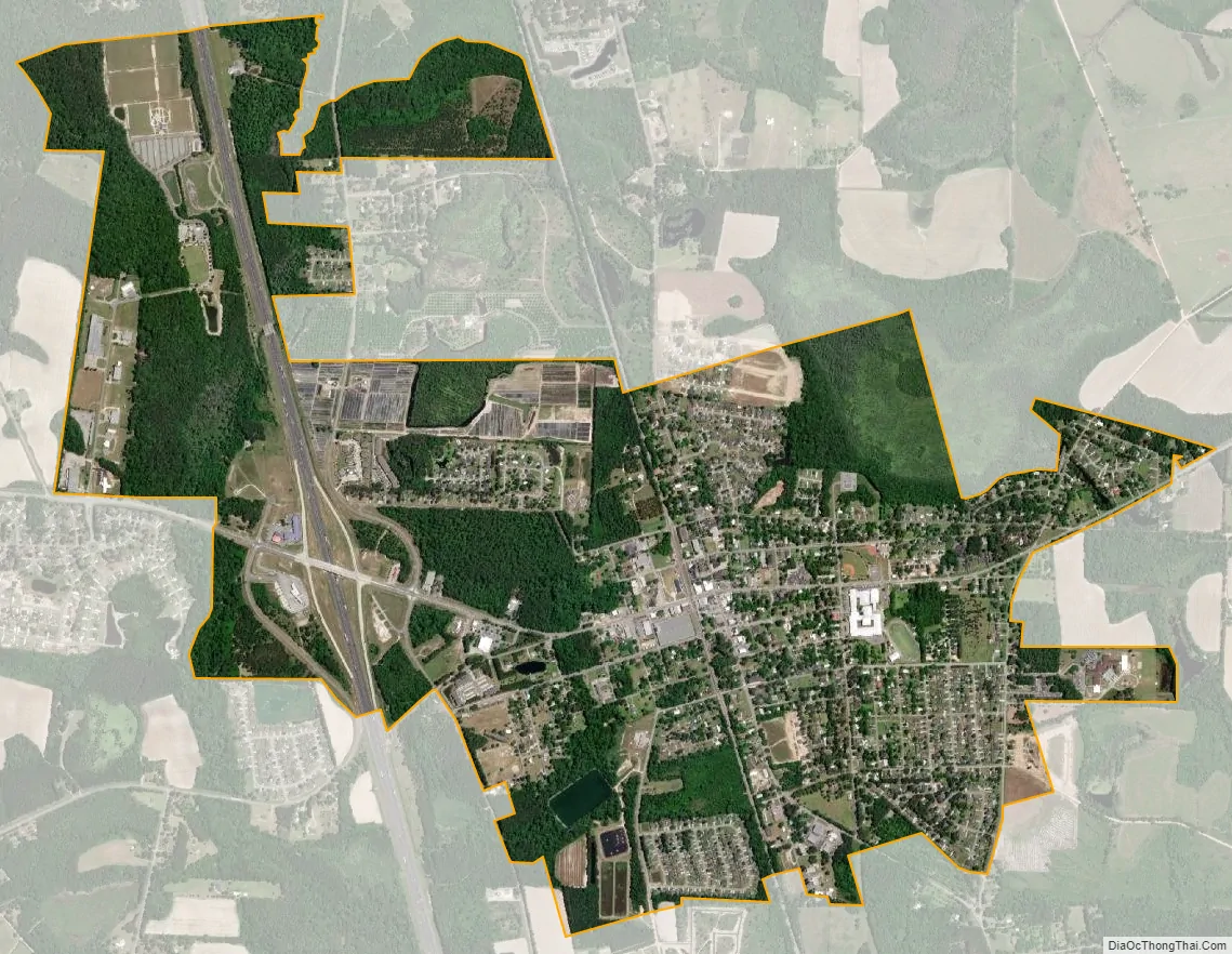
Hahira city Satellite Map
Geography
Hahira is located at 30°59′26″N 83°22′17″W / 30.99056°N 83.37139°W / 30.99056; -83.37139 (30.990537, -83.371433). U.S. Route 41 passes through the center of town as Church Street, leading north 4 miles (6 km) to Cecil and south 14 miles (23 km) to Valdosta, the county seat. Interstate 75 passes through the west side of Hahira, with access from Exit 29 (Georgia State Route 122). I-75 leads north 33 miles (53 km) to Tifton and south past Valdosta 74 miles (119 km) to Lake City, Florida. State Route 122 is Hahira’s Main Street and leads east 18 miles (29 km) to Lakeland and west 22 miles (35 km) to Pavo.
According to the United States Census Bureau, Hahira has a total area of 2.80 square miles (7.26 km), of which 2.69 square miles (6.97 km) are land and 0.11 square miles (0.29 km), or 4.00%, are water. Franks Creek runs through the westernmost part of the city and is part of the Little River–Withlachoochee River–Suwannee River watershed, flowing to the Gulf of Mexico.
See also
Map of Georgia State and its subdivision:- Appling
- Atkinson
- Bacon
- Baker
- Baldwin
- Banks
- Barrow
- Bartow
- Ben Hill
- Berrien
- Bibb
- Bleckley
- Brantley
- Brooks
- Bryan
- Bulloch
- Burke
- Butts
- Calhoun
- Camden
- Candler
- Carroll
- Catoosa
- Charlton
- Chatham
- Chattahoochee
- Chattooga
- Cherokee
- Clarke
- Clay
- Clayton
- Clinch
- Cobb
- Coffee
- Colquitt
- Columbia
- Cook
- Coweta
- Crawford
- Crisp
- Dade
- Dawson
- Decatur
- DeKalb
- Dodge
- Dooly
- Dougherty
- Douglas
- Early
- Echols
- Effingham
- Elbert
- Emanuel
- Evans
- Fannin
- Fayette
- Floyd
- Forsyth
- Franklin
- Fulton
- Gilmer
- Glascock
- Glynn
- Gordon
- Grady
- Greene
- Gwinnett
- Habersham
- Hall
- Hancock
- Haralson
- Harris
- Hart
- Heard
- Henry
- Houston
- Irwin
- Jackson
- Jasper
- Jeff Davis
- Jefferson
- Jenkins
- Johnson
- Jones
- Lamar
- Lanier
- Laurens
- Lee
- Liberty
- Lincoln
- Long
- Lowndes
- Lumpkin
- Macon
- Madison
- Marion
- McDuffie
- McIntosh
- Meriwether
- Miller
- Mitchell
- Monroe
- Montgomery
- Morgan
- Murray
- Muscogee
- Newton
- Oconee
- Oglethorpe
- Paulding
- Peach
- Pickens
- Pierce
- Pike
- Polk
- Pulaski
- Putnam
- Quitman
- Rabun
- Randolph
- Richmond
- Rockdale
- Schley
- Screven
- Seminole
- Spalding
- Stephens
- Stewart
- Sumter
- Talbot
- Taliaferro
- Tattnall
- Taylor
- Telfair
- Terrell
- Thomas
- Tift
- Toombs
- Towns
- Treutlen
- Troup
- Turner
- Twiggs
- Union
- Upson
- Walker
- Walton
- Ware
- Warren
- Washington
- Wayne
- Webster
- Wheeler
- White
- Whitfield
- Wilcox
- Wilkes
- Wilkinson
- Worth
- Alabama
- Alaska
- Arizona
- Arkansas
- California
- Colorado
- Connecticut
- Delaware
- District of Columbia
- Florida
- Georgia
- Hawaii
- Idaho
- Illinois
- Indiana
- Iowa
- Kansas
- Kentucky
- Louisiana
- Maine
- Maryland
- Massachusetts
- Michigan
- Minnesota
- Mississippi
- Missouri
- Montana
- Nebraska
- Nevada
- New Hampshire
- New Jersey
- New Mexico
- New York
- North Carolina
- North Dakota
- Ohio
- Oklahoma
- Oregon
- Pennsylvania
- Rhode Island
- South Carolina
- South Dakota
- Tennessee
- Texas
- Utah
- Vermont
- Virginia
- Washington
- West Virginia
- Wisconsin
- Wyoming