Lake Park is a city in Lowndes County, Georgia, United States. The population was 733 at the 2010 census, up from 549 at the 2000 census.
| Name: | Lake Park city |
|---|---|
| LSAD Code: | 25 |
| LSAD Description: | city (suffix) |
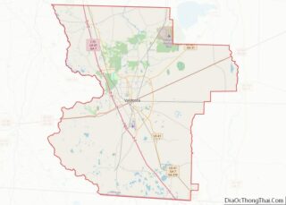
| State: | Georgia |
| County: | Lowndes County |
| Incorporated: | 29 December 1890 |
| Elevation: | 157 ft (48 m) |
| Total Area: | 1.43 sq mi (3.70 km²) |
| Land Area: | 1.41 sq mi (3.64 km²) |
| Water Area: | 0.02 sq mi (0.05 km²) |
| Total Population: | 932 |
| Population Density: | 662.40/sq mi (255.74/km²) |
| ZIP code: | 31636 |
| Area code: | 229 |
| FIPS code: | 1344704 |
| GNISfeature ID: | 0332166 |
| Website: | cityoflakeparkga.com |
Online Interactive Map
Click on ![]() to view map in "full screen" mode.
to view map in "full screen" mode.
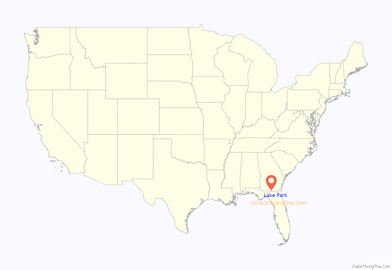
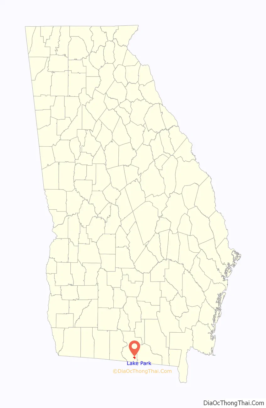
Lake Park location map. Where is Lake Park city?
History
Lake Park was laid out in 1889 along the route of the newly completed Georgia Southern and Florida Railway. It was originally named Lawrence after its founder Lawrence A. Wisenbaker. The name Lawrenceville was rejected due to there already being a town of that same name in Georgia. It was renamed Lake Park in April 1890 for the many lakes surrounding the original town site. The Georgia General Assembly incorporated Lake Park in December 1890.
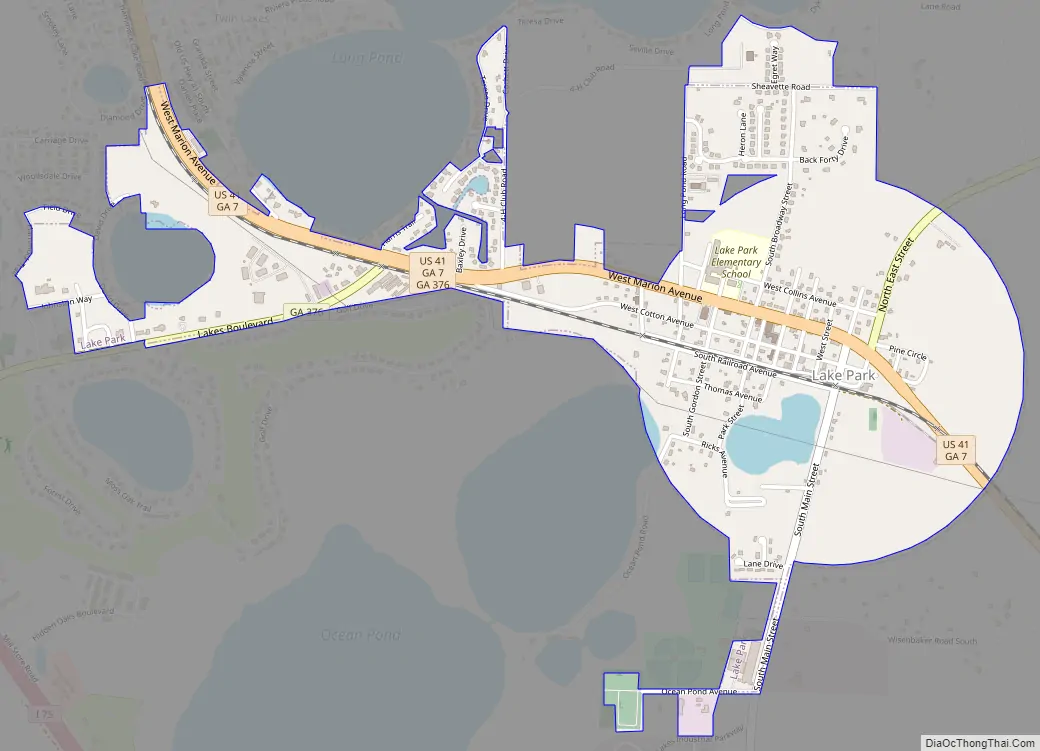
Lake Park Road Map
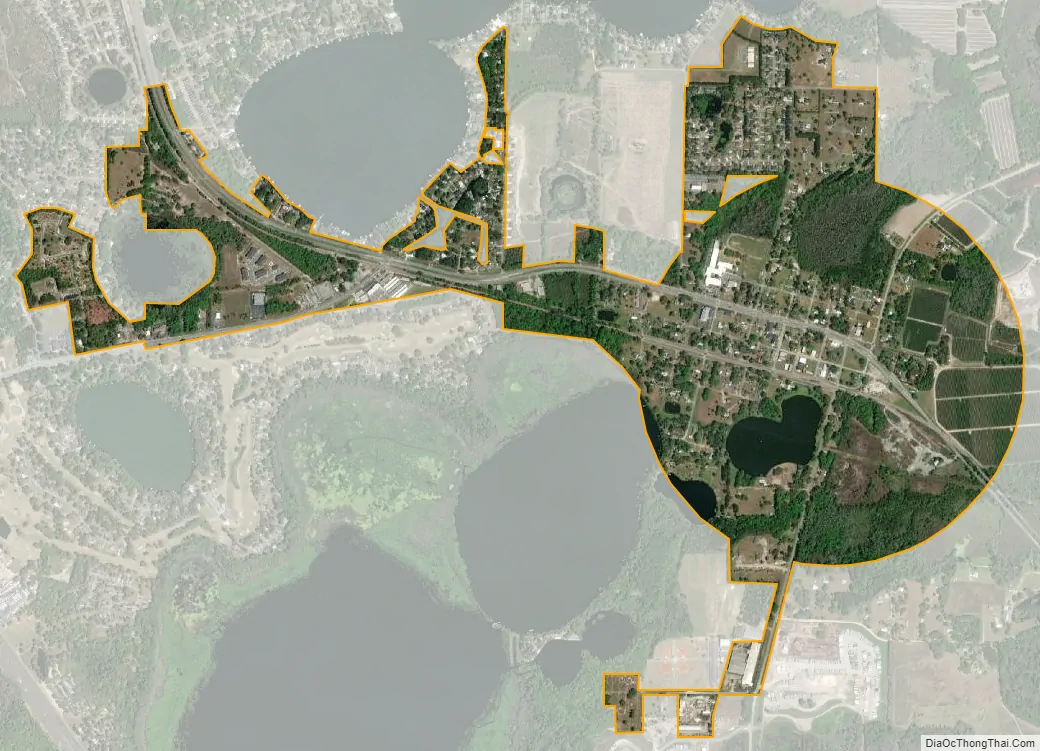
Lake Park city Satellite Map
Geography
Lake Park is located in southeastern Lowndes County at 30°41′5″N 83°11′16″W / 30.68472°N 83.18778°W / 30.68472; -83.18778 (30.684704, -83.187639). It is bordered to the northwest by the unincorporated community of Twin Lakes.
U.S. Route 41 passes through the center of town as Marion Avenue. It leads northwest 13 miles (21 km) to Valdosta, the county seat, and southeast 7 miles (11 km) to Jennings, Florida. Georgia State Route 376 leads east 10 miles (16 km) to Statenville and west 8 miles (13 km) to Clyattville. Interstate 75 passes west and south of Lake Park, with access from Exits 2 (Belville Road) and 5 (State Route 376). I-75 leads north past Valdosta 57 miles (92 km) to Tifton and southeast 47 miles (76 km) to Lake City, Florida.
According to the United States Census Bureau, Lake Park has a total area of 1.4 square miles (3.7 km), of which 0.019 square miles (0.05 km), or 1.48%, are water. There are several natural lakes west and north of the city, including two (Ocean Pond and Long Pond) within the city limits.
See also
Map of Georgia State and its subdivision:- Appling
- Atkinson
- Bacon
- Baker
- Baldwin
- Banks
- Barrow
- Bartow
- Ben Hill
- Berrien
- Bibb
- Bleckley
- Brantley
- Brooks
- Bryan
- Bulloch
- Burke
- Butts
- Calhoun
- Camden
- Candler
- Carroll
- Catoosa
- Charlton
- Chatham
- Chattahoochee
- Chattooga
- Cherokee
- Clarke
- Clay
- Clayton
- Clinch
- Cobb
- Coffee
- Colquitt
- Columbia
- Cook
- Coweta
- Crawford
- Crisp
- Dade
- Dawson
- Decatur
- DeKalb
- Dodge
- Dooly
- Dougherty
- Douglas
- Early
- Echols
- Effingham
- Elbert
- Emanuel
- Evans
- Fannin
- Fayette
- Floyd
- Forsyth
- Franklin
- Fulton
- Gilmer
- Glascock
- Glynn
- Gordon
- Grady
- Greene
- Gwinnett
- Habersham
- Hall
- Hancock
- Haralson
- Harris
- Hart
- Heard
- Henry
- Houston
- Irwin
- Jackson
- Jasper
- Jeff Davis
- Jefferson
- Jenkins
- Johnson
- Jones
- Lamar
- Lanier
- Laurens
- Lee
- Liberty
- Lincoln
- Long
- Lowndes
- Lumpkin
- Macon
- Madison
- Marion
- McDuffie
- McIntosh
- Meriwether
- Miller
- Mitchell
- Monroe
- Montgomery
- Morgan
- Murray
- Muscogee
- Newton
- Oconee
- Oglethorpe
- Paulding
- Peach
- Pickens
- Pierce
- Pike
- Polk
- Pulaski
- Putnam
- Quitman
- Rabun
- Randolph
- Richmond
- Rockdale
- Schley
- Screven
- Seminole
- Spalding
- Stephens
- Stewart
- Sumter
- Talbot
- Taliaferro
- Tattnall
- Taylor
- Telfair
- Terrell
- Thomas
- Tift
- Toombs
- Towns
- Treutlen
- Troup
- Turner
- Twiggs
- Union
- Upson
- Walker
- Walton
- Ware
- Warren
- Washington
- Wayne
- Webster
- Wheeler
- White
- Whitfield
- Wilcox
- Wilkes
- Wilkinson
- Worth
- Alabama
- Alaska
- Arizona
- Arkansas
- California
- Colorado
- Connecticut
- Delaware
- District of Columbia
- Florida
- Georgia
- Hawaii
- Idaho
- Illinois
- Indiana
- Iowa
- Kansas
- Kentucky
- Louisiana
- Maine
- Maryland
- Massachusetts
- Michigan
- Minnesota
- Mississippi
- Missouri
- Montana
- Nebraska
- Nevada
- New Hampshire
- New Jersey
- New Mexico
- New York
- North Carolina
- North Dakota
- Ohio
- Oklahoma
- Oregon
- Pennsylvania
- Rhode Island
- South Carolina
- South Dakota
- Tennessee
- Texas
- Utah
- Vermont
- Virginia
- Washington
- West Virginia
- Wisconsin
- Wyoming