East Point is a suburban city located southwest of Atlanta in Fulton County, Georgia, United States. As of the 2020 census, the city had a population of 38,358. The city name is derived from being at the opposite end of the former Atlanta & West Point Railroad from West Point.
| Name: | East Point city |
|---|---|
| LSAD Code: | 25 |
| LSAD Description: | city (suffix) |
| State: | Georgia |
| County: | Fulton County |
| Elevation: | 961 ft (293 m) |
| Total Area: | 14.70 sq mi (38.08 km²) |
| Land Area: | 14.69 sq mi (38.04 km²) |
| Water Area: | 0.01 sq mi (0.04 km²) |
| Total Population: | 38,358 |
| Population Density: | 2,611.34/sq mi (1,008.24/km²) |
| ZIP code: | 30344, 30364 |
| Area code: | 404 |
| FIPS code: | 1325720 |
| GNISfeature ID: | 2403534 |
| Website: | www.eastpointcity.org |
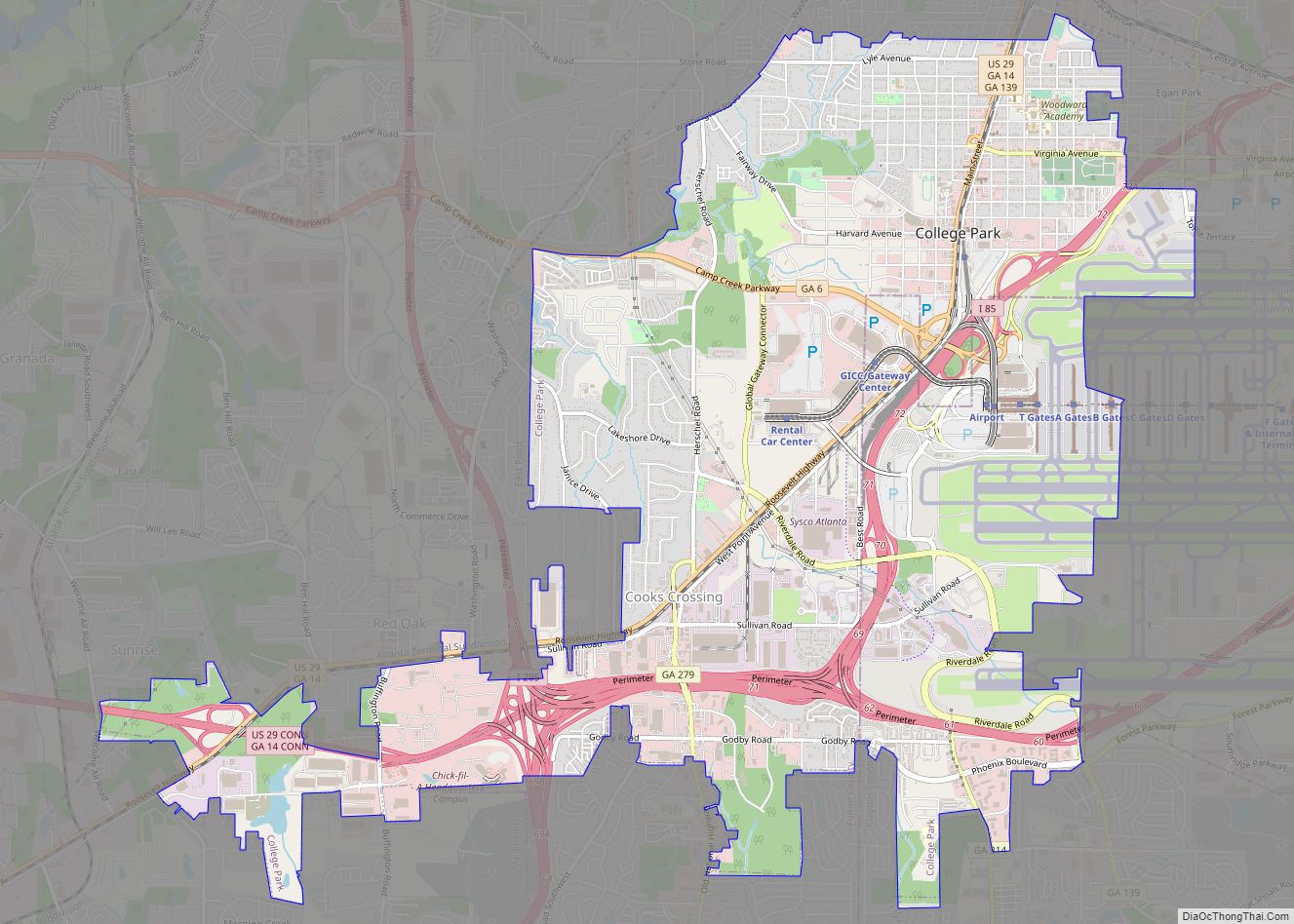
Online Interactive Map
Click on ![]() to view map in "full screen" mode.
to view map in "full screen" mode.
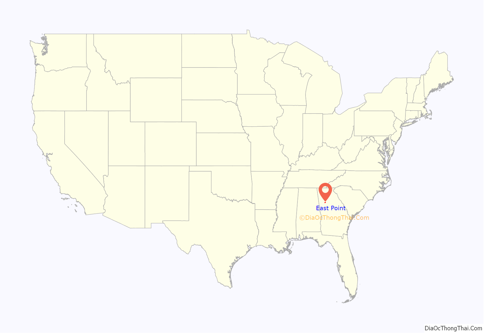
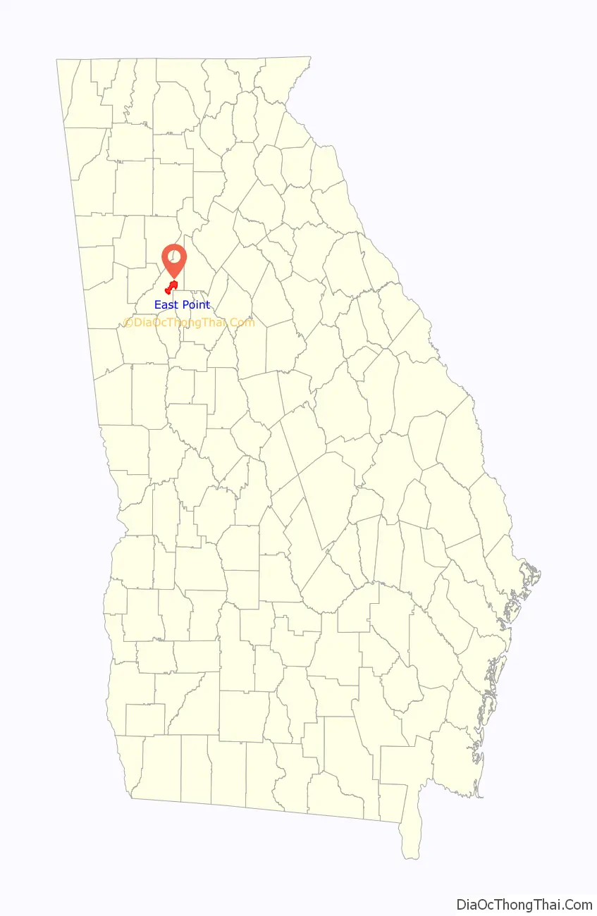
East Point location map. Where is East Point city?
History
The name “East Point” derives from the fact that this is the terminus of the Atlanta & West Point Railroad in the east; West Point, Georgia, is the terminus where the rail line ends in the west.
This settlement was founded as a railroad terminus with 16 families in 1870, but grew quickly after it became an inviting place for industry to develop. Soon it boasted the railway, two gristmills, and a government distillery located on Connally Drive. One of the earliest buildings was the factory of the White Hickory Manufacturing Company, built by B.M. Blount and L.M. Hill (who became the first chairman of the board of aldermen of the city).
By 1880 the town had two churches, a common school, a steam-cotton gin, a sawmill, a post office (founded in 1851), a telegraph office and its own newspaper weekly, The Plow Boy. East Point ranked as a grain and cotton-growing center. With its pleasant upland climate and proximity to the railway, it was a popular summer resort for people from the city of Atlanta.
In 1884 the first telephone rang in East Point, and in 1887 the city received its first charter. In 1890 a major portion of property along East Point Avenue was subdivided and developed, opening the way for more homes, more churches, more people, and more places of employment. By 1892 Main Street was completed, despite protests from a few progress-shy early settlers who maintained that one major thoroughfare, Newnan Road, was more than sufficient.
By the start of the 20th century, the adolescent town was poised to grow into the city it eventually would become.
In late 2015 and early 2016, some scenes for the Netflix series Stranger Things were filmed at the exterior of the First Baptist Church (standing in for a hospital exterior in a fictional Indiana town).
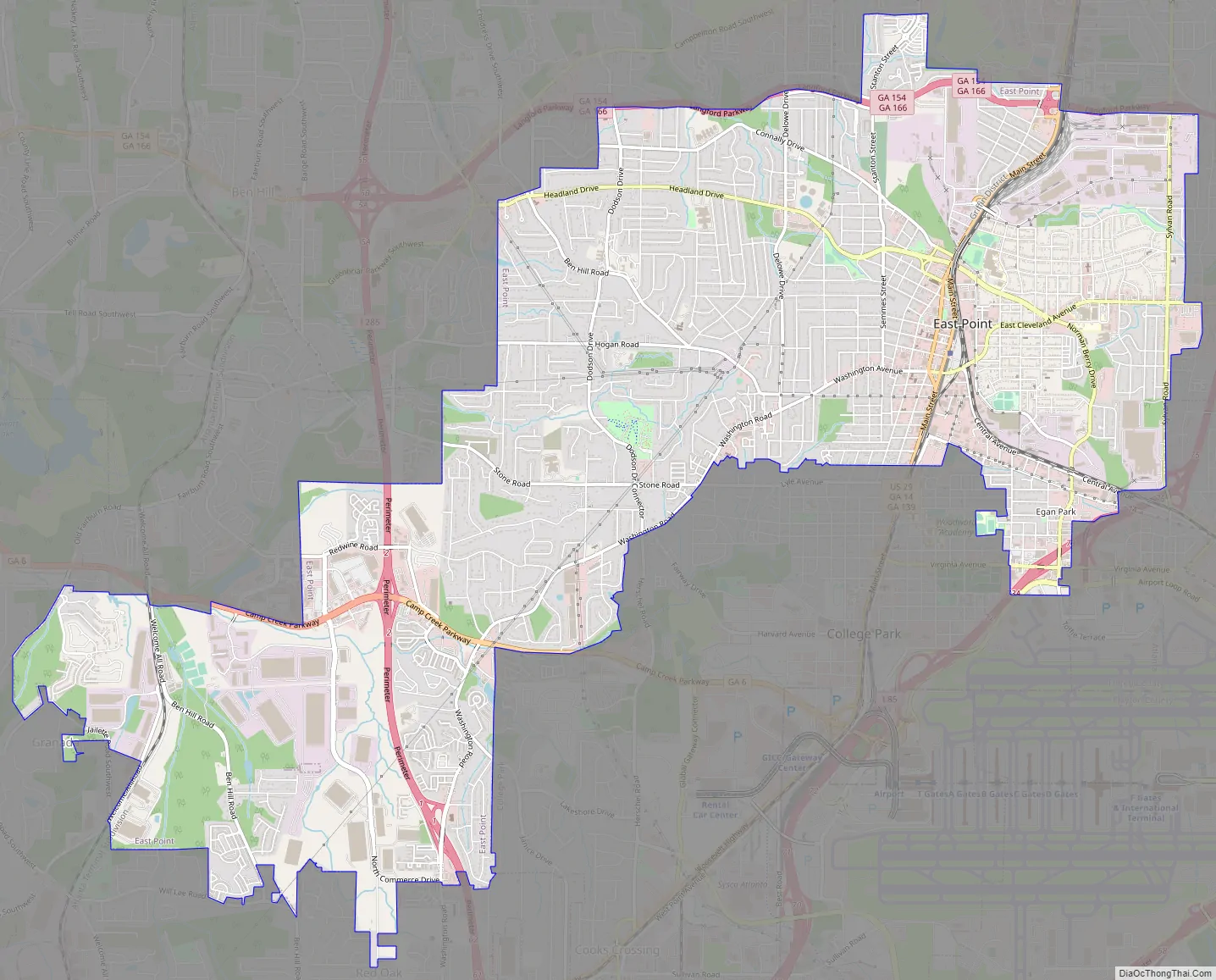
East Point Road Map
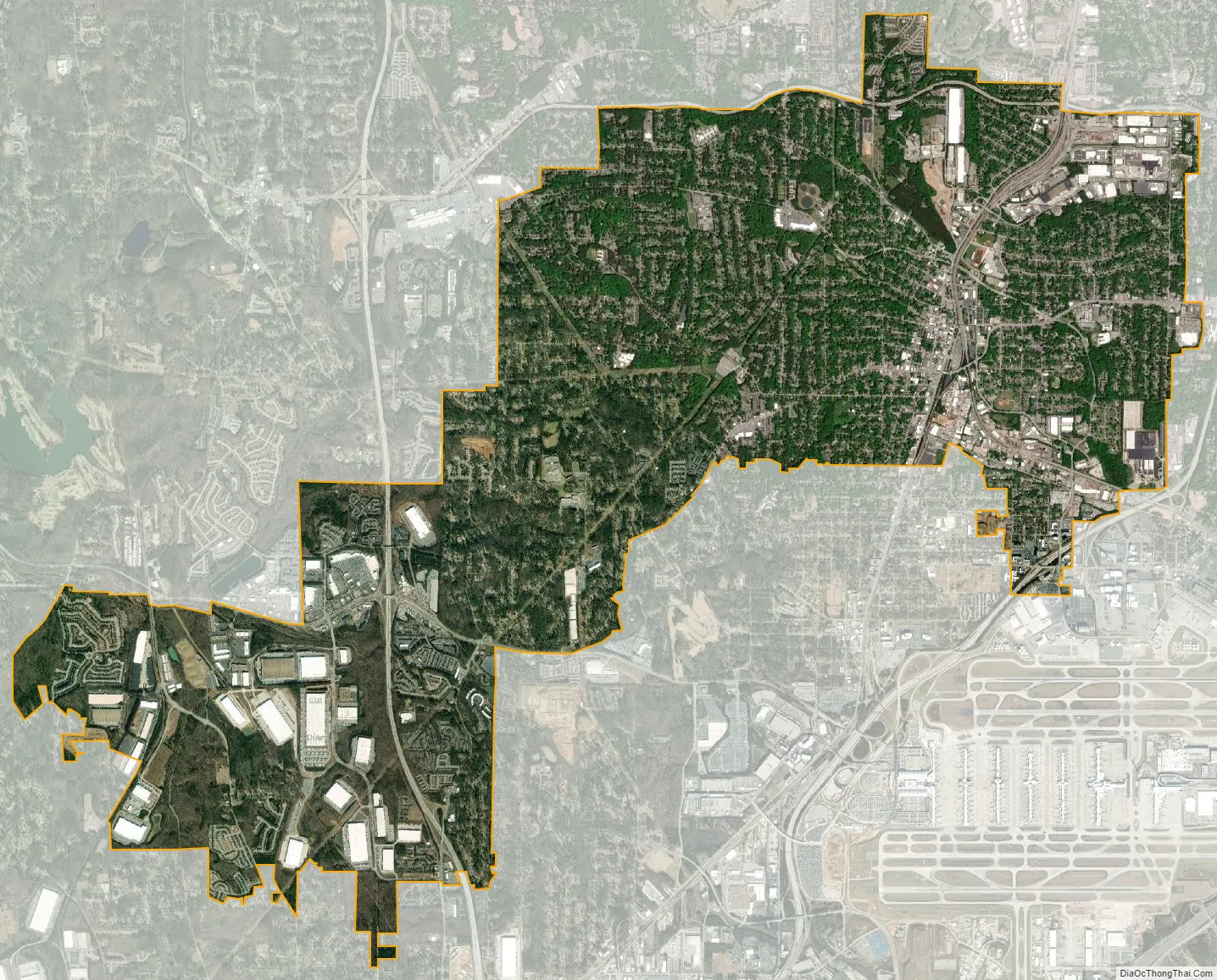
East Point city Satellite Map
Geography
East Point is located at 33°40′34″N 84°27′05″W / 33.676008°N 84.451277°W / 33.676008; -84.451277. It is bordered to the north, east, and west by the city of Atlanta, to the southeast by Hapeville, and to the south by College Park. Downtown Atlanta is 7 miles (11 km) northeast of the center of East Point.
According to the United States Census Bureau, East Point has a total area of 14.7 square miles (38.1 km), of which 0.02 square miles (0.05 km), or 0.12%, is water.
See also
Map of Georgia State and its subdivision:- Appling
- Atkinson
- Bacon
- Baker
- Baldwin
- Banks
- Barrow
- Bartow
- Ben Hill
- Berrien
- Bibb
- Bleckley
- Brantley
- Brooks
- Bryan
- Bulloch
- Burke
- Butts
- Calhoun
- Camden
- Candler
- Carroll
- Catoosa
- Charlton
- Chatham
- Chattahoochee
- Chattooga
- Cherokee
- Clarke
- Clay
- Clayton
- Clinch
- Cobb
- Coffee
- Colquitt
- Columbia
- Cook
- Coweta
- Crawford
- Crisp
- Dade
- Dawson
- Decatur
- DeKalb
- Dodge
- Dooly
- Dougherty
- Douglas
- Early
- Echols
- Effingham
- Elbert
- Emanuel
- Evans
- Fannin
- Fayette
- Floyd
- Forsyth
- Franklin
- Fulton
- Gilmer
- Glascock
- Glynn
- Gordon
- Grady
- Greene
- Gwinnett
- Habersham
- Hall
- Hancock
- Haralson
- Harris
- Hart
- Heard
- Henry
- Houston
- Irwin
- Jackson
- Jasper
- Jeff Davis
- Jefferson
- Jenkins
- Johnson
- Jones
- Lamar
- Lanier
- Laurens
- Lee
- Liberty
- Lincoln
- Long
- Lowndes
- Lumpkin
- Macon
- Madison
- Marion
- McDuffie
- McIntosh
- Meriwether
- Miller
- Mitchell
- Monroe
- Montgomery
- Morgan
- Murray
- Muscogee
- Newton
- Oconee
- Oglethorpe
- Paulding
- Peach
- Pickens
- Pierce
- Pike
- Polk
- Pulaski
- Putnam
- Quitman
- Rabun
- Randolph
- Richmond
- Rockdale
- Schley
- Screven
- Seminole
- Spalding
- Stephens
- Stewart
- Sumter
- Talbot
- Taliaferro
- Tattnall
- Taylor
- Telfair
- Terrell
- Thomas
- Tift
- Toombs
- Towns
- Treutlen
- Troup
- Turner
- Twiggs
- Union
- Upson
- Walker
- Walton
- Ware
- Warren
- Washington
- Wayne
- Webster
- Wheeler
- White
- Whitfield
- Wilcox
- Wilkes
- Wilkinson
- Worth
- Alabama
- Alaska
- Arizona
- Arkansas
- California
- Colorado
- Connecticut
- Delaware
- District of Columbia
- Florida
- Georgia
- Hawaii
- Idaho
- Illinois
- Indiana
- Iowa
- Kansas
- Kentucky
- Louisiana
- Maine
- Maryland
- Massachusetts
- Michigan
- Minnesota
- Mississippi
- Missouri
- Montana
- Nebraska
- Nevada
- New Hampshire
- New Jersey
- New Mexico
- New York
- North Carolina
- North Dakota
- Ohio
- Oklahoma
- Oregon
- Pennsylvania
- Rhode Island
- South Carolina
- South Dakota
- Tennessee
- Texas
- Utah
- Vermont
- Virginia
- Washington
- West Virginia
- Wisconsin
- Wyoming