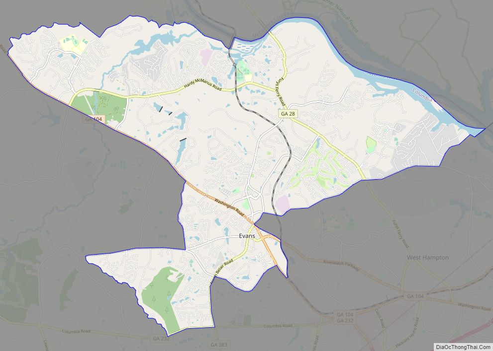
Evans is a census-designated place (CDP) in Columbia County, Georgia, United States. It is a suburb of Augusta and is part of the Augusta metropolitan area. The population was 29,011 at the 2010 census, up from 17,727 at the 2000 census.
Evans County is named after General Clement A. Evans, however according to an interview with his son, Lawton B. Evans, in the Augusta Chronicle, the town of Evans was not named after his father, but rather after an unrelated family by the same last name. Evans is the de facto county seat of Columbia County, although Appling still holds the de jure designation. The Columbia County Government Center, the Government Complex Addition, and the Columbia County Courthouse Annex are all located in Evans.
| Name: | Evans CDP |
|---|---|
| LSAD Code: | 57 |
| LSAD Description: | CDP (suffix) |
| State: | Georgia |
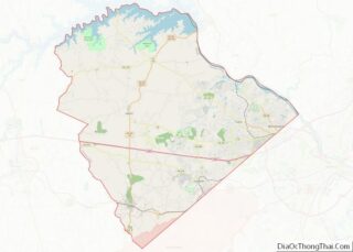
| County: | Columbia County |
| Elevation: | 417 ft (127 m) |
| Total Area: | 26.55 sq mi (68.77 km²) |
| Land Area: | 25.27 sq mi (65.44 km²) |
| Water Area: | 1.28 sq mi (3.33 km²) |
| Total Population: | 34,536 |
| Population Density: | 1,366.84/sq mi (527.75/km²) |
| ZIP code: | 30809 |
| Area code: | 706 |
| FIPS code: | 1328044 |
| GNISfeature ID: | 0355729 |
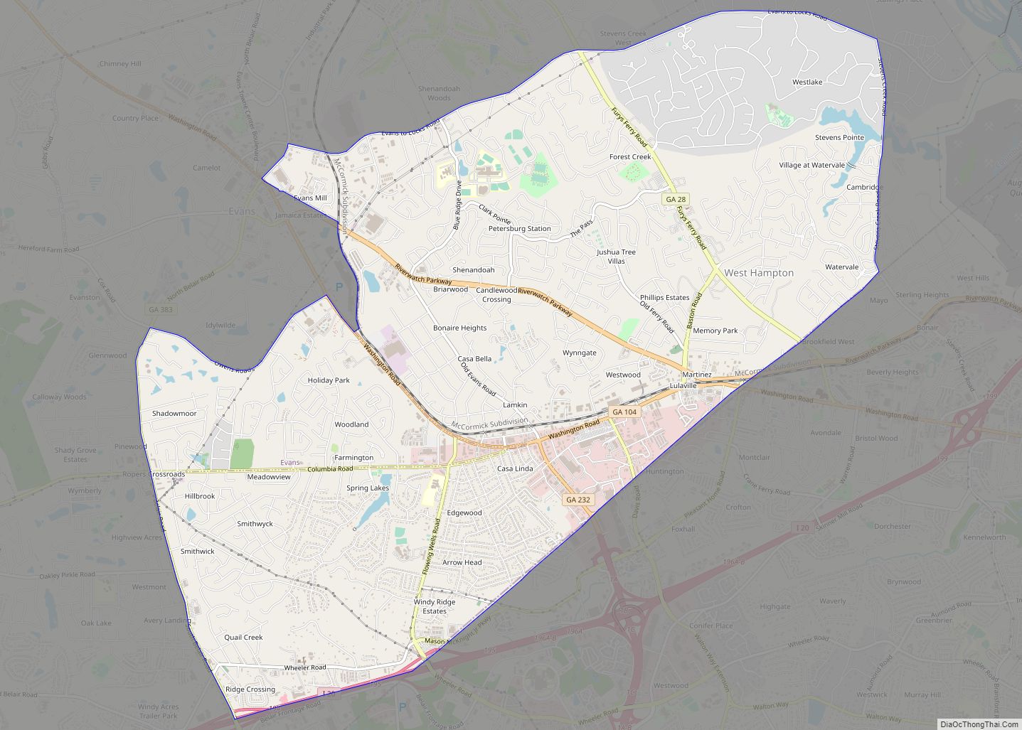
Online Interactive Map
Click on ![]() to view map in "full screen" mode.
to view map in "full screen" mode.
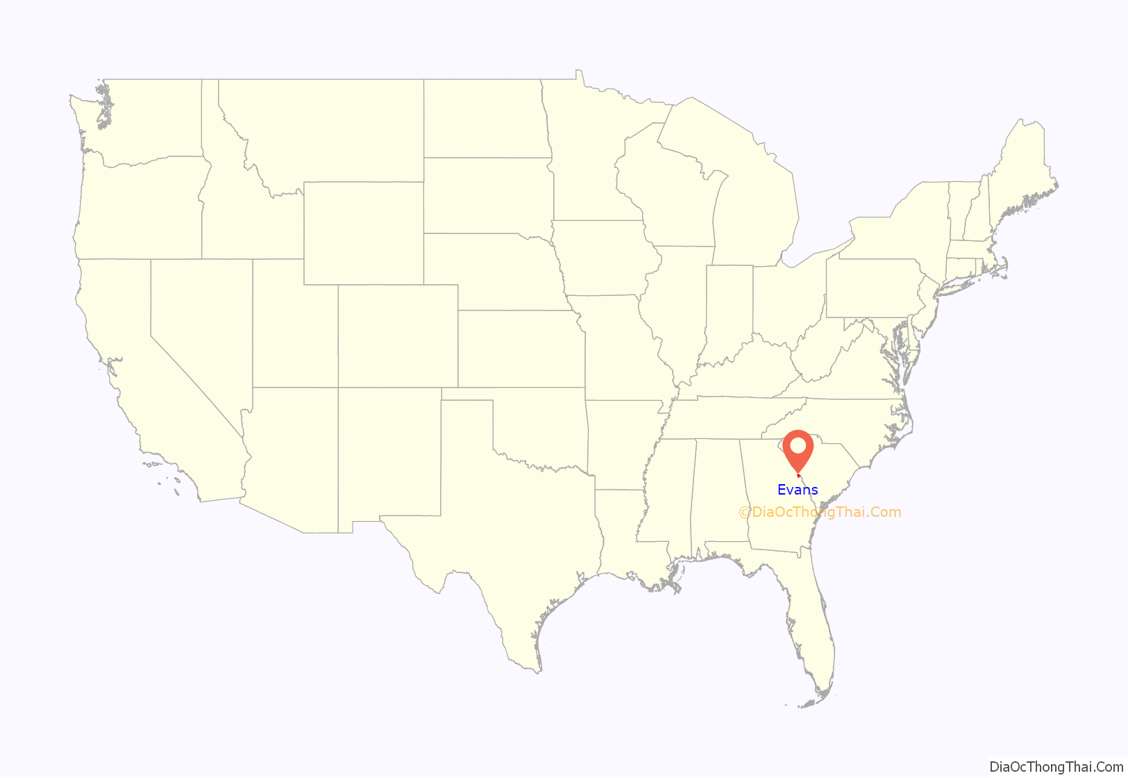
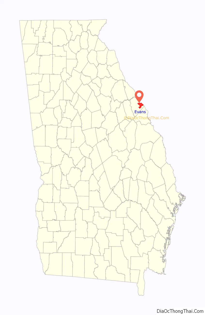
Evans location map. Where is Evans CDP?
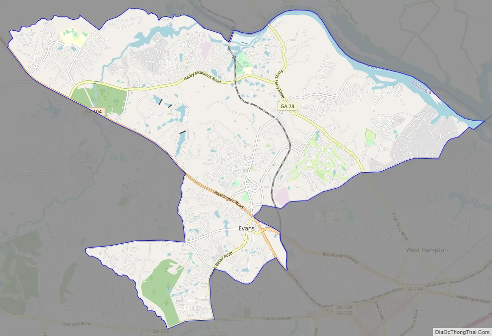
Evans Road Map
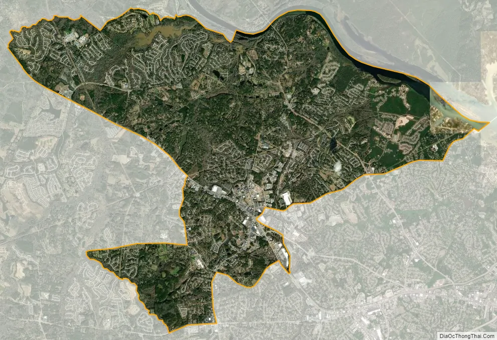
Evans city Satellite Map
Geography
Evans is located in eastern Columbia County, bordered to the northeast by the Savannah River, which forms the South Carolina state line. To the southeast is the town of Martinez. Downtown Augusta is 11 miles (18 km) to the southeast.
The original community of Evans is centered on North Belair Road (Georgia State Route 383 (SR 383)) southwest of Washington Road (SR 104). The community extends west from this point to Gibbs Road and Crawford Creek and south as far as Columbia Road (SR 232), but most of the settled area is north of Washington Road and Evans to Locks Road, extending west as far as Little Kiokee Creek and east to Stevens Creek Dam on the Savannah River.
According to the United States Census Bureau, the CDP has a total area of 26.6 square miles (68.8 km), of which 25.3 square miles (65.4 km) is land and 1.3 square miles (3.3 km), or 4.87%, is water.
See also
Map of Georgia State and its subdivision:- Appling
- Atkinson
- Bacon
- Baker
- Baldwin
- Banks
- Barrow
- Bartow
- Ben Hill
- Berrien
- Bibb
- Bleckley
- Brantley
- Brooks
- Bryan
- Bulloch
- Burke
- Butts
- Calhoun
- Camden
- Candler
- Carroll
- Catoosa
- Charlton
- Chatham
- Chattahoochee
- Chattooga
- Cherokee
- Clarke
- Clay
- Clayton
- Clinch
- Cobb
- Coffee
- Colquitt
- Columbia
- Cook
- Coweta
- Crawford
- Crisp
- Dade
- Dawson
- Decatur
- DeKalb
- Dodge
- Dooly
- Dougherty
- Douglas
- Early
- Echols
- Effingham
- Elbert
- Emanuel
- Evans
- Fannin
- Fayette
- Floyd
- Forsyth
- Franklin
- Fulton
- Gilmer
- Glascock
- Glynn
- Gordon
- Grady
- Greene
- Gwinnett
- Habersham
- Hall
- Hancock
- Haralson
- Harris
- Hart
- Heard
- Henry
- Houston
- Irwin
- Jackson
- Jasper
- Jeff Davis
- Jefferson
- Jenkins
- Johnson
- Jones
- Lamar
- Lanier
- Laurens
- Lee
- Liberty
- Lincoln
- Long
- Lowndes
- Lumpkin
- Macon
- Madison
- Marion
- McDuffie
- McIntosh
- Meriwether
- Miller
- Mitchell
- Monroe
- Montgomery
- Morgan
- Murray
- Muscogee
- Newton
- Oconee
- Oglethorpe
- Paulding
- Peach
- Pickens
- Pierce
- Pike
- Polk
- Pulaski
- Putnam
- Quitman
- Rabun
- Randolph
- Richmond
- Rockdale
- Schley
- Screven
- Seminole
- Spalding
- Stephens
- Stewart
- Sumter
- Talbot
- Taliaferro
- Tattnall
- Taylor
- Telfair
- Terrell
- Thomas
- Tift
- Toombs
- Towns
- Treutlen
- Troup
- Turner
- Twiggs
- Union
- Upson
- Walker
- Walton
- Ware
- Warren
- Washington
- Wayne
- Webster
- Wheeler
- White
- Whitfield
- Wilcox
- Wilkes
- Wilkinson
- Worth
- Alabama
- Alaska
- Arizona
- Arkansas
- California
- Colorado
- Connecticut
- Delaware
- District of Columbia
- Florida
- Georgia
- Hawaii
- Idaho
- Illinois
- Indiana
- Iowa
- Kansas
- Kentucky
- Louisiana
- Maine
- Maryland
- Massachusetts
- Michigan
- Minnesota
- Mississippi
- Missouri
- Montana
- Nebraska
- Nevada
- New Hampshire
- New Jersey
- New Mexico
- New York
- North Carolina
- North Dakota
- Ohio
- Oklahoma
- Oregon
- Pennsylvania
- Rhode Island
- South Carolina
- South Dakota
- Tennessee
- Texas
- Utah
- Vermont
- Virginia
- Washington
- West Virginia
- Wisconsin
- Wyoming