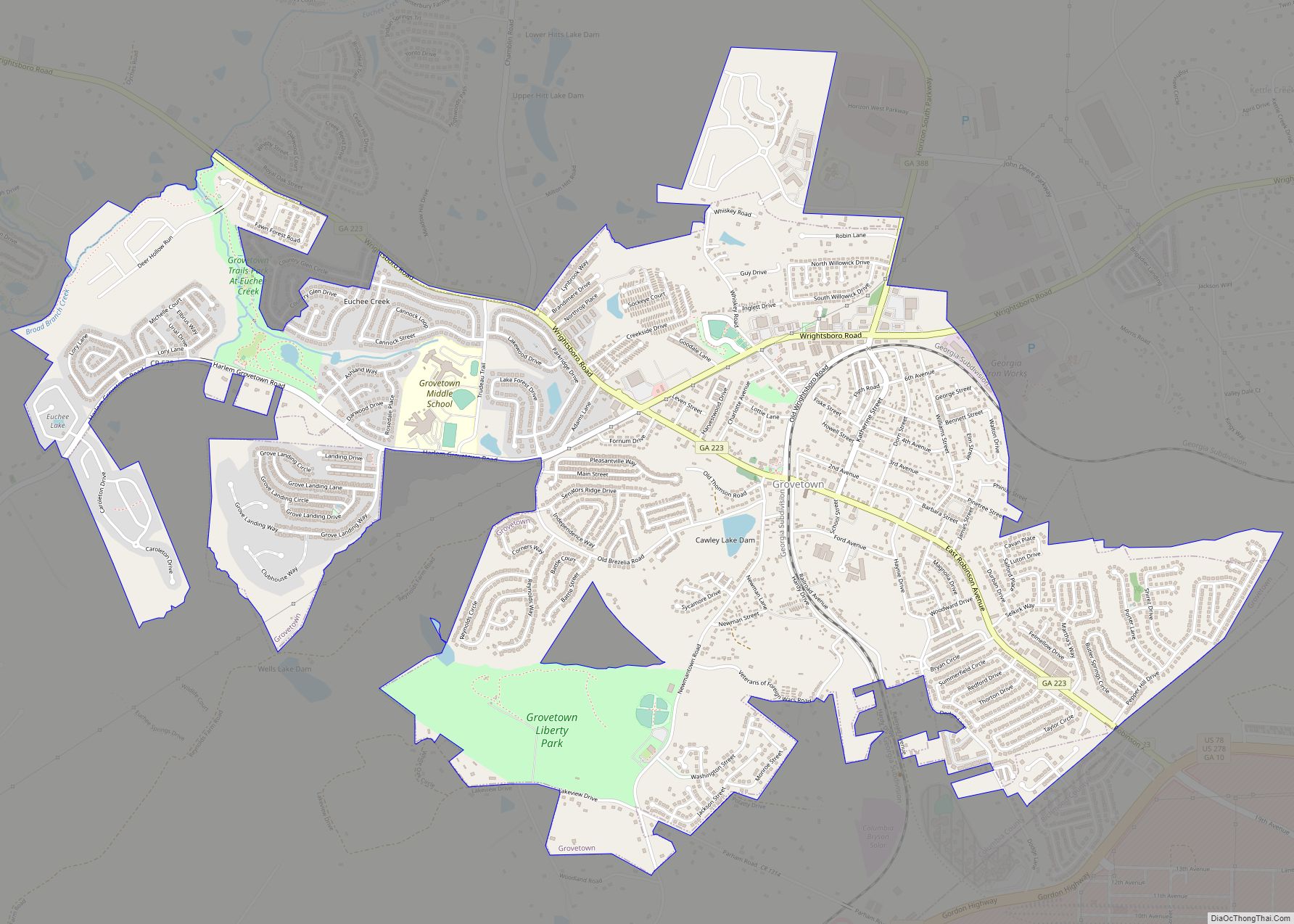
Grovetown is a city in Columbia County, Georgia, United States. It is part of the Augusta metropolitan area and the Central Savannah River Area. The 2019 population estimate was 15,152. The mayor is Gary Jones.
Climates and Weather Extremes
Grovetown has yet had some extreme weather. The strongest tornado was an EF2 on October 31st 2019. The highest temperature was 108 degrees Fahrenheit both on August 10th 2007 and on August 21st 1983. The coldest temperature was -1 degrees Fahrenheit set on January 21st 1985.
| Name: | Grovetown city |
|---|---|
| LSAD Code: | 25 |
| LSAD Description: | city (suffix) |
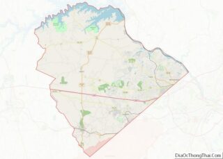
| State: | Georgia |
| County: | Columbia County |
| Elevation: | 482 ft (147 m) |
| Total Area: | 5.29 sq mi (13.69 km²) |
| Land Area: | 5.27 sq mi (13.65 km²) |
| Water Area: | 0.01 sq mi (0.03 km²) |
| Total Population: | 15,577 |
| Population Density: | 2,954.67/sq mi (1,140.81/km²) |
| ZIP code: | 30813 |
| Area code: | 706 |
| FIPS code: | 1335716 |
| GNISfeature ID: | 356123 |
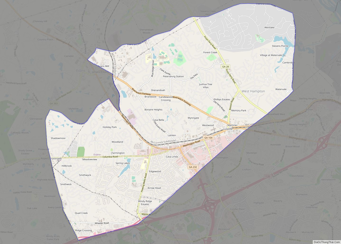
Online Interactive Map
Click on ![]() to view map in "full screen" mode.
to view map in "full screen" mode.
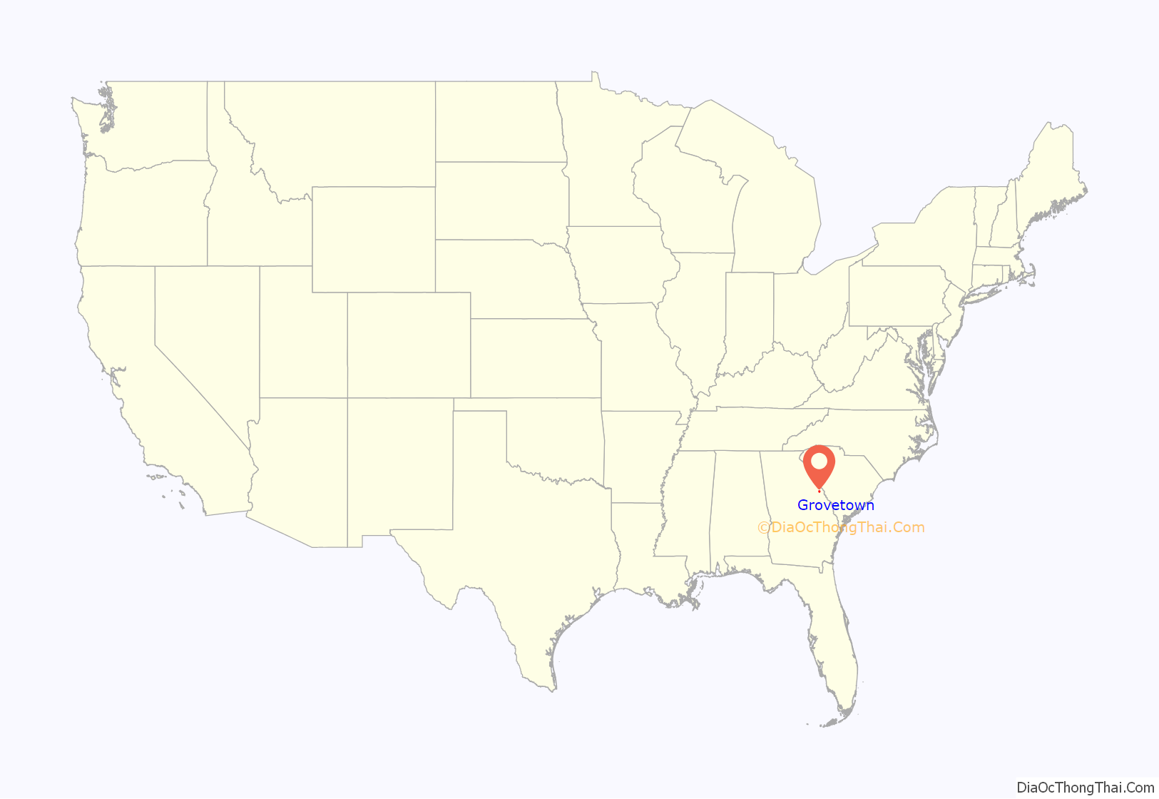
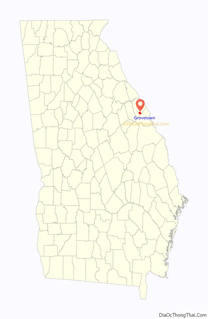
Grovetown location map. Where is Grovetown city?
History
From the building of the Georgia Railroad, which travels through the city until at least the 1860s, the community was known as “Belair”. The city was chartered by the Georgia Legislature and officially incorporated on January 1, 1881. The name of the small village purportedly came from the old Grove Baptist Church that was founded in 1808. A poet famous in the post-Civil War era, Paul Hamilton Hayne, moved to Copse Hill in the Parham Road area in the 1860s. He solicited the United States Postal Service to establish the Grovetown post office. The first U.S. mail service was inaugurated on September 28, 1877, with Charles Clifford as postmaster. Mr. Clifford was also the train depot agent and the owner of the corner store.
The first railroad depot was a small structure built in 1878–79. The last depot was an ornate structure built in 1891 at a cost of $5,041.74. It served the citizens of Grovetown until 1970, when passenger trains no longer traveled on the Augusta–Atlanta line. It was demolished in 1973.
Many wealthy and influential Augusta residents had summer homes in Grovetown, escaping the heat and disease of the city. They commuted on the old “Picayune” train, relying on its frequent service. The Rosland Hotel, later known as the “Eagle”, was built in the 1880s. Its huge rotunda was frequently used for church gatherings, suppers, parties, and dances. It later became a boarding house and burned in the 1970s. The Church of Christ is now located on the site.
Several country stores were established on Old Wrightsboro Road near the railroad crossing. One was S. F. Poole’s store, where the gazebo now stands at the corner with Robinson Avenue, with a “philosophers’ bench” by the door. During the early days, many famous residents lived in the Grovetown area: Hayne, the literary figure; Stewart Phinizy and James Tobin, cotton brokers; Charles Phinizy, banker and railroad president; Dr. H. H. Steiner, physician; and John Dodge, pharmacist and harness racing enthusiast. Dodge brought his stable from Ohio and built a large home and racetrack.
With the construction of Camp Gordon in 1942, Grovetown experienced rapid growth; it was no longer a small agricultural town. Due to its close proximity to Fort Gordon, Many military families looked to Grovetown for housing. Gradually, more and more retired military saw the benefits of living in the small town and population began to grow and stabilize.
Annexation and multi-housing construction has increased the population of the formerly quiet town. Currently, Grovetown has a population of approximately 15,000, up from the 1990 census figure of 3,596. A variety of stores, dining establishments, schools, and churches add to the town’s culture. Services include recreational facilities, a public safety department, two fire stations, water and sewer services, a senior center, and museum.
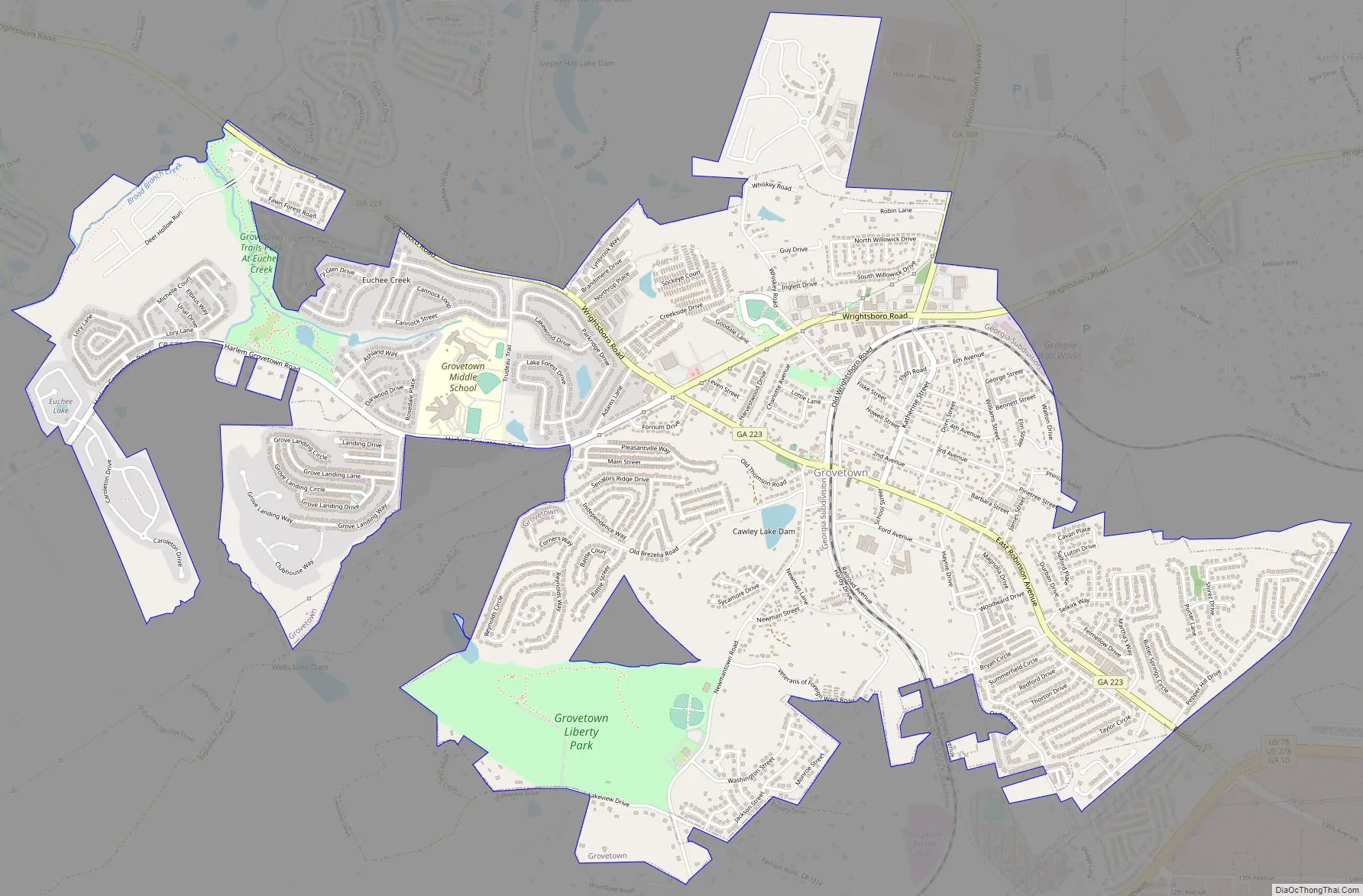
Grovetown Road Map
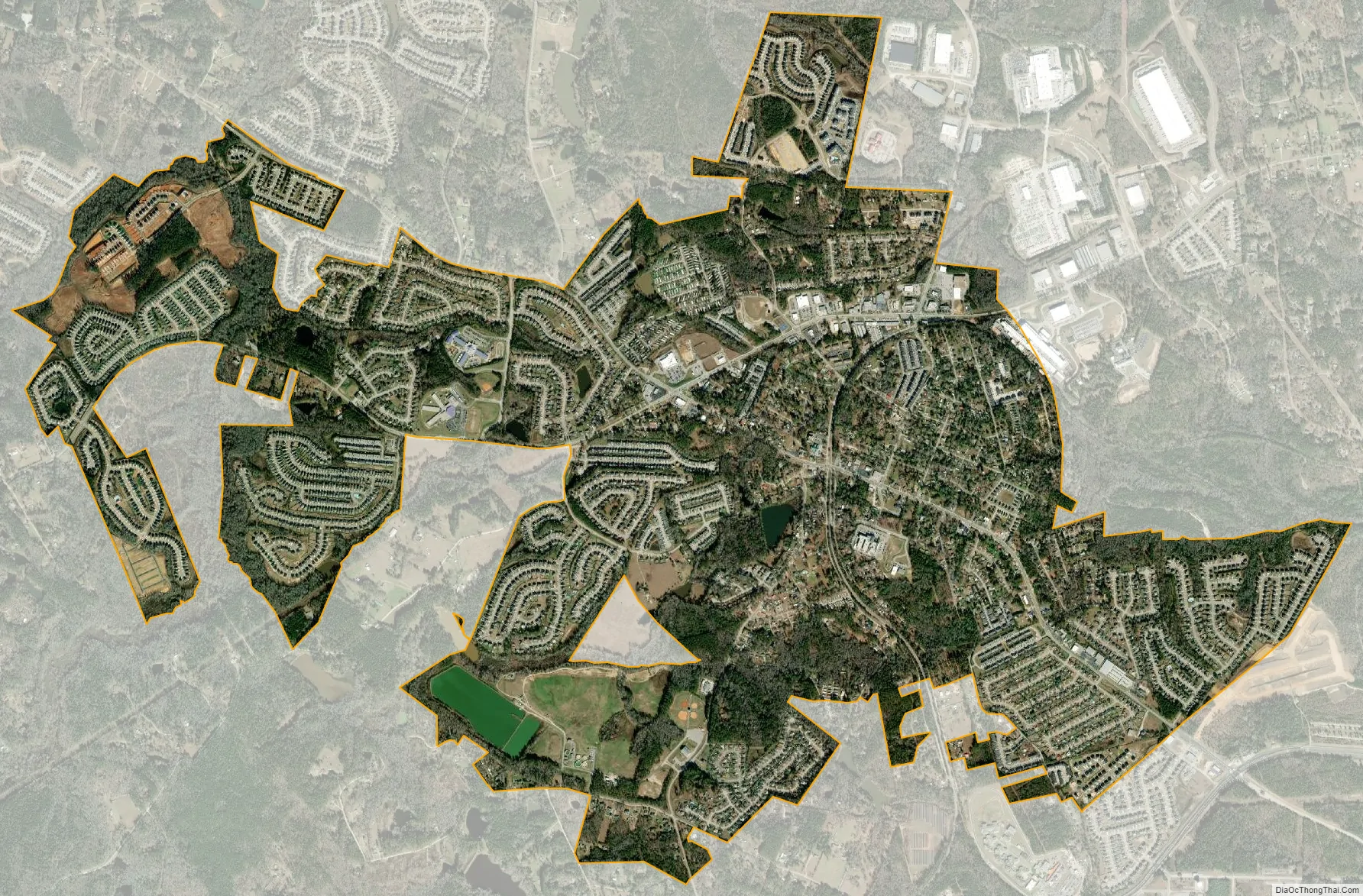
Grovetown city Satellite Map
Geography
Grovetown is located in southern Columbia County. Downtown Augusta is 15 miles (24 km) east. The northern boundary of Fort Gordon is 2 miles (3 km) south.
According to the United States Census Bureau, Grovetown has a total area of 4.8 square miles (12.5 km), of which 0.01 square miles (0.03 km), or 0.23%, is water.
See also
Map of Georgia State and its subdivision:- Appling
- Atkinson
- Bacon
- Baker
- Baldwin
- Banks
- Barrow
- Bartow
- Ben Hill
- Berrien
- Bibb
- Bleckley
- Brantley
- Brooks
- Bryan
- Bulloch
- Burke
- Butts
- Calhoun
- Camden
- Candler
- Carroll
- Catoosa
- Charlton
- Chatham
- Chattahoochee
- Chattooga
- Cherokee
- Clarke
- Clay
- Clayton
- Clinch
- Cobb
- Coffee
- Colquitt
- Columbia
- Cook
- Coweta
- Crawford
- Crisp
- Dade
- Dawson
- Decatur
- DeKalb
- Dodge
- Dooly
- Dougherty
- Douglas
- Early
- Echols
- Effingham
- Elbert
- Emanuel
- Evans
- Fannin
- Fayette
- Floyd
- Forsyth
- Franklin
- Fulton
- Gilmer
- Glascock
- Glynn
- Gordon
- Grady
- Greene
- Gwinnett
- Habersham
- Hall
- Hancock
- Haralson
- Harris
- Hart
- Heard
- Henry
- Houston
- Irwin
- Jackson
- Jasper
- Jeff Davis
- Jefferson
- Jenkins
- Johnson
- Jones
- Lamar
- Lanier
- Laurens
- Lee
- Liberty
- Lincoln
- Long
- Lowndes
- Lumpkin
- Macon
- Madison
- Marion
- McDuffie
- McIntosh
- Meriwether
- Miller
- Mitchell
- Monroe
- Montgomery
- Morgan
- Murray
- Muscogee
- Newton
- Oconee
- Oglethorpe
- Paulding
- Peach
- Pickens
- Pierce
- Pike
- Polk
- Pulaski
- Putnam
- Quitman
- Rabun
- Randolph
- Richmond
- Rockdale
- Schley
- Screven
- Seminole
- Spalding
- Stephens
- Stewart
- Sumter
- Talbot
- Taliaferro
- Tattnall
- Taylor
- Telfair
- Terrell
- Thomas
- Tift
- Toombs
- Towns
- Treutlen
- Troup
- Turner
- Twiggs
- Union
- Upson
- Walker
- Walton
- Ware
- Warren
- Washington
- Wayne
- Webster
- Wheeler
- White
- Whitfield
- Wilcox
- Wilkes
- Wilkinson
- Worth
- Alabama
- Alaska
- Arizona
- Arkansas
- California
- Colorado
- Connecticut
- Delaware
- District of Columbia
- Florida
- Georgia
- Hawaii
- Idaho
- Illinois
- Indiana
- Iowa
- Kansas
- Kentucky
- Louisiana
- Maine
- Maryland
- Massachusetts
- Michigan
- Minnesota
- Mississippi
- Missouri
- Montana
- Nebraska
- Nevada
- New Hampshire
- New Jersey
- New Mexico
- New York
- North Carolina
- North Dakota
- Ohio
- Oklahoma
- Oregon
- Pennsylvania
- Rhode Island
- South Carolina
- South Dakota
- Tennessee
- Texas
- Utah
- Vermont
- Virginia
- Washington
- West Virginia
- Wisconsin
- Wyoming